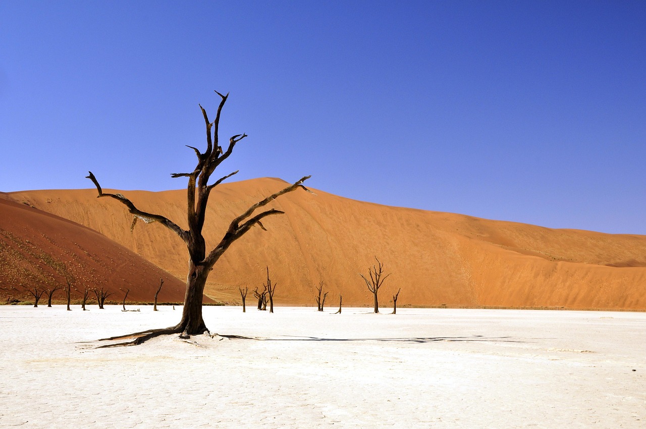
Wood is supposed to disappear. Fungi get into it, bacteria follow, beetles and termites open the grain, and within a couple of decades a fallen tree in most of the world has become soil. At Deadvlei that machinery was never installed. The white clay pan sitting in a bowl of dunes in Namibia's Namib-Naukluft National Park is so dry that the decomposers which end a dead tree simply cannot live there. So the trees have not ended. Their death is dated to roughly 1340 to 1430, six or seven centuries ago, and guides will stretch that toward nine. Either way, a forest that stopped living before the printing press is still standing exactly where it grew.
They are camel thorns, Vachellia erioloba, a slow, iron-hard acacia that can reach twenty metres and whose timber is a dense reddish brown. The black on them is not petrification and not char from any fire. It is sun. Centuries of hard ultraviolet and summer surface temperatures that travellers have measured on site in the forties Celsius have scorched the outer millimetres to the colour of coal, while the wood underneath stays wood. Break a fragment and the red-brown timber is right there. Anyone arriving expecting a fossil bed has the wrong category in mind. After 700 years in the open, this wood is still only weathering.
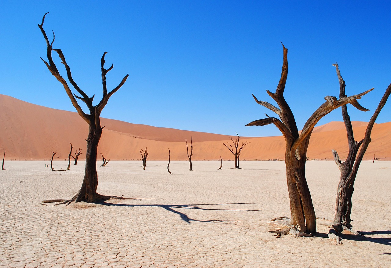
The reason they are there at all is a river that stopped arriving. The Tsauchab is ephemeral, running out of the Naukluft mountains only after rare rain, and in wetter centuries it flooded this basin and left shallow pools. Camel thorns took root on that water. Then the climate hardened, the dunes migrated, and the sand walled the basin off from the river. The trees died standing. The Tsauchab still floods, occasionally, though several years can pass between one flood and the next. The dunes around the basin are still creeping. On the sand sea's coastal side, thick Atlantic fog arrives on more than 180 days a year, and fog rather than rain is what keeps this desert alive at all.
The obvious scale here is vertical, and the stranger half of it is underground. The dunes ringing the pan run 300 to 400 metres, averaging around 350, and the tallest of them, nicknamed Big Daddy, is put at something like 325 metres. Impressive, but not a world record: the Namib Sand Sea is rated the second largest dune field on earth, not the highest, and taller dunes stand in Argentina and in China's Badain Jaran. The real engineering here went the other way. Camel thorns in this region have been recorded sending a taproot sixty metres down after groundwater, and a shepherd's tree in the same country holds the deepest root ever documented at sixty-eight metres. Whatever is standing on the pan was never the larger half of the tree.
A forest that stopped living before the printing press is still standing exactly where it grew.
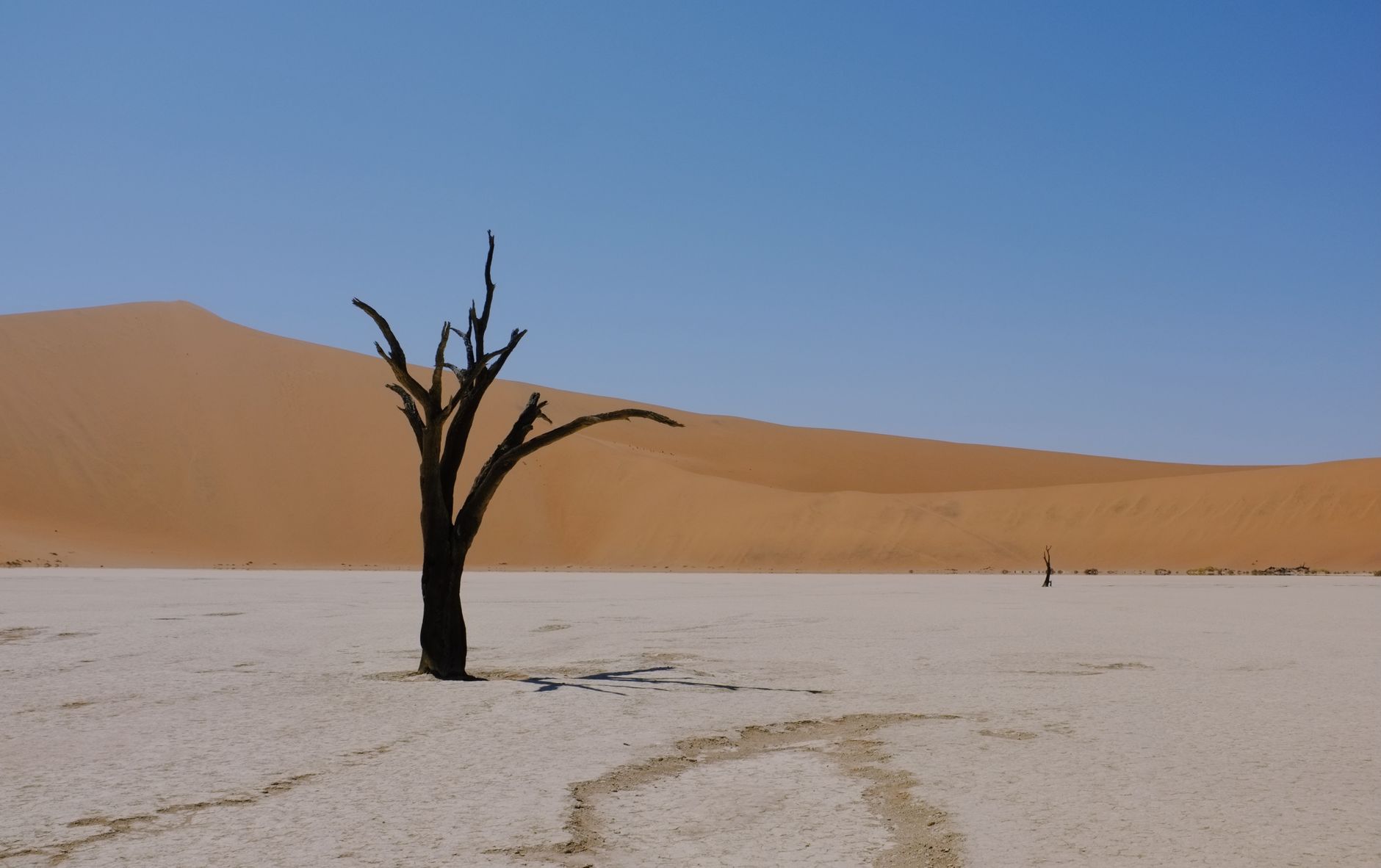
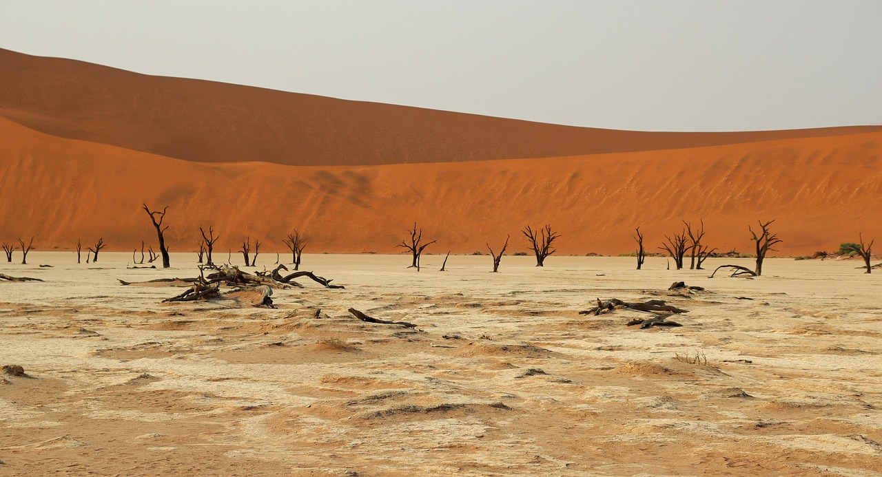
The light here runs on a short and counterintuitive schedule. The instinct is to aim for sunrise. But the dunes are high enough that the sun does not reach the pan floor for twenty to thirty minutes after it clears the horizon. What happens in that gap is the actual picture: the dune wall behind goes brilliant orange while the trees and the ground stay in deep shadow, so the camel thorns read as pure black cut-outs against fire. Photographers who work the pan regularly describe that separation as lasting a couple of minutes. Once the sun touches the trees, the contrast collapses, and by mid-morning the scene has, in one photographer's phrase, lost all shadows and depth. The loss is abrupt. Anyone still walking in at 09:00 has already missed it.
Sunset does less here than it sounds like it should. The clay radiates the afternoon's stored heat, and an orange sky washes over the dunes without separating them, so the picture flattens. Heat shimmer sets in around eleven in the morning and softens everything regardless of composition. Treat Deadvlei as a first-light destination and spend the late afternoon elsewhere: Dune 45, or Elim Dune near the gate, where the limiting factor is wind.
Which turns the whole visit on a piece of administration. Sesriem has two gates. The outer one opens at dawn. The inner desert gate opens roughly an hour before sunrise, and only for guests staying inside the park, which means Sesriem Campsite, the newer Sesriem Oshana Campsite, Dead Valley Lodge and Sossus Dune Lodge. Sleep outside the fence and you cannot legally start the sixty kilometre drive to the car park until the sun is already up, by which point the window has begun closing. No tour gets around it either; they queue at the outer gate with everyone else. Book the bed on the correct side of that fence first and arrange the rest of the trip around it.
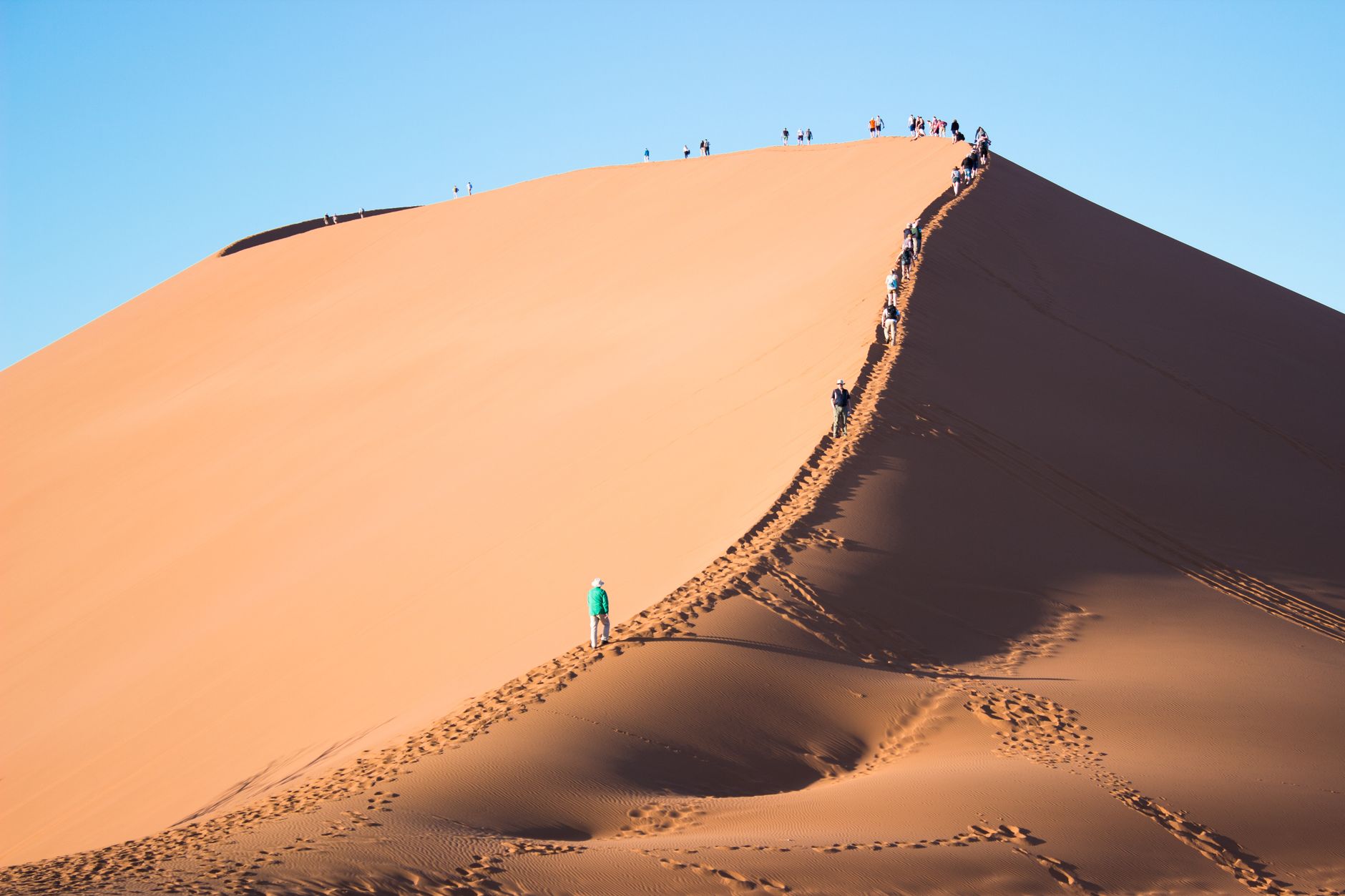
The climb up Big Daddy is a genuine effort and routinely underestimated. Reported ascents run from forty-five minutes to an hour and a half, ninety minutes being typical, on top of the walk from the road to the base. It is soft sand at a steep angle, one step forward and most of one back, with no shade anywhere and the steepest section saved for last. Turning back partway is common and costs nothing, because the photographs that matter are taken from the pan floor. The descent is the reward and takes about ten minutes: a run or a slide straight down the face into Deadvlei. One route note saves a lot of misery. Start the climb from the car park path rather than from the pan below, which adds height and softer sand to an ascent that already has plenty of both.
The road catches people out too. Tar runs sixty kilometres from the Sesriem gate to the 2WD car park and then stops. The last five to six and a half kilometres to the Deadvlei parking is deep, soft sand, and it strands cars daily; travellers report passing three bogged 4x4s in a single morning. Driving it needs a real 4x4, tyres deflated to around 1.6 bar, low range, momentum held, the shuttle tracks followed, and no stopping in the soft stuff. Anything short of that is how vehicles end up dug out at seven in the morning while the light goes. The park shuttle runs from the 2WD lot, ten minutes each way, and removes the problem entirely.
Then the walk, which reads shorter on paper than it plays. From the Deadvlei parking it is between 1.1 and two kilometres over a sand saddle, fifteen to twenty-five minutes, and it is harder than the distance suggests because the sand swallows a foot to the ankle at every step. There is no shade on that saddle, no shade on the pan, and no water anywhere out there. One to two litres per person is a minimum; a photographer working the pan for a single morning reported nearly emptying her supply. The white clay reflects sun upward as well as down, so hat and sunscreen are doing double duty. Bring a weather-sealed camera body if you have one, because the dust is severe enough that changing lenses on the pan is a bad idea.
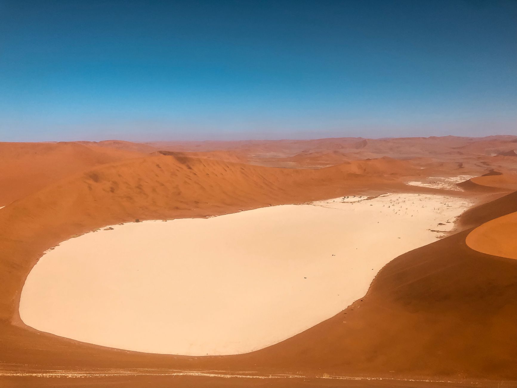
It is worth understanding what the pan sits inside. The Namib Sand Sea was inscribed by UNESCO in 2013 under all four natural criteria, becoming Namibia's second World Heritage Site after Twyfelfontein, and it is described as the only coastal desert in the world with extensive dune fields shaped by fog. The Namib may be the oldest desert on the planet, arid or semi-arid for somewhere between 55 and 80 million years. The dunes read red because iron oxide in the sand has been oxidising for a very long time, and the older dunes read reddest. Deadvlei is a small detail inside three million hectares of that, and the only part of it left standing still when the Tsauchab stopped arriving.
Come between April and October, when the air is clearest and the days are workable. Expect to be cold at five in the morning at the gate and hot enough by ten that the sand is no longer walkable barefoot. And the proportions catch most people out: the camel thorns are smaller than the photographs suggest, while the dune wall behind them climbs three hundred metres.