The money moved on commission. Kathmandu hospitals reportedly returned a fifth to a quarter of each insurance payment to the trekking agency that had referred the patient, helicopter operators took a comparable share, and a single flight carrying several passengers could be billed to several insurers at once. Nepal's Central Investigation Bureau traced that arrangement across the Everest routes from about 2022 to 2025, a network of agencies, operators and hospitals manufacturing or inflating medical emergencies so that international insurers would pay for evacuations. Prosecutors filed against 32 people in early 2026, and nine were arrested, the rest absconding. One detail cuts against the headlines: the helicopter executive investigators had publicly named as the organiser was arrested in February 2026 and then exempted from the charge sheet, which recorded no evidence establishing his involvement.
One part of the coverage travelled further than the case did. Headlines around the world reported that guides were poisoning their clients. The file describes baking powder put in a client's food in one instance, and Diamox pushed with quantities of water, both to manufacture symptoms. What it does not support is the systematic poisoning of trekkers, and that is the version that circulated. The fraud is documented; the thriller is not. What a trekker needs from it is narrower: insurers have tightened verification and raised premiums on Everest-region cover, and a guide who suggests reporting yourself sicker than you are so a helicopter can be called is recruiting you into a crime.
From the airstrip at Lukla to Base Camp and back is roughly 120 to 130 kilometres on foot, usually across twelve to fourteen days, climbing from 2,846 metres at Lukla to about 5,364. It crosses Sagarmatha National Park, established as a park in 1976 and inscribed by UNESCO in 1979, a distinction operator pages routinely garble by giving the earlier date as the inscription. Most of it is barren ground above five thousand metres and only a small fraction is forest, and it was gazetted around its inhabitants, who stayed where they were, which is why there are villages and monasteries inside a World Heritage site.
The destination will disappoint anyone who has not been told what it is. Base Camp is a scatter of prayer-flagged boulders on the surface of a moving glacier, occupied in spring by an expedition tent city and empty for much of the rest of the year, and it has no view of Everest at all: the summit sits behind the wall of Nuptse. The view everyone has seen comes from Kala Patthar, a rubble shoulder above the village of Gorak Shep, traditionally given as 5,545 metres though GPS surveys put it closer to 5,640, which is why the standard plan climbs it in the dark and stands on it at dawn.
The mountain has three names. It is Sagarmatha in Nepali and Chomolungma in Tibetan, usually rendered as goddess mother of the world. Everest is a surveyor's honour, applied in 1865 for Sir George Everest, a former Surveyor General of India who never saw the peak and objected to having it named after him. Its height was argued over for decades because of the snow cap; a joint Nepali and Chinese resurvey published in December 2020 settled it at 8,848.86 metres, which is the figure to use.
The valley the trail crosses is Sherpa country, and Sherpa is an ethnicity, not a job description. The Sherpa came from Kham in eastern Tibet in waves from around the fifteenth and sixteenth centuries, most of them over the Nangpa La, a glaciated pass at about 5,800 metres that still connects the Khumbu to Tibet, and oral history names four founding clans. They are Nyingma-school Buddhists who lived by yak herding and by trading salt and wool.
The potato arrived in the mid nineteenth century and the population climbed with it: the Khumbu held under two hundred households in the eighteen-thirties and more than three times that by the nineteen-fifties, though how much of that the potato caused is argued over. The trade of high-altitude climbing porter took the Sherpa name in the twentieth century because the people were already living at the bottom of the mountain when the expeditions arrived.
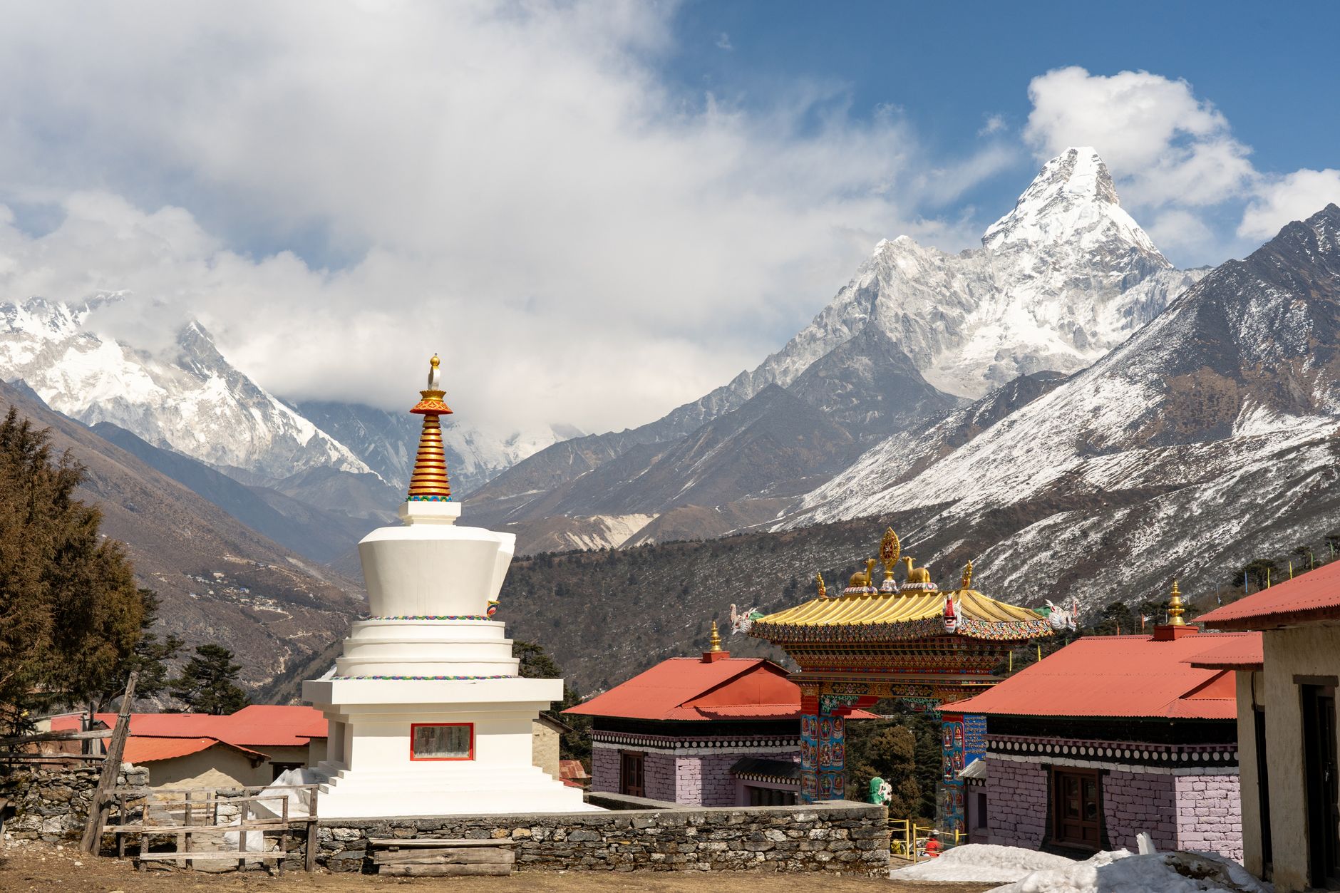
Tengboche, at about 3,867 metres, is the spiritual centre of that country and the most persistent building in the Khumbu. It was founded in 1916 by Lama Gulu on a site with a clear sightline to both Everest and Ama Dablam. The Nepal-Bihar earthquake flattened it in 1934 and it was rebuilt by 1938. On a January night in 1989 a newly installed electric wire shorted and it burned to the ground, taking old scriptures and murals with it, and it was rebuilt again over the four years that followed with help from Hillary's Himalayan Trust and from trekkers walking past. It holds the Mani Rimdu festival in autumn. A monastery that has been destroyed twice in a century and reassembled twice is a fair emblem for a valley that keeps rebuilding on a moving mountain.
Base Camp cannot see Everest. The picture everyone has come for is taken from a rubble hill above it, in the dark, at 5,545 metres.
The summit story starts above the point where this trek stops, and it is the reason the trek exists. On 29 May 1953, at about half past eleven in the morning, Edmund Hillary, a New Zealand beekeeper, and Tenzing Norgay, a Sherpa on his seventh Everest expedition, stood on top.
They were two members of the ninth British attempt, a large siege-style expedition led by Colonel John Hunt. The line they climbed, up the Khumbu Icefall, the Western Cwm, the Lhotse Face and the South Col, had been found by the British reconnaissance of 1951 and first climbed by a Swiss team in 1952, on which Tenzing and Raymond Lambert reached about 8,600 metres before turning back.
On the summit Tenzing buried sweets and biscuits in the snow as an offering and Hillary left a crucifix. For two years the two would say only that they got there together; Tenzing wrote in his 1955 autobiography that Hillary stepped up first. The Hillary Step, the twelve-metre rock pitch just below the top, appears to have collapsed or been buried in the April 2015 earthquake and is now a snow slope, a change the Nepal Mountaineering Association's chairman initially disputed before conceding once he had seen the photographs.
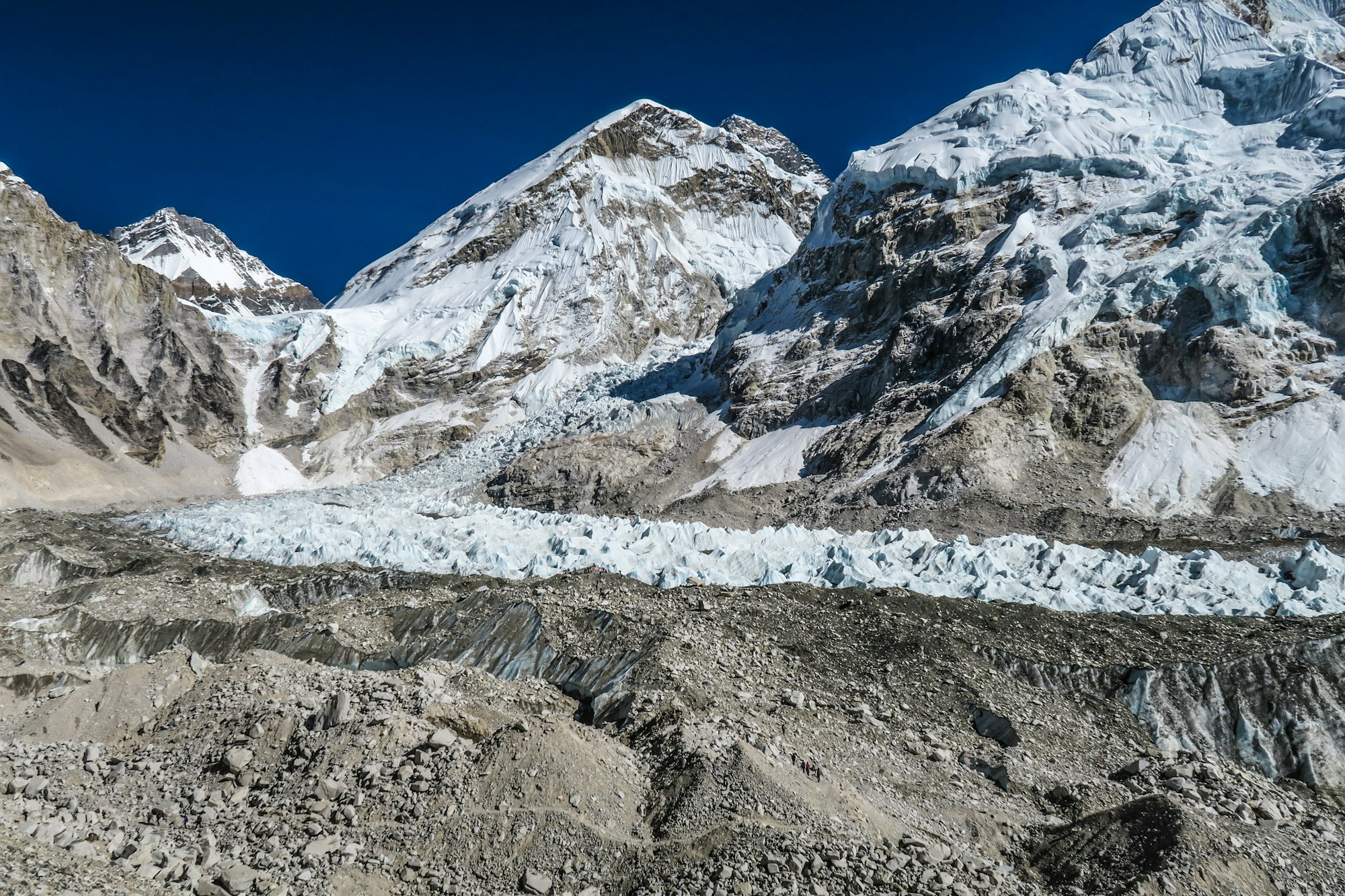
What the trek does deliver is a close look at the thing that kills climbers. The Khumbu Glacier runs about 17 kilometres from the Western Cwm down to roughly 4,900 metres, and just above Base Camp it breaks over a cliff into the Khumbu Icefall: a moving chaos of seracs and crevasses that shifts something like a metre a day, so that ice takes about four years to travel the six hundred metres of drop.
Climbers cross it in the dark, before the sun starts loosening it, on a route re-rigged each season by a specialist Sherpa team known as the Icefall Doctors. It has been lethal on a scale that gets forgotten between headlines: six Sherpa killed in 1970, sixteen Nepali climbing workers, most of them Sherpa, killed by a serac avalanche in April 2014, and nineteen people killed at Base Camp itself when the earthquake of April 2015 brought an avalanche down off Pumori.
The Himalayan Database records 44 deaths in the icefall between 1953 and 2016. Trekkers stop at the foot of it. Going into the icefall is climbing, with a permit and a rope team.
Altitude governs this walk, and the itinerary is a piece of physiological engineering more than a route. The profile runs Namche Bazaar at 3,440 metres, Tengboche at 3,867, Dingboche at 4,410, Lobuche at about 4,940, Gorak Shep at 5,164 and Base Camp at about 5,364, with two deliberate acclimatisation days built in, at Namche and again at Dingboche, each spent climbing several hundred metres higher in the afternoon and coming back down to sleep.
Trekkers who treat those days as padding and skip them tend to discover the mistake at Dingboche, though the last place to rent gear is Namche, four days lower. Strong walkers get sick here and slow ones do not, and the difference is almost always the schedule. Pheriche, an hour beyond Dingboche, has the Himalayan Rescue Association aid post, which runs a free altitude talk at three most afternoons in season and is the best hour a trekker can spend on this trail.
Two permits are needed and neither is the one people expect. The Sagarmatha National Park entry permit is a Department of National Parks and Wildlife Conservation document, bought at its counter in the Nepal Tourism Board complex in Kathmandu or at the park gate at Monjo, and the Khumbu Pasang Lhamu Rural Municipality permit is bought in Lukla or Monjo; the municipality permit replaced the old TIMS card in this region, so a TIMS card is not what this trek needs.
On guides, the position is the opposite of what most operator pages say. Nepal's 2023 guide rule had no statutory backing and was never enforced in the Khumbu, and the municipality publicly refused to apply it, so walking to Base Camp alone remains legal in 2026. That may not last: a tourism bill passed the National Assembly in February 2026 with amendments pending that would make guides mandatory on designated Himalayan routes, so it is worth checking at the tourist information centre in Lukla.
A guide is still the sensible purchase. The trail asks for no navigation; what it asks for is someone with judgement about altitude who is not the person suffering from it.
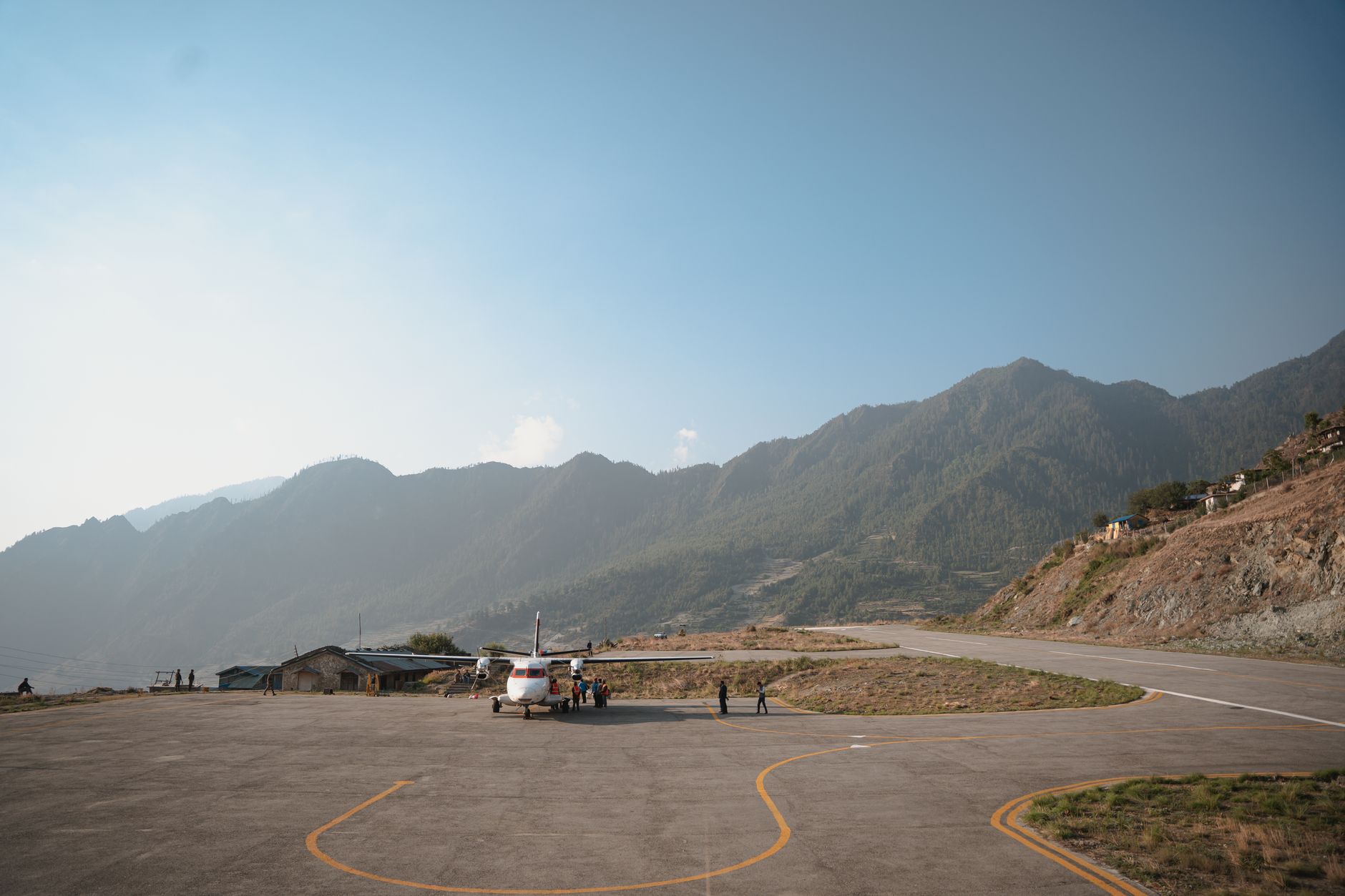
The flight is the weak link, and in the two peak seasons it is worse than the brochures admit. Through roughly mid-March to mid-May and late September to late November, on dates the civil aviation authority re-announces each season, most Lukla operations move out of Kathmandu to Manthali Airport at Ramechhap, about 130 kilometres away, because Kathmandu has one runway and international traffic has priority on it. In practice that adds a pre-dawn road transfer of four to five hours at the start, five to six on the way back depending on traffic, and a night in a town with almost nothing for visitors. Outside those windows, flights leave from Kathmandu. Either way they are weather-dependent and cancellations are routine, so a spare day at each end of the trip is not contingency planning, it is the plan.
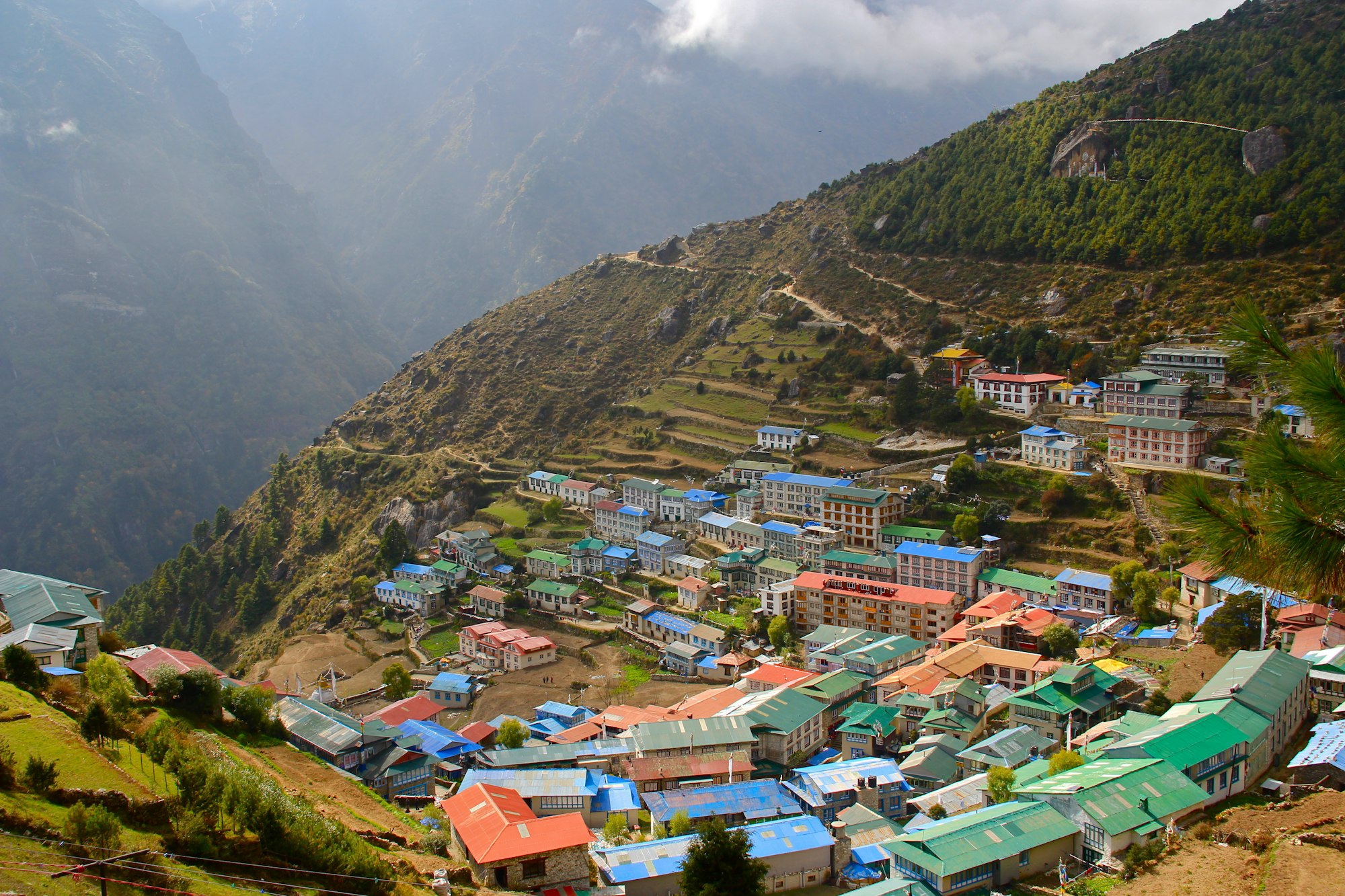
Life on the trail is teahouse life, and it is comfortable in a specific, narrowing way. Lodges are almost all Sherpa-owned, and lodge income built the stone hotels that now line the route.
Charging is generally free in the lowest villages and a paid extra from Namche upward, rising with altitude; wifi is a separate purchase from Everest Link, whose solar towers run from Lukla to Base Camp; dal bhat is the order that comes with refills and the one to build a fortnight around. Costs rise with every hundred metres of altitude for the honest reason that everything arrived on an animal or a person.
Sagarmatha National Park recorded a little over sixty thousand visitors in the year to mid-2025, which is a ceiling rather than a floor for the Base Camp route because the same gate counts Gokyo, the Three Passes and day visitors, and the current grievance in the valley is the helicopter: sightseeing and shuttle flights that lift visitors over the lower stages take income out of the porter and teahouse economy the trek is supposed to support. Between that and the fraud case, the fastest way up this valley is also the least welcome.
So the trek rewards the unfashionable choices. Walk the low stages instead of flying over them, take both rest days, sit through the talk at Pheriche, order the refillable meal, keep the spare day, and decline the shortcut when it is offered on the way down. What it does not reward is speed. The tent city at the end of it is rubble and nylon on a glacier that is going somewhere else, and the mountain it belongs to is invisible from there. Both of those facts are easier to take if somebody says them before you leave Kathmandu.