Anangu had been asking visitors not to climb since 1985, the year the rock was handed back to them, and from the early 1990s the request stood in writing on a sign at the base. The route up the western flank follows the path of the ancestral Mala men, and Anangu have said that climbing it was never theirs to permit. They have also said, again and again, that they felt responsible for the people who died on it. Two practical arguments sat alongside those: the scar the route had worn into the flank, and the waste it flushed down into the waterholes below. For three decades the only enforcement was explanation. A sign, guides who answered the question when it was asked, and no barrier at all at the bottom of the chain.
What finally delivered the request was arithmetic. The park's 2010 management plan set out the conditions under which the route would shut, among them the proportion of visitors still going up falling below a fifth. In the 1980s that proportion had been roughly three quarters. By the middle of the 2010s it was about 16 percent, and the condition had been satisfied without anyone marking the moment. The board of management, which holds an Anangu majority, voted unanimously in November 2017 to act on it, setting the date for 26 October 2019, the thirty-fourth anniversary of the handback. The chain came down, the holes were filled, and climbing Uluru is now an offence under Australian environmental law. It is still widely reported as a ban imposed on tourists, when the paperwork records something closer to a request kept.
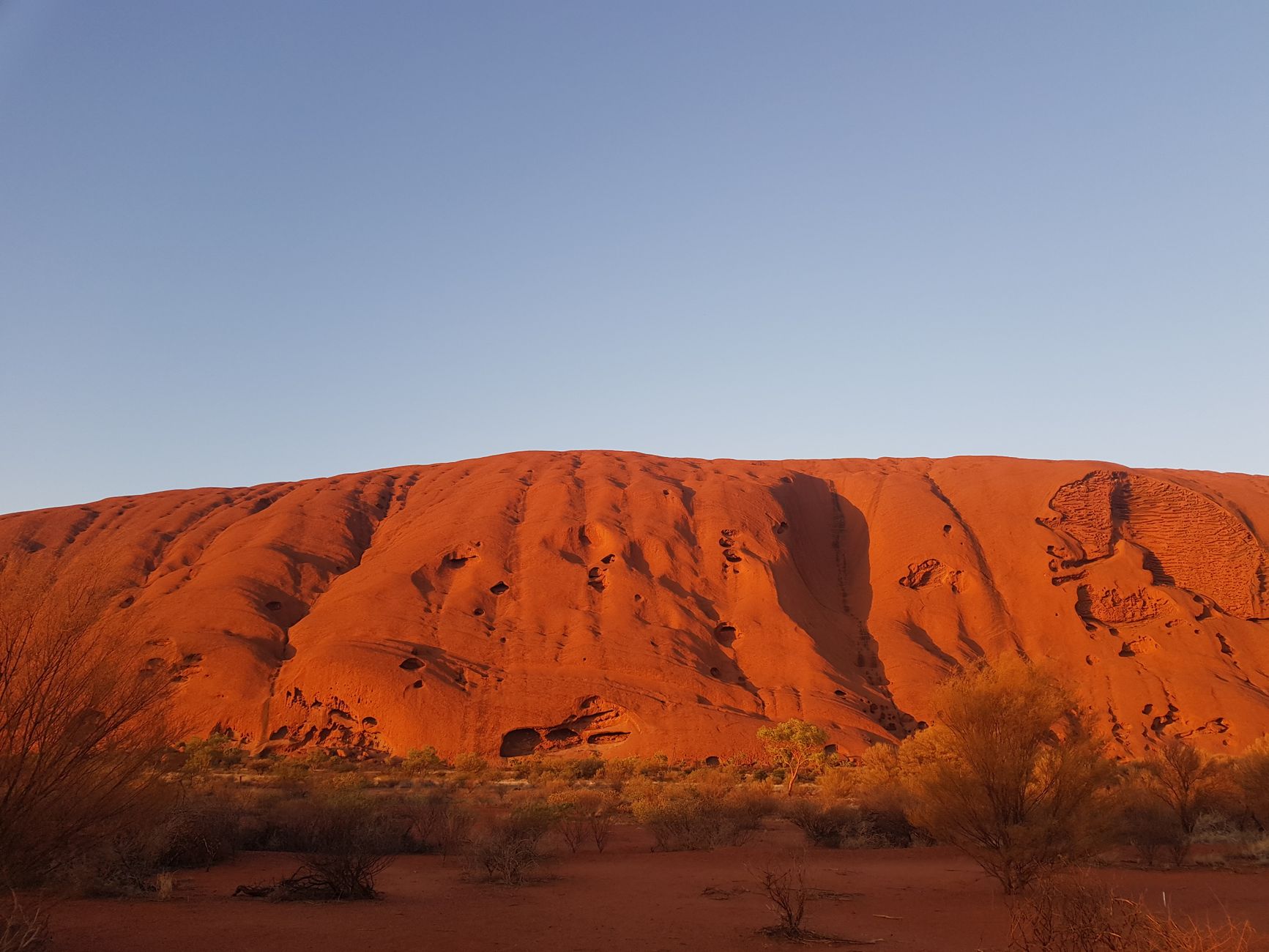
What the rock is instead takes a word most travel writing gets wrong. Tjukurpa is the Anangu law, knowledge and moral system, the framework that binds people to country, plants, animals and each other, and it governs who may go where, who may know what, and how the land is used. It is not folklore, and "Dreamtime story" is a translation that quietly demotes a functioning legal and educational tradition into decoration. Features of Uluru are the physical record of Tjukurpa: this gully, that scar, that overhang, each holding a piece of the account.
Which is why certain stretches of the base walk carry no-photography signs. The sites behind them relate to gender-restricted knowledge that may not be seen by the uninitiated or reproduced offsite. Anangu ask that they not be photographed, and the park states plainly that photographing them is prohibited; publishing any image of the park commercially requires a permit.
The transfer of title happened on 26 October 1985 at Mutitjulu, when the Australian government handed the freehold of Uluru and Kata Tjuta to the Anangu after decades of lobbying. In the same act the Anangu leased the land back to the Director of National Parks for 99 years, creating the joint board that later closed the climb. The arrangement was watched closely across Australia and became a reference point in Indigenous land rights; its fortieth anniversary fell in October 2025.
The colonial names have been receding on a slower schedule. William Gosse, surveying in 1873, named the rock for Sir Henry Ayers, then Chief Secretary of South Australia. A dual name was adopted in 1993, the order was later reversed, and Uluru is now simply what it is called. Kata Tjuta still carries The Olgas as a fading alternative.
The climb did not close because the rock was fragile. It closed because a request made in 1985 was finally being kept.
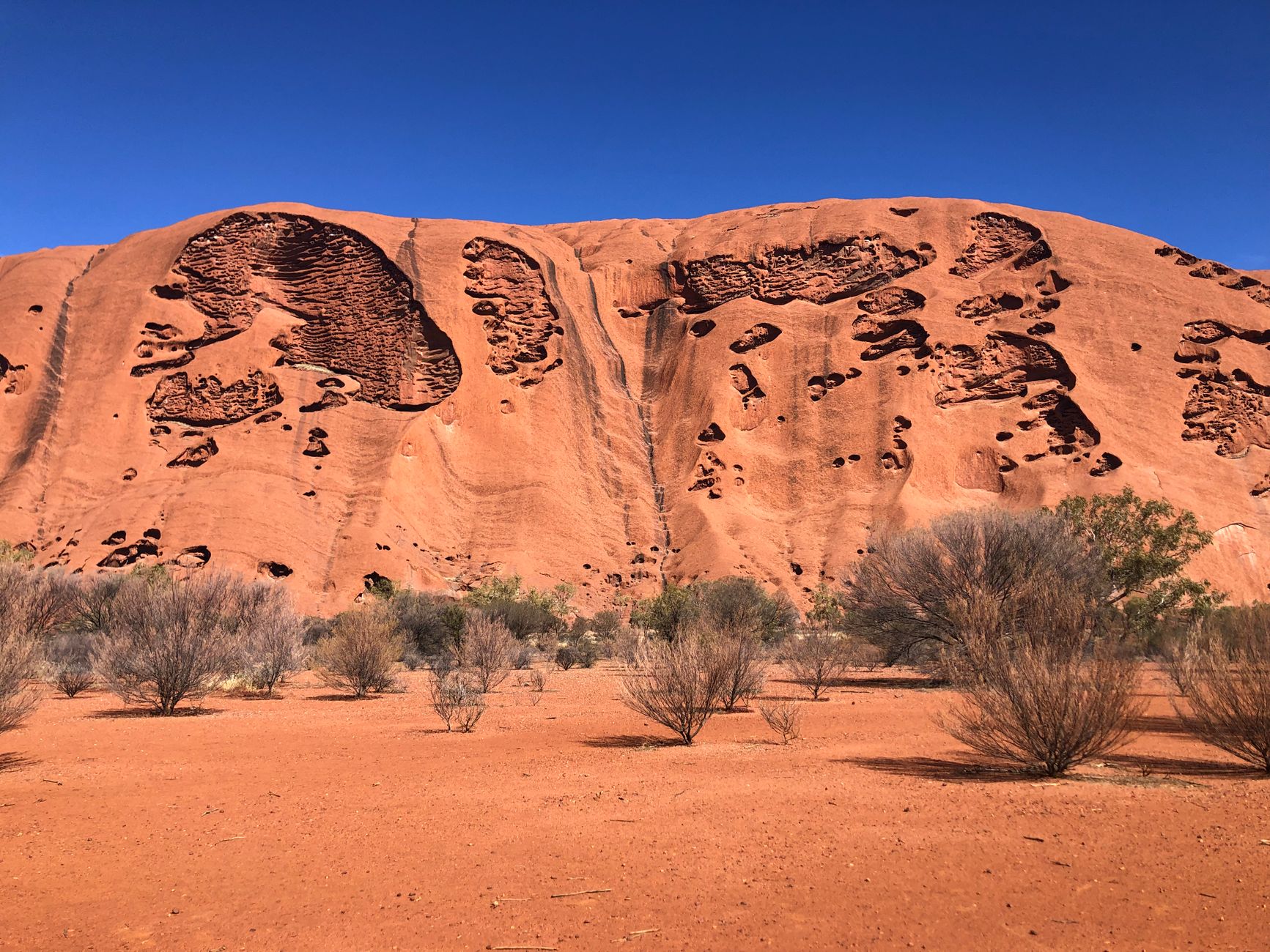
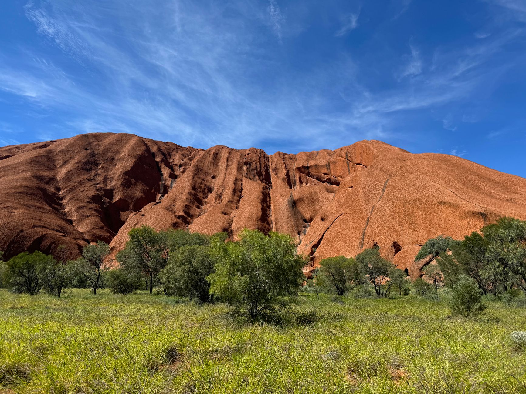
The geology is stranger than the silhouette suggests. Uluru is arkose, a coarse sandstone heavy in feldspar, laid down from about 550 million years ago; roughly 400 million years ago the whole sequence was tilted by tectonic movement, Kata Tjuta modestly and Uluru through almost 90 degrees, which is why the layers now run vertically up its flanks instead of banding across them.
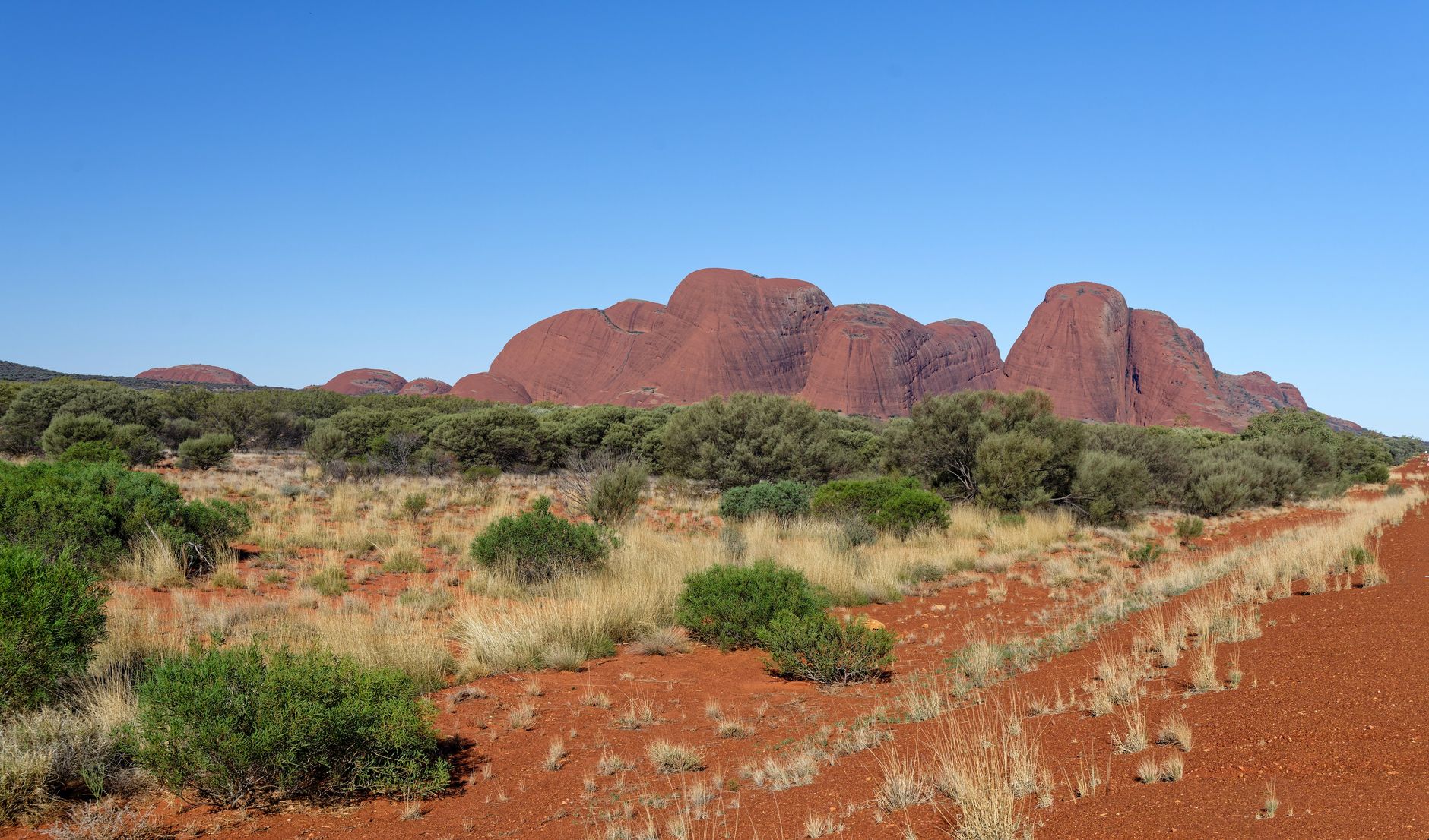
What stands above the plain is a fraction of the object. Both formations continue underground for as much as six kilometres, so the monolith is closer to the exposed corner of something enormous than to a boulder dropped on a desert. They are related without being the same stone: Uluru is a single mass of sandstone, Kata Tjuta a conglomerate of pebbles and boulders set in sand and mud. The famous red belongs to the surface rather than to the rock: iron oxidising, rust in slow motion, and where the skin has recently spalled away what shows underneath is grey.
Then there is the question of which of the two walks is the better one. Uluru's base circuit is roughly ten to eleven kilometres and takes most people two and a half to three and a half hours with stops at the interpretive signs, and it is essentially flat, gaining about fifty metres in total. Its difficulty is exposure rather than gradient.
Kata Tjuta, fifty kilometres west, is where the walking is: the Valley of the Winds route climbs up and between the domes, 2.2 kilometres return to Karu Lookout, 5.4 kilometres return if you carry on to Karingana, or 7.4 kilometres for the full circuit at three to four hours over rock and uneven ground. The park's own advice is that completing the circuit is easier than turning back at Karingana. Kata Tjuta's high point stands 546 metres above the plain, nearly 200 metres higher than Uluru. Travellers who do both tend to report that the domes were the day they remember and the monolith was the day they photographed.
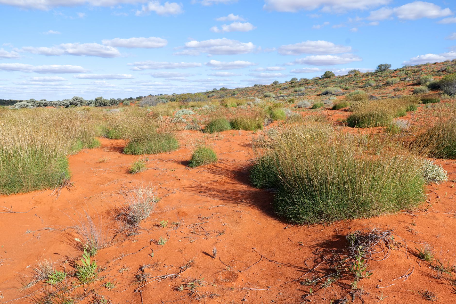
Heat here is administered, and the rules are published in advance. When the forecast or the actual temperature reaches 36 degrees or above, the Valley of the Winds closes beyond Karu Lookout from 11am for the rest of the day. When it reaches 40 or above, the northeast section of the Uluru base walk closes from 11am and the Lungkata section from 2pm.
In the November to March window those thresholds are met often enough that a walk planned for after breakfast can be shut before a visitor reaches the car park. The workable answer is to be walking by half past five or six, to carry roughly a litre of water per person per hour and count on no refills, and to know that shade on the base circuit exists only at the gorges and nowhere along the open stretches.
Then the flies. From about September to April they arrive in numbers that make a netted hat standard equipment, and the consensus among travellers who have tried both is that repellent does very little and the net does everything. Nets cost more at the Yulara shops and can sell out, so the sensible purchase happens before arrival. Deep winter, June to August, is close to fly-free, which is one of several reasons the cool months are the ones to book.
Yulara is the only base, and it is a single operator. Ayers Rock Resort, owned through the Indigenous Land and Sea Corporation and run by Voyages Indigenous Tourism Australia, holds every hotel, the campground, the supermarket and most of the services, about 18 kilometres from Uluru and an hour from Kata Tjuta, which means there is no independent budget option near the park and no competitive pricing on food or fuel. Visitors driving from Alice Springs, about 450 kilometres and five hours or so on sealed road, tend to stock up before they leave.
The accommodation runs from Sails in the Desert at the top of the resort's own range down through Desert Gardens, Emu Walk Apartments, The Lost Camel and the Outback Hotel and Lodge to the campground; Longitude 131, a separate camp of fifteen tents and a two-bedroom Dune Pavilion with direct views of the rock, sits apart from all of it.
Inside the park, the Uluru-Kata Tjuta Cultural Centre is where Anangu explain Tjukurpa in their own terms, and two Anangu-owned galleries sit with it: Maruku Arts, which carries work from hundreds of artists across the Western Desert and runs dot-painting workshops, and Walkatjara Art, run by the Mutitjulu community. A three-day park pass is bought online in advance or at the entry station, and under-18s enter free.
Two after-dark experiences justify their own evenings. Bruce Munro's Field of Light, more than 50,000 solar-powered stems spread across an area of about seven football pitches, was installed in 2016 as a temporary work, has just passed its tenth year, was refurbished in 2024 and now runs until at least the end of 2029. It reads better in person than in photographs, and the pre-dawn slot is the quieter one. The other is simply the sky. There is almost no light within hundreds of kilometres, so the Milky Way and the Southern Cross arrive without effort, and the resort runs astronomy sessions for anyone who wants the names.
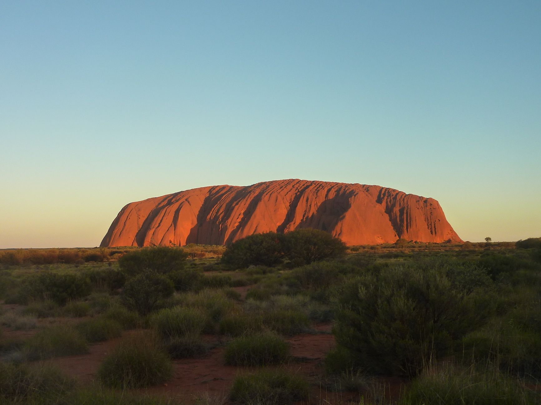
As for the light everyone comes for, the first thing to know is where the crowd is not. Talinguru Nyakunytjaku, on a dune about 20 kilometres from Yulara, is the park's main sunrise area, and it holds Uluru and Kata Tjuta in the same frame. At sunset the coaches gather instead at the dedicated Uluru sunset viewing areas on the western side, which is where the front-lit evening colour is, and which is why Talinguru at the end of the day is often close to empty.
The change itself takes about twenty minutes from first colour to flat grey, because low sun is travelling a long way through the atmosphere to reach a surface that has been rusting for a very long time. Two evenings is the sensible allocation, because the first one goes on working out which of the park's five viewing areas to be standing in.