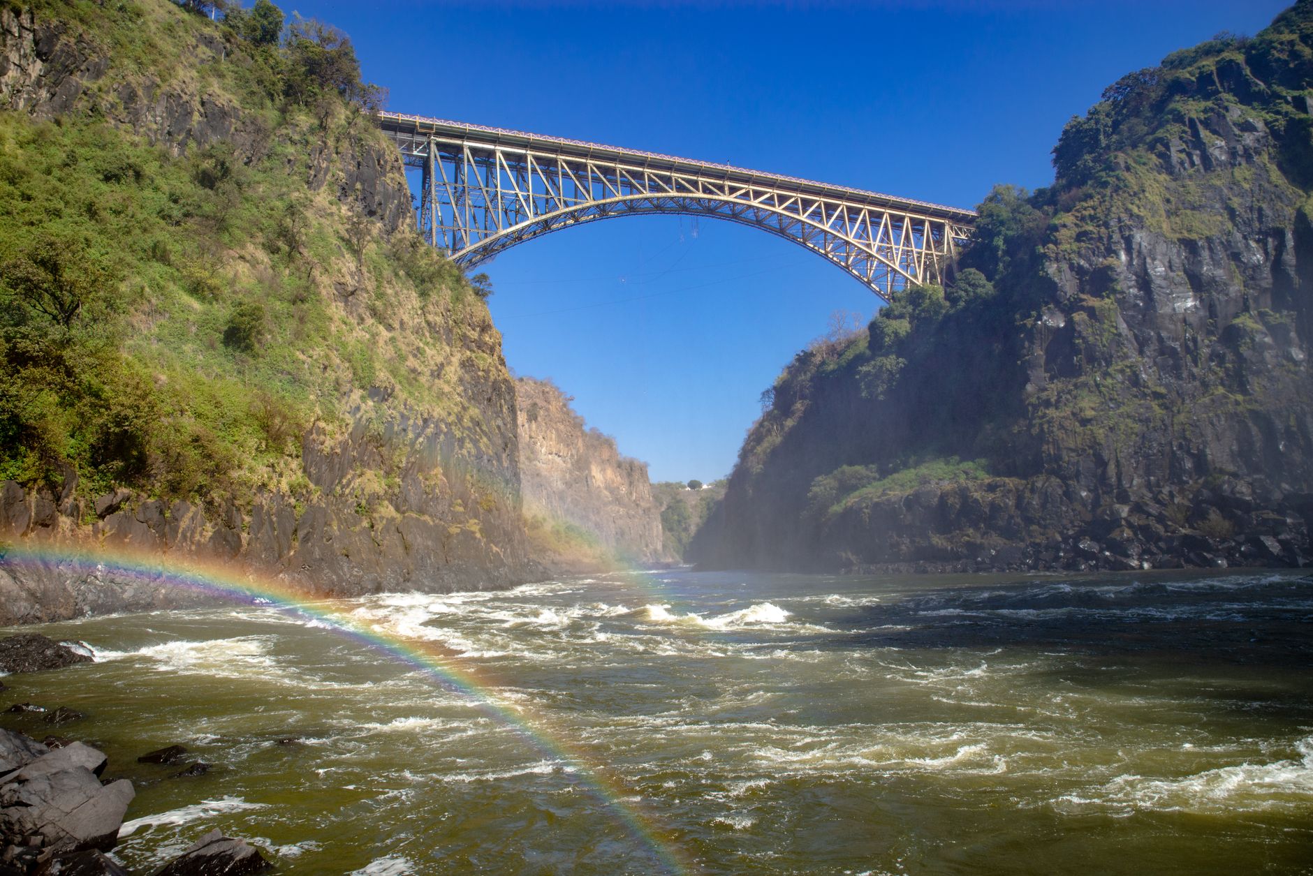
Rhodes told his engineers to place the crossing over the Zambezi so that the trains, as they passed, would catch the spray of the falls. He never visited. He died in 1902, two years before the first girder went up. The bridge that resulted, designed by George Andrew Hobson with stress calculations by Ralph Freeman, fabricated in Darlington by the Cleveland Bridge and Engineering Company and shipped in pieces, was assembled in fourteen months and opened on 12 September 1905. It spans 156.5 metres at the arch, runs 198 metres end to end, and hangs 128 metres above the river. It still carries road, rail and pedestrians between Zimbabwe and Zambia.
The waterfall it was built to serve runs to a timetable. The Zambezi drops up to 108 metres across a curtain 1,708 metres wide, which is the largest sheet of falling water in the world, but the volume behind that sheet swings by a factor of ten across the year. Mean annual flow is about 1,088 cubic metres per second. In a peak month it reaches around 3,000. In the leanest month it can fall to roughly 300. Peak and trough sit about six months apart, and the same gate ticket covers both.
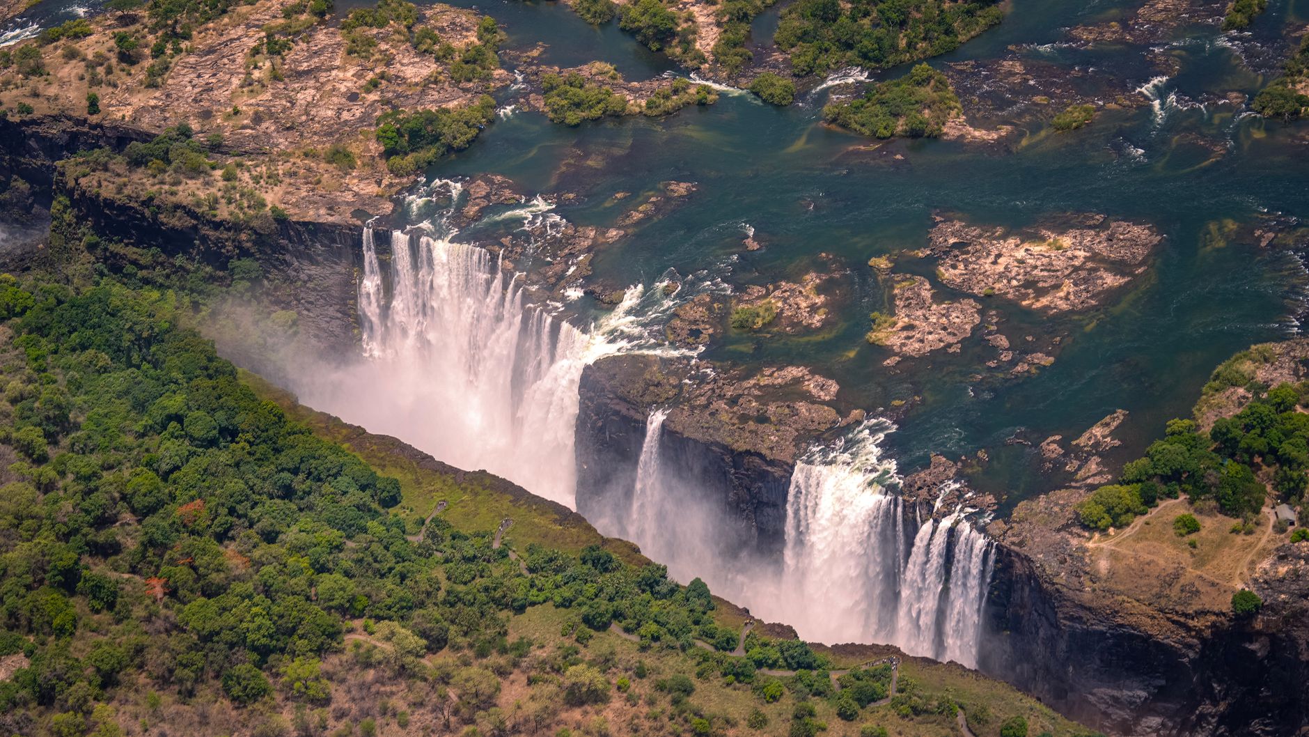
Zimbabwe holds roughly three quarters of the width, which is the fact that resolves the question most readers arrive with. From the Victoria Falls National Park side, a two mile footpath runs past sixteen numbered viewpoints, from Devil's Cataract through Cataract Island, Main Falls, Horseshoe and Rainbow Falls to Danger Point, and finishes near the bridge. It is the head-on view, taken across the gorge, and it is the one that appears on every poster. Zambia, on the far bank, offers the close and wet version: the Knife-Edge Bridge, the Boiling Pot stairs, and the only route to the lip itself. The two banks are a bridge walk apart, about fifteen minutes across the span, and are best planned as separate visits.
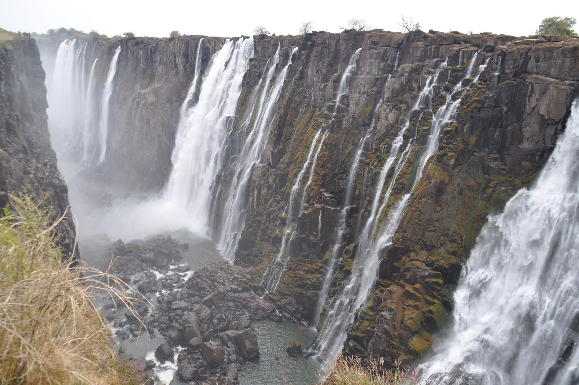
Choose the month before choosing anything else. February to May is the flood, with the maximum around April, and it is spectacular and largely unphotographable at the same moment. Visitors on the Zimbabwe path in February report mist so dense at the near viewpoints that visibility collapses entirely, water running down the rock face of the walkway and clothes soaked through within seconds of leaving cover. Ponchos sold at the gate are close to useless at that volume. Rain jackets soak through. The practical technique is patience: the wind shifts, the mist clears for thirty seconds, the view arrives and then goes again. Nobody gets a camera out at Rainbow Falls in April without a dry bag.
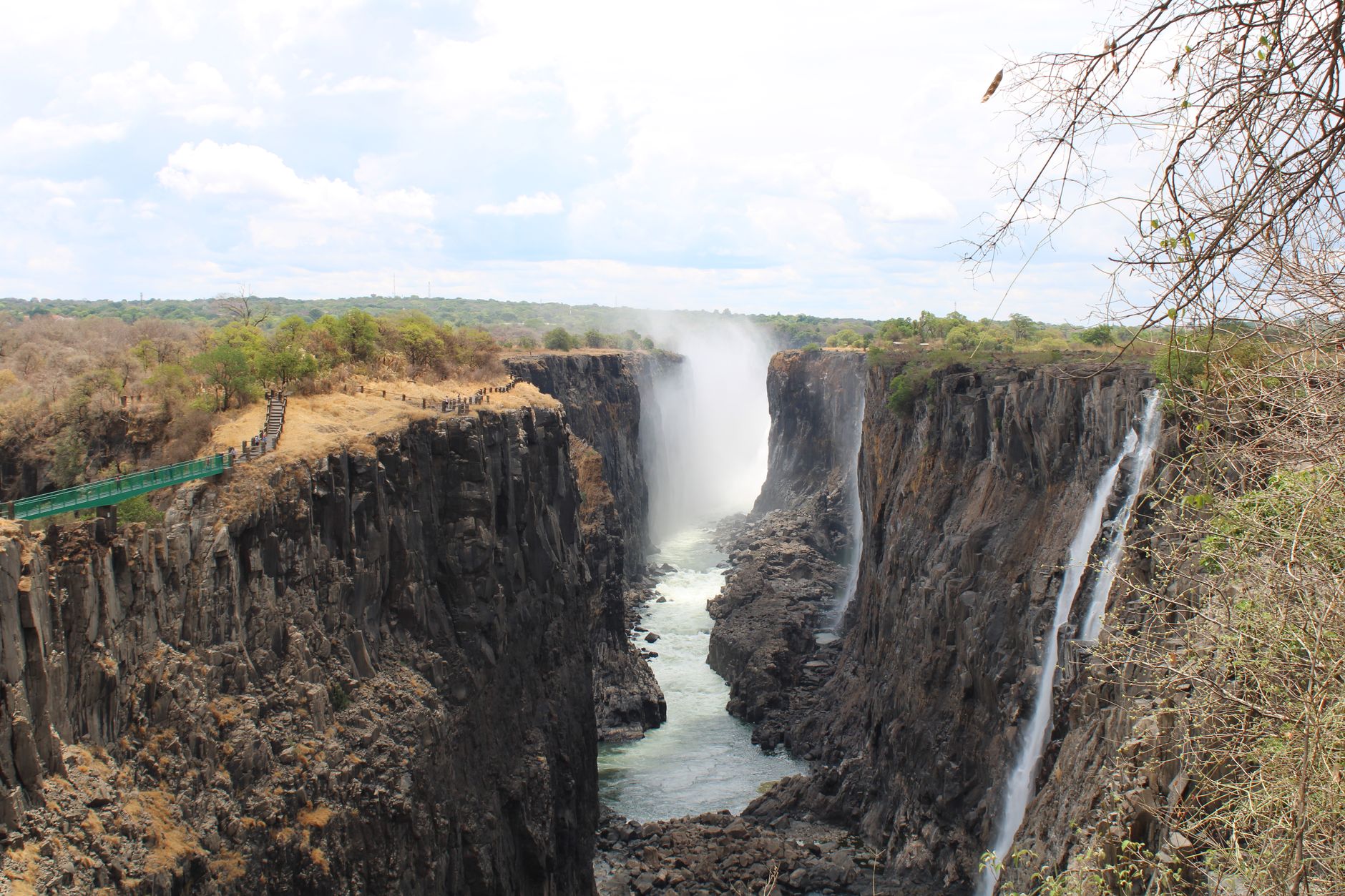
September to January is the opposite trade. The panorama comes up clean, the walkways stay dry underfoot, and up to half the rocky face can run empty. A bare face shows the geology properly, which is worth seeing in its own right, though it is a long way from the poster. Anyone booking November for the volume should either move the dates or plan the trip around the flight and the river rather than the footpath. June and July sit between the two: still flowing, dry winter air, walkable stone, and for a first visit with no fixed agenda they are the months that misfire least.
Insect repellent is the item most often underestimated here. The spray washes it straight off. A high-water walker who reapplied nothing after the wet viewpoints collected six mosquito bites in a day, inside a malaria zone. Carry it onto the path and use it again at the exit, not once at the hotel.
The same ticket, in April and in November, buys two entirely different waterfalls.
The rock explains the shape. The plateau here is basalt laid down in the Jurassic, roughly 200 million years ago, and as it cooled it cracked along mostly east to west seams that later filled with softer sediment. The south-flowing Zambezi erodes those soft seams far faster than the hard basalt around them, so each time the river finds a new one it abandons its old lip and cuts a fresh gorge along the crack.
Eight former positions of the falls are documented in the zigzag chain downstream, and the present lip is the latest in that sequence. The crack that will eventually replace it is already being widened upstream. The Batoka Gorge itself was cut when Lake Makgadikgadi overflowed around 20,000 years ago. UNESCO inscribed the whole transboundary property in 1989. On the ground it is two parks: Victoria Falls National Park in Zimbabwe, 23 square kilometres, and Zambia's Mosi-oa-Tunya National Park, 66.
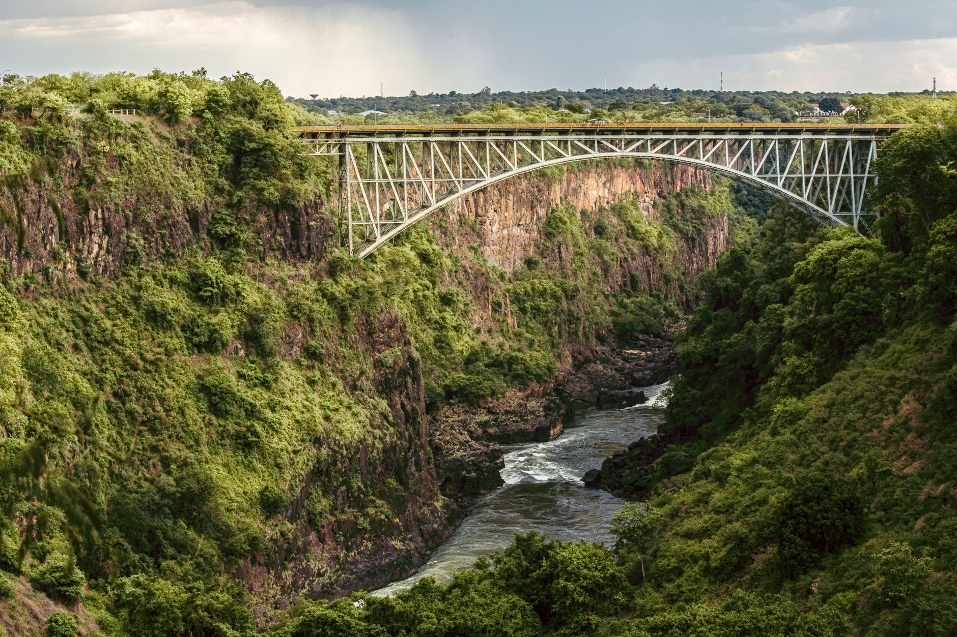
It is about ten minutes on foot from the park to the border post and fifteen to cross, and the pedestrian path runs clear of the freight trucks that habitually back up on the span. Bungee operators work from the middle, with the jump measured at 111 metres, plus a swing and a zip line for the less committed. Round trip to look at the falls from the far bank runs to a couple of hours before any queueing. Basing on one side and day-tripping the other saves the most time. The walking distances are trivial; the paperwork is what wears people down, and flying into the far country then taxiing over turns one transfer into three.
Devil's Pool, the rock basin on the lip, is Zambia only, sits on the western tip of Livingstone Island, and exists for roughly four months of the year, approximately September through December, with the window moving as the river does. Getting there means wading the river holding ropes, chest deep on a shorter swimmer, over rock that is both slippery and sharp, which is why water shoes are the single most repeated recommendation from people who have done it. The pool is about three metres across and four deep, the water is cold enough that the guides shiver while holding swimmers' ankles, and time actually in it runs to a few minutes because the group takes turns.
From inside the pool the drop is not visible. Lying flat and craning over gives a glimpse of water disappearing. The terrifying photograph everyone arrives with was taken from the Zimbabwe bank, not from the pool. Book the first departure of the day for better light and a smaller group, because slots sell out.
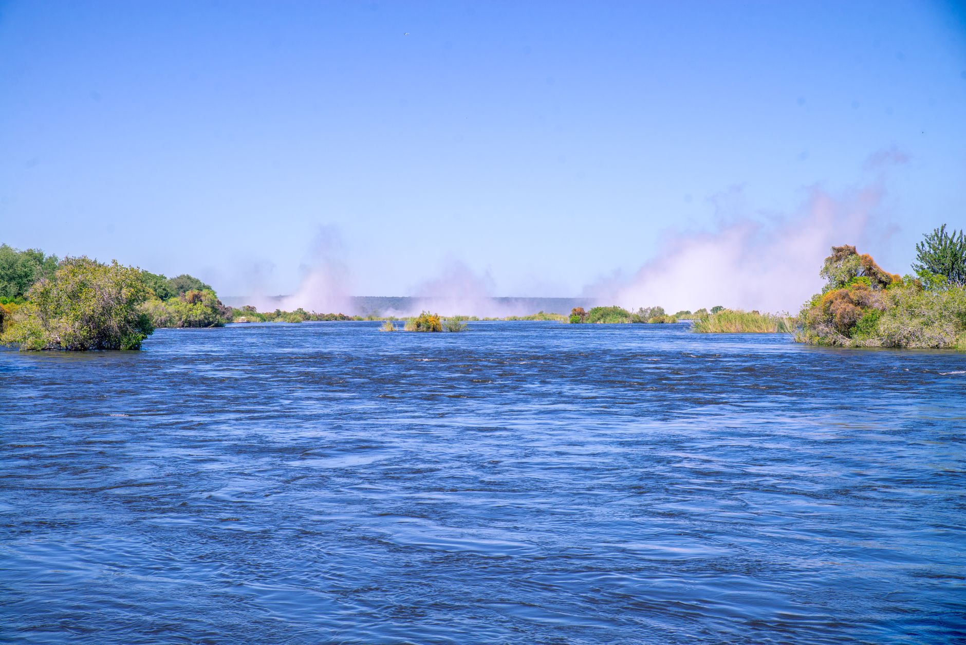
Above the lip the Zambezi turns to glass, which is what the sunset cruises are for. They run around three and a half hours and are the best chance of hippo and elephant from water level. Boats do break down, and the passengers who drifted for twenty minutes waiting on a rescue launch reported the best wildlife of their trip while they waited. Helicopter flights over the falls and the gorge chain last about fifteen minutes and are weather dependent, with mist grounding them at short notice. In high water, when the ground views are half hidden, the flight is the thing travellers most often name as the one they wish they had booked.
Two hazards get underplayed in the brochures. Chacma baboons work the footpaths and are practised at it: a hat taken straight off a walker's head on the climb from the Boiling Pot, a charge at a woman carrying a visible water bottle. Anything held loosely, and anything that looks like food, is a target. And around the river after dark, hippos come ashore. Local advice is to take a taxi rather than walk the riverside road at night, and that advice travels by word of mouth rather than by signpost. Add to that a purely administrative hazard: the Boiling Pot trail on the Zambian side closes at 16:00, which regularly catches people who cross the bridge after lunch.
Give the Zimbabwe footpath two to four hours. Most of the drop-off happens after the first three viewpoints, and the western end of the path holds Danger Point and the view back along the bridge. The Zambian circuit takes three to four hours and is steeper, with roughly 350 feet of stairs down to the Boiling Pot and a humid, shadeless climb back out. Doing both means two border posts, two park fees and a morning of queueing, which most visitors judge worth it once. That it can be done at all in a single day is down to a bridge specified from four thousand miles away by a man who never came to see what it crossed.