The West Baray gives the scale of it. Dug by hand between 1001 and 1066, it still holds something on the order of fifty million cubic metres a thousand years later, and it was one component in a system of reservoirs, feeder canals, moats and embankments that made a city of this size possible where the rain arrives in a four-month block and then stops. Angkor was a hydraulic machine before it was a skyline. Recent work on the sediment records suggests the machine is also what failed: decades of drought in the fourteenth and fifteenth centuries, broken by violent monsoons that tore out the infrastructure faster than it could be repaired, in a system too large and too interdependent to patch.
What did not happen is the part everybody knows. Angkor was never lost. The story that Henri Mouhot, a French naturalist whose notes were published after his death in the early 1860s, stumbled on a forgotten city in the jungle has been repeated for a century and a half, and it was untrue when he wrote it. Cambodian monks were living and praying at Angkor Wat continuously; a Portuguese friar named Antonio da Madalena described the place in 1586, nearly three hundred years earlier; and the site appears on European maps before Mouhot was born. What he supplied was an audience, at a moment when France was looking for reasons to be in Indochina.
What the forest did swallow were the outlying temples, and there were a great many of them, because Angkor was not a temple but a city. At its height it was the most extensive urban complex of the preindustrial world, spread across more than 1,000 square kilometres outside modern Siem Reap. It ran on water. An enormous engineered system of moats, channels, embankments and vast reservoirs, called barays, fed the rice that fed the labour that raised the stone. The West Baray alone still holds on the order of 50 million cubic metres, a reservoir dug by hand between 1001 and 1066 and still holding water a thousand years on. A visitor who grasps that Angkor was a hydraulic machine before it was a skyline has already understood more than the sunrise crowd.
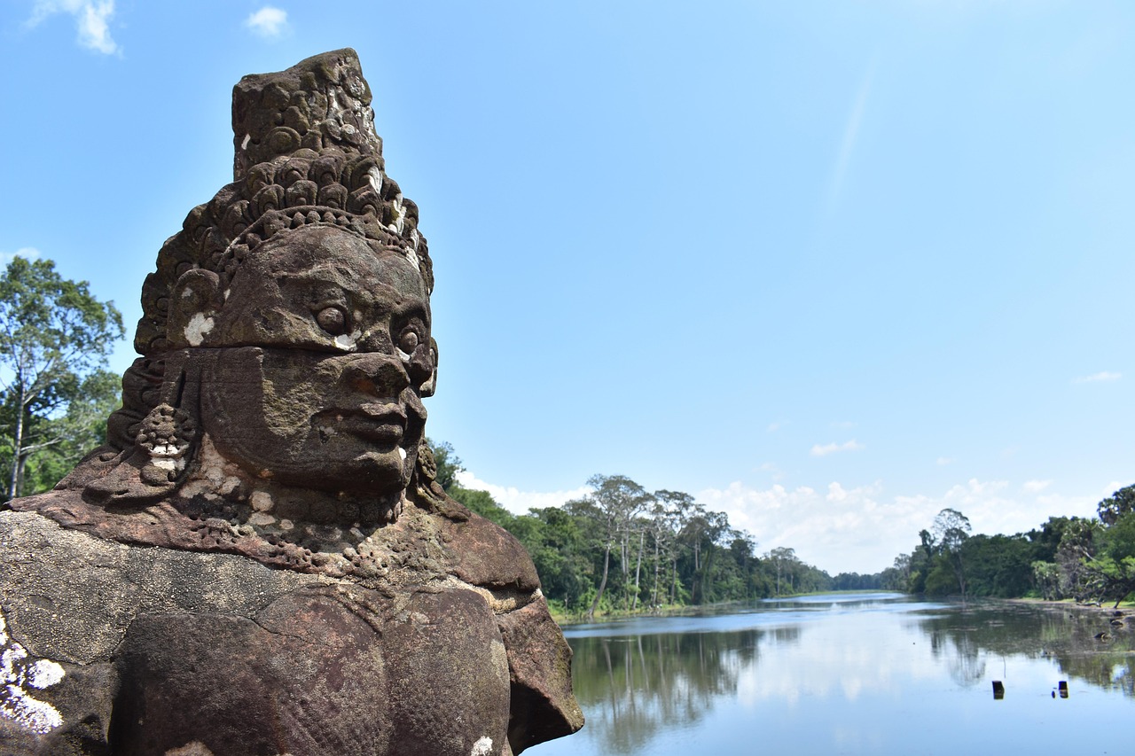
The front door is Angkor Wat itself, built in the first half of the 12th century under Suryavarman II as a Hindu temple to Vishnu and later turned to Buddhist use. It is the largest religious monument on Earth, and it is the only building to appear on any national flag. But the temple most people remember afterwards is not the wat. It is the walled city of Angkor Thom, entered across a causeway lined with rows of gods and demons hauling on a stone serpent, and at its centre the Bayon.
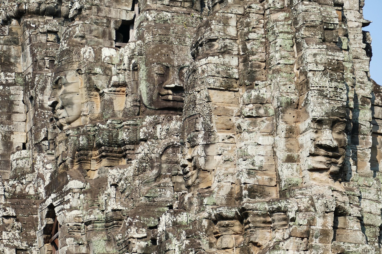
Angkor Thom, the Bayon, Ta Prohm and Preah Khan were all raised within a single reign, that of Jayavarman VII between 1181 and 1218. Most historians consider him the greatest of the Khmer kings and comfortably the most prolific builder in the empire's history, an output of stone with no real parallel in premodern Asia. His signature is the Bayon's towers, 54 of them, each carrying four serene faces turned to the cardinal directions. That is roughly 216 faces, and scholars still argue over whose they are: the bodhisattva of compassion, the king himself remade as a god-king, or deliberately both at once. Standing in the middle of them, the arithmetic stops mattering. Whichever way a visitor turns, a face is already watching, half smiling, at close range.
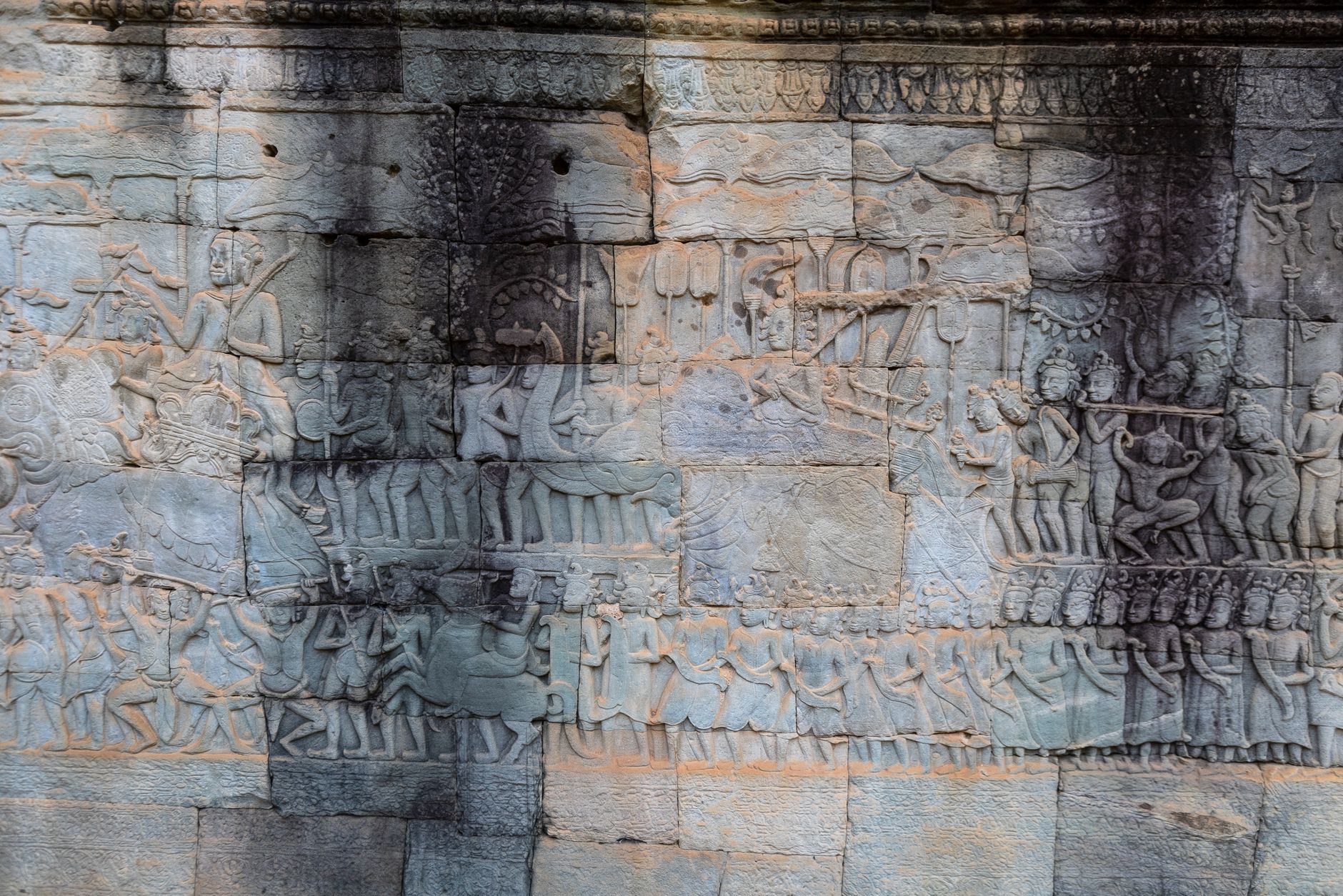
The forest swallowed the outlying temples. Local memory never did.
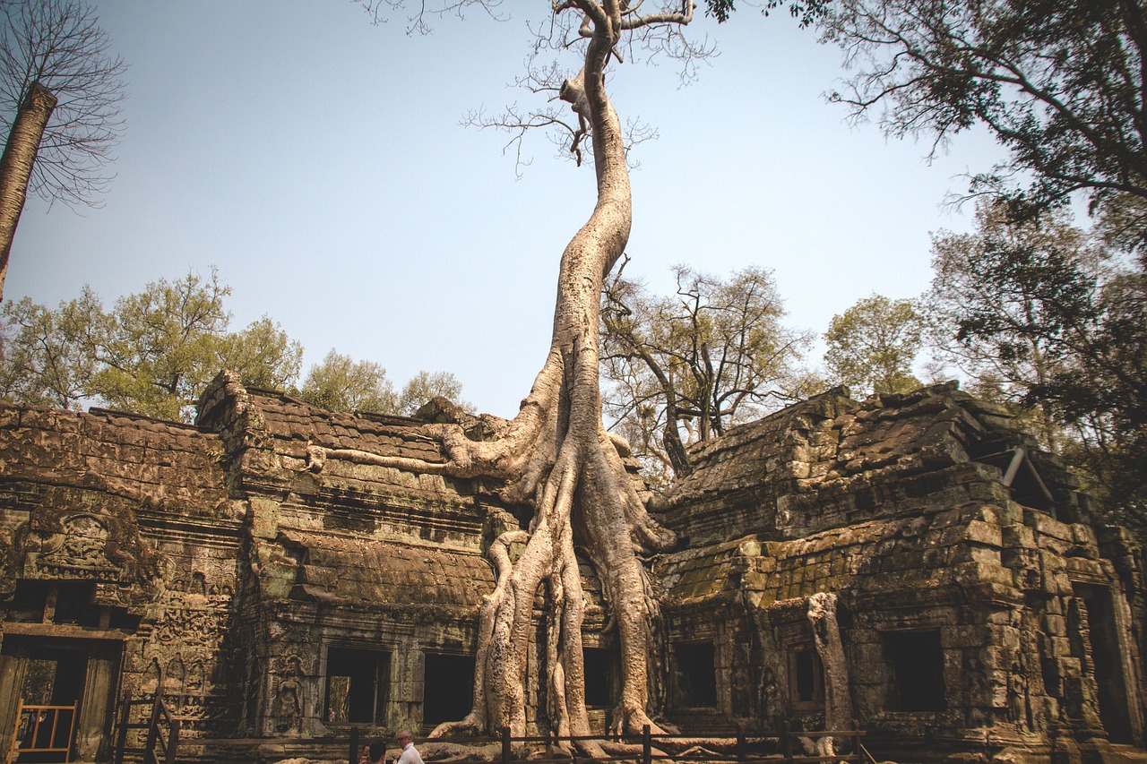
The temple everyone photographs for the roots is Ta Prohm, begun in 1186 as a Buddhist monastery dedicated to Jayavarman's mother. An inscription records that more than 12,500 people served it directly, including 18 high priests and 615 dancers, with tens of thousands more in the villages that supplied it. When French teams began clearing Angkor early in the 20th century, they made a deliberate decision at Ta Prohm: leave the giant silk-cotton and strangler-fig trees where they had rooted in the galleries, as, in the conservators' own phrase, a concession to the general taste for the picturesque. So the famous wildness is curated. Ta Prohm is stabilised, roped and, in season, crowded. The trees are real, the roots are real, and the sense of a place mid-swallow is a stage set, maintained on purpose.
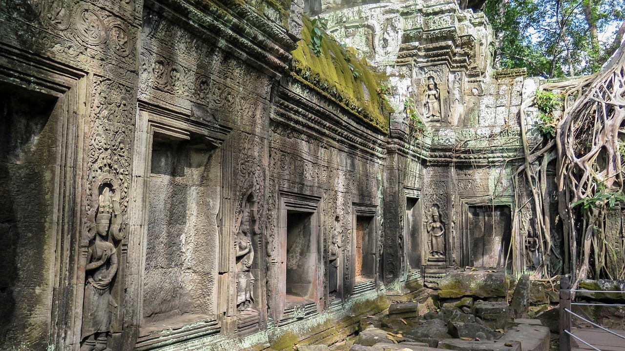
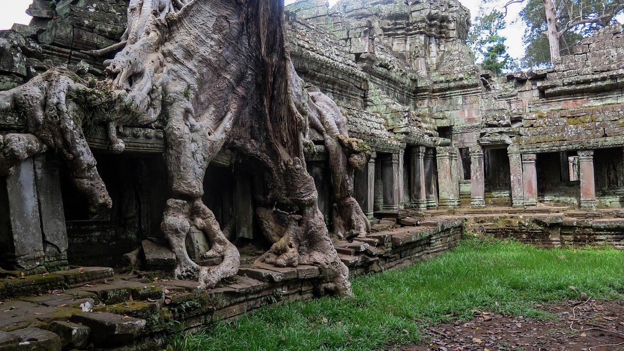
The genuinely unrestored temple, the one the myth actually promised, is further out. Beng Mealea sits about 40 kilometres east of the main temple group, and roughly 70 by road from Siem Reap, built in the 12th century to a plan close to Angkor Wat's own, and then left as a collapsed field of moss-covered blocks and root-cracked galleries with few barriers and, most days, close to no one. It is now covered by the standard Angkor pass, and it is worth the drive of ninety minutes to two hours each way, precisely because it has not been made safe and legible. Where Ta Prohm is a performance of ruin, Beng Mealea is the thing itself, and the freedom to pick a way over the stones is part of what the tidier temples no longer allow.
All of which leaves the sunrise, which is the part most trips get wrong. Angkor Wat, Srah Srang and Phnom Bakheng open at 5am; Bayon, Ta Prohm and Banteay Srei not until 7.30, and around the equinoxes, when the sun comes up directly behind Angkor Wat's central tower, the crowd at the northern reflecting pool can run several thousand deep. The counter-move is simple. The south reflecting pool gives nearly the same mirror image with a fraction of the bodies, and plenty of seasoned visitors skip the pond entirely, spending first light at the almost empty royal bathing pool of Srah Srang or at Pre Rup, then walking into Angkor Wat's galleries in the hour after sunrise, when the pond crowd disperses for breakfast and the carved corridors fall quiet and beautifully lit.
A few practical rules save a wasted morning. Shoulders and knees must be covered to climb to the upper level of Angkor Wat, the Bakan, and visitors who turn up for sunrise in vests and shorts are turned back at the stairs, so a light long layer belongs in the day bag. There are no vendors on the upper terraces, so water and a headlamp for the pre-dawn walk are on the visitor to carry. Drones and flash are not allowed. And the marquee temples are at their worst in the middle of the day, hot, hard-lit and thickest with buses, which is the window to spend on the long drive to Beng Mealea or a shaded lunch, keeping the Bayon and Ta Prohm for late afternoon when the light softens.
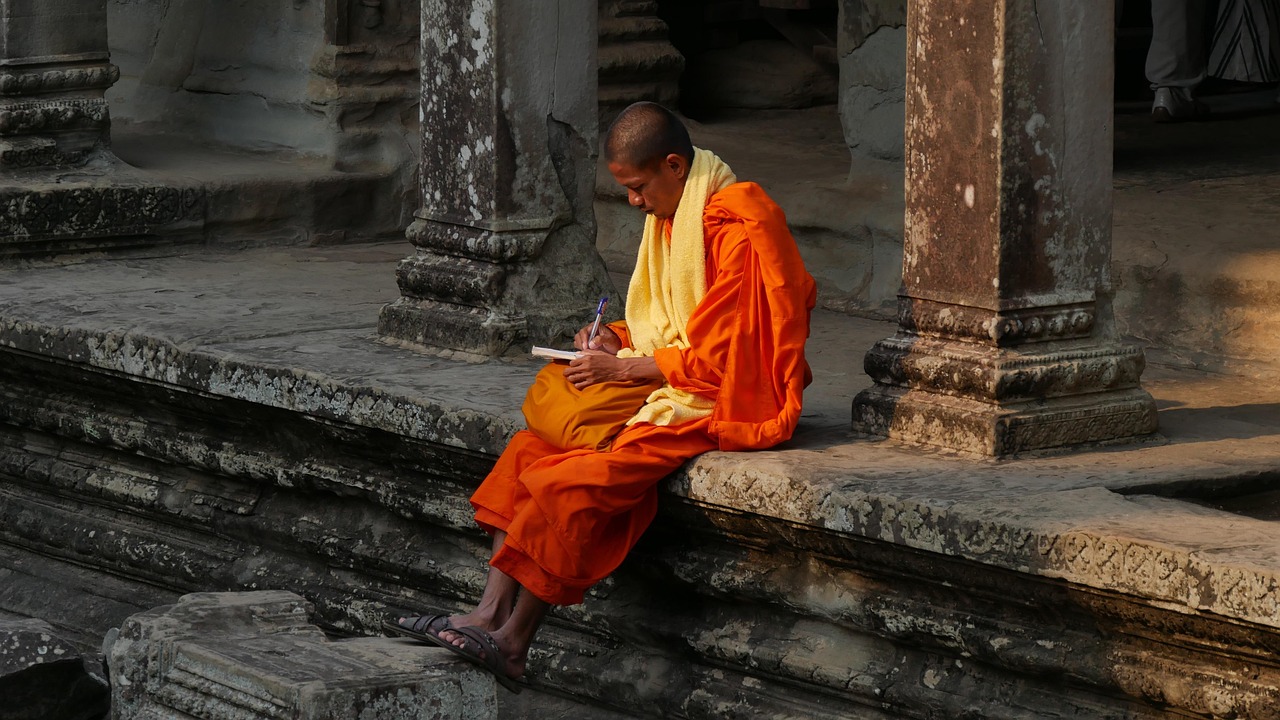
The last thing to plan for is fatigue. Travellers warn each other, with good reason, of being templed out by the third day, and the antidote is restraint: a three-day pass spread across its ten-day validity window, with slow mornings built in, beats three dawn-to-dusk marathons in a row. Angkor rewards the visitor who treats it as a living place, which it plainly is, and not as a checklist. Saffron-robed monks still move through the same galleries the guidebooks call ruins, which is the quiet proof of the thing the sunrise crowd never quite absorbs. The reporting that called it lost was written by men who had walked past monks living in it.