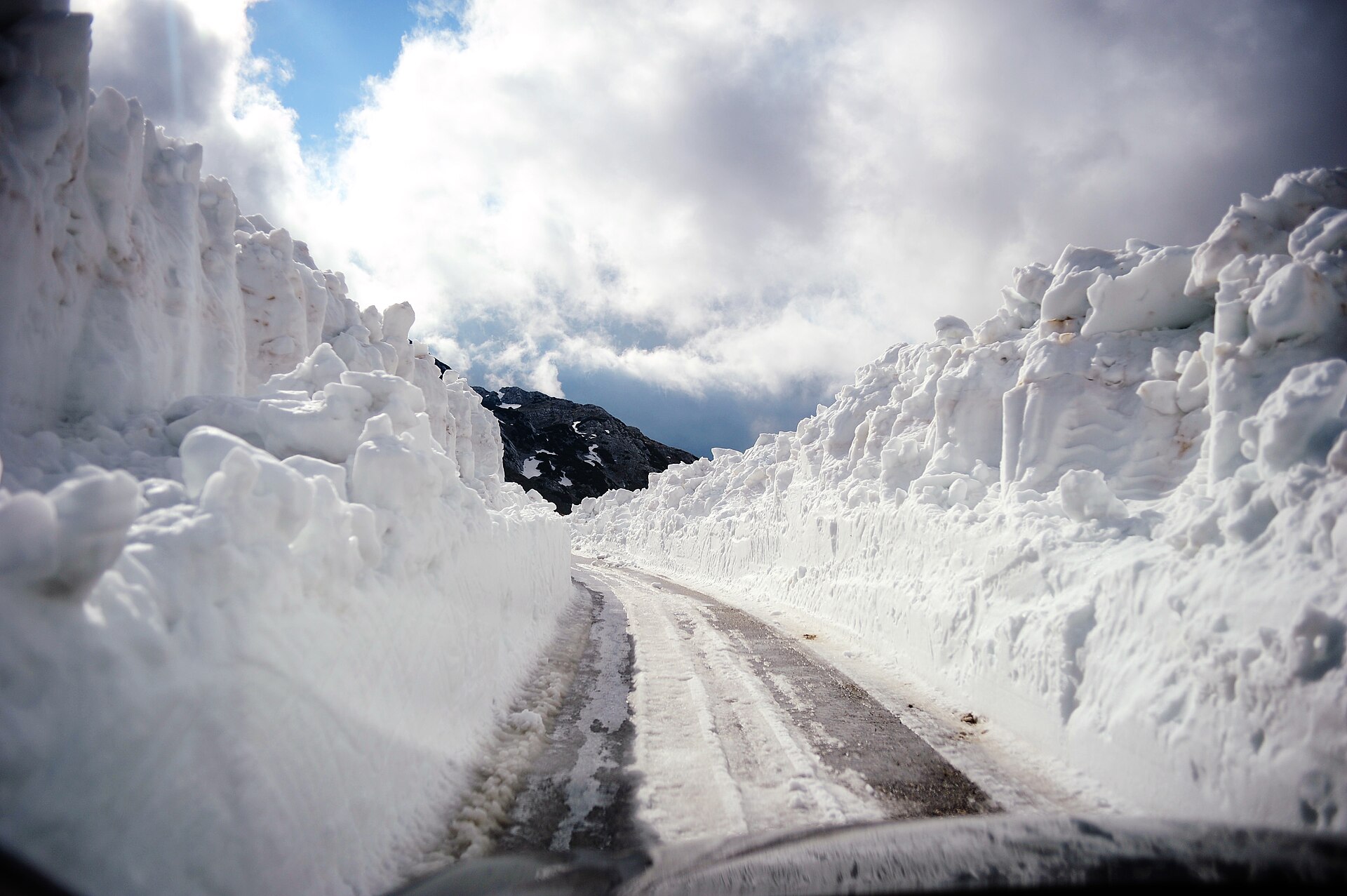
The Sedlo pass is the last part of the loop to clear, and its opening date is effectively the ring's. In 2026 the ploughs cut through on 21 May, between drifts still standing higher than the road. If a late thaw keeps Sedlo shut, the alternative road through the Sušica canyon opens earlier in spring and stays open later into autumn.
Snow is not a marginal fact here. The massif carries more than 15 centimetres of it on around 120 days a year, and the ski stations above the town hold usable cover for about 150. The walking routes run weeks behind the road. Late June to early October is the window, July to September is the answer that needs no caveat, and late June and September give the better combination of mild weather and a thin crowd.
Through June the high routes change week to week. The park office in Žabljak and the guides working out of the town are the source worth acting on, not a forecast read at home.
The Đurđevića Tara bridge closes to everything. Montenegro's transport administration suspends all traffic on the M-6 between Pljevlja and Žabljak from six in the morning on 10 August 2026 until midday on 26 October, for the reconstruction of the bridge. People on foot and on bicycles are included, so for eleven weeks of the season the most photographed object in northern Montenegro cannot be walked onto. Through the first nine days of August the regime is alternating one-way working with timed passage windows. For the Pljevlja direction, and for transit north towards Serbia, the state sends drivers round by Mojkovac and Bijelo Polje, with a signed local alternative at Vrulja and Mijakovići. The approach from Podgorica through Nikšić and Šavnik, two and a half to three hours by car, does not touch the bridge at all, and the buses to Žabljak from Podgorica and Nikšić run on that side of the mountain. The works run on past October: lorries over 3.5 tonnes have been barred since March 2026 and the crossing is not expected to be signed off before 2027.
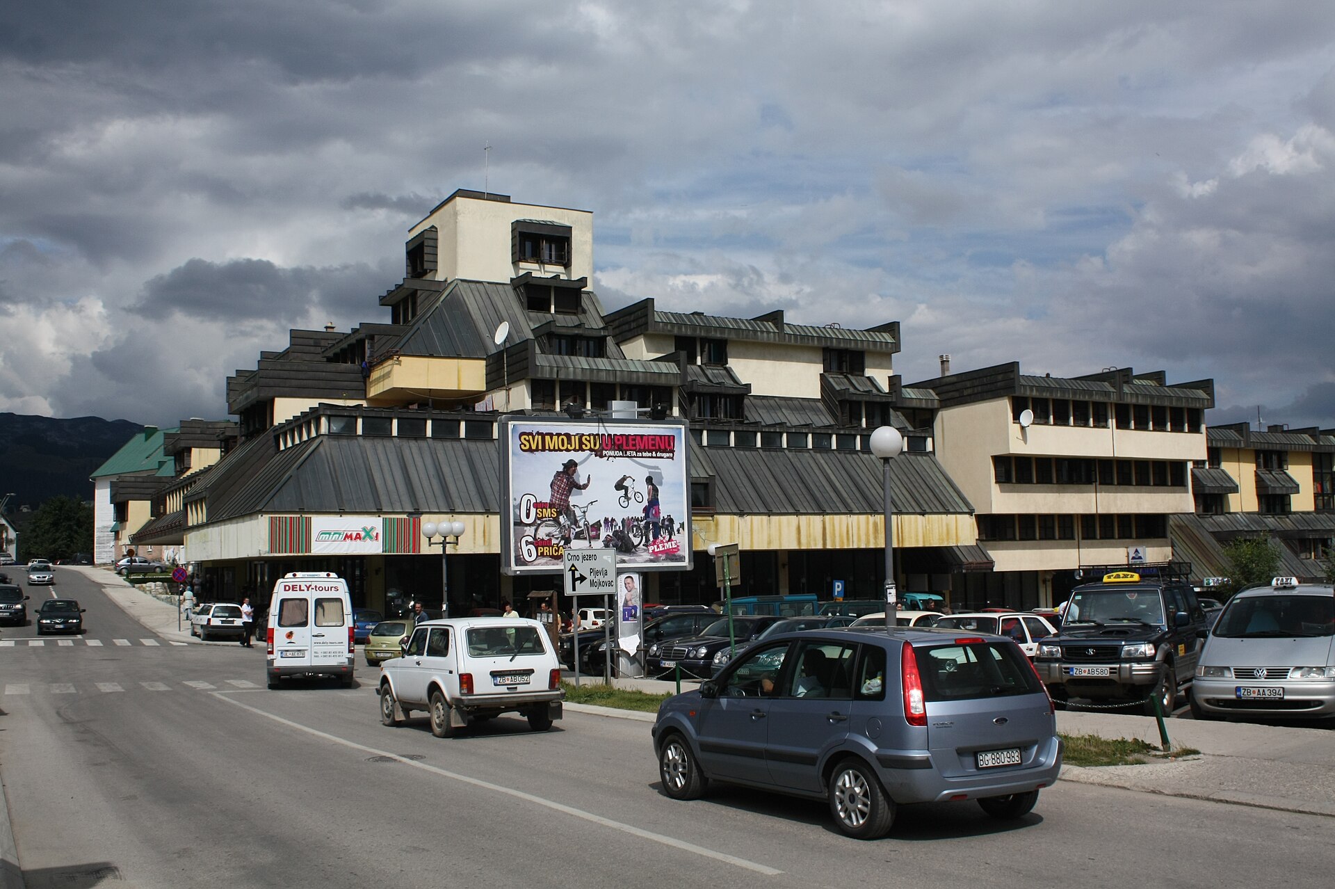
Base yourself in Žabljak and expect it to ask very little of you. Under 2,000 residents, walkable end to end in a quarter of an hour, with something like twenty restaurants and taverns, two supermarkets, a bakery, a health centre, banks, taxis waiting near the supermarket and paid parking along the main strip. It sits at 1,456 metres and it is a base rather than a destination. There is no reason to give it a day of the trip.
Buy a park ticket wherever you first stop inside the boundary, because there is no gate to buy one at. Rangers sell them at car parks and trailheads, with Sedlo, Ćurevac and Prutaš named by the park, plus a booth on the Black Lake approach and a checkpoint at the river crossing into the Sušica canyon. There is an online system as well.
Tickets are sold by the day, with multi-day options and an annual card covering all of Montenegro's national parks. Keep yours, and carry cash as well as a card: enforcement is consistent in high season and patchier outside it. Parking at Black Lake is charged separately and by the hour.
Walk the three kilometres out to Black Lake rather than driving. It is a flat half hour on pavement and it removes the parking problem entirely, which matters in August, when the car park fills through the morning.
The circuit is an educational trail of 3.6 kilometres and about an hour. It is easy for most of its length, uneven and slippery in the middle, with a short scrambly section on a fixed rope in at least one account. Trainers are enough. There is a restaurant, a café, a playground and rowing boats for hire, and the swimming is cold and stony underfoot, so water shoes earn their space.
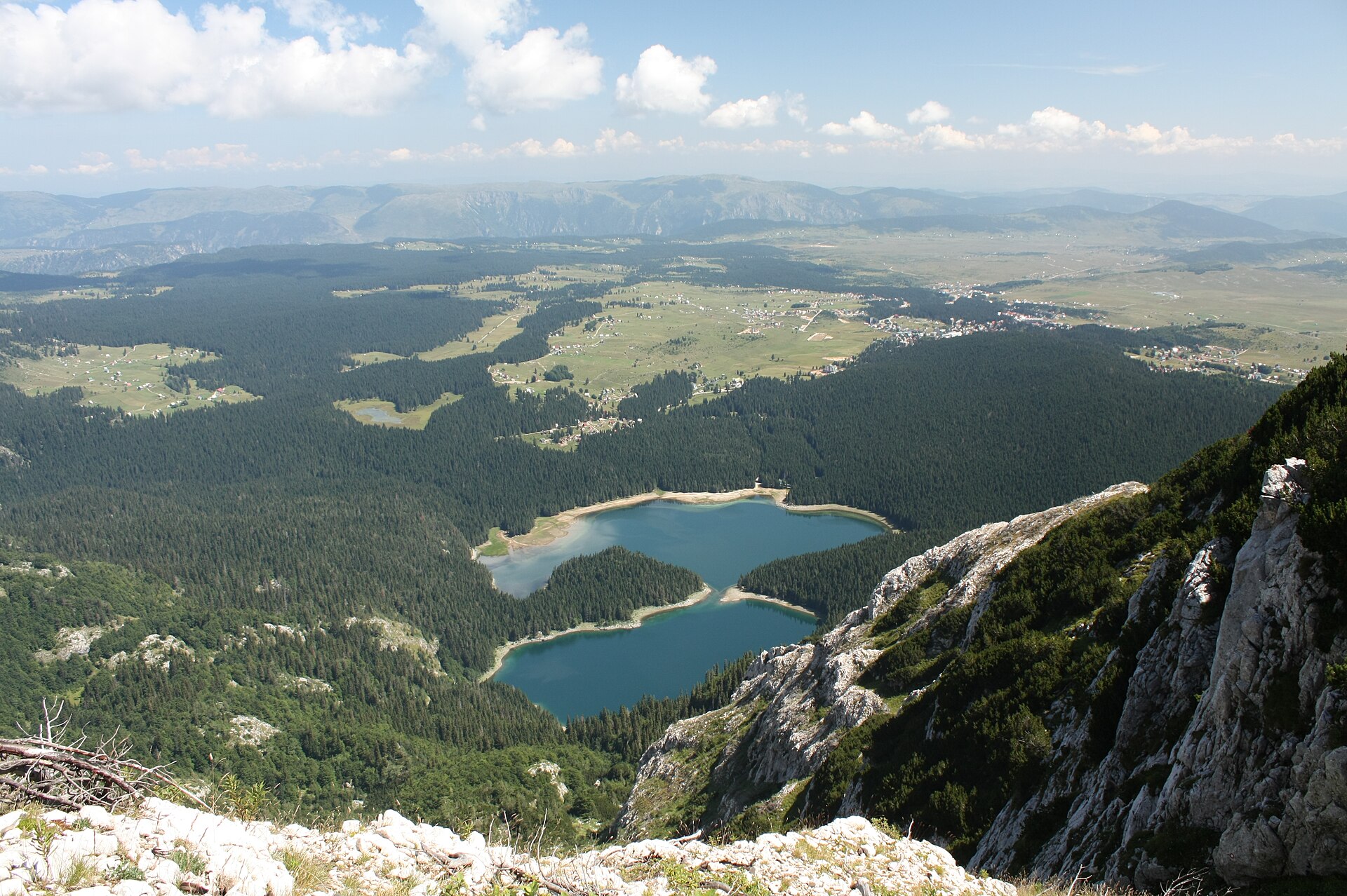
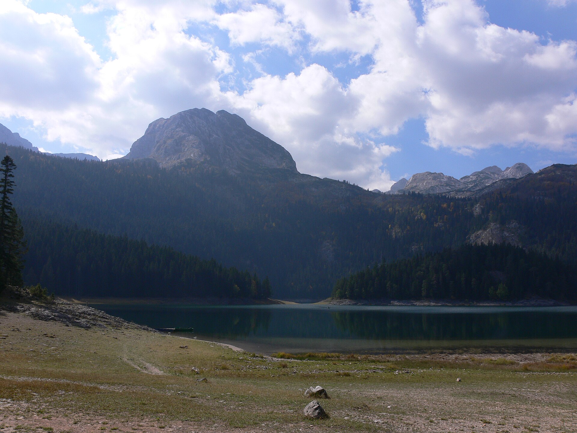
What is called one lake is really two. Veliko jezero and Malo jezero are joined by a narrow strait that dries as the season goes on, until the pair separate; in a wet June a visitor can find them merged into a single sheet. The smaller basin is the deeper of the two, 49 metres against 24. Meded stands over the water at 2,287 metres.
The ring itself is Montenegro's Panoramic Road number 2. It runs 76 kilometres from the middle of Žabljak, or 83 with the detour to Ćurevac, paved for its whole length and much of it a single lane carrying traffic in both directions, which is where the whole difficulty lies.
Expect sharp bends, long stretches without guardrail, and passing that depends on finding somewhere wide. Independent accounts describe reversing along a shoulder after meeting a car on a blind curve, and loose rock on the carriageway on the northern half. No four-wheel drive is wanted and a mid-size car is the right tool. The official limits rule out anything 7 metres or longer, 2.30 wide or 2.90 high.
Counterclockwise is the state's recommendation for cars and clockwise for campervans, though travel writers disagree about which suits a car better, so there is no consensus to report. There is no fuel and no shop anywhere on the route, so leave town with a full tank, water and lunch. Trsa at the halfway point is the reliable stop for a meal.
Two to three hours is the moving time, which nobody achieves. Give it a day, and expect to lose twenty minutes of it to a flock coming down the road.
Taken counterclockwise the road crosses the massif in an order that makes sense of it. First the plateau surface and Black Lake. Then the rim of the Tara canyon past Bosača and the Ćurevac viewpoint at 1,625 metres, where the car park doubles as a payment point and a rocky, unfenced path runs 1.1 kilometres each way along the gorge edge, about an hour there and back and slippery in and after rain.
Then the gate between Veliki Štuoc and Mali Štuoc at about 1,952 metres, which is the highest point the road reaches and stands above Sedlo, the pass usually printed as the route's summit. Then the drop into the Sušica canyon, singled out in the official leaflet for rockfall. Then the Pivska Planina pastures at Pišče.
Then Todorov Do at 1,800 metres under Prutaš, where the folded bedding of a Jurassic sea floor is unusually legible from the car. Then Sedlo at 1,907 metres, a small free parking area with benches, a dependable cold wind, and the trails for Bobotov Kuk and Sedlena Greda leaving from it. Then the Pošćenska lakes, and Žabljak again.
Bobotov Kuk is 2,523 metres and the high point of the massif, though not of the country: that is Zla Kolata at 2,534 metres, on the Albanian border in the Prokletije. The habit of naming Bobotov Kuk first has a reason behind it. The Mountaineering Association of Montenegro treats it as the highest summit lying wholly inside the country, since the Prokletije peaks straddle a border.
From Sedlo the standard route is about ten kilometres out and back in five to eight hours. Meadows, then a cabled traverse around the Uvita greda rock face, a boulder field at Surutka, limestone steps to Velika Previja, and and, in settled summer conditions, a final half hour on a narrow airy ledge with fixed rope. The waymarking is good and nothing beyond boots and poles is wanted for any of it.
Starting from Žabljak instead makes it a different day, about twenty kilometres and eight and a half to twelve hours, which is why people are still coming down at dusk. The version most people should take is the one-way traverse: a taxi from town up to Sedlo, then roughly fourteen kilometres back down to Black Lake in six hours.
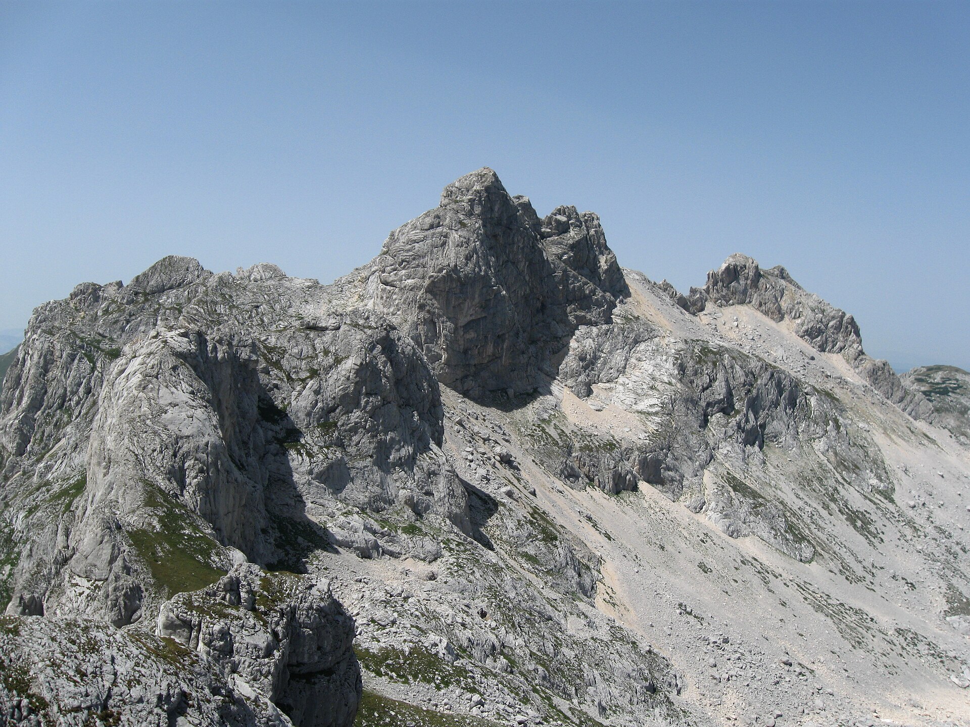
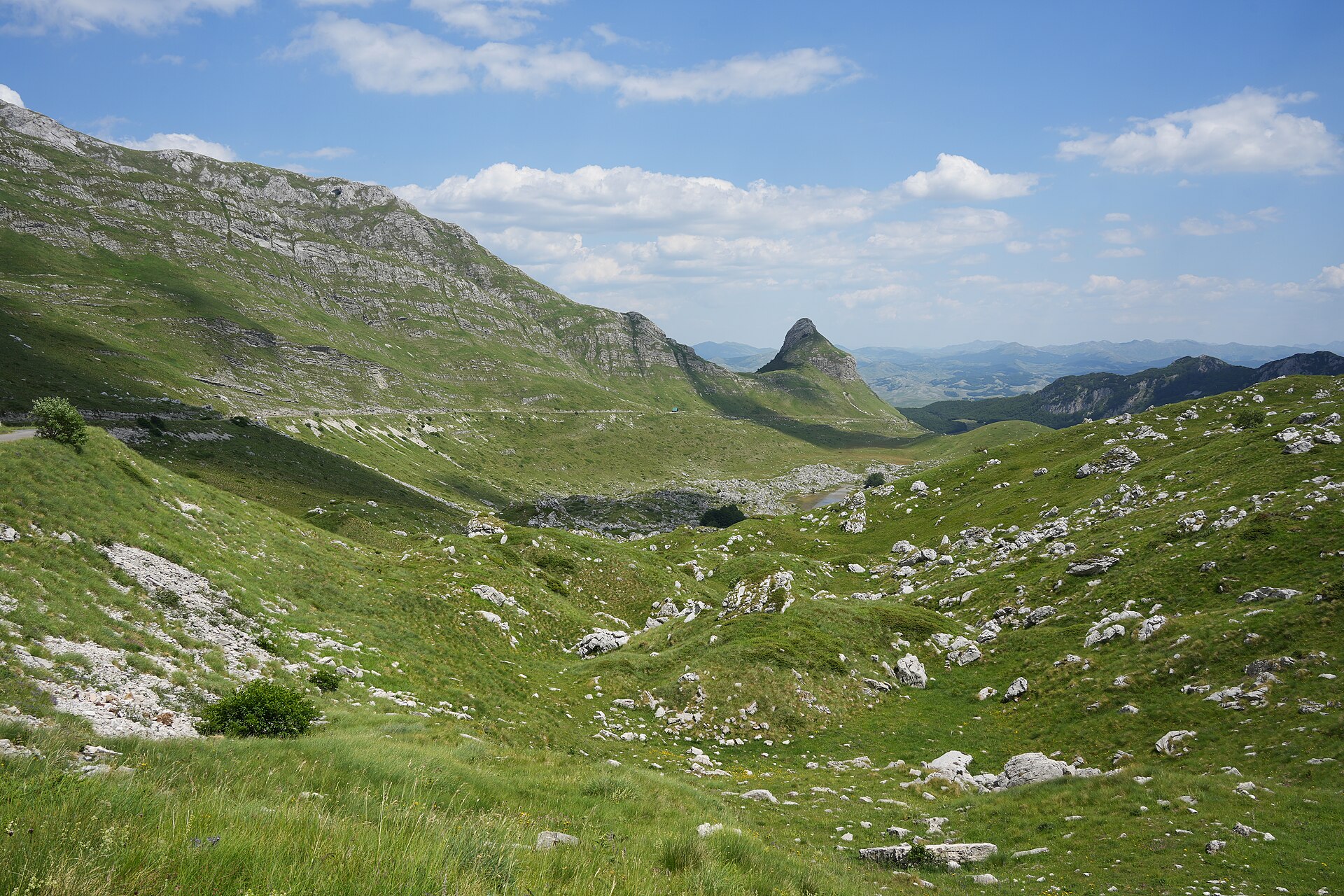
The last thirty minutes is the whole question.
That final ledge is protected but narrow, and the rock is polished by boot traffic. A Žabljak hostel operator puts the share who turn back there at something like one in five. That is a guess from behind a desk, but it points at something real. Anyone unhappy with height and drop should plan to stop at the ridge and treat that as the day.
There is plenty to take instead. Prutaš is eight or nine kilometres and roughly four hours, easier from the southern Dobri Do and Šarban side, and it is the standard substitute on a poor forecast. The Sušica canyon from Sušičko jezero up towards the Škrčka lakes runs 13.2 kilometres return in about six hours for 600 metres of gain, easy going apart from a long overgrown stretch where sleeves and trousers matter, and with almost nobody else on it.
Ledena pećina, the ice cave that opens at about 2,160 metres below Obla glava and holds permanent ice people walk into in August, is just under fourteen kilometres and six to eight hours. There is a steep snow and ice ramp of about forty metres inside, where poles help and crampons can. Planinarski dom Škrka, between the two Škrčka lakes at about 1,723 metres, keeps roughly twenty beds and a short summer season, and needs confirming directly before anyone counts on a bed in it.
Carry more water than looks necessary. Two litres a person is the minimum on a summit day and more in a heatwave. There is nothing on the Bobotov Kuk ascent apart from Zeleni Vir, a small lake reached at about an hour forty, and every named spring on the plateau should be treated as seasonal, because on a mountain made of limestone that is what a spring is.
One party on the ice cave route carried three quarters of a litre each, found the promised stream stagnant and the café shut, and needed at least twice what they had. Above the treeline there is nothing to shelter under and afternoon storms are routine, with sun at the trailhead and hail by the middle of the day in more than one report. Start early, be off the ridges by mid-afternoon, and carry a shell and a warm layer even in August.
Ticks are a genuine regional risk in long grass and at path margins. Snakes are about in summer, and one walker counted seven in a day in the Sušica canyon. Livestock guardian dogs work the pastures at katuns and are worth giving room. Download the offline maps in Žabljak, because mobile signal drops off with terrain.
About 1,500 people live inside the park boundary, mostly farming and herding, and the high grazing runs on katuns, the seasonal settlements families move up to with their animals for the warm months. The katuns a walker passes on a trail are somebody's summer farm, so hospitality at them depends on the family's willingness that day.
The system has a product worth eating. Durmitorski skorup, the local clotted cream, holds a national protected designation of origin tied to production in Žabljak, Plužine and Šavnik, and Pišče on the ring is known for sheep's cheese and kajmak. Eko katun Durmitor near Žabljak is the one properly verifiable way to see the arrangement from the inside: it sits on the Montenegrin rural-tourism registry and offers beds, meals from the farm and a hand in making them.
What the walking crosses is worth naming. Durmitor is heavily folded limestone standing above a karst plateau at around 1,500 metres, and limestone dissolves, so water had abandoned the surface for the inside of the rock long before any ice arrived. When the glaciers came they filled hollows that were already there. That is why the cirques a walker crosses were karst depressions first, why the park was listed in 1980 under the geological criterion as well as the scenic one, and why the lakes sit where they do at all.
Eighteen is the count the park uses, and locally they are the gorske oči, the mountain eyes, though only fifteen are permanent. Sušičko jezero and the river below it both take their name from suša, drought. It fills on snowmelt and by late summer has normally drained completely through holes in its own bed, leaving a flat green floor that gets cut for hay.
Two oddities up here follow from the same arrangement, and both are really about snow. Debeli Namet, a small glacier under Šljeme between roughly 2,030 and 2,170 metres, sits hundreds of metres below the regional snowline and survives on avalanche and wind-drifted snow delivered into a shaded cirque. And minus 40 degrees has been logged at the bottom of Valoviti Do, a stone bowl about 750 metres across: cold air drains into it on a clear night and cannot get out again.
One argument over the park should reach a visitor, because it concerns the ski area rather than the back country. In July 2025 the World Heritage Committee noted with utmost concern reports of artificial snowmaking installed at Savin Kuk, inside the property, and recalled that expanding the ski area inside the boundary would be an ascertained danger to the values Durmitor was listed for. The next state-of-conservation report is due on 1 December 2026.
The lifts are part of it. A chair on Savin Kuk II lost its grip in December 2025 and a 34-year-old skier was killed, and the operator has said that maintaining thirty-five-year-old machinery now runs on improvisation, because the parts are no longer made.