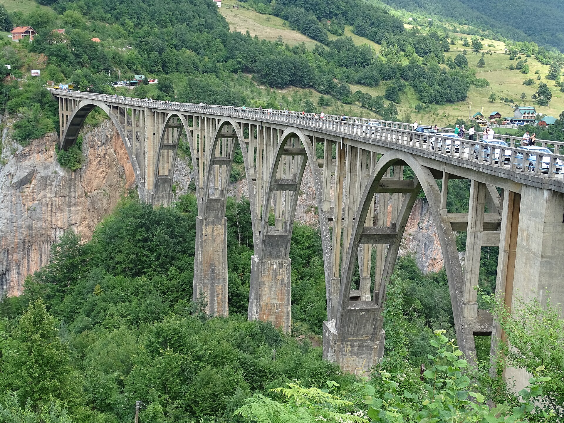
The bridge is the easy half, in an ordinary year. The Đurđevića Tara carries the M-6 across the canyon on five concrete arches, 23 kilometres from Žabljak. The stop it anchors has grown souvenir stalls, a few taverns and at least two zipline businesses. Their published cable lengths and speeds disagree badly enough that anyone buying a ride should ask which cable they are being sold.
Walking out to the middle of the span takes about ten minutes each way, and that is where the canyon opens up properly. There is no separate footway and the deck carries live traffic, so it is a walk to take deliberately. At least one traveller has judged the railing too low for small children.
The better photograph is not from the deck at all. A viewing platform sits twenty or thirty metres below the road on the southeastern side and gives the full arc of the arches. An hour covers all of it, outside the worst window of roughly eleven to three in July and August, when the coaches land from the coast and the smaller southern car park has already filled.
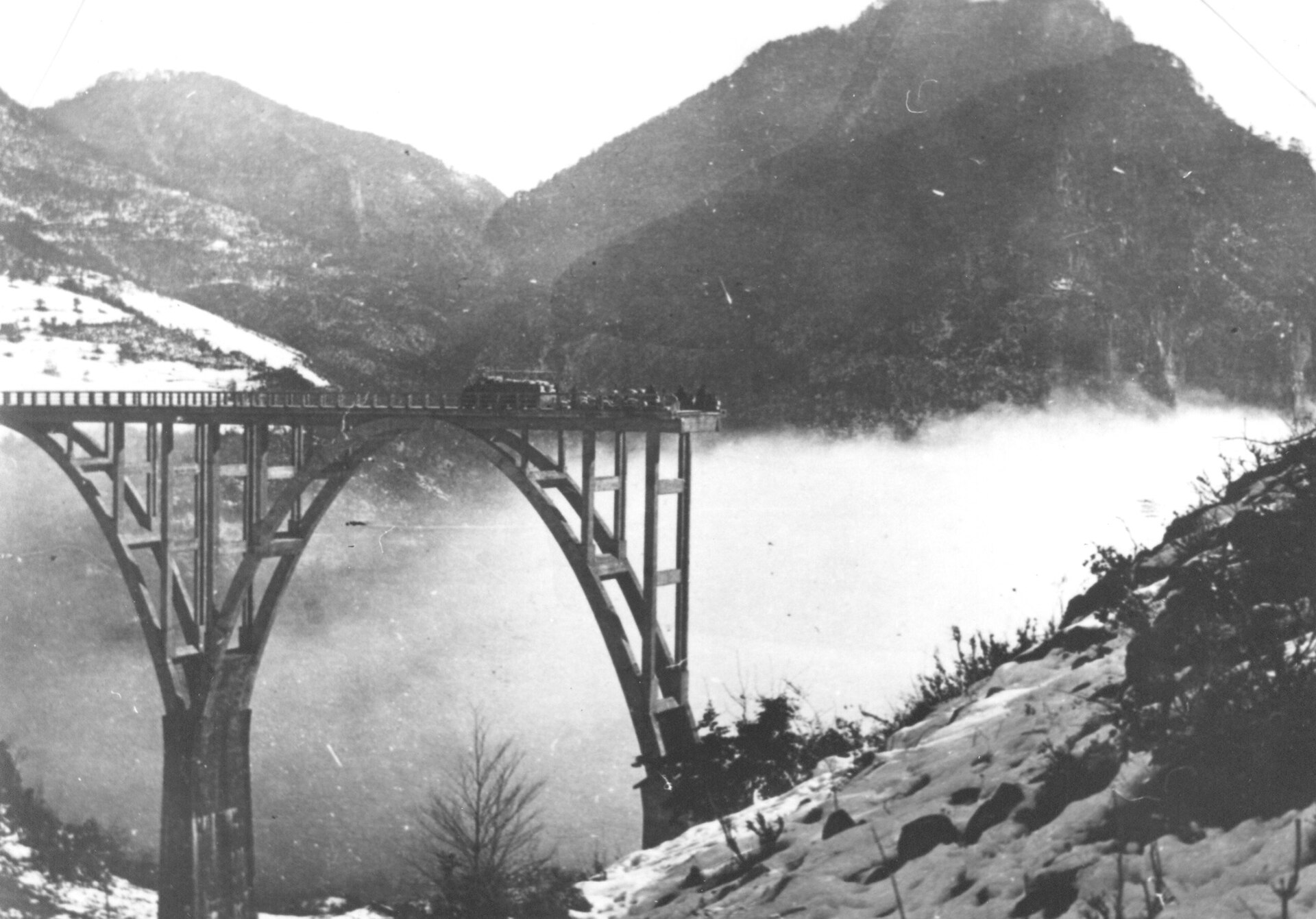
The structure earns a few minutes of that hour on its own account. It went up between 1937 and 1940, a start some Montenegrin sources put at 1938. Its main arch was poured on a timber falsework tower about 141 metres high, built by hand from local timber by the Swiss master carpenter Richard Coray. It was the tallest he ever raised.
In May 1942 the partisans cut the crossing to stall an Italian advance. The engineer who laid the charges, Lazar Jauković, brought down the smallest of the five arches on an order that the break be repairable after the war. He was caught within three months and shot on the deck on 2 August 1942, by Chetniks in the presence of the Italian occupiers, as the memorial at the bridge head records it.
The legend that spread afterwards, that the bridge had been destroyed by the man who designed it, named the wrong engineer. The designer, Mijat Trojanović, was in a German prison camp at the time. By Montenegrin accounts he engineered the 1946 repair himself and never corrected the story, out of respect for the man who was shot for it. The 1969 partisan film Most was shot here and carried the tale as far as China, which is part of why a share of the coach traffic arrives already knowing a version of it.
The Chinese-funded reconstruction has moved onto the structure itself, and the M-6 across the bridge is suspended for all traffic, people on foot included, from 10 August until 26 October 2026, with sign-off on the works not expected before 2027. The detour runs by Vrulja and Mijakovići, and the rafting is unaffected. Dates like these move, so confirm the current state in Žabljak or Pljevlja before planning a crossing. The canyon road up from Mojkovac has its own habit of closing for rockfall works, is paved but tightly curved, and runs through a string of unlit tunnels. Fill the tank at Mojkovac, the last reliable pump before the canyon, and download offline maps, because signal drops for most of its length.
The river is the other trip, and the honest version of it depends entirely on the calendar. The Tara is undammed, so there are no scheduled releases and the grade tracks snowmelt and nothing else. From May to the middle of June the guides call it class four to five. Accounts from genuine high water describe a paddler thrown clear of the boat and a trainee guide breaking a wrist against the canyon wall.
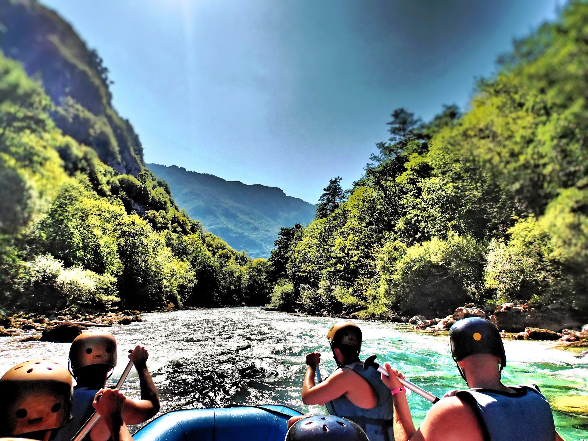
After that the river settles into a fast, extremely cold float through a canyon more than a kilometre deep, with rapids arriving as bursts of twenty or thirty seconds between long calm reaches. Most people come off the river enthusiastic. Nearly all the disappointment traces to the same mistake, which is booking an August trip on the strength of the word whitewater.
The water stays cold in every month: six to ten degrees in spring and thirteen to seventeen at the height of summer. The wetsuits, booties and buoyancy aids the camps hand out are not a formality.
Outside high water, the Tara run is a very cold float through the deepest canyon in continental Europe, with rapids in it.
Almost all of the rafting departs from Šćepan Polje, where the Tara meets the Piva on the Bosnian border. The standard half day is a rough half-hour transfer up to the put-in at Brštanovica, then 18 kilometres back down to the camps, two to three hours on the water. There is a safety briefing of variable quality, a voluntary rock jump, a waterfall stop, and a midway bar where two separate parties record the same mistake, which is arriving without cash.
The food back at the camps is the most consistently praised part of the whole day: trout, lamb, priganice with kajmak, and in one camp a meal cooked under an iron bell. The recurring complaint is language. Paddle commands are sometimes given in Montenegrin on boats where not everyone speaks it, so ask what language the guiding runs in when booking, and ask the camp its own minimum age rather than trusting a listing.
The river crosses the border repeatedly on the way down. Carry a passport whichever side your camp is on, and a green card if driving. Camp drivers commonly hold the documents dry while the boats are on the water.
Two gentler products wear the same name, and neither should be bought by accident. A half day sold out of Žabljak runs on the upper river near the bridge, with about an hour actually on the water. One June reviewer's verdict is the fairest description of it: not so much whitewater rafting as rafting.
The full days sold from Kotor are twelve-hour affairs with roughly three hours of driving at each end. The reviewers who liked them liked them as a way to see the interior of the country rather than as a rafting day. The season as a whole opens at some point in May, genuinely variable year to year, and runs to the middle of October. An early-April arrival can find every camp on the river still shut.
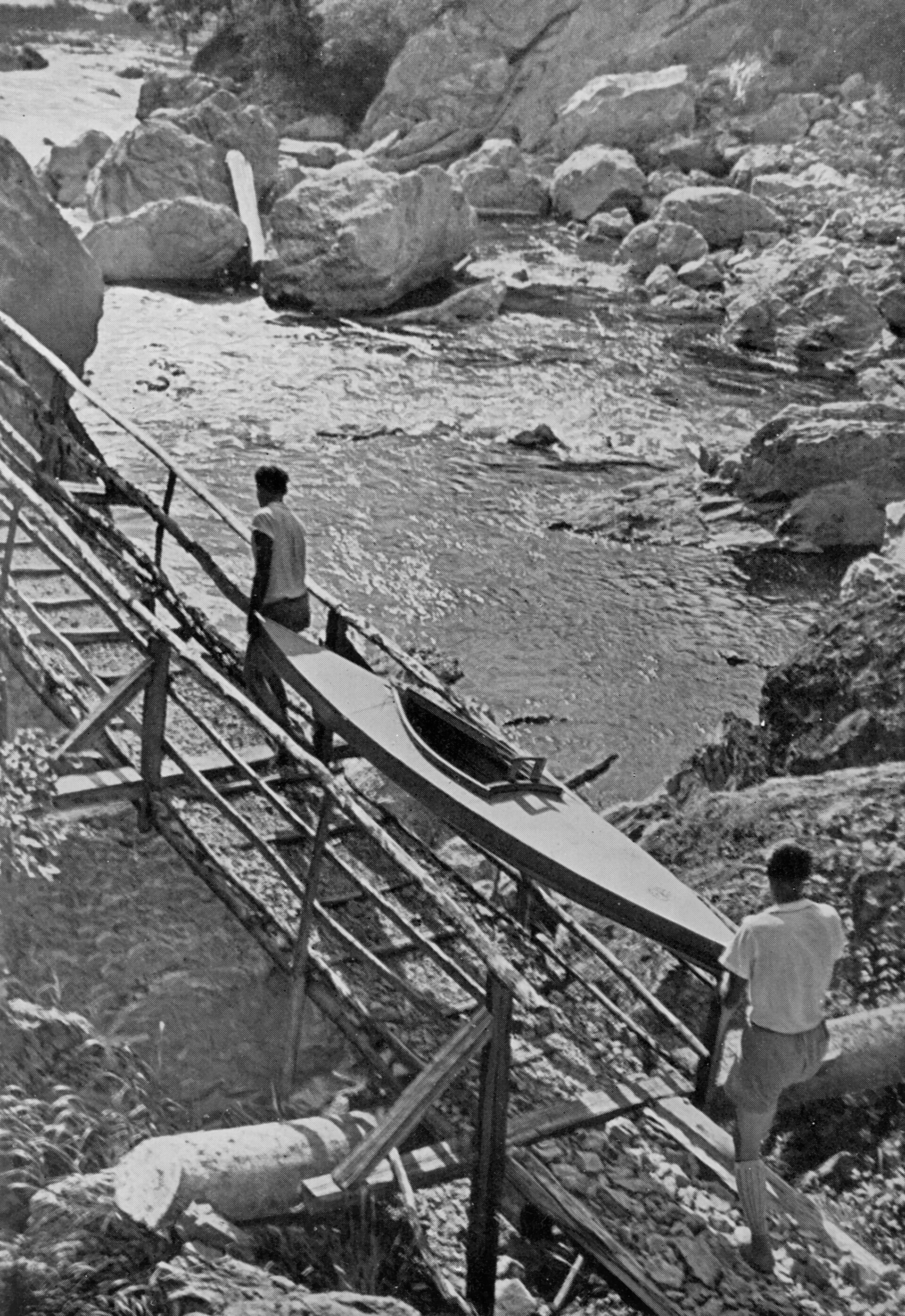
People have been coming a long time for this water. Kayakers were portaging folding boats past the worst of the rapids here by 1932, and a newspaper account from the same decade describes tourists being floated through the canyon on rudder-steered timber rafts.
Montenegrin tourism material prints the Tara as the second deepest canyon in the world after the Grand Canyon, and the claim does not survive a reference shelf. Canyons in Nepal, Tibet, Peru and Idaho all run deeper, and the Grand Canyon itself beats the Tara by more than five hundred metres.
What the canyon can defend is its European rank: about 1,300 metres deep by UNESCO's figure, over roughly 60 protected kilometres, and the deepest in continental Europe. It needs that qualifier, because the Sulak canyon in Dagestan runs deeper on the readings that place the Caucasus inside Europe.
The scale is easier to feel than to read. The Ćurevac viewpoint, a Durmitor Ring stop above the village of Tepca, looks the better part of a kilometre straight down onto its rooftops on the canyon floor. Locals call the river the tear of Europe for its clarity. It was once drinkable along its whole length and no longer uniformly is, which is worth knowing before anyone fills a bottle from it.
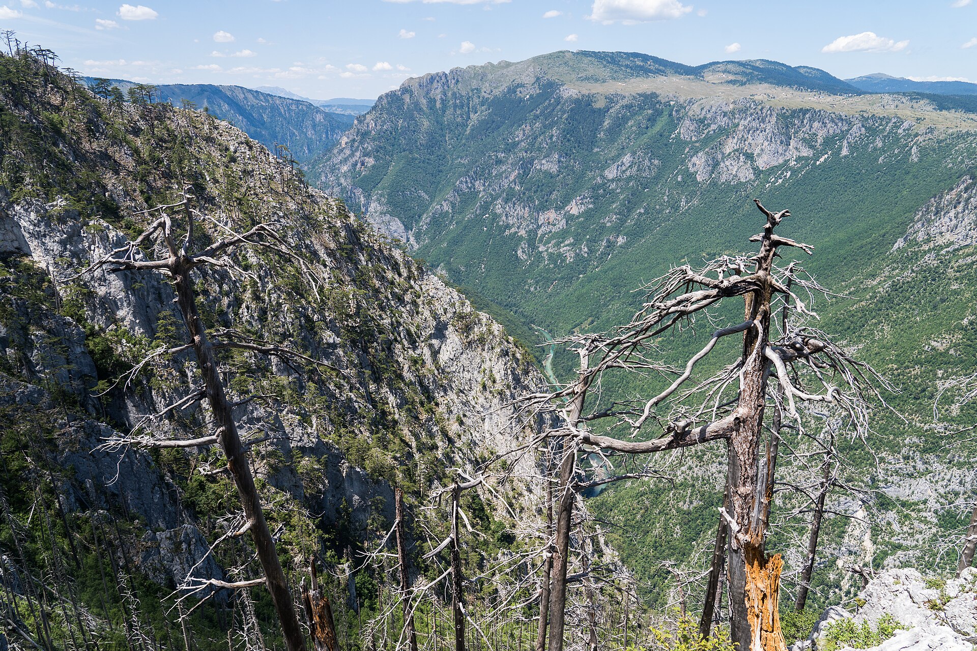
Plan it as two bases or accept a long day. Žabljak serves the bridge, the rim viewpoints and the gentle upper-river float, with buses in from Podgorica in three to four hours. The local bus from Žabljak to the bridge runs to its own timetable and the last one back leaves around four in the afternoon, so most visitors drive.
Šćepan Polje is its own base, because the camps are the accommodation: cabin villages with hot showers, where the trip ends at a long table. Allow about two hours from Žabljak by the Piva canyon, whatever a rental-car map promises.
The river between the two owes its condition to a political decision. A dam project downstream would have flooded kilometres of the gorge, and on 14 December 2004 the Montenegrin parliament adopted a declaration protecting the Tara. The smaller version of that dam, revived across the border in Bosnia, had as of late 2025 still not secured its financing. From source to border, the river runs undammed.