Dispatches About Get the App
Mongolia  ·  47.20°N 102.82°E

The Empire of Grass

Written by Camille Rousseau  ·  20 June 2026

The largest empire in history left almost nothing standing. Two weeks across Mongolia, by road, looking for what it left instead.


The largest land empire the world has known left almost nothing you can stand inside. I drove for two weeks looking for it and found grass, mostly, and wind, and a horizon that never came any closer. The Mongols took half the known world in a single century and then let it slide back into the steppe, because they never built for permanence. They built for movement. What survives is on the UNESCO list now, and it is stranger than any cathedral: a meadow where the capital stood, fields of carved stone older than the empire, and a mountain you are forbidden to climb.

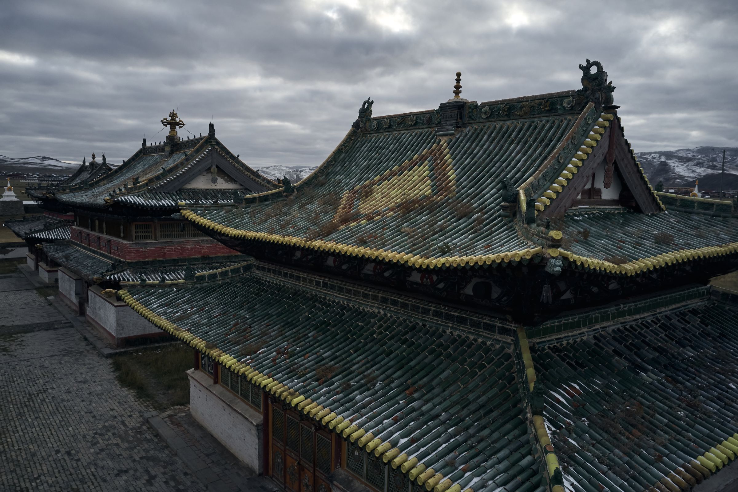
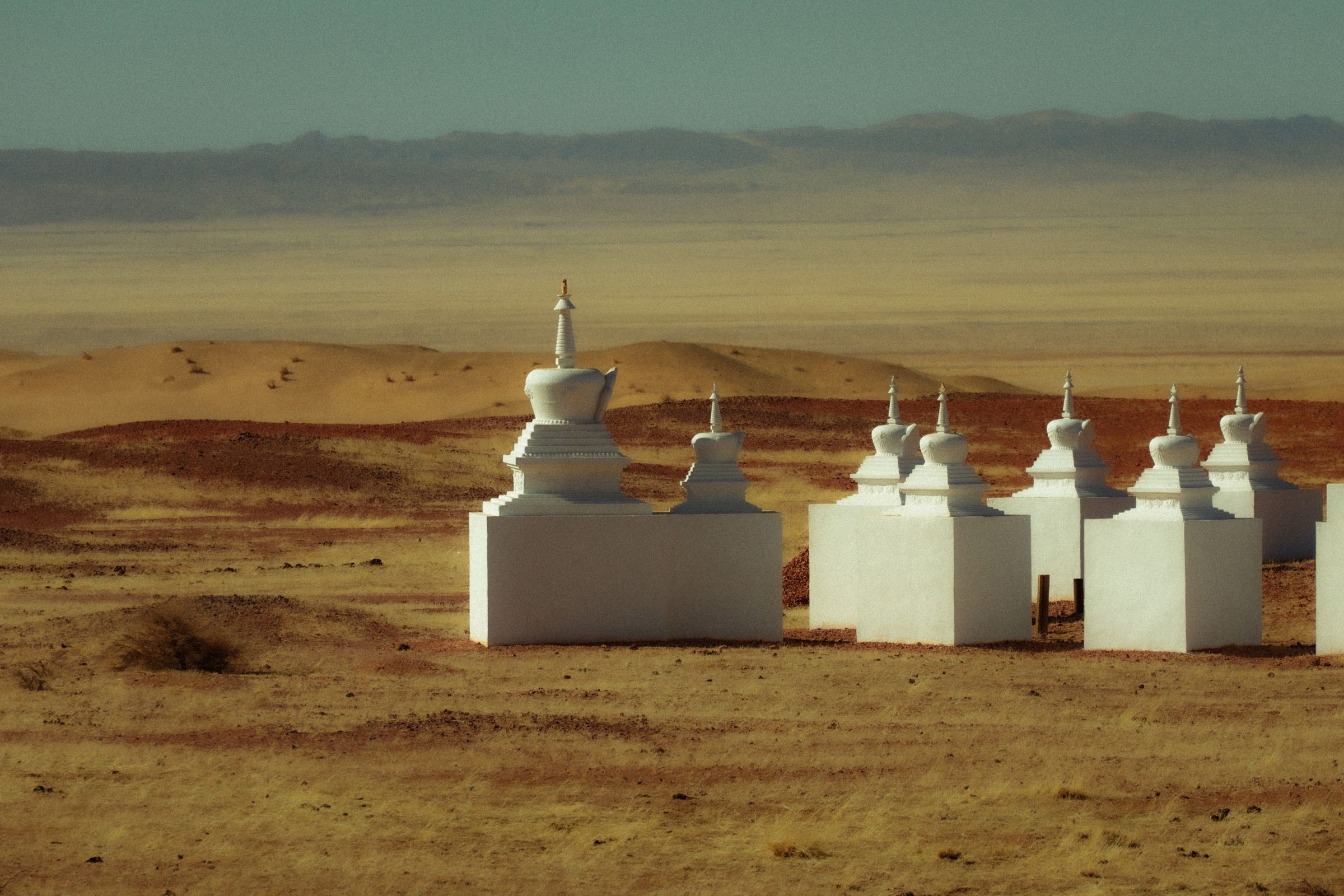
The capital is the easiest thing to miss. Kharkhorin sits three hundred kilometres west of Ulaanbaatar, a full day on a road that gives out into track halfway along, and at the end of it there is no city. Karakorum ran the empire from this valley for forty years and was later taken apart to its foundations. The one thing left standing is the monastery raised afterward from its rubble, Erdene Zuu, ringed by a wall of a hundred and eight white stupas. I walked the wall in a cold wind. Inside it stood three temples and a great deal of empty grass. The capital of the known world is a field with a fence of shrines around it.

The green-tiled temple roofs of Erdene Zuu monastery and its white stupa wall beneath snow hills
Erdene Zuu, built from the rubble of Karakorum

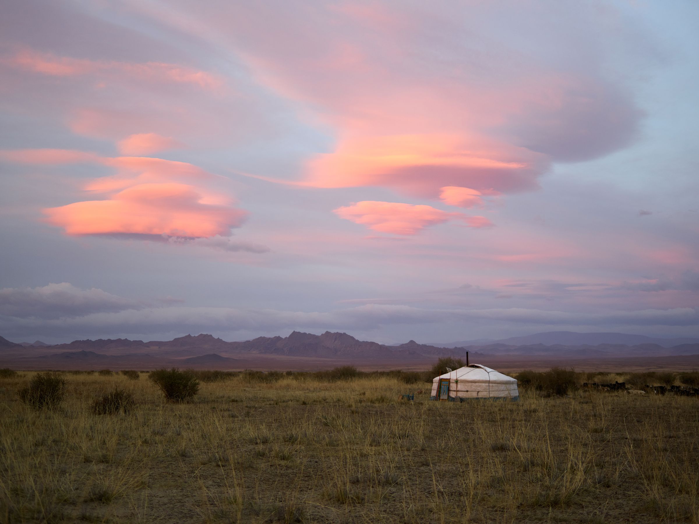
The valley itself is the heritage, not the ruin. UNESCO drew its line around the whole of the Orkhon, the grassland and the river and the herders still moving across it, because the way of living here is the monument. A single ger stood far out on the plain under a sky doing something violent and pink, smoke going sideways off the stovepipe. People have grazed this valley for two thousand years and left it more or less as they found it. That restraint is the thing being protected.

A lone white ger on the open Orkhon grassland under a pink and grey sunset sky
One ger on the Orkhon, the way of living that the listing protects

To go back further you go looking for stone. Out in Arkhangai, with no fence and no ticket office and most days no one else, the deer stones stand where they were set three thousand years ago. They are tall grey slabs cut with herds of stylised stags, antlers swept flat, climbing toward the top of each stone as if going somewhere. Nobody is sure what they marked. Bronze Age nomads carved them six centuries before the first written word reached Mongolia, then vanished off the grass, the way the empire would vanish later. The stags are still mid-flight. UNESCO added them to the list only in 2023, which on this timescale is yesterday.

A lone horseman crossing a wide golden plain toward a distant ger and low mountains
The same open grass the deer stones have stood in for three thousand years

The site that matters most is the one you cannot reach. Somewhere in the Khentii, north-east of the capital, a mountain called Burkhan Khaldun rises out of a protected forest. Genghis Khan was born in its shadow and, the story runs, buried somewhere on it, in a grave that was deliberately lost. It is the most sacred ground in the country, and foreigners are turned back at the foot of it. I got as far as an ovoo on a pass below, a cairn of stones and weathered blue silk, tied another scarf to it because that is what you do, and looked up at a summit I was not allowed to walk on. The holiest place in the empire is one almost nobody is permitted to disturb.

White stupas standing on open ground under a hazy sky on the Mongolian steppe
Below the forbidden summit, the sacred ground you are allowed to reach

They took half the world and then let it fall back into the grass, because they never built to stay.


The last of it is a long way west. I flew to Olgii, three hours over country with no road worth the name, out to the Altai where Mongolia runs up against Russia and China. The cliffs here hold twelve thousand years of carving, the oldest rock art in the country, hunters and chariots and whole migrations of animals scratched into the rock through one age after another. It is the longest unbroken record of people anywhere on the steppe. In a sense it is still being added to, because the people who began it never left.

A single rider on a road running toward the snow-covered peaks of the Mongolian Altai
The road west into the Altai, where the petroglyphs begin

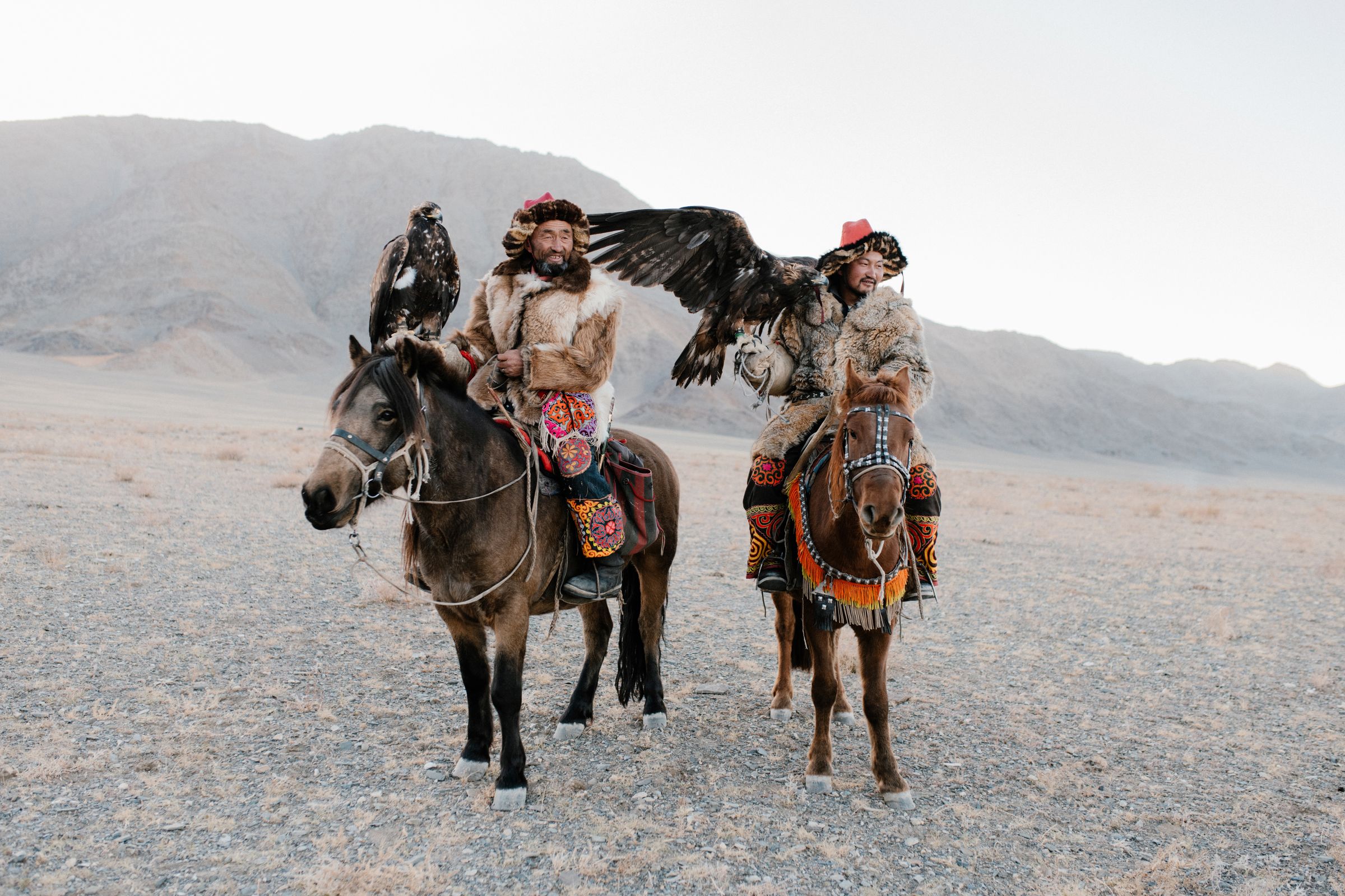
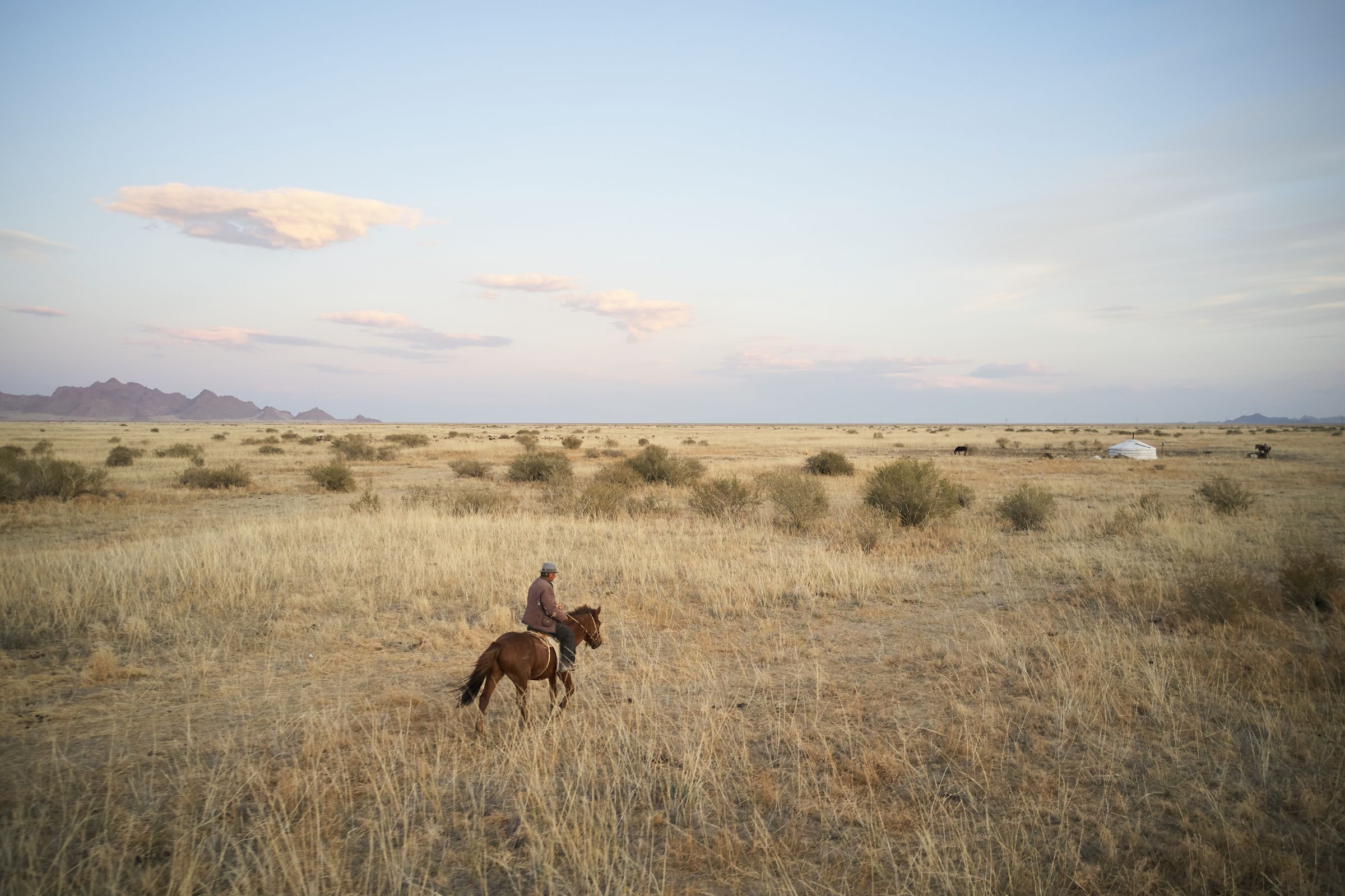
I watched two of them ride out at first light with golden eagles on their arms, fur and silk and a bird the weight of a small dog, exactly the way it has been done in these mountains for centuries. This is the part the list cannot quite hold, the heritage that is not behind a rope. The Mongols built nothing to last because the building was never the point. The horse was the point, and the grass, and the moving on. A few thousand kilometres taught me that the real monument to the empire is the steppe itself, and the people still crossing it.

Two Kazakh eagle hunters on horseback in fur and embroidered dress, a golden eagle with wings spread, the Altai behind
Kazakh eagle hunters in the Altai, the heritage still on the move
Plan a similar trip

My itinerary

Fly into Ulaanbaatar and travel the steppe by Russian UAZ van or Land Cruiser with a driver-guide, sleeping in ger camps. Base a night or two at the Shangri-La Ulaanbaatar at each end, fly the long western leg to the Altai, and go June to September for green grass, or early October for the eagle festival.

  1. Days 1–2

    Ulaanbaatar

    Land, provision the trip, and read the empire at the National Museum and Gandan monastery before the road swallows you.

    Travel

    Fly into Chinggis Khaan International, then a driver-guide and van for the rest

  2. Days 3–4

    Orkhon and Karakorum

    West to Kharkhorin, the lost imperial capital, and Erdene Zuu inside its wall of 108 stupas. The capital is a meadow now.

    Travel

    Ulaanbaatar to Kharkhorin, about 320 km, a full day on the road

    The last stretch turns to track; the van, not the map, decides the pace.

  3. Days 5–6

    The deer stones

    North into Arkhangai for the Bronze Age deer stones standing in open grass, and the Orkhon waterfall at Ulaan Tsutgalan.

    Travel

    Off-road tracks between herder camps; short distances still take hours

  4. Days 7–9

    Burkhan Khaldun

    The long leg into the Khentii to the sacred mountain, Genghis Khan's birthplace, reached only as far as an ovoo at its foot.

    On foot

    The summit itself is forbidden; you go as far as the protected boundary

    A guide and the right permissions matter here; respect the closures and the cairns.

  5. Days 10–12

    Fly to the Altai

    West to Olgii in Bayan-Olgii for the petroglyph cliffs, twelve thousand years of carving above the Kazakh valleys.

    Travel

    Ulaanbaatar to Olgii by air, roughly three hours; Hunnu Air or Aero Mongolia

  6. Days 13–14

    The eagle festival, and out

    The Golden Eagle Festival on the Altai grass, hunters riding out at dawn, then the long flight back east.

    Onward

    Olgii back to Ulaanbaatar by air, then home

    The big festival falls in early October; smaller meets run in September.

← All dispatches
Keep exploring

More dispatches

Meridian Dispatch for iPhone

A travel journal that
writes itself.

Your best memories, journaled automatically, from the photos already on your phone. The app reads your photo library, finds the international trips you have taken, identifies the venues, writes the prose, and lays it out like a magazine spread. The first time you open it, the last several years of your travel are already there. Every trip after that goes in by itself.

  1. Mapped on a globe

    Your whole world, on one globe.

    Every country you've visited, lit on a private 3D globe. Spin it to find a trip and fall straight back into it. The globe is the table of contents for your journal.

    The app's private globe of visited countries.
  2. Detected automatically

    It finds your trips on its own.

    Your photos cluster by place and time, and each cluster becomes a venue: the museum you spent the morning in, the restaurant you lingered over, the streets you wandered after dinner. No tagging, no prompts, no logbook to keep up.

    The app's archive, every trip a dispatch.
  3. In warm prose

    Each place, written up.

    Every day opens on a hero photograph, and each place you stopped gets its own short entry beside your own photographs, no two days laid out the same. A record of where you've been, kept in real sentences. Edit a line, or regenerate any passage you want fresh.

    A written day in the app, with a place entry and a photo grid.
  4. Yours to keep

    Every trip, as a photobook.

    Download any journal as a clean photobook, send it to whoever was there, or have it printed as a hardback you keep on the shelf. What you read on your phone is exactly what lands on the page.

    The app exporting a trip as a photobook, with Share PDF and Save to Files.