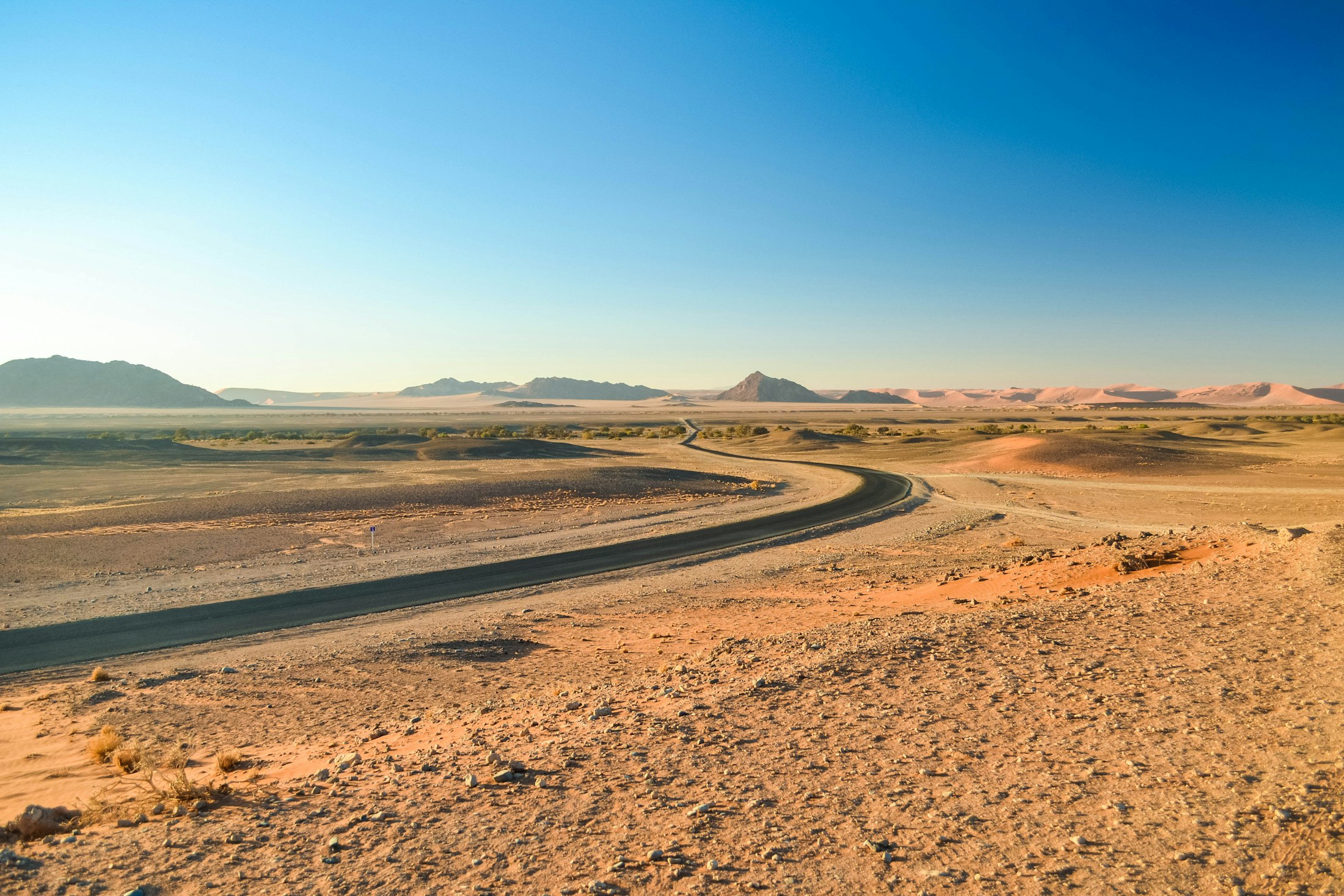
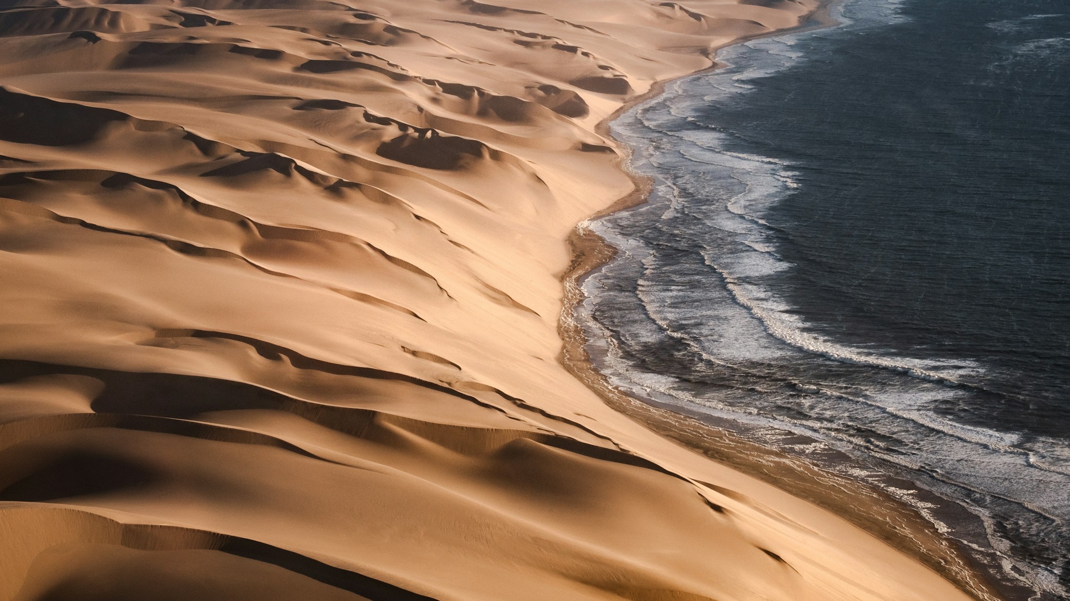
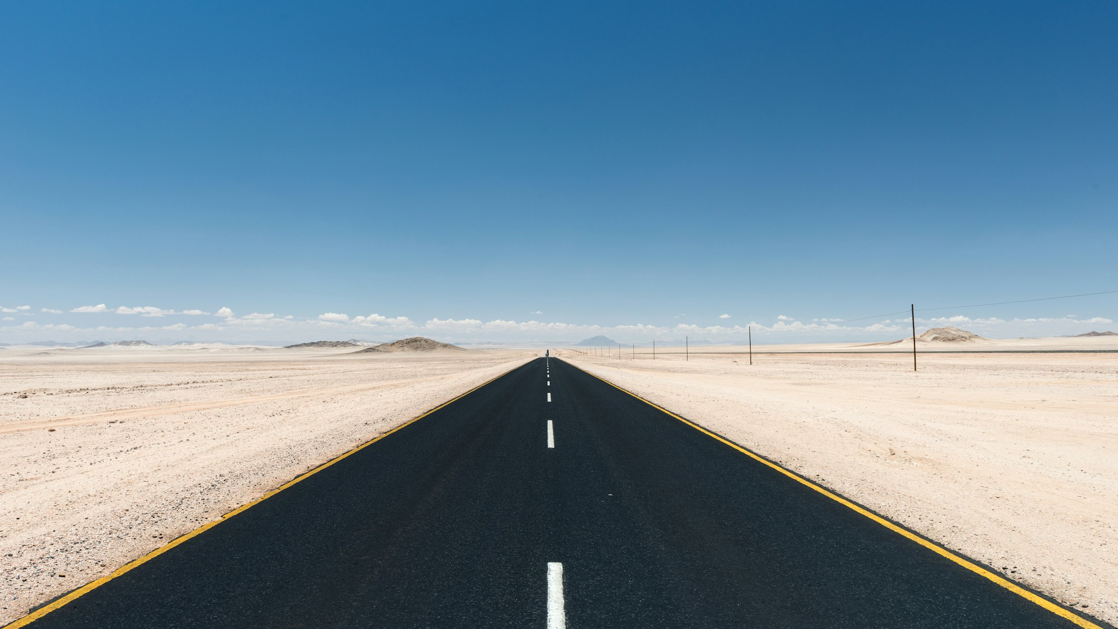
The names give out somewhere north of Swakopmund. The tar ends and a salt road takes over, pale and dead straight, and the last of the towns slides away in the mirror until there is only the cold sea on the left, the gravel running ahead, and a wind off the water that already smells of fog. This is the only coast I have driven where the map seems to lose its nerve, the labels thinning to a handful of blunt syllables, Cape Cross, Ugab, Torra, Terrace Bay, and then nothing at all.
The cold runs the whole place. The Benguela current comes up from the Antarctic along this shore, and where it meets the heat coming off the Namib it throws a fog so dense and so reliable that it, and not the sun, is the local weather. Portuguese sailors who stood off here called it the Sands of Hell and turned their bows around. The name it carries now came later, from a 1944 book by a journalist named John Henry Marsh about a stranded liner, and it stuck because it was simply true. The beaches were once littered with the bones of whales and seals, and then with the ribs of ships.
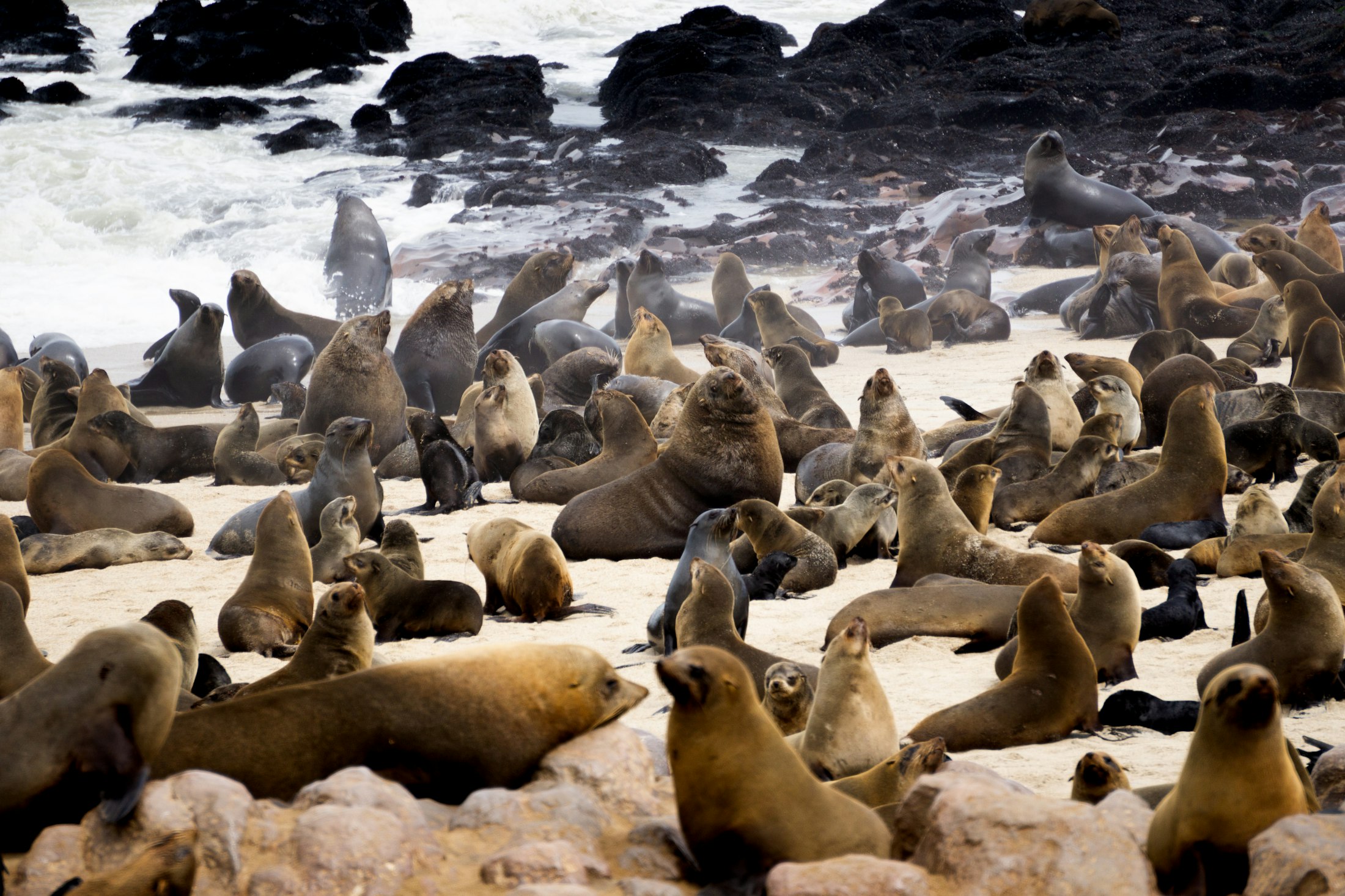
For a while you have company. Sixty-odd kilometres past Henties Bay the wind shifts and you smell Cape Cross before you see it, a reek of ammonia and fish that gets into the car and stays there for an hour. Then the noise reaches you, and then the colony itself: a hundred thousand Cape fur seals and more, hauled out on the rocks in a heaving brown carpet that runs the length of the bay. It is the one crowded thing on the whole coast, and once it is behind you the emptiness feels almost deliberate.
The wrecks are the reason most people come, so it is worth being honest about what you will actually see. The famous photographs, the steamer half swallowed by a dune, the liner breaking up in the surf, are mostly of places you cannot drive to, locked away down the restricted diamond coast to the south or scattered far up in the closed north. What the road gives you is the Zeila, a fishing trawler that snapped its tow line in 2008 and now stands rusting in the shallows a few kilometres south of Henties Bay, close enough to watch the cormorants use it as a perch. One wreck, reachable, turns out to be enough. The rest you take on faith, knowing the sand is full of them.
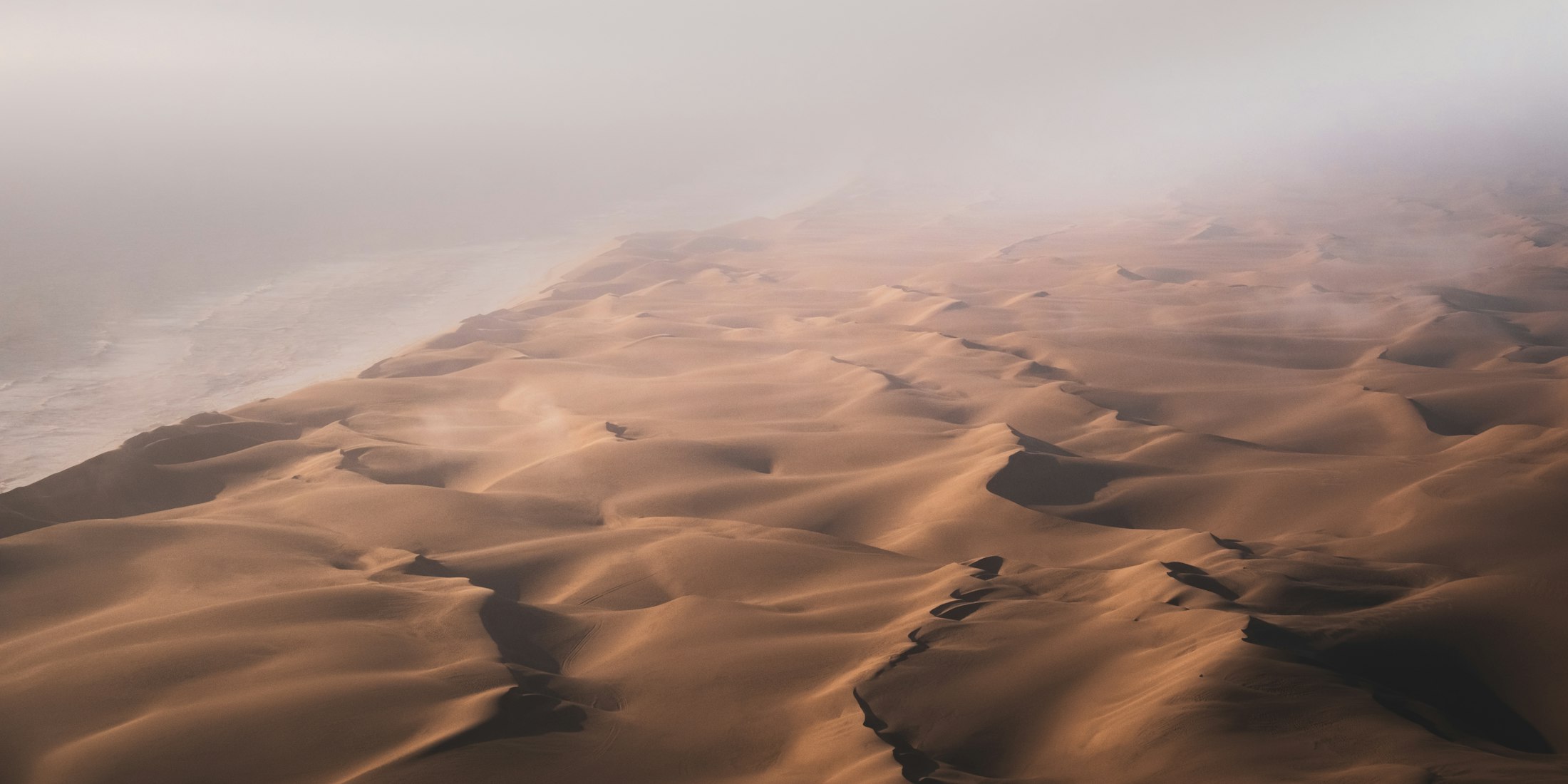
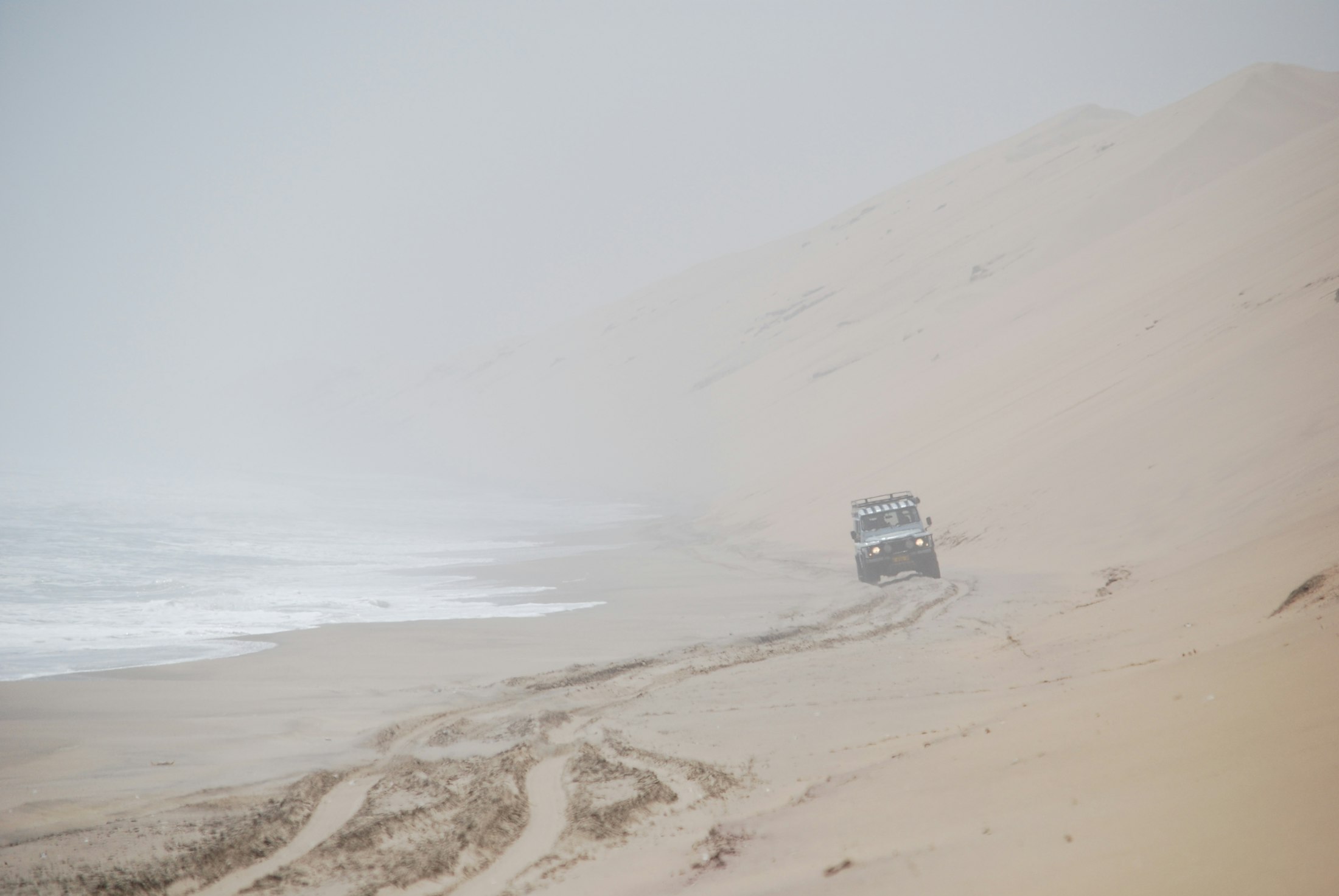
At the Ugab gate the recreation area ends and the Skeleton Coast Park proper begins, and the country goes lunar: black gravel plains, low dunes the colour of bone, and a silence so complete that switching off the engine feels like an intrusion. This is where the coast stops being scenic and starts being serious. There is no fuel you can count on beyond the last pumps in the south. The camp at Torra Bay opens for only two months of summer, and even its filling station, the sign says plainly, cannot always be relied upon. You carry your own water and your own fuel, and you keep an eye on the gate times, because the rangers lock the road and there is nobody out here to talk your way past.
The road ends at Terrace Bay. Not in a town, just a scatter of low buildings on the gravel, a fuel pump that may or may not be working, and a barrier. This is the most northerly point the public is allowed to reach, and standing at the barrier you can watch the track carry on north and understand that you are not going to follow it. Everything beyond is a wilderness concession the size of a small country, and the only way into it is to leave the car behind and fly: a light aircraft onto a gravel strip, a transfer to a lodge built to look like the wrecks, a guide who knows where the desert lions cross the dry riverbeds. It is some of the emptiest country on earth, and it is closed to the likes of me, which is probably the point.
The road ends at Terrace Bay. Not in a town, just gravel, a barrier, and a track you are not allowed to follow.
So you turn around, or you turn inland. The eastern gate at Springbokwasser lets you off the coast and up into Damaraland, and within an hour of climbing the fog burns away and the first thorn tree looks like an extravagance. I have driven roads with far more to look at and not one that left a heavier mark. The Skeleton Coast is not a place you conquer, or even, in the end, a place you arrive at. It is a road that runs out, on purpose, and the going back was the only direction it ever offered.