Rebelo, Holmes, Klopper, Spear and van Wilgen published the count in Koedoe in 2025, counting the park together with the Cape Peninsula surrounds it was surveyed with, about 250 square kilometres. What makes the number land is what it works out to per unit of ground. Divide the count by that area and the Peninsula carries roughly eleven plant taxa per hundred hectares; do the same sum for Kruger and it carries 0.1. The list strips out garden escapes, urban parkland and anything recorded as planted, and still arrives at 2,785. Nine of those taxa are globally extinct, two of the nine only in the wild, and those two have been re-established at Tokai inside the park. Another 261 are threatened, 38 of them Critically Endangered.
The trait that organises all of it is serotiny. Many of the Proteaceae hold their seed in hard woody cones on the living plant, sometimes for years, and release it only when the cone or the whole bush dies. Nothing accumulates in the soil, so everything depends on one number: how long the plant has had to grow before the next fire arrives. Juvenile periods for Proteaceae run from four to nine years, fires in five-year-old vegetation have produced near zero recruitment, and only fires in stands seven years or older put back more than they took. Managers here work to a target of roughly 12 to 15 years.
What happens when the interval collapses has been watched and written down. Two fires eight years apart in Jonkershoek removed the local population of Protea grandiceps outright. At the top of Montagu Pass a three-year interval left Protea aurea and Leucadendron uliginosum locally extinct, the seedlings forty centimetres high when the second fire came through.
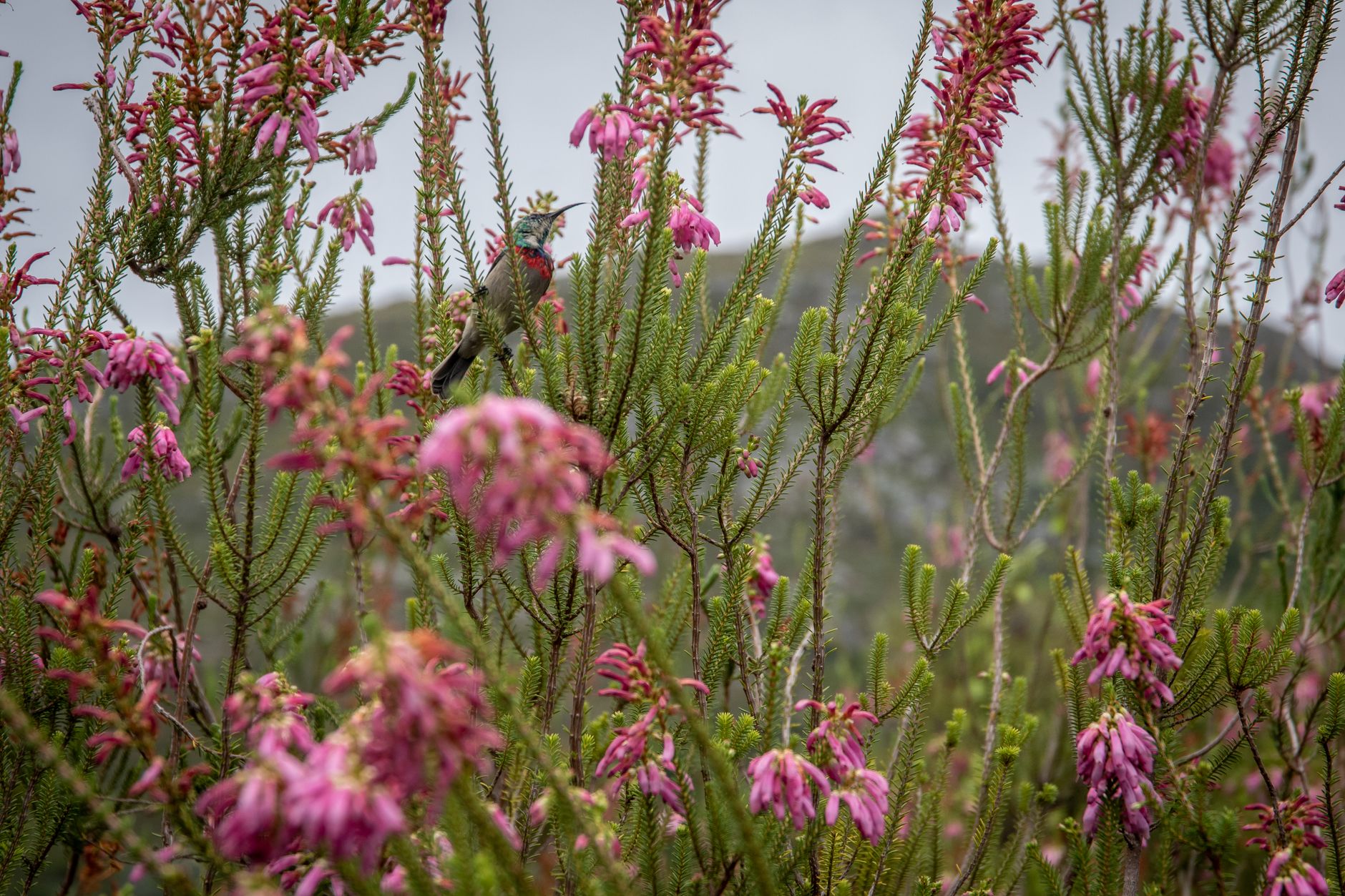
The shorthand a visitor will hear on the mountain, that fynbos needs fire, is looser than the science behind it. Writing in Veld & Flora in 2000, Saunders and Saunders pointed out that the line gets repeated far more often than it gets tested. Erica seed and bulb seed will germinate without a burn, and the resprouters, among them Protea nitida and the restios that give the slopes their wiry texture, come back from underground rootstock and cope with short cycles perfectly well. It is the slow reseeders that pay.
Leave it too long and the system fails from the other end. Without fire the bulbs and the small perennials are shaded out, the stand goes senescent, species drop out, and the vegetation begins to move toward forest. Season matters as much as frequency: fynbos normally burns between October and April, and a midwinter burn at Fernkloof produced protea seedlings that germinated in August with two months of growth behind them before the summer drought, while the bulb display failed altogether. Recovery is decided less by the fire than by the rain in the winter that follows it.
Then there are the trees that should not be here. Pines, hakea and Australian acacias have spread through the catchments for a century and a half, and they do two bad things at once. They pile up fuel, so a fire burns hotter and for longer and can cook the seed the whole system is banking on. They also drink, transpiring far more water than the shrubland they replaced, which is why the Western Cape treats clearing them as water infrastructure. The Greater Cape Town Water Fund reported in October 2023 that it had cleared more than 46,000 hectares across the wider catchments and was recovering roughly 15.2 billion litres of water a year.
The reason such a small mountain can hold such an inventory is that the rock is poor. The upper six hundred metres are Ordovician quartzitic sandstone, acidic, free-draining and close to sterile. Poverty of that kind rewards extreme specialisation over a few hundred metres of slope, which is how a plant ends up confined to a single ravine. The mountain reads as one habitat and behaves as many: Peninsula Sandstone Fynbos over the high ground, Granite and Shale Fynbos on the lower slopes, Afrotemperate forest hiding in the kloofs where fire cannot easily reach. Peninsula Granite Fynbos is now Critically Endangered, and the Koedoe authors put it in a sentence no tourist board would write: Cape Town, they say, is the extinction capital of the planet.
A protea that burns in its fifth year does not come back. It had one chance to set seed and it had not finished growing.
Fire here is also a municipal event, because four and a half million people live at the bottom of the mountain. The fire that started at Muizenberg on 1 March 2015 and burned until the ninth was the largest in the park's history, taking more than 5,000 hectares inside the park by the most conservative count and killing one person. On 18 April 2021 a fire began near Rhodes Memorial and ran through at least 400 hectares, burning the Rhodes Memorial restaurant, Mostert's Mill of 1796, and the reading room of the Jagger Library at the University of Cape Town, where roughly 73,500 items of the African Studies collection were lost. Investigators concluded it was most likely an object thrown from a vehicle. The rare material in the underground vaults survived, including major San and Khoi documentation.
Mostert's Mill was fully restored and reopened on 13 April 2024, and it works. The Rhodes Memorial tea room has not. A contractor was appointed in November 2023 and the rebuild has run past its deadline, so the walk up to the monument needs water in the bag.
The last eighteen months have turned the interval argument into news. Nearly 3,000 hectares burned around Tokai and the south peninsula between April and May 2025. On 24 March 2026 a fire started along the Hout Bay Pipe Track and crossed the ridge overnight toward Constantia, running to roughly 160 hectares. In early August 2026 ground crews and City of Cape Town Fire and Rescue worked a fire above Kloof Nek corner overnight, with precautionary evacuations and aircraft on the hotspots the next day. Three fires on one mountain inside a year and a half is the frequency the ecology cannot absorb, and SANParks spokesperson Charles Phahlane has said the places with a long history of invasive infestation, Tokai above all, need heavier management because the aliens come back fast out of the seedbank. The long record is set out in Simon Pooley's Burning Table Mountain of 2014.
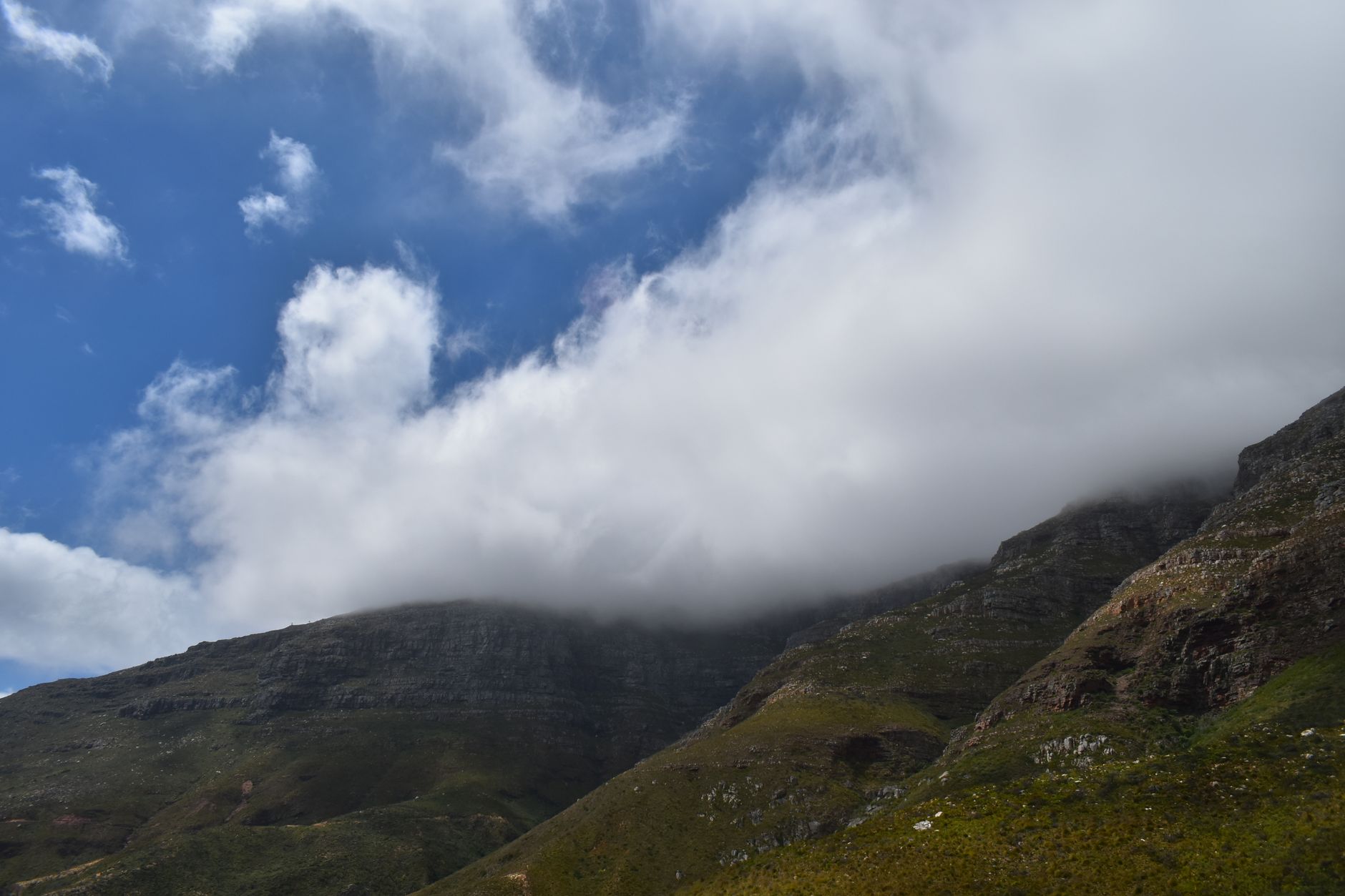
The wind is the other thing that decides what happens up there, and it decides it hour by hour. The Cape runs a Mediterranean climate, so the wet, green, cold season falls roughly between May and August and the dry, hot, windy one between November and March. The south-easter is a summer wind, which means high summer buys the hard blue light and the same wind that ruins it. Pushed up the slope into colder air, its moisture condenses into the flat sheet of cloud that Capetonians call the tablecloth, and it can be on the plateau within minutes of a clear morning. The standard casualty is somebody who walked up in a t-shirt at eleven. Carry a windproof layer, more water than seems reasonable, and a torch.
For flowers, time the visit. Red disa, Disa uniflora, the floral emblem of the Western Cape, grows on wet cliff faces and in the ravines beside running water and flowers between January and March, peaking into mid-February, which makes high summer the season to walk with your eyes on the dripping gullies. King protea runs roughly May to November with a late-winter peak, and Kirstenbosch is the reliable place to see it without hunting a slope for it.
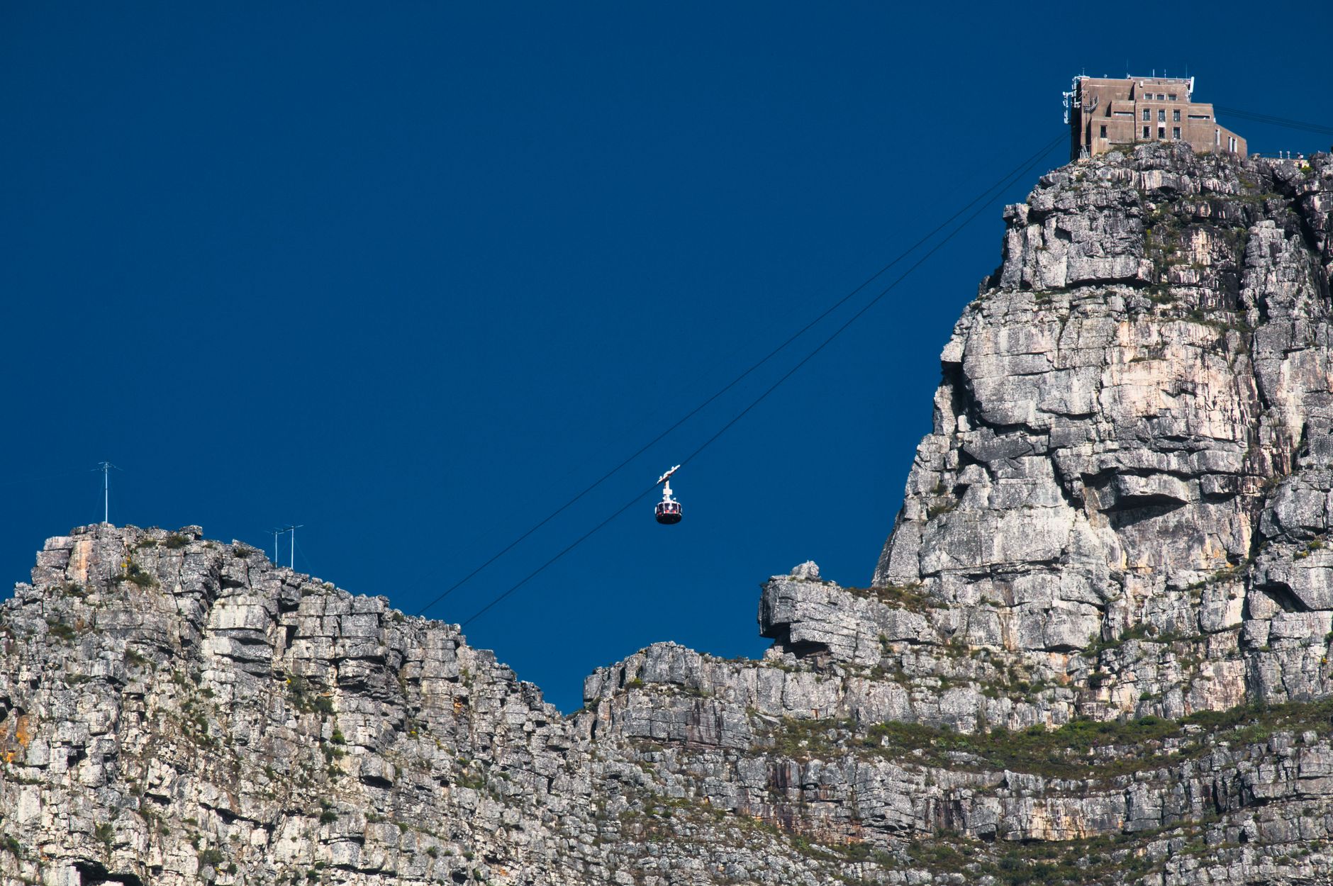
The Table Mountain Aerial Cableway is why a mountain this steep is a mass-visitation site, at around a million passengers a year. The lower station sits on Tafelberg Road at about 302 metres, the upper station at 1,067 metres, a vertical rise of 765 metres covered in four to five minutes. The line opened on 4 October 1929 and was rebuilt in 1996 and 1997 with Swiss Garaventa Rotair cars. Each takes sixty-five passengers, hangs from a double cable for stability in wind, and has a floor that rotates through a full 360 degrees on the way up, so there is no window seat to fight over.
It also stops, and this is the part to plan around. The cableway shuts when the south-easter gets up, and the operator publishes no threshold: third-party guidance clusters somewhere in the 35 to 50 km/h band, the Cape Times once recorded a closure in gusts of 102 km/h, and the decision is discretionary on the day. It stops for heavy rain and for cloud sitting on the plateau too. On top of that the line closes once a year for maintenance, about a fortnight, and in recent years that fortnight has fallen in late July or early August, with the exact dates set and announced annually rather than fixed; every facility at the upper station closes with the ride, including VIEWS by De Grendel, TEN67 Eatery, KLOUD Bar, TAP Bar, the shops and the toilets. The walking routes stay open throughout, which is the trap: during the shutdown there is no ride down, and everyone who goes up walks down carrying their own water, food and warm layers. Check tablemountain.net on the morning, never the night before, and do not build a day around the ride.
Tickets are sold at tablemountain.net and through webtickets.co.za, as a return or as a single in either direction, and the one-way down is the ticket most walkers actually want. Buying online does not skip the queue; the operator says so on its own booking page. The queue is worst from mid-morning to early afternoon in high summer, and on the first clear day after a run of wind, when everybody turned away in the previous three days arrives at once. First cars run from around eight in summer and half past in winter, the last car down goes about half an hour after the last car up, and those hours are reset seasonally.
The walking alternative is Platteklip Gorge, and it should be understood as a staircase. It is 2.5 km up and 5 km on the round trip, with about 650 metres of gain, topping out near 1,030 metres in the cleft that splits the front face. The trailhead is on Tafelberg Road roughly 1.5 km beyond the Lower Cableway Station toward Devil's Peak, with no car park, only roadside parking. Fit hikers do it in an hour to an hour and a half; the honest published range is an hour and a half to three hours up. The first half is fully exposed with no shade, and there is no water on the route at all: the shop, the restaurant and the toilets are at the top. Start early, and between December and February start very early.
The stone steps are high enough that coming down turns into a series of controlled drops, which punishes knees far more than the climb punishes lungs. That is the argument for the one-way ticket, and it is why regulars walk up and ride down. The recurring complaint on the trail forums is the descent nobody planned for, after the wind came up and the cableway shut while they were on the summit.
India Venster deserves a blunt description. It is a scramble with fixed ironwork, and the people who get into trouble on it are the ones who read it as a hike. Around 3.7 km with roughly 722 metres of ascent, three to four hours, rated five out of five for difficulty by the trail site that documents it in most detail. There are fixed chains and metal staples in the rock, a footpath along the edge of a narrow cliff, and a hardest section between roughly the 1.7 and 2.7 km marks. Navigation is by yellow footprints painted on the rock from the Contour Path junction, which fails the moment cloud comes down. People have died on this route. Every source that describes it says the same thing: not for beginners, never solo, and never as a way down. The rescues logged on it cluster around late starts and darkness more than around falls, so the operative rule is the clock.
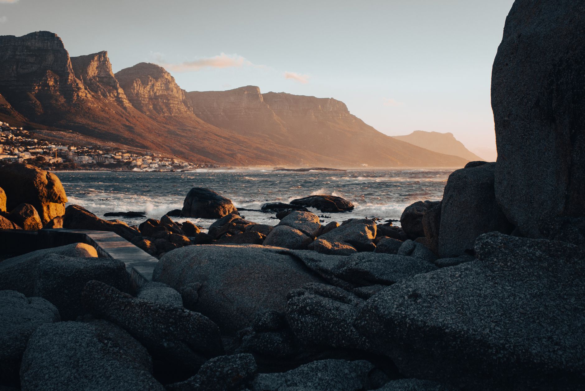
Lion's Head, 669 metres, is the city's evening habit and the busiest thing on the peninsula after dark. The spiral path is straightforward until the upper shoulder, where the route splits: one line goes up short vertical rock faces on fixed staples and chains, and a bypass to the left climbs steeper rock steps without the exposure. On full-moon nights the chains bottleneck badly, and the queue is the reason people miss the moonrise they came for. Arrive about half an hour before sunset to get the sun going down over the Atlantic and the moon coming up over the Boland. Bring a proper head torch, because the chains need both hands and the southern side of the mountain is black even under a full moon. The summit runs five to eight degrees colder than the car park, and parking on Signal Hill Road fills hours before sunset.
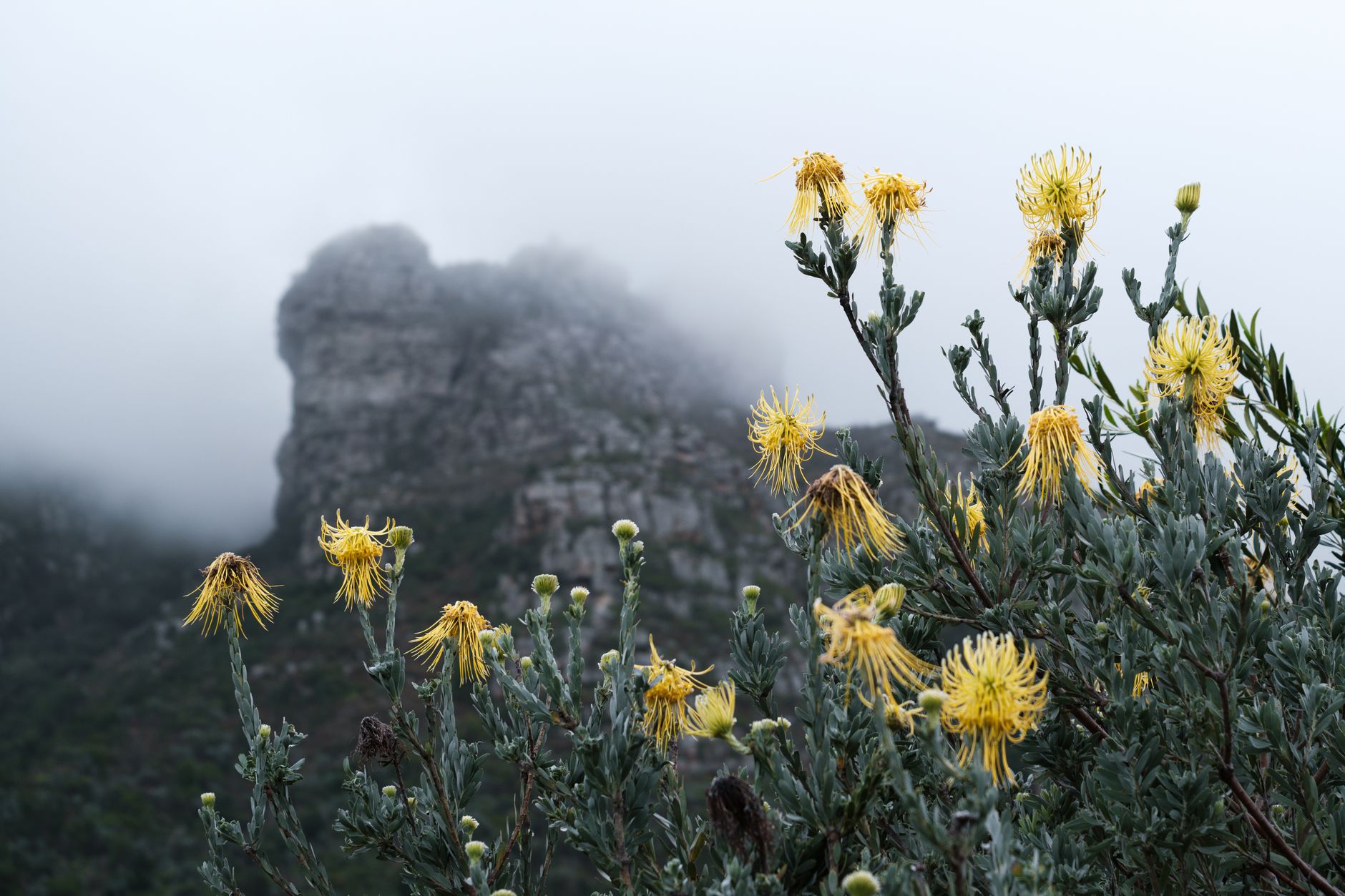
Kirstenbosch National Botanical Garden is the way to see the flora without climbing for it, and it runs straight into the park: Skeleton Gorge, the Smuts Track, starts inside the garden and climbs to Maclear's Beacon, the one walk that joins the botanical layer to the summit. The Boomslang tree canopy walkway, 130 metres long and 12 metres up through the arboretum, opened on 17 May 2014 and costs nothing beyond garden entry, with the Rycroft Gate the shortest approach. Three hours is the realistic minimum for the walkway, the lawns and a stretch of the gorge path.
The park has roughly 850 km of trails and, on 2023 reporting, about 70 field rangers, which is the frame for the numbers. Friends of Table Mountain counted at least 130 attacks on Table Mountain, Signal Hill and Lion's Head between 2011 and 2021, and 80 muggings across those three areas in 2023 to the end of November. SANParks confirmed two incidents near Deer Park in July 2026 and put more rangers there in response, and the pattern is a small number of known places hit repeatedly: Signal Hill, the Deer Park jeep tracks, the Pipe Track above Camps Bay, the Hangberg trails and Sentinel Peak, Rocket Road to Sandy Bay, and the paths around Kleinplaas Dam. Enormous numbers of people walk this mountain every day without trouble, and the standing advice is a group of about four and never alone. If you are confronted, Friends of Table Mountain and the guides quoted alongside those numbers say the same thing: hand over whatever they ask for and do not resist.
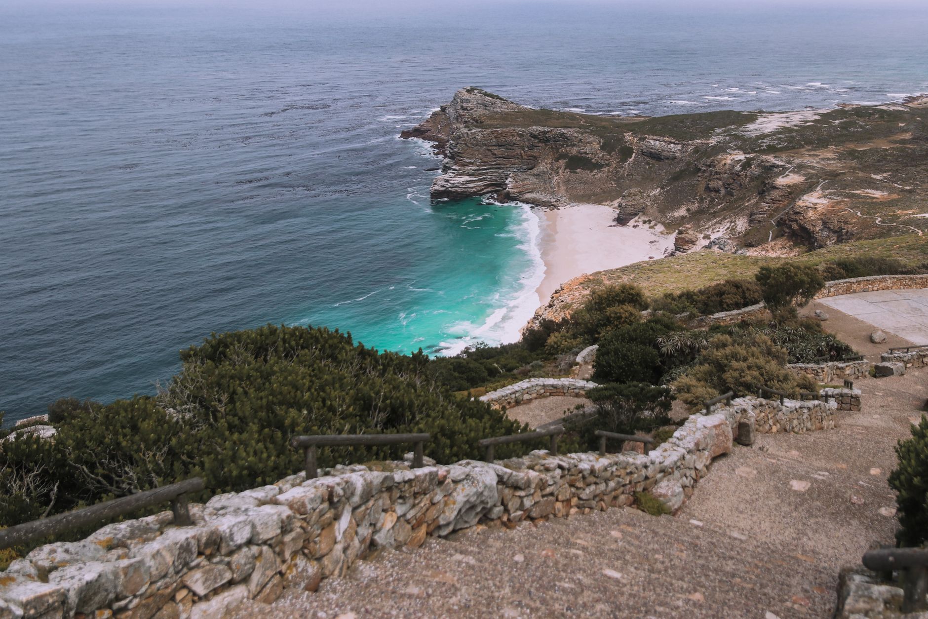
The peninsula day, Cape Point and the penguins at Boulders, is one drive, and the version of it in the guidebooks no longer exists. A rockfall on 24 April 2026 closed Chapman's Peak Drive between Hout Bay and Noordhoek, after scheduled safety closures in March, and the operator's live status page at chapmanspeakdrive.co.za still read closed in August. The loop still works, it just goes round the back: Ou Kaapse Weg, the M64, climbs from Constantia over Silvermine and drops into Noordhoek and Kommetjie, and the M3 and M4 run down the False Bay side through Muizenberg, Kalk Bay and Simon's Town. Take the mountain road out and the False Bay road home, or the reverse, and Boulders falls naturally on the coastal leg. The SANParks conservation fee is charged at the gated sections, Cape of Good Hope, Boulders, Silvermine, Tokai and Oudekraal, and not on the main mountain: Platteklip, Lion's Head and the Pipe Track are free to walk, and the cableway is a separate commercial ticket. A Wild Card, in the All Clusters version for an international visitor, is the alternative to paying at each gate.
What none of that schedules is the thing worth building a year around. The bulbs spend most of the cycle underground, shaded out by the taller shrubs and waiting, and in the first spring after a burn they come up all at once: watsonias and gladiolus and moraeas in sheets across ground that was black a few months earlier. It is the same event as the protea in its fifth year, read from the other side. The fire that takes the slow reseeders before they have finished growing is the fire that hands the bulbs their one open season, which is why managers on this mountain argue about the interval rather than the burn. No visitor can book it. The most that can be done is to find out where the last summer's fire ran, and go there in September.