Dispatches About Get the App
Chile  ·  47.10°S 72.33°W

The Sheep Ranch That Became the Serengeti of Patagonia

Written by Meridian Dispatch  ·  10 July 2026

A man made a fortune in outdoor clothing, bought one of the largest sheep ranches in Patagonia, and pulled out every fence. This is what came back.


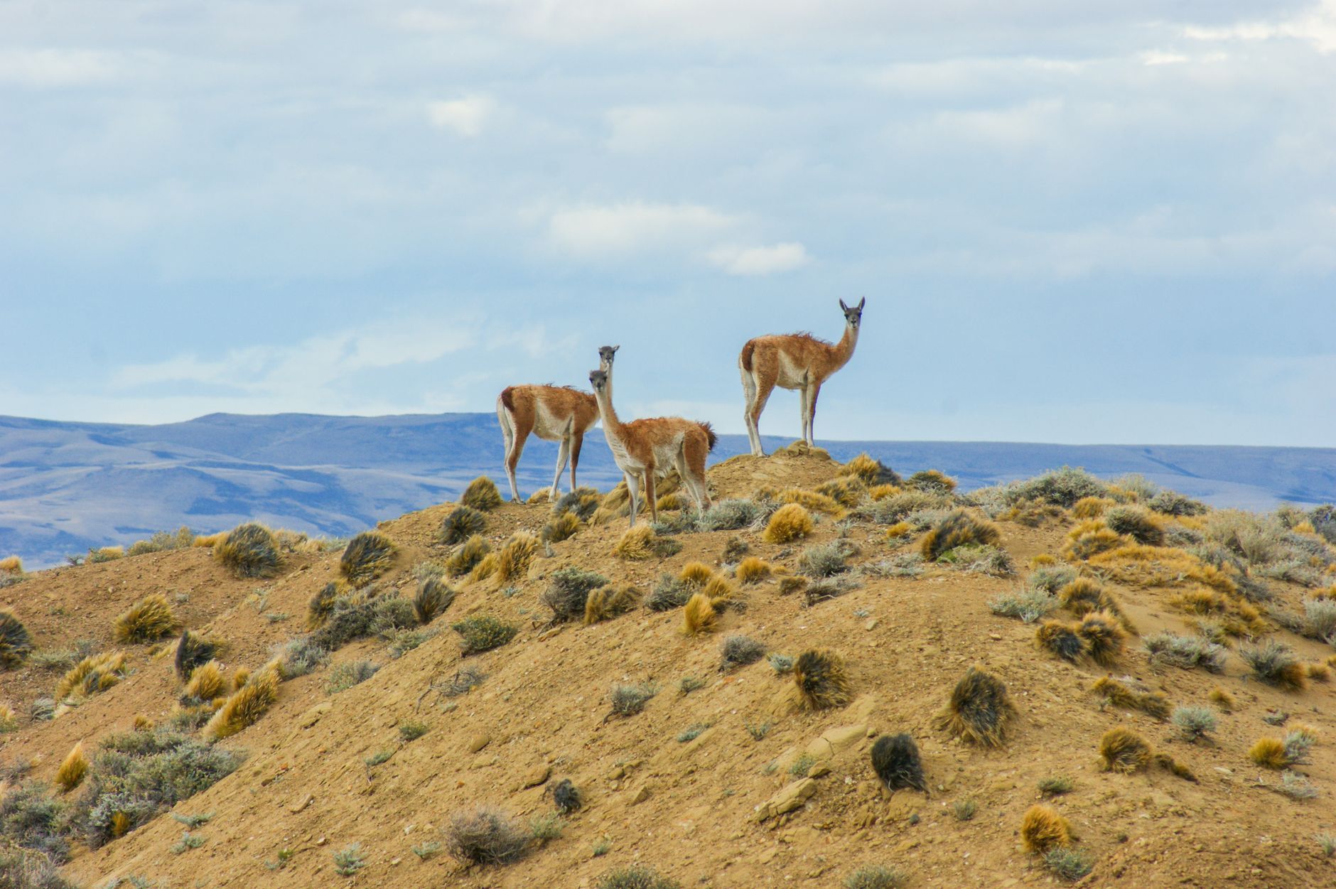
The guanacos were on the hill before the sun reached it, a loose herd standing into the wind, and it took me a while to see what was odd about the picture. There were no fences. In a valley this size, in this part of Patagonia, that is close to unnatural. For most of a century Valle Chacabuco was one of the largest sheep ranches in the region, its grassland cut into paddocks by hundreds of kilometres of wire. Somebody had taken all of it down on purpose.

That somebody was Douglas Tompkins, who made his money in clothing, first as the founder of a mountain-gear label and then in fashion, and spent the last decades of his life buying Patagonian land in order to leave it alone. He bought this estancia in 2004. Then he did the thing that made Chileans suspicious of him for years, a foreigner accused at various times of running a spy base and of trying to seize the country's fresh water: he sold off the twenty-five thousand sheep, pulled up six hundred kilometres of fence, and waited to see what the land would do without them.
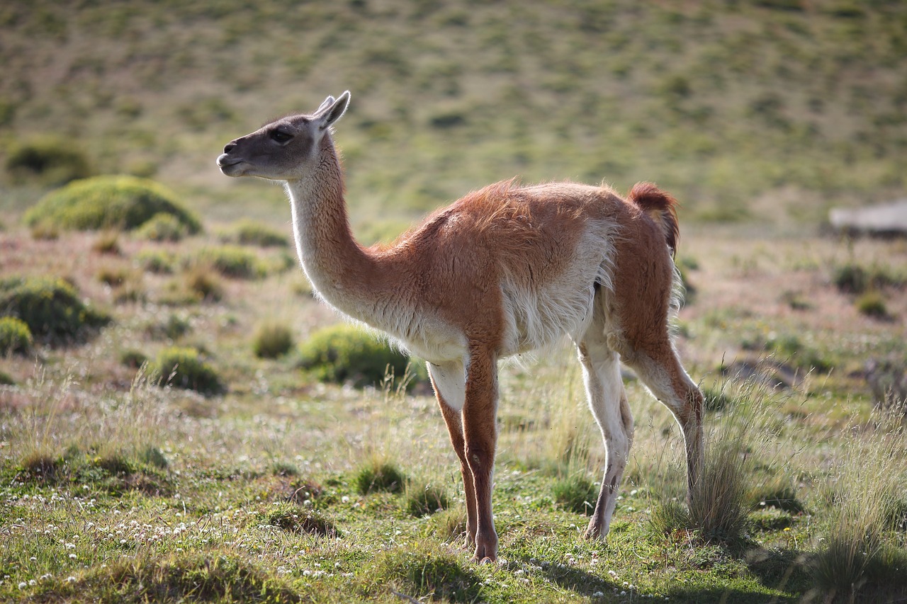
A herd of guanacos on the open grassland of Valle Chacabuco
The guanacos, back on the open grass

What it did was fill back up. The guanacos came first, in the numbers the ranch had spent a century keeping down, and people who know the valley took to calling it the Serengeti of Patagonia. Where the guanacos went the pumas came after them, and this is now one of the better places to watch a wild puma outside Torres del Paine, though nobody here will promise you one. The cat keeps its own hours. You watch the guanacos instead, and when a whole hillside of them turns to face the same patch of empty ground and begins to call, you know they have seen something you have not.

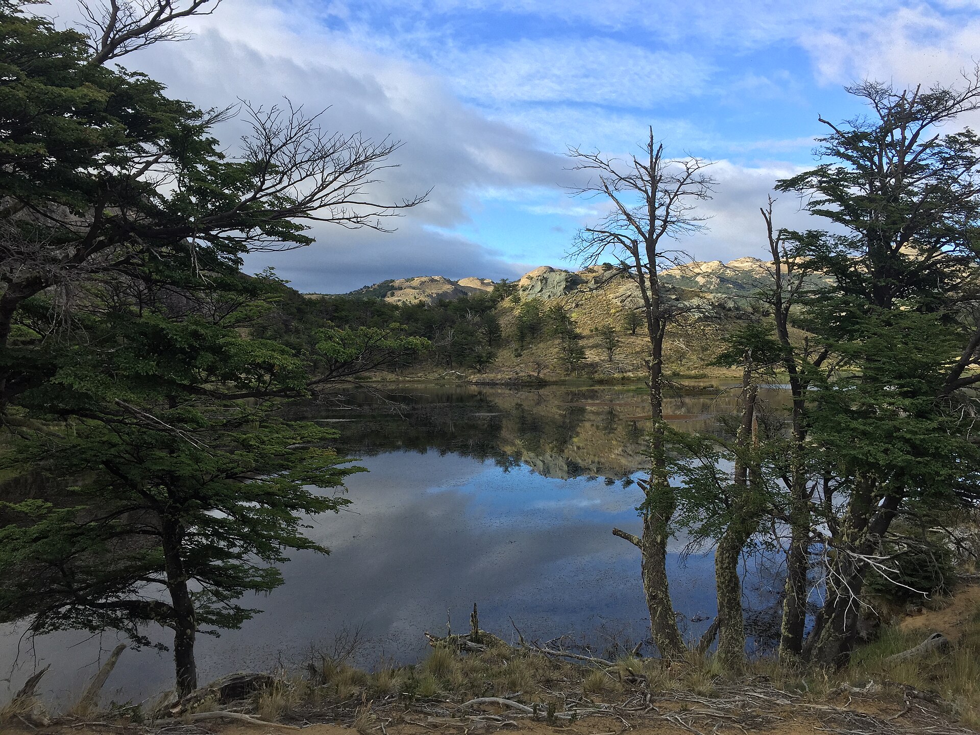
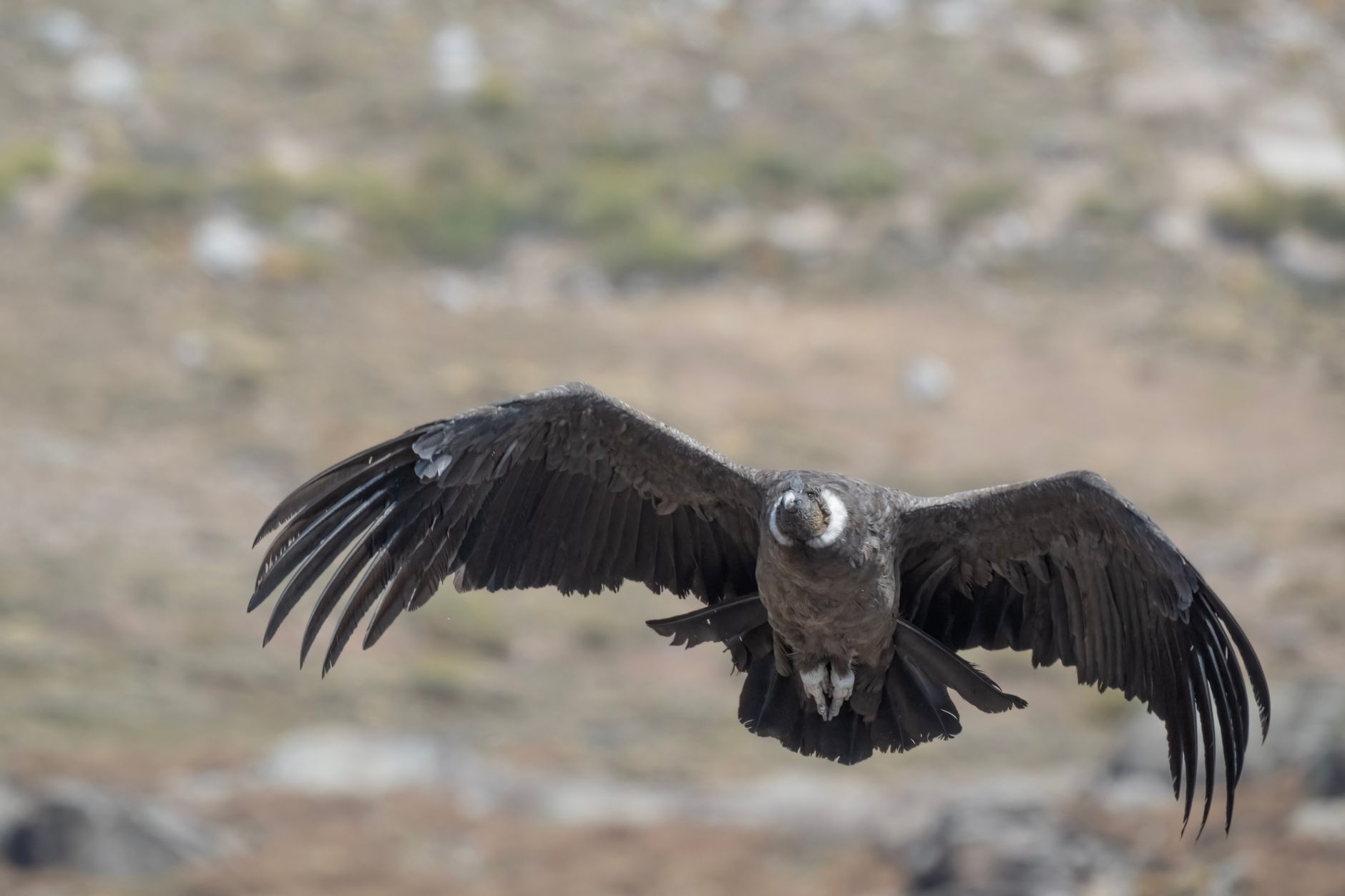
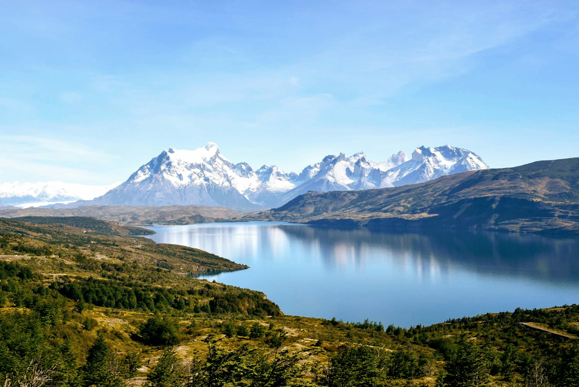
I walked up to the high lagoons on the trail they call Lagunas Altas, a long climb off the valley floor to a shelf of tarns held under the peaks. A condor came over the ridge and hung there without seeming to move. The lagoons held the light without a ripple, and for most of the morning the only sounds were the wind in the grass and my own boots. I passed no one. In a national park, at the height of summer, I passed no one at all.

A still high lagoon under snow-streaked peaks on the Lagunas Altas trail
The high lagoons, under the peaks
An Andean condor turning over the ridgeline
A condor, hung over the ridge

The weather does not hold still the way the water does. A clear hour turns to hail and then clears again, and the wind is a constant the way it is at sea. People who camp in the valley talk about waking to snow in December. It is beautiful in the plain, unshowy way that cold open country is beautiful, and it asks a certain patience of you before it gives anything back.

He spent a fortune to buy this valley, and another to give it away, on the plain faith that the wild would know what to do with it once the fences were down.

Tompkins did not live to finish the park. In December 2015 his kayak went over on Lago General Carrera, the great lake to the north, in high wind and near-freezing water, and he died of hypothermia at seventy-two. His wife, Kristine, who had herself run an outdoor company, completed the work he had begun. In 2018 she and the Chilean president signed the land over: a donation of roughly a million acres from the Tompkins foundation, matched with millions more of federal ground, that created a chain of new national parks down the length of the country. This valley is the heart of it. Tompkins is buried a short walk from the visitor centre, in the ground he spent a fortune giving away.
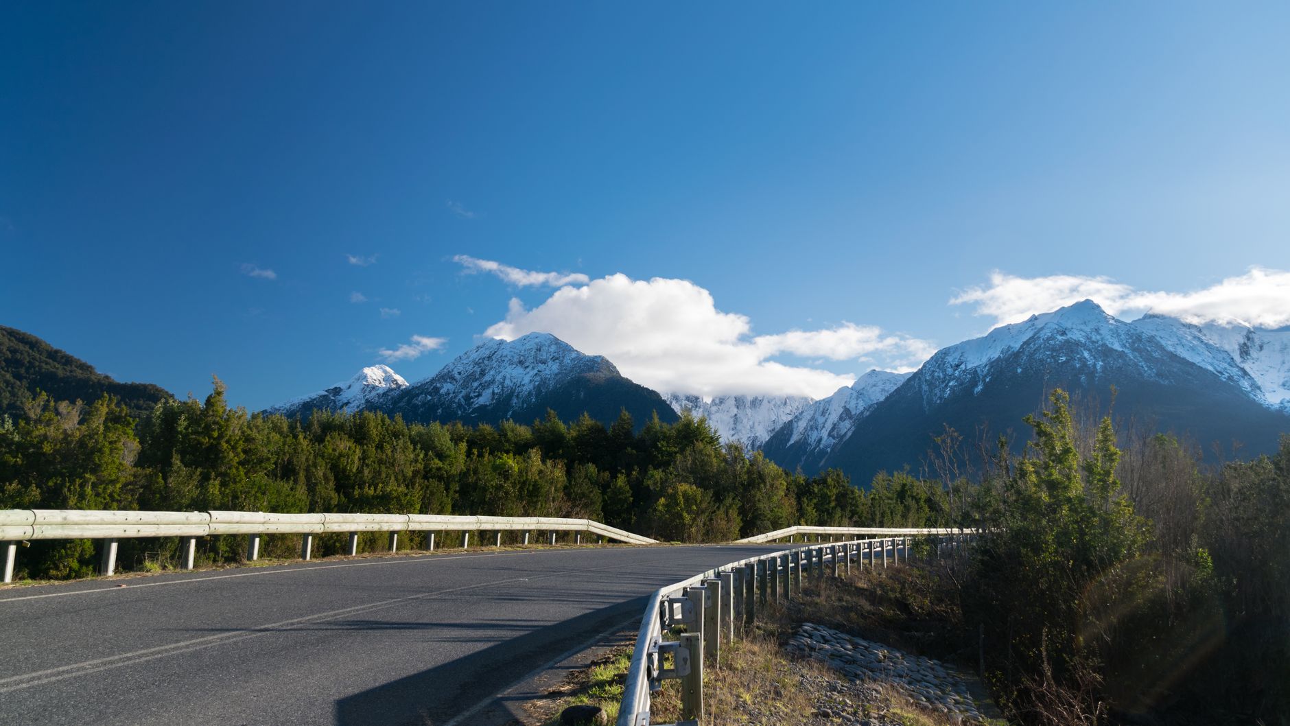
The gravel Carretera Austral running through the valley under the peaks
The Carretera Austral, the long gravel road in

I went to the grave on the last morning, because it seemed the honest place to end. It is a plain marker on a rise above the valley, easy to walk past. From it you can see the grassland the sheep once cropped bare, greened over now, a guanaco herd strung along the far ridge where a fence used to run. A ranger told me the emptiness was the hardest thing they ever built here. Standing at the grave in the cold early light, I believed it.

Plan a similar trip

My itinerary

Fly into Balmaceda, near Coyhaique, and drive the Carretera Austral south. Base at the Lodge at Valle Chacabuco, the West Winds campground, or a hostel in Cochrane. Facilities generally run October to April; winter access on the Carretera Austral gets hard.

  1. Day 1

    Down the Carretera Austral

    Fly in to Balmaceda, pick up a car, and drive the long gravel highway south to Cochrane, the last real town before the park.

    Travel

    Balmaceda to Cochrane, a long day on the gravel, roughly 6 to 9 hours with stops

    A 4x4 is not essential on the main road but helps on the park's inner spurs.

  2. Day 2

    The Lagunas Altas trail

    The marquee day hike: a steep climb off the valley floor to a plateau of high tarns under the peaks, condors overhead and guanacos most of the way.

    Trail

    About 20 km loop from near the West Winds campground, a full day

    Carry layers and rain shell; the weather turns fast up on the plateau.

  3. Day 3

    Wildlife, and the story

    Watch the grasslands at dusk for pumas, walk the visitor-centre museum, and pay a visit to Douglas Tompkins' grave in the valley.

    Travel

    Late afternoon is the best window for wildlife on the valley floor

    Pumas are never guaranteed; the guanaco alarm call is the sign to look.

  4. Day 4

    The Aviles valley

    The El Aviles trail up the river and over the hanging bridge, past the Painted Mountain, before the long drive back north.

    Onward

    Cochrane back up to Balmaceda for the flight, another full gravel day

    Fuel up in Cochrane; stations are sparse on the Carretera Austral.

← All dispatches
Keep exploring

More dispatches

Meridian Dispatch for iPhone

A travel journal that
writes itself.

Your best memories, journaled automatically, from the photos already on your phone. The app reads your photo library, finds the international trips you have taken, identifies the venues, writes the prose, and lays it out like a magazine spread. The first time you open it, the last several years of your travel are already there. Every trip after that goes in by itself.

  1. Mapped on a globe

    Your whole world, on one globe.

    Every country you've visited, lit on a private 3D globe. Spin it to find a trip and fall straight back into it. The globe is the table of contents for your journal.

    The app's private globe of visited countries.
  2. Detected automatically

    It finds your trips on its own.

    Your photos cluster by place and time, and each cluster becomes a venue: the museum you spent the morning in, the restaurant you lingered over, the streets you wandered after dinner. No tagging, no prompts, no logbook to keep up.

    The app's archive, every trip a dispatch.
  3. In warm prose

    Each place, written up.

    Every day opens on a hero photograph, and each place you stopped gets its own short entry beside your own photographs, no two days laid out the same. A record of where you've been, kept in real sentences. Edit a line, or regenerate any passage you want fresh.

    A written day in the app, with a place entry and a photo grid.
  4. Yours to keep

    Every trip, as a photobook.

    Download any journal as a clean photobook, send it to whoever was there, or have it printed as a hardback you keep on the shelf. What you read on your phone is exactly what lands on the page.

    The app exporting a trip as a photobook, with Share PDF and Save to Files.