Mornings in this valley begin with the webcams. The live cameras on jungfrau.ch watch each level separately, and people who know the place read them over breakfast before committing to a mountain, because the sky over the village says nothing about the summits. Rain on the meadows can be fresh snow at Kleine Scheidegg, and a grey lid of cloud on the valley floor can mean hard sunshine in Mürren, which sits above the whole ceiling of it.
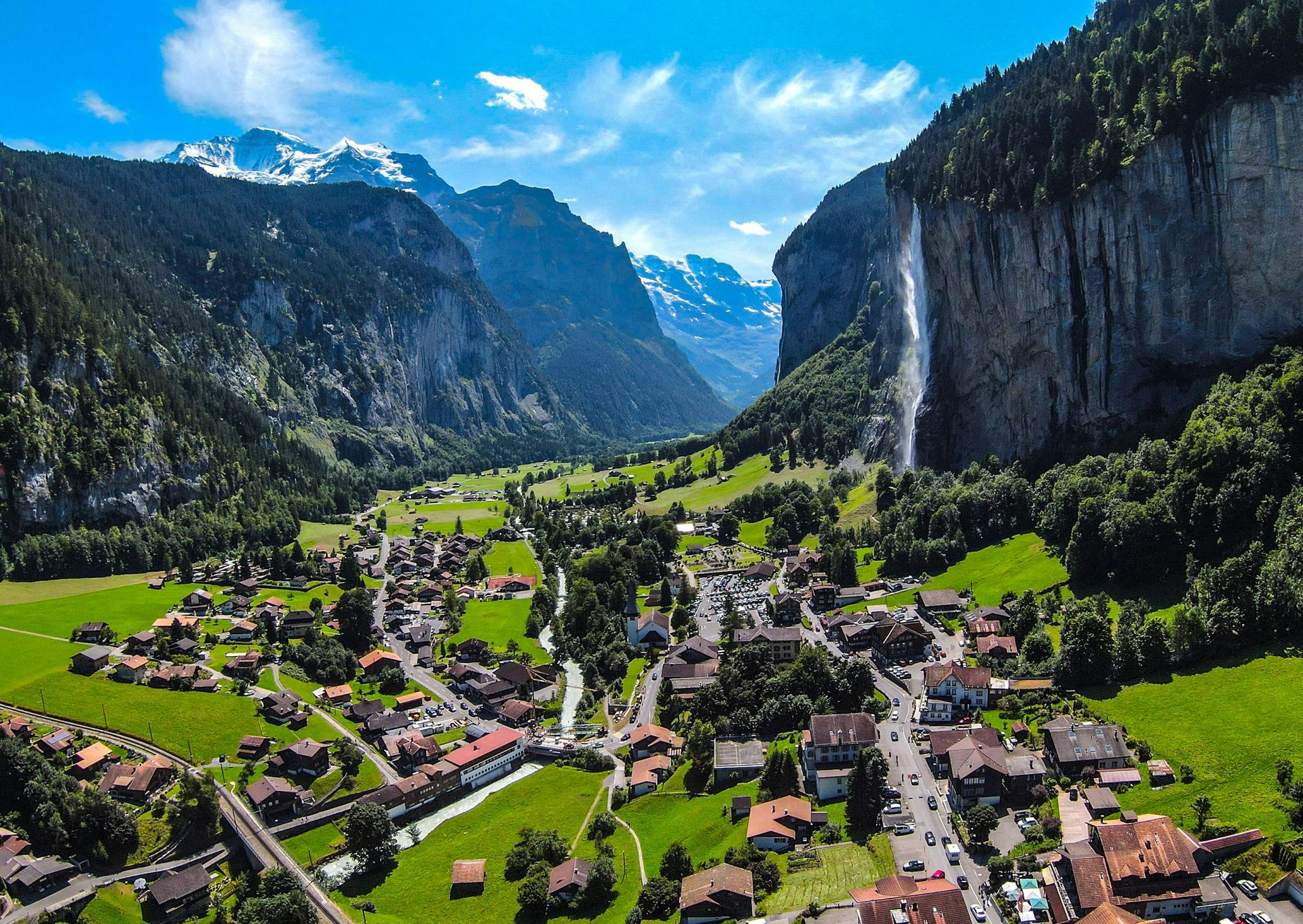
The valley itself is a glacial trough with a flat green floor and walls that rise sheer on both sides, and it is best understood as a building. Lauterbrunnen village is the ground floor, where the trains from Interlaken Ost arrive and most of the beds are. Wengen and Mürren stand on natural shelves several hundred metres up, one on each wall. Kleine Scheidegg and the Schilthorn hold the high storeys, and the Jungfraujoch, the saddle between the Mönch and the Jungfrau, is the roof at 3,454 metres, the highest railway station in Europe.
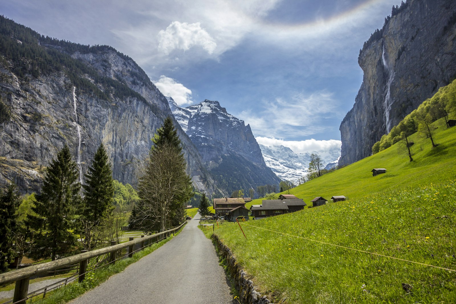
The ground floor asks the least of a visitor. The lane to Stechelberg runs flat along the river for an hour or two, past the Staubbach, which leaves the cliff rim in a single fall of almost three hundred metres and turns to spray before it lands. The village is weighing a charge for the path to its foot, the money going first to a rockfall net, with residents due to vote on it in early 2027.
Around twenty minutes south of the village, where a path branches toward Trümmelbach, the cliff above the trail carries several of the valley's named exits; on fine summer weekends the jumpers come off the rim in twos and threes, wingsuits tracking out over the meadows, while paragliders share the same air and cowbells carry up from every field. Roughly five hundred people jump here a year, registering a jump is a legal requirement rather than a courtesy, and afterwards they gather at the Horner Pub.
Trümmelbach is the one paid stop on the floor, and the strangest. Ten glacier-fed falls drop through the inside of the mountain, draining the Eiger, Mönch and Jungfrau at up to twenty thousand litres a second at peak melt.
A tunnel lift, first cut into the rock in 1913 and twice rebuilt since, carries visitors up through the dark to the sixth and seventh, so the galleries can be walked back down through the noise. The gorge holds a cold fine mist that soaks clothes without seeming to, and the stone steps run slick enough that sandals are a poor idea. It opens roughly April to early November and closes in winter for a plain reason: with the glaciers frozen, there is almost no water. On a rainy morning expect a queue for the lift, because this is where the whole valley goes when the tops are clouded in.
No road has ever reached Mürren or Wengen, and none is coming; the shelves are served by their own machines. Wengen's is the cogwheel railway from Lauterbrunnen, which has climbed through the village since the 1890s on its way up to Kleine Scheidegg. Mürren has two: a cable car out of Lauterbrunnen to Grütschalp with a small mountain train along the shelf, and, from Stechelberg at the head of the valley, the new Schilthornbahn, rebuilt in stages from 2024 and completed on 2 April 2026, whose first section up to Mürren is the steepest aerial cableway in the world, climbing at a gradient of nearly 160 percent.
Which shelf to sleep on is the most argued question in the valley, and the practical answer hangs on a timetable. Wengen is the larger village, with more restaurants and a last connection up from the valley after midnight. Mürren is smaller, higher and quieter, with the closer line on the big three peaks, best of all from the upper village near its little church, and its Grütschalp route stopping around half past eight, though the cable car from Stechelberg runs close to midnight, so a late night out means coming up the other side. Repeat visitors give the same counsel either way: take four nights or more, since a spell of cloud can write off a full day of them.
Ride up from Mürren instead and the Schilthorn answers the Jungfraujoch, cheaper to reach and far less crowded. At Birg, the mid-station, a steel and glass walkway called the Thrill Walk hangs off the cliff face for two hundred metres, and even in July it can be close to empty first thing. The top station carries Piz Gloria, a round restaurant that had been going up since 1961 and stood unfinished when the makers of On Her Majesty's Secret Service arrived in 1968; the production paid to complete it and got the film's lair in return. The room turns a full circle in about three quarters of an hour while the buffet stands still. The cableways queue from mid-morning in summer, so be on them before nine.
No one conquers these mountains. They lend a clear morning, then take it back before the cloud comes in.
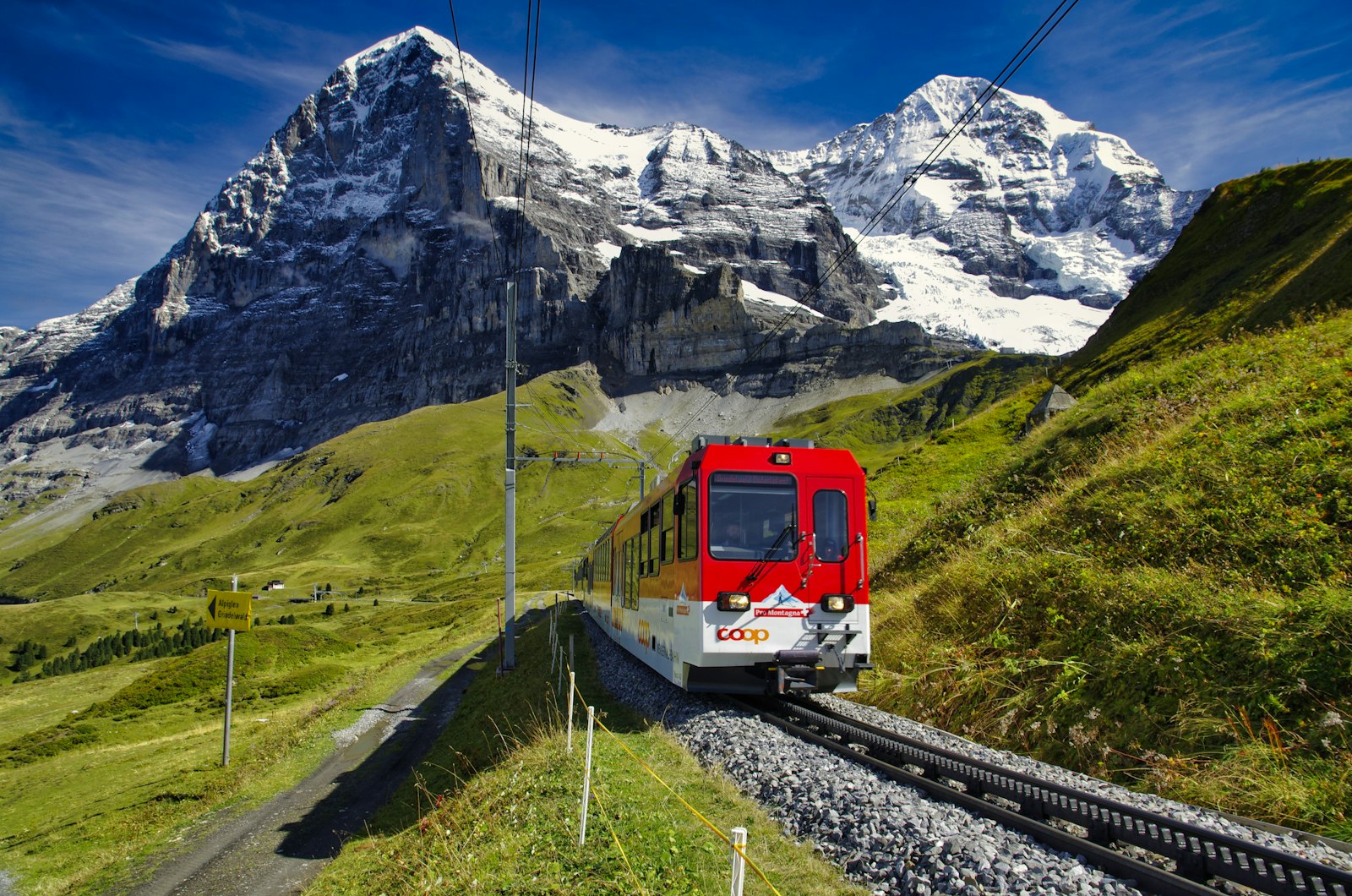
The east wall carries the serious railway. The cog train from Lauterbrunnen climbs through Wengen to Kleine Scheidegg, a bare saddle of hotels and track laid directly under the north face of the Eiger, and the path down from Eigergletscher station passes a line of wooden steles recording the face's climbing history, the triumphs and the deaths in order. From the saddle the Jungfrau Railway takes over, bored upward through the Eiger and the Mönch between 1896 and 1912, sixteen years of tunnelling that end at the Jungfraujoch.
Two things decide whether the summit day works: the hour of departure, and whether the last leg was booked. From May to October the final leg above Eigergletscher requires a paid seat reservation on top of any pass, and the tour groups board from about ten in the morning, when two-hour queues at the changeover are a reported and repeated experience. Leave at first light or go up in the late afternoon instead; an early start from the valley can put a visitor on the roof by half past eight.
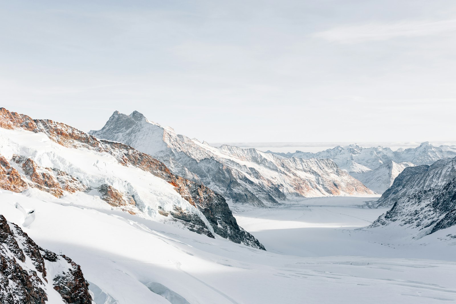
Allow three to four hours up there. The Sphinx terrace, on the days it is open, looks down the Aletsch, the largest glacier in the Alps, running some twenty-three kilometres to the south and losing about fifty metres of its length a year. The snow walk out toward the Mönchsjoch hut takes about forty-five minutes each way and is harder than it looks at this altitude, and the Ice Palace holds a temperature a few degrees below freezing and a crowd whose noise rings off the ice. Breathlessness on the Sphinx stairs is normal, headaches after a couple of hours are common, and the cure for both is the train down.
The best-value day here needs no summit ticket at all. From Wengen a cable car rises to Männlichen in five minutes; walk from there down to Kleine Scheidegg, in that direction, so the going is gentle and the Eiger, Mönch and Jungfrau stay ahead the whole way. The path runs about four and a half kilometres of wide gravel, exposed and shadeless, with cowbells alongside and paragliders launching off the summit behind, and the viewing platform at Restaurant Grindelwaldblick, just short of the saddle, is the customary stop. The lifts run from late May to late October and the trail is walkable from about mid June, once the snow has gone; the Wengen cableway itself also runs through the ski season. Watch the time of the last car down, because after it the descent is on foot.
Put the trip together this way. Fly into Zürich and reach Lauterbrunnen by rail in about three hours via Interlaken Ost. The valley floor is the connective base, the one place with easy access up both walls, and the Hotel Silberhorn sits a minute from the station. A Jungfrau Travel Pass covers the region's trains and cableways as far as Mürren and Eigergletscher, with the Jungfraujoch summit leg and the Schilthorn sold as discounted supplements on top. Dinner runs early everywhere: the mountain terraces want reservations, the village Coop shuts at half past six and does not open on Sunday, and the season to aim for is June to September, when every storey of the valley is open at once.
The famous number here is seventy-two, the count of waterfalls the tourist office gives the valley. It is honest across a year and optimistic on any given day, because a count from the valley floor tends to give up somewhere in the teens. The difference is snowmelt. Come in May or June and the walls run everywhere, the Staubbach at full force; by a dry August it thins until the wind takes it, and the tallest fall in the valley arrives at the ground as mist.