 Submit a photo
Ninety seconds on Ceannabeinne Beach
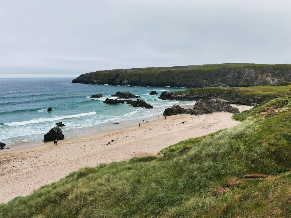
Worth the stop on the A838 for two sights on one stretch of road: a sandy cove between two cliffs, and the stone outlines of a crofting township. The township loop alone takes 30 to 45 minutes.
Look at the rocks first. The cliffs either side of the sand are ancient gneiss, banded orange and black where the rock was squeezed and folded billions of years ago, and in some light they look pink.
Behind the beach a grassy slope climbs to Beinn Ceannabeinne, a 383 metre hill whose name means end of the mountains and which the beach shares. Offshore lies Eilean Hoan, once farmed and now a nature reserve.
The township of Ceannabeinne was home to about 50 people until a landlord's eviction notice gave them 48 hours to leave. A few low stone walls now mark the houses and gardens, and the old school house is the one building still standing.
Parking in the small car park off the A838 puts the whole cove below you, so look from the bank before you take the steps down. The beach slopes gently to the water, with the rock cliffs at either end. If you swim, go on a calm morning, before the wind picks up.
For the township, go through the gate where the waymarked trail starts. Signboards take you round the ruins in order and bring you out at the shore, so you need no guide. Go out onto the headland for the best view back over the walls.
Dogs are allowed on the beach, but sheep graze the trail, so keep yours on a lead there. Watch for seabirds and wildflowers on the way round in spring and summer.
In a campervan or other large vehicle, park carefully so that other traffic can still pass on the A838. The nearest toilets, café and other amenities are in Durness, since the beach and the trail have none. Pack layers and waterproofs, even for a short stop.
Explore the rest of Durness
A scatter of crofts on limestone grassland above white beaches, Durness is the last village before the north-west corner of Scotland.…
Below the village centre, Sango Bay is a sandy cove broken by limestone stacks and reached by steps from the clifftop. A campsite runs…
Flat-roofed huts built as a Cold War early-warning station now hold studios, galleries, a bookshop and cafes, a short drive west of…
Last updated