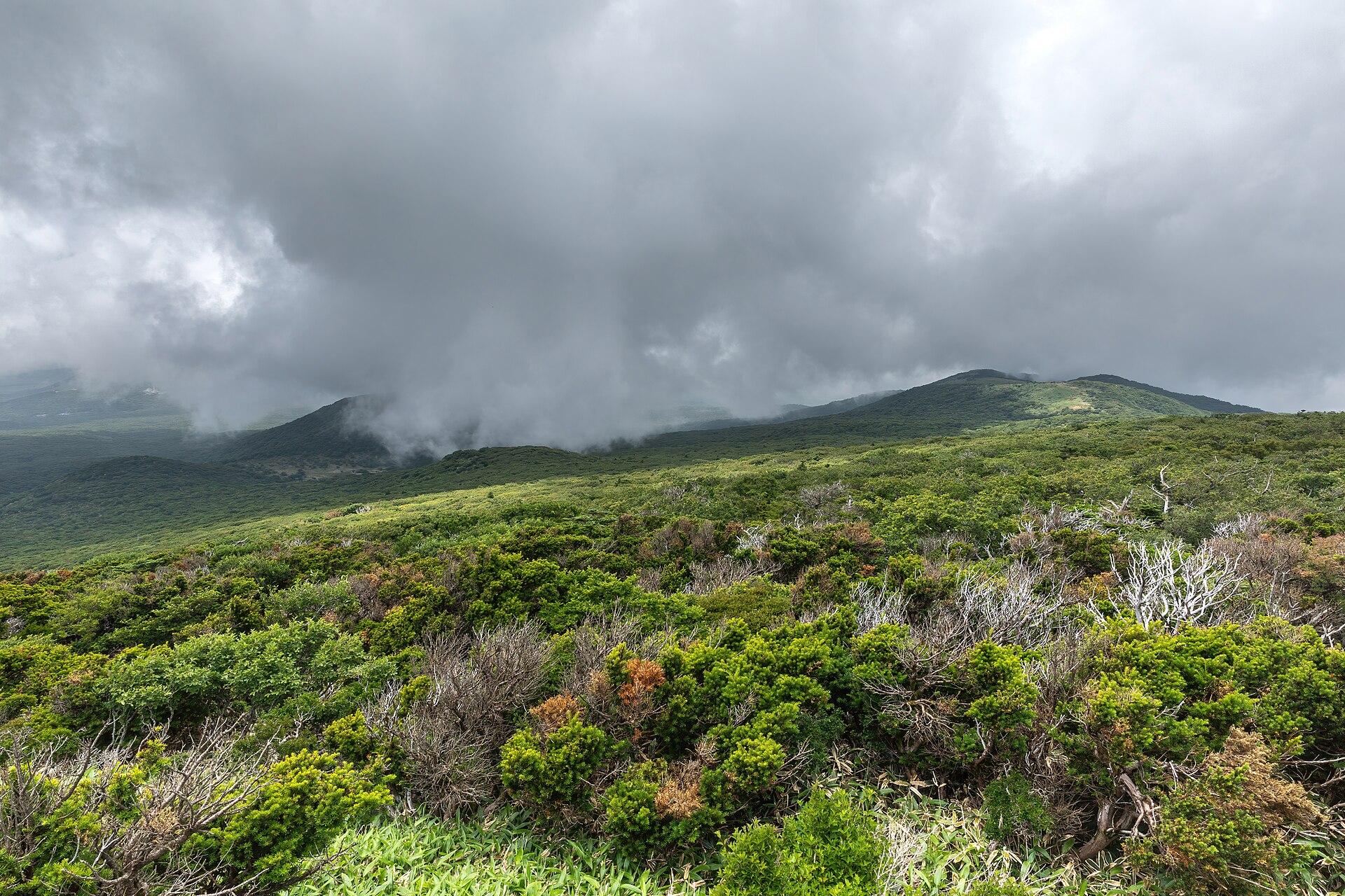
A haenyeo works on one breath at a time. She drops under ten metres, stays down between thirty seconds and a minute, cuts a conch or an abalone off the rock, and comes back up. Then she does it again, for four to five hours in the water, at least three days a week.
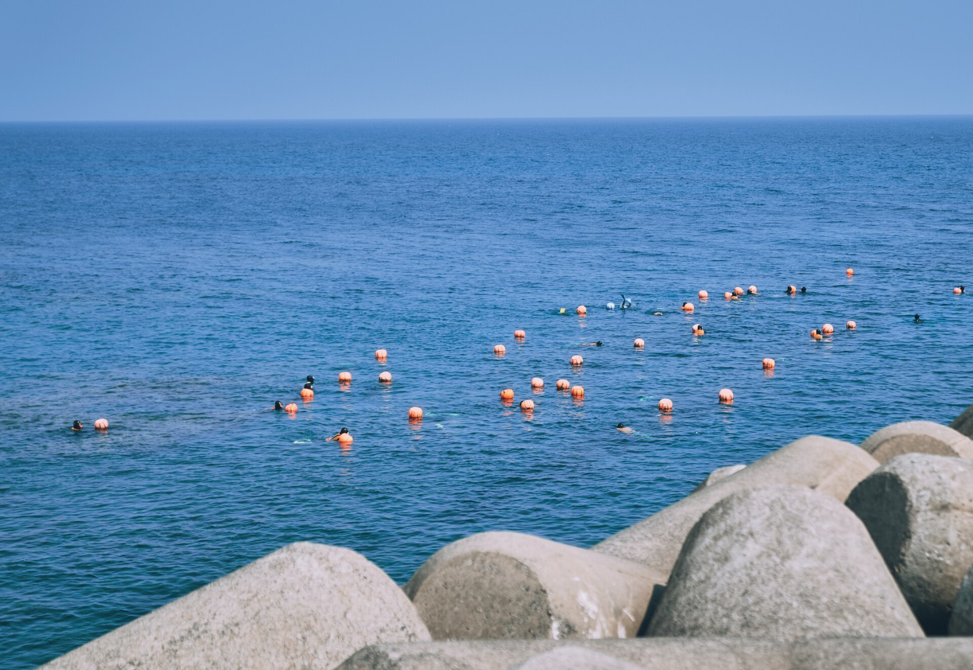
On the surface she rests against a tewak, a hard orange float with a mangsari net bag slung beneath it for the catch, which is why counting divers from a beach means counting floats. Coming up she empties her lungs in a sharp rising whistle, the sumbisori, a breathing technique rather than a song.
Divers are graded hagun, junggun and sanggun, lower, middle and upper, and the grade decides who works which ground. The sanggun take the deep water and train everyone below. It is a workplace hierarchy with money attached.
Decades of that leave a record in the body, and it has now been measured twice. Fieldwork across 527 working divers in 2021 sorted their decompression-sickness symptoms into classes and set the rest of the occupational load alongside: chronic headache, hearing impairment concentrated among the longest-serving, otitis media, gastric complaints, musculoskeletal pain. Over-the-counter headache and dizziness medication is habitual in the cohort.
Then, in July 2026, Samsung Medical Center and the Haenyeo Health Research Center at Jeju National University Hospital compared several thousand divers against a control group and published in Rhinology. Acute sinusitis, allergic rhinitis and pharyngeal disease all ran sharply higher. The sharpest finding was that rhinitis risk rose most among divers under fifty, which is to say among the ones with the most working years left.
The headcount tells the other half of it. Around 14,000 divers worked the island in 1970. The roll has fallen every year since, and the fall is accelerating: the last provincial census took more than two hundred names off it in twelve months, a drop of nearly a tenth in a single year.
Almost two thirds of the women still diving are past seventy, and more than four hundred are eighty or over, which is why researchers who work with them say plainly that this is the last generation. Published earnings figures differ by a factor of several and none come from the co-operatives or the province.
What is exact is what the province pays out. A living-stability programme funded from lottery revenue covers the out-of-pocket cost of outpatient treatment for diving illness, and pays certificated working divers a monthly allowance, doubled for the over-eighties. That is fifteen hundred divers drawing it, and the province paying the medical bills those two studies describe.
The mechanism holding the job together is the village fishing co-operative, the eochongye, which holds the rights to the inshore ground. A diver reaches the sea through membership and sells her conch, abalone and sea urchin through it. A good winter day and a day in late May can differ by a factor of four or five in kilos landed, and plenty of divers farm through the off-season.
That same collective structure produced the largest women's protest movement of the colonial period. Around 230 demonstrations ran from December 1931 into January 1932 against Japanese control of their association and of the price paid for their catch, converging on 12 January on the market at Sehwa, thousands of divers carrying hoes and abalone knives.
Recognition arrived late. UNESCO listed the culture of Jeju haenyeo as intangible heritage in 2016, and in November 2023 the FAO designated the Jeju Haenyeo Fisheries System a Globally Important Agricultural Heritage System, the listing that names it as a fishery. Intake now runs through the Hansupul Haenyeo School at Hallim, opened in 2007, and through the co-operatives and the museum, no longer down the family line.
Visitors meet the work in two separate settings, and the difference matters before booking. The scheduled one sits below Seongsan Ilchulbong, at the Umutgae cove on the seaward side, where a real crew dives to a timetable and runs the seafood stall beside it. Start times circulate in trip reports, but the official listing publishes none and says the schedule moves with the season and the sea, so ask at the gate and expect nothing.
The other setting is the east-coast villages, Hado-ri, Jongdal and Sehwa of the 1932 march, where some of the most active remaining crews still work. They go by the tide, not the clock, broadly late morning through the March to October season, with no schedule to consult.
The signs from the road are the bulteok, the low round basalt windbreaks where divers change and warm up, gear drying beside parked scooters, and orange floats offshore. Do not block a slipway a diver is climbing, and do not photograph faces at close range. The reference stop, in either case, is the Haenyeo Museum at Hado-ri in Gujwa-eup.
The divers at the Seongsan cove are a working crew doing a scheduled demonstration. When the sea or the catch says otherwise, they sing instead of diving.
Everything else on the island follows from the rock. Jeju is a shield volcano lying about 130 kilometres off the southern tip of the peninsula, built of basalt from the tideline up to the 1,947 metre summit of Hallasan, the tallest mountain in South Korea, with something like 360 oreum, parasitic cones, scattered across its flanks.
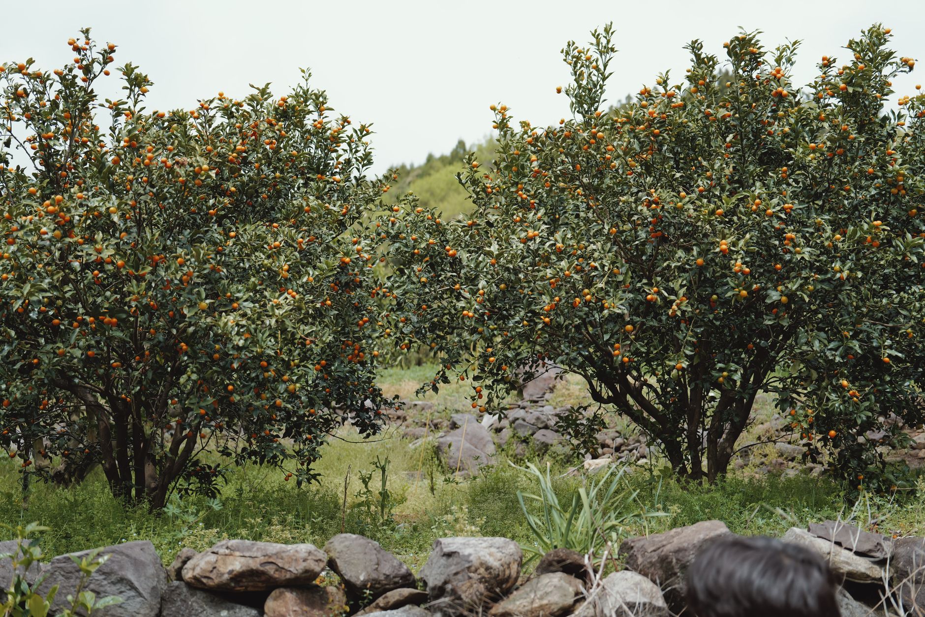
Basalt drains. Rain sinks into porous rock and will not stand in a paddy field, which ruled out the crop that fed the rest of Korea and left tangerines, barley and rape. Clearing a field produced stone, and the stone went into the dry-laid black walls that still divide almost every plot. Protein had to come out of the sea.
UNESCO inscribed Jeju Volcanic Island and Lava Tubes in 2007, the country's first and still only natural World Heritage site, in three components: the Hallasan Natural Reserve, the Geomunoreum lava tube system and the Seongsan Ilchulbong tuff cone.
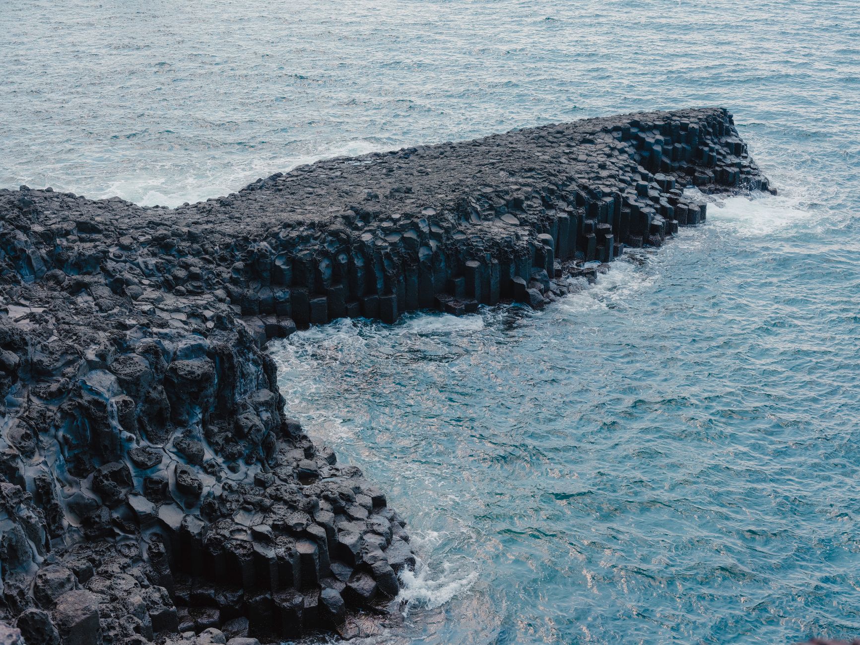
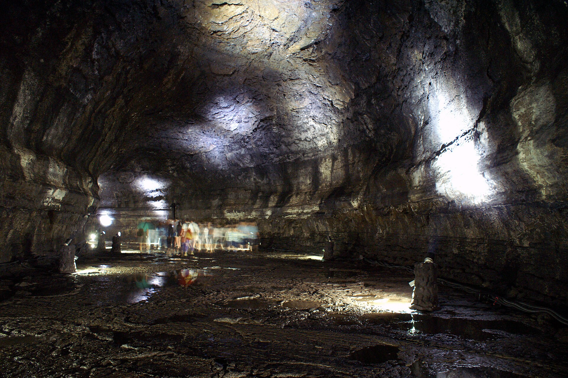
The lava that built the island also drained out of it, leaving the Geomunoreum tube system, of which only Manjanggul is open to the public. Read anything written between 2024 and mid-2026 and it will say the cave is shut. It was, after a rockfall in late 2023, and the reopening date slipped twice before it finally reopened on 30 May 2026.
Published figures for the tube's full length disagree, and only a kilometre is open in any case, walked out and back in about an hour. At the turnaround stands a lava column described as the largest known anywhere. The interior sits at ten to twelve degrees all year, which in August is a drop of twenty from the car park, and the stone stairs at the entrance are steep and permanently wet, so bring a long-sleeved layer and shoes with grip.
Hallasan has four main trails and only two of them reach the crater rim. Seongpanak climbs from the east, about 19 kilometres there and back, long and gradual. Gwaneumsa climbs from the north, roughly 9 kilometres one way, steeper, harder and the one with the views, though a June 2026 notice placed its summit section under access control, so check that before building a day around it. Yeongsil and Eorimok stop at the Witse Oreum plateau.
The summit sections need booking and the lower trails do not. Reserve free at visithalla.jeju.go.kr, which has an English version, and note that no-shows are penalised with a ban of months for a first offence and a year for a second. Places are rationed daily and released a month at a time, and summer and autumn dates go quickly once the window opens.
Rangers turn hikers back at the gate whatever the distance already climbed. The start windows and cut-offs they enforce are seasonal, shifting by roughly two hours between summer and winter, so take the current table from visithalla and plan the day backwards.
Budget eight to ten hours for the round trip either way. One fit pair took nearly ten hours up Gwaneumsa and down Seongpanak, close to three of them on the final descent, which is the leg nobody allows for and a knee problem more than a lung problem.
There is no water and no food above the shelters beyond limited snacks at Jindallaebat, everything carried up comes down again, wrappers included, and a litre and a half to two each is the minimum. Snow lies from November to March, when the windows shorten at both ends, and the summit closes outright for heavy rain, high wind or snow whatever a booking says.
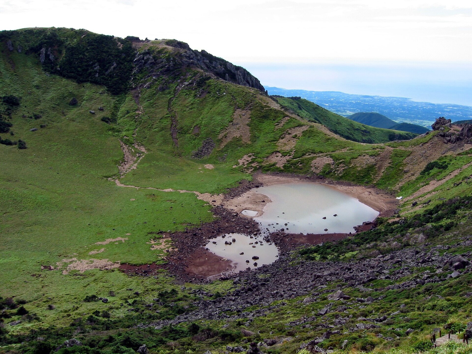
What waits at the top is Baengnokdam, a crater about 550 metres across that is called a lake and often is not one, drawn down in a dry spell to a couple of shallow brown pools on a green floor, with the north coast and its oreum far below.
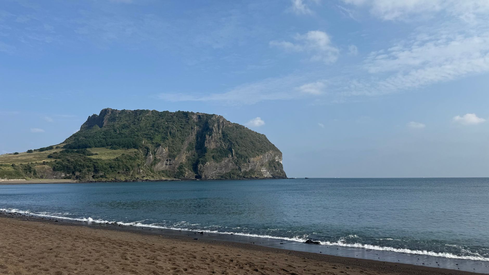
Seongsan Ilchulbong, the third listed component, is the one that fits inside an hour. The tuff cone stands about 180 metres, thrown up by a shallow-marine eruption, once an island and now tied to Jeju by a sand isthmus, its bowl ringed by a crown of rock peaks.
The climb is stairs from bottom to top, twenty minutes if pushed and forty at a normal pace, with separate up and down routes. Ilchulbong means sunrise peak, and sunrise is when the staircase is at its worst. Late afternoon is the calm slot, and the gate time for a sunrise morning moves with the season, so confirm it the day before.
Jeju International is the island's only airport, and Seoul Gimpo to Jeju was the busiest air route in the world across 2025, about seventy minutes in the air. Almost everyone connects through Gimpo. Jeju Air restored a direct Incheon to Jeju service in May 2026, a decade after the route was dropped for losses, but it is twice weekly on a trial and not yet permanent, so confirm it before you count on it.
Headline fares understate the cost either way, because the domestic fuel surcharge resets monthly against the ticket-issue date and has moved sharply, so price the current band, not the one you saw last year.
A rental car is the practical default. The island is 73 kilometres east to west and 31 north to south, its sights strung around the coast with an empty interior between them, and foreign drivers need an International Driving Permit. Google Maps does not give driving directions in South Korea, so use Naver Map or Kakao Map, and enter destinations by telephone number, which is what Korean navigation expects.
The buses are the unusual part, because they genuinely work: trunk routes down each coast, an airport limousine to Seogwipo and Jungmun, all on a T-money card. The cost is time, since a coast-to-coast leg that drives in an hour takes well over two by bus.
Coastal seafood stalls and market vendors prefer cash, and a stall is where to eat mulhoe, the cold raw-fish soup that is the divers' own summer food. Canola flowers late March into April, hydrangeas in June, and typhoons arrive in August and September.
All four have moved within the last two years. The direct Incheon to Jeju flight returned on 12 May 2026 after a decade, but it is a twice-weekly trial approved only to 24 October 2026, so check it before assuming you can skip Gimpo. Manjanggul reopened on 30 May 2026, so confirm it is open for your dates rather than trusting older guidance. Hallasan's summit reservations, start windows and cut-offs changed on 3 May 2025 and most write-ups predate that, so take the current table from visithalla.jeju.go.kr and check whether the Gwaneumsa summit section is still under June 2026's access control. The haenyeo demonstration at Seongsan has no published schedule and is cancelled in poor sea conditions.
Sources 7
The official and primary sources this dispatch was checked against.
- Jeju Province: haenyeo statistics
- UNESCO World Heritage: Jeju Volcanic Island and Lava Tubes
- UNESCO Intangible Heritage: Culture of Jeju Haenyeo
- Hallasan National Park: trail reservations
- Jeju UNESCO Global Geopark: Manjanggul
- Rhinology (2026): upper-airway disease in haenyeo
- Cell Reports (2025): haenyeo genetics and diving