Hike · Zagori, Greece
The crossing from Monodendri to Vikos village takes about six to seven hours of walking over 10 to 12 km. Most of the day is on the gorge floor, between a steep descent at the start and a climb at the end.
The classic route starts in Monodendri, at the southern head of the gorge, and ends in Vikos village on the west rim. It runs one way, south to north, so the long descent comes first.
By taxi. The road from Vikos back to Monodendri runs a long way round the gorge, so walkers book the ride before setting out, through a guesthouse or taverna in Monodendri, for the expected finish time.
One spring, Klima, lies on the route a little before halfway. Otherwise the gorge floor is dry until the Voidomatis springs near the northern end, so walkers carry water for the whole day from Monodendri.
Late spring and early autumn are the easiest months for the crossing. Snowmelt in early spring can make some passages difficult, and in July and August the air on the gorge floor is still and hot.
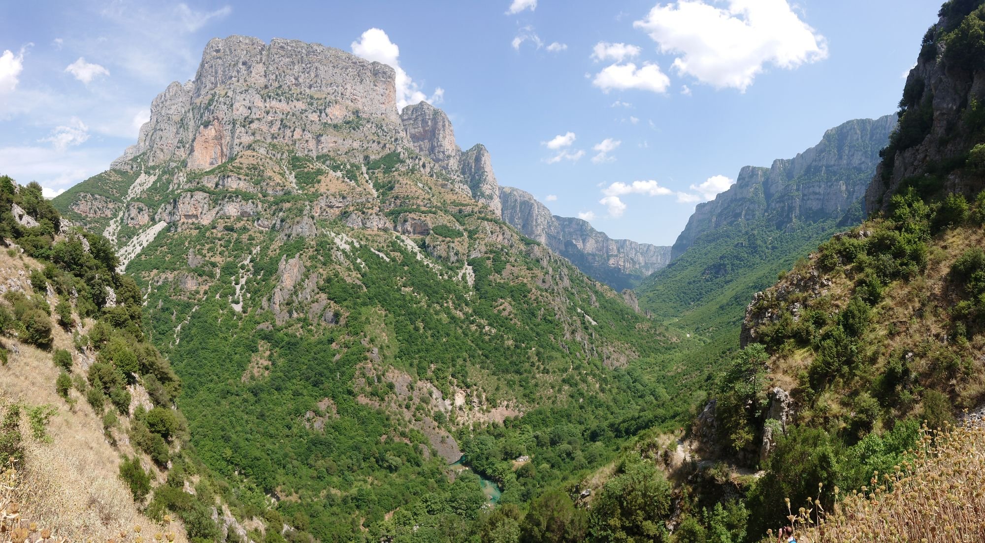
Nine hundred metres of limestone wall stand over you for most of a day on the floor of the Vikos Gorge, walked one way from Monodendri down to the riverbed and up to Vikos village.
Heights are approximate. Between the foot of the descent and the springs the floor line is smoothed, and the last climb is drawn straight up to Vikos village.
The gorge runs for about 12 km through the Zagori mountains, and in places its walls stand 900 metres above the floor. At the narrowest point the rims are only about 1,100 metres apart. The walk keeps to the bottom, so the scale is above you all day.
For most of the way the riverbed is dry stones under plane trees. Near the northern end the Voidomatis rises from springs in the bed, and from there the water runs clear and cold.
Overhead, the limestone layers are bent into folds, and overhanging rock shelters open under the cliffs beside the path.
The gorge lies inside the Vikos-Aoos National Park, where bears, wolves and chamois live.
Start in Monodendri and walk north. The path is part of the national trail O3, and the first stretch is a steep stone stair down to the riverbed.
On the floor the path climbs and drops over boulders and scree beside the river. Klima, the one spring on the route, sits a little before halfway, so fill your bottles there.
At the northern end a side path drops to the Voidomatis springs. The main path climbs to Vikos village at 770 metres.
Both ends are steep. The descent from Monodendri, much of it on old cobbled steps, drops roughly 300 metres in under two kilometres. The paved stair up to Vikos village climbs roughly 270 metres, so take both slowly, as polished stone is slippery when wet.
Between them, about ten kilometres of earth and rock path follow the riverbed, with fords over the dry stream, boulder fields and short climbs where the path leaves the bed. Waymarks keep you on the line where the path crosses open stone. Wear mountain boots.
The high walk above Papingo, the springs at the northern end, and the village guide
A small glacial tarn at 2,050 metres on the Tymfi plateau, about five hours up from Papingo past the Astraka refuge.
Where the river rises from the stones of the gorge floor, reached on short paths down from Vikos and Papingo.
Two stone villages under the Astraka towers at the northern mouth of the gorge, with rock pools between them.
The official pages this guide was checked against.
Last updated