Globe Countries Cities Itineraries World's Best Hotels Events Login
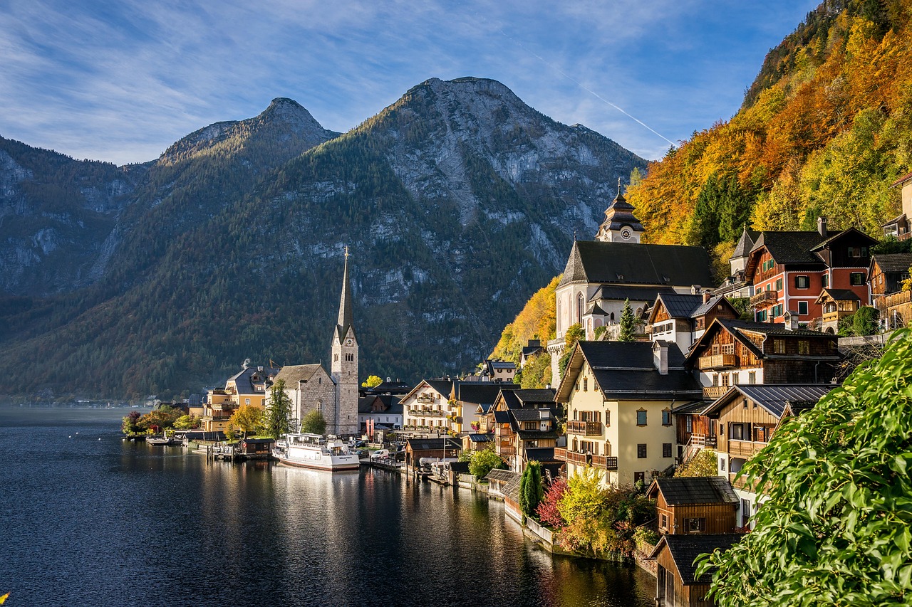
Hallstatt village stacked along the shore of the Hallstattersee with its church spire and the wooded mountainside behind
Leonhard Niederwimmer
Austria  ·  47.56°N 13.65°E

The Salt Village Under the Postcard

Written by Meridian Dispatch  ·  29 September 2026  ·  Updated

The salt mine above Hallstatt reopened in September 2026 with a new funicular, after a year closed. It takes half a day on its own, and the Dachstein caves across the lake take another.


Is a village you can walk end to end in under half an hour worth two nights of your trip? Hallstatt is, because the lakefront is only the ground floor: above it is a salt mine you go down on a miners' wooden slide, and across the water a cable car climbs to ice caves and a steel platform hung off a cliff.

Salt has been cut from the mountain here for some seven thousand years, and the mine above the roofs is billed as the oldest in the world. Coach tours give the village about two hours of the ground floor, in the middle of the day.


Coach tours from Salzburg and Vienna arrive between eleven and one in summer and leave around five, and between those hours the lakefront lane and the market square are packed. The classic postcard view is a five minute walk north of the square; go before nine, or share it. The early start has a second reason: after half past nine the car parks begin to fill.

Painted human skulls with names and floral wreaths lined up in the Hallstatt ossuary
The charnel house at St Michael's, where the painted names are still legible on the bone.Ahmet Yüksek
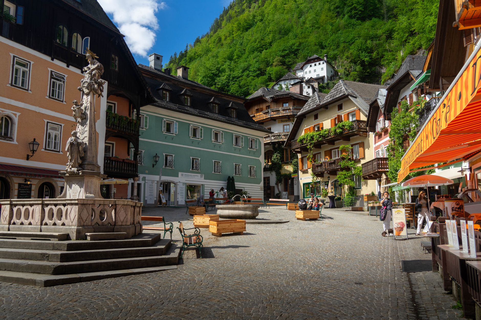
The Marktplatz in Hallstatt with pastel facades, a carved stone column on its fountain basin and cafe awnings
The Marktplatz, which is most of the flat public ground the village has.Husam Wafaei

Up the stone steps from the square, the chapel beside the Catholic parish church, the Katholische Pfarrkirche Hallstatt, holds the village's strangest room. Its charnel house holds more than six hundred skulls painted with names, dates and wreaths of flowers, moved there in a second burial when a grave was reused. In summer it opens at ten; from November to March it keeps short midday hours and closes on Mondays and Tuesdays.

Sleep on the square if you can. The yellow Seehotel Grüner Baum sits right on it, a little dated but comfortable, with rooms over the lake or the square, and the village you walk out into after the last coach has gone is quiet and nearly empty. Lahn, the flat southern end, has the lake beach and the start of the Echern valley walk; Obertraun, at the head of the lake, is cheaper and quieter under the cable car, but its kitchens keep short hours out of season.
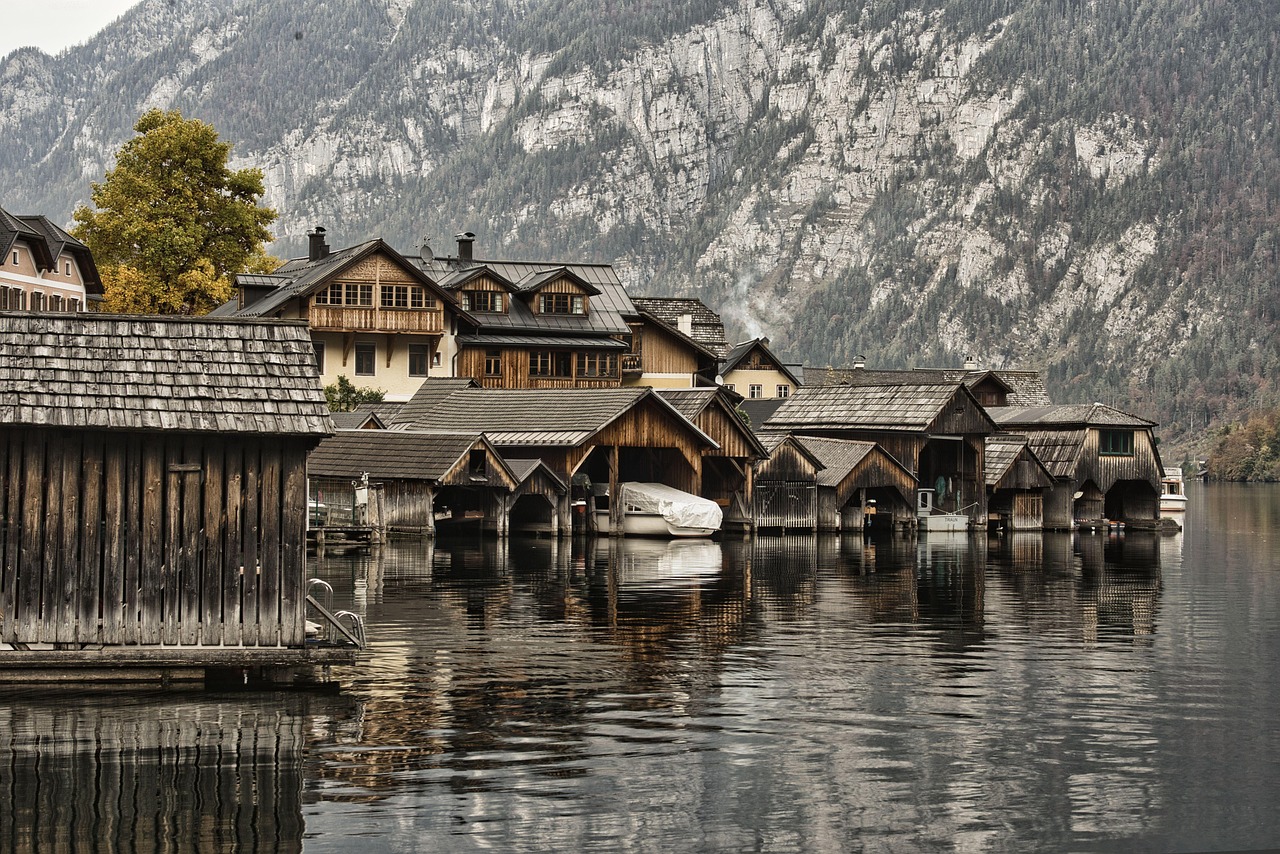
Wooden boathouses standing in the shallows of the Hallstattersee below timber-fronted village buildings
The boathouses on the waterfront, built out over the lake because there was nowhere on land to put them.rainhard2

The electric boats rented on the quay are the way to see the village from the water, and by afternoon the wait for one can run past an hour, so be there when the hire opens. The lake beach at Lahn is the place to swim.


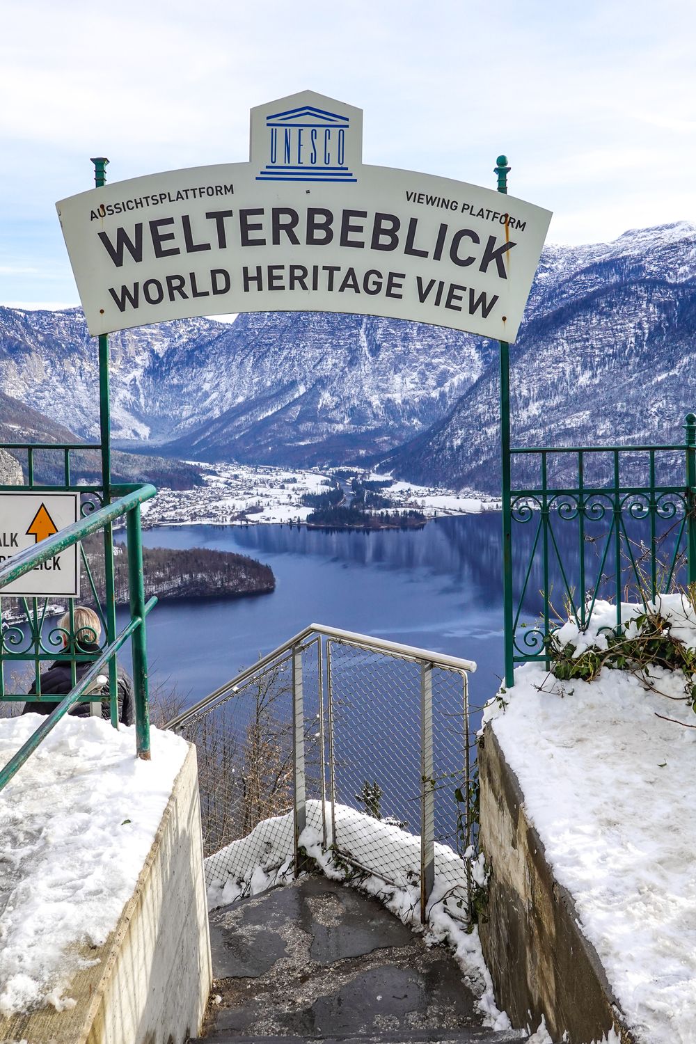
The new funicular climbs to the high valley, and the Skywalk beside its top station hangs about three hundred and sixty metres above the roofs. From there a path leads to the mine entrance across the Hallstatt Prehistoric Cemetery, the burial ground of the early miners, whose graves gave a whole age of European prehistory the name Hallstatt.

Inside, the guided tour runs about ninety minutes on foot and down the miners' wooden slides, past an underground salt lake. It stays around eight degrees all year, so bring a layer, and allow three hours from the funicular and back. Book ahead: in summer a same-day place is not a given.

Sleep on the square if you can.


The top floor is across the lake at Obertraun, a short bus ride from Lahn, where the Dachstein Krippenstein cable car climbs in stages. Its first stop, Schönbergalm, is a fifteen to twenty minute walk from both the Giant Ice Cave and the Mammoth Cave. Each is guided and takes about fifty minutes, and one cave is plenty for a day; they open from May to 1 November, and the Mammoth Cave's last tours leave at two, or three in high summer.

The second section carries on to Krippenstein, and from its station a walk of thirty to forty minutes reaches the 5fingers, five steel platforms over a drop of about five hundred metres. Save it for the clearest morning of the stay. In cloud there is nothing to see, and a strong wind spoils it even when the sky is clear.
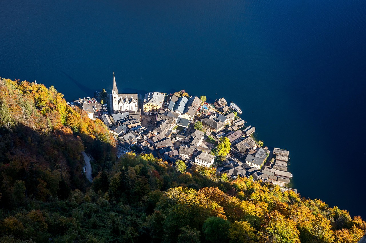
Hallstatt seen from above in autumn, houses stacked down a gold and green slope to the dark blue lake
Autumn on the slope, seen from above, when the beeches turn and the light comes in low.Leonhard Niederwimmer
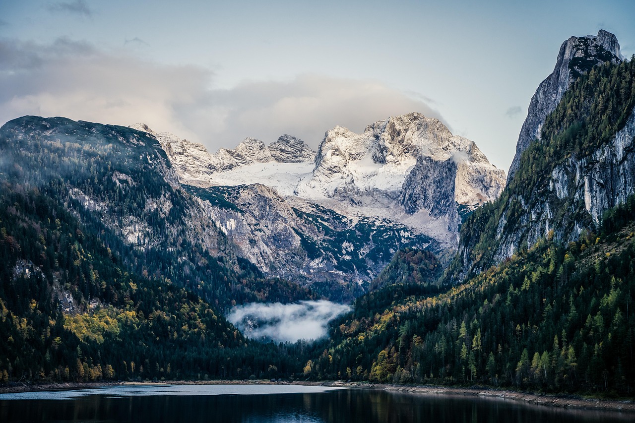
The Gosausee lake below the snow-covered Dachstein massif in autumn
The Gosausee, twenty-five minutes west, which is where the Dachstein massif is visible end to end.Leonhard Niederwimmer

West of the village, twenty-five minutes by car, the lower Gosausee lies under the Dachstein glacier with a level four kilometre path around it, an hour at a walk and easy with a pushchair. Go in the morning, when the water is still enough to hold the reflection; storms often build in the afternoon.


Most arrivals are by road, and the centre is closed to private cars by day, hotel guests included. Leave the car at P1, the year-round car park with a shuttle into the village, or at P2 in summer; neither can be booked for a day visit, and on busy summer days both can be full by midday, so come early.
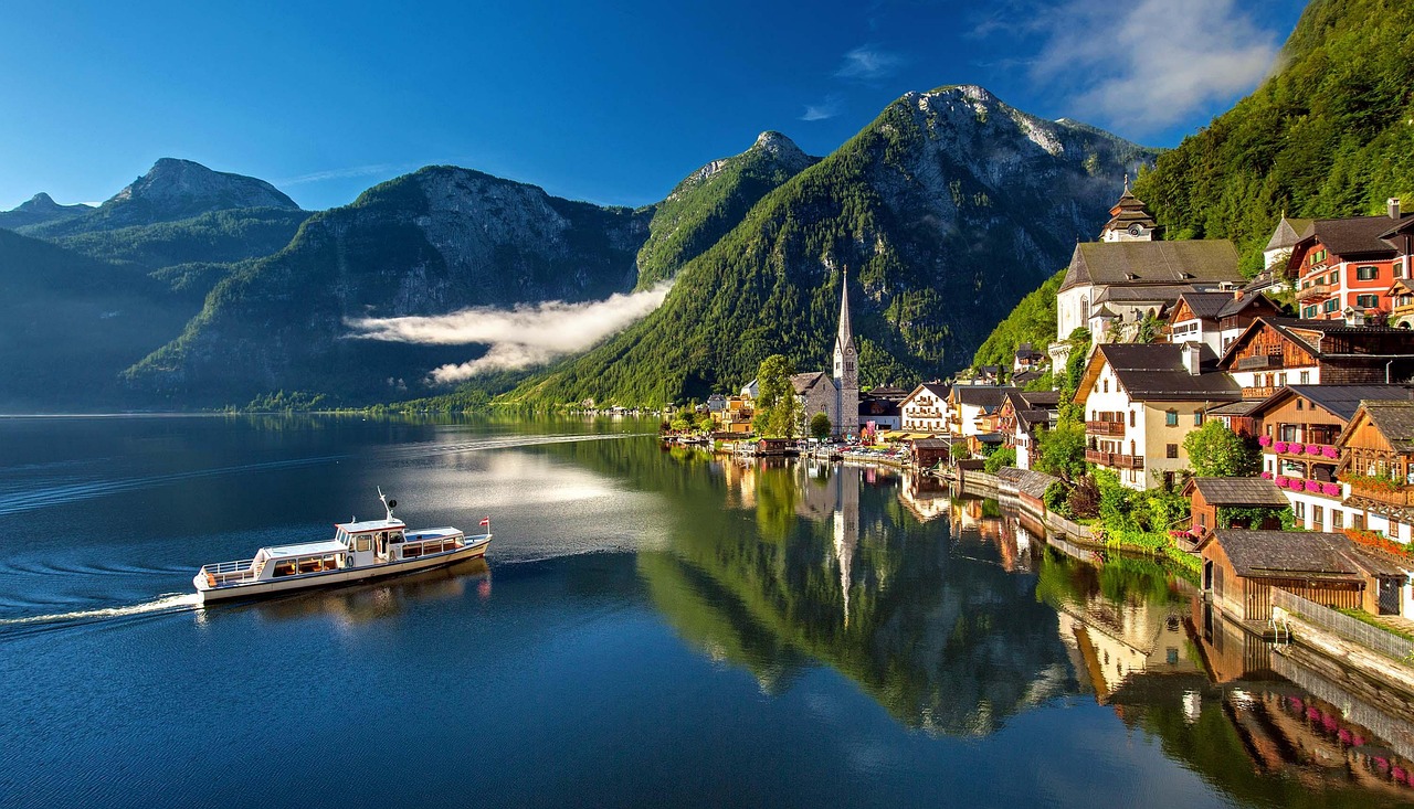
Hallstatt reflected in the flat water of the Hallstattersee with a small passenger ferry crossing and cloud caught on the wooded mountainside behind
A lake boat off the village on a still summer morning.Julius Silver

By rail, Hallstatt station is on the far shore, and the ferry is timed to meet the trains: about ten minutes across, every day of the year, cash only. Salzburg is about an hour away by car and closer to three hours by train with changes.

Cash matters around the whole lake, from the ferry to a number of the cafés. Food and souvenirs near the square are geared to the day crowd, so eat for convenience and save the evening for the walk. Most of the houses in the photographs are lived in: signs in several languages ask visitors off the private steps and gardens, and flying a drone here is banned.

The Soleleitungsweg, the path along the old brine pipeline toward Bad Goisern, is closed from the Salzberg to Steeg after rockfall, with no date set to reopen. From Steeg on to Bad Ischl it is open and runs almost level along the slope.
← All dispatches
Places on record

Every place in this dispatch

  1. Church
    Map of Katholische Pfarrkirche Hallstatt
    Church

    Katholische Pfarrkirche Hallstatt

    The short climb from the lane gives you two rooms worth the effort: a chapel of painted skulls, and a church with a carved late Gothic altar.

  2. Archaeological Site
    Map of Hallstatt Prehistoric Cemetery
    Archaeological Site

    Hallstatt Prehistoric Cemetery

    When archaeologists from Vienna dig in the high valley in summer, you may watch them at work above Hallstatt. The rest of the year, a signed path takes you across the Iron Age burial ground.

  3. Viewpoint
    Map of Krippenstein
    Viewpoint

    Krippenstein

    The 5fingers platform is five steel walkways built out over a drop of about five hundred metres. In cloud the plateau is just fog, so pick your day.

  4. Viewpoint
    Welterbeblick Skywalk
    Viewpoint

    Welterbeblick Skywalk

    Near the funicular's top station a steel platform juts from the slope about three hundred and sixty metres above the roofs, with the whole lake laid out below. The funicular is the way up, and a clear day is the time to ride it.

  5. Church
    Map of Christuskirche
    Church

    Christuskirche

    The slim spire at the water's edge in every photograph of the village belongs to this Protestant church, completed in 1863 on the shore beside the market square. Inside it is plain and quiet, a few minutes' stop. It shows best from the water, or from the northern end of the village.

  6. Cableway
    Map of Dachstein Krippenstein-Seilbahn
    Cableway

    Dachstein Krippenstein-Seilbahn

    Two of the three sections are worth riding: the first for the ice caves, the second for the viewing platform and the plateau walks. The third is only worth it if you have boots on.

  7. Other
    Map of Dachstein-Mammuthöhle
    Other

    Dachstein-Mammuthöhle

    No ice in this one: the mammoth of the name is the size of the passages, vast dry galleries cut by water through the mountain. It leaves from the same middle station as the ice cave, a fifteen to twenty minute walk away, and the guided tour runs about fifty minutes. Last tours leave at two, or three in high summer, so reach the middle station by noon.

  8. Cave
    Map of Dachstein-Rieseneishöhle
    Cave

    Dachstein-Rieseneishöhle

    This cave stays below freezing even in summer, so bring warm clothes. Visits are by guided tour only, from May to the first of November.

  9. Lake
    Map of Gosauseen
    Lake

    Gosauseen

    Best on a clear day: the Dachstein glacier at the head of the valley is the view, and the easy walk round the lower lake keeps it in sight most of the way.

  10. Museum
    Map of Hallstatt Museum
    Museum

    Hallstatt Museum

    Finds from the prehistoric cemetery and the mine end up in the World Heritage Museum, a short walk from the market square on the lake road, arranged from the Stone Age to the present. It fills an hour, and a wet one best. Hours shrink outside summer, so check them before a winter visit.

  11. Lake
    Map of Hallstätter See
    Lake

    Hallstätter See

    Take the boat at least once, even if you arrive by car. The crossing from the railway station on the far bank gives you the classic view of the village. Bring cash: the ferry takes nothing else.

  12. Other
    Map of Koppenbrüllerhöhle
    Other

    Koppenbrüllerhöhle

    After heavy rain or snowmelt the dry stream bed in this cave turns within minutes into a roaring brook, which is where the name comes from. A level quarter hour path along the Traun from the edge of Obertraun reaches the entrance, and guided tours of about an hour run from May to late September. It stays at about six degrees inside, so bring a warm layer.

Explore

More of Austria

Town guide

Hallstatt

The lake, the Dachstein ice cave and the cable car to Krippenstein.

Town guide

Salzburg

The fortress, the Getreidegasse and the old town an hour north.

Meridian Dispatch for iPhone

Plan the trip.
Keep the story.

Every other travel app asks you to start logging. Meridian Dispatch opens with years of your travel already written, from the photographs you already took.