 Submit a photo
Ninety seconds on Skógafoss
Quiet at sunrise and late evening, Skógafoss lets you stand in the spray of a broad white fall, then climb the stairs beside it and look straight down over the lip.
The cliff Skógafoss pours over is the old coastline of south Iceland: the sea once reached its base, and the flat ground you cross from the car park was shore. The Skógá river drops off its edge in a single sheet.
From the platform at the top you look down the length of the drop into the pool, and upstream along the river that feeds it.
In winter the fall keeps running through hard frost, but the steps and rocks around it ice up.
Legend says Þrasi Þórólfsson, the first settler here, buried a treasure in a cave behind the water. A ring said to come from his chest went to the local church and is now on show in the Skógar Museum, in the village a short way from the falls.
Two or three minutes on a flat gravel path take you from the car park to the pool at the base. Within a few metres of the water you will be damp, so keep a camera and glasses covered.
The metal staircase climbs the slope on the east side, to the right as you face the fall, up to a viewing platform at the top. The climb takes ten to thirty minutes depending on your pace. The steps are steep and some of them shaky, with several rest points on the way.
Beyond the platform a path follows the Skógá upstream past smaller falls, far less crowded than the main one. A couple of kilometres along it already gives several waterfall views, and you can turn back wherever you like.
Keep going and the path becomes the Waterfall Way, 7.6 km one way to a bridge over the river. Check conditions before you walk it in winter.
You need no guide for the falls, the stairs or the first stretch of river path. If you are not driving, guided South Coast day trips from Reykjavík stop here.
Past the bridge, the Fimmvörðuháls trail crosses to Þórsmörk, 25 km one way and eight to ten hours of walking. The pass is usually open only from late June to mid-September, and a guided hike puts you with someone who knows the route.
The tourist board has warned of steep slopes and scree between the two mountain huts, where there was once snow and ice. Check its trail warnings before you plan the crossing.
Wear a waterproof jacket and shoes with good grip even on a dry day: spray, rain and, in colder months, ice make the treads slippery, and the top of the cliff is exposed to the wind. If you walk on along the river, wear closed-toe waterproof shoes, because the path has a couple of stream crossings.
In winter, bring microspikes for the stairs. The car park toilets charge a small fee, while restaurants and hotels nearby let customers use theirs. If you hike beyond the falls, carry the SafeTravel app, which sends your GPS location to the 112 emergency line.
Explore the rest of Vík
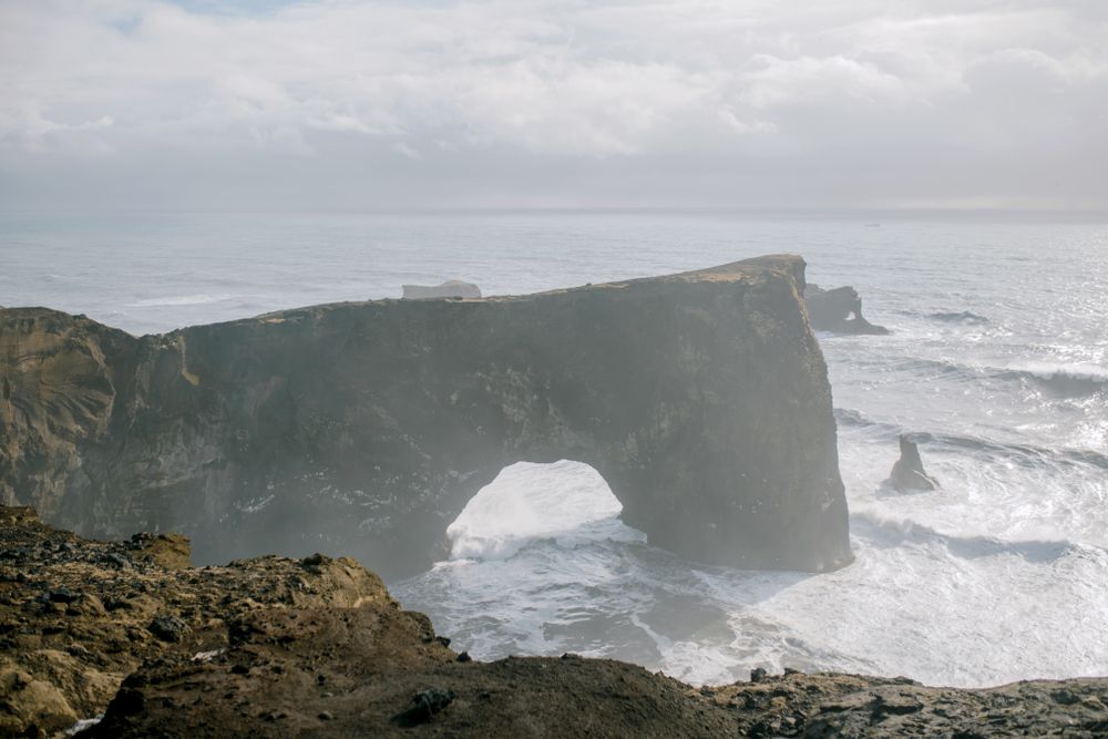
A headland on the coast west of Vík with two hills: low Lágey by the beach, and higher Háey, topped by a small lighthouse beside the sea…
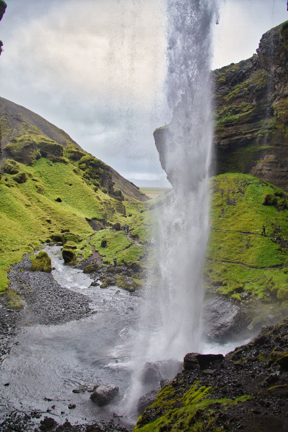
A waterfall in a narrow gorge just east of Skógafoss, reached on a path that starts behind the Skógar museum. The walk there and back takes…
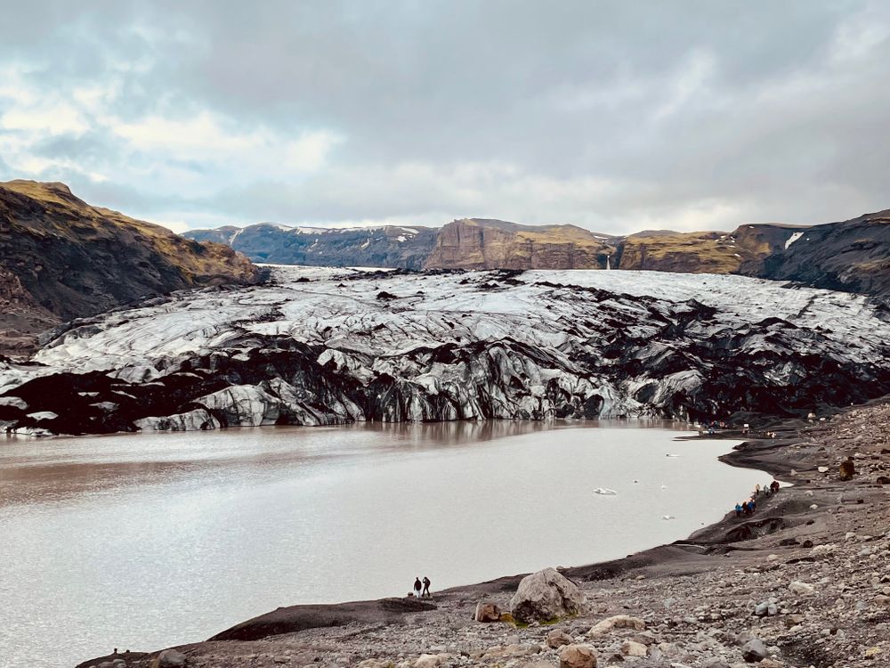
An outlet tongue of the Mýrdalsjökull ice cap, several kilometres long, ending in a meltwater lagoon that has widened as the ice has pulled…
The official pages this guide was checked against.
Last updated