 Submit a photo
Ninety seconds on Cliffs of Moher
Less than ten kilometres. The operator of the Cliffs of Moher Experience lists Doolin among its places to stay within 10km, and a hotel in the village puts the visitor centre a ten-minute drive away. The road is the R478, which runs south from Doolin to the cliffs.
No, not as of August 2026. The coastal walk from Doolin is open only as far as Surfers Path, where walkers turn back, and it no longer reaches the Cliffs of Moher Experience. Carrying on along the road at Surfers Path is hazardous, and the Liscannor end is closed outright.
By bus. A free hop-on hop-off shuttle runs between Doolin, Liscannor, Lisdoonvarna, Kilfenora and other North and West Clare towns, and its routes link them with the Cliffs of Moher Experience. With the coastal path closed short of the cliffs, the road is the only way in from Doolin.
Yes. Tickets are booked ahead on the official site, and each one is valid for the date and time on the booking confirmation. The charge is not only for parking: it includes entry to the visitor centre. With the coastal walk shut at both ends, there is no free approach on foot.
As of 2026, eight in the morning to nine at night from May to August, with shorter days the rest of the year. The centre closes on 24, 25 and 26 December. After closing, the car park exit barrier lifts automatically, so staying on for the sunset does not trap a car inside.
About two hours, which is what the operator recommends. That allows for walking the whole site, north past O'Brien's Tower and south to the platform facing Goat Island, plus a stop in the visitor centre's exhibition.
They are present from the end of March to mid-July, and the best viewing falls in May and June. The puffins nest on Goat Island, and the South Platform, the viewing area to the left, looks straight across at it. Binoculars make the difference at that distance.
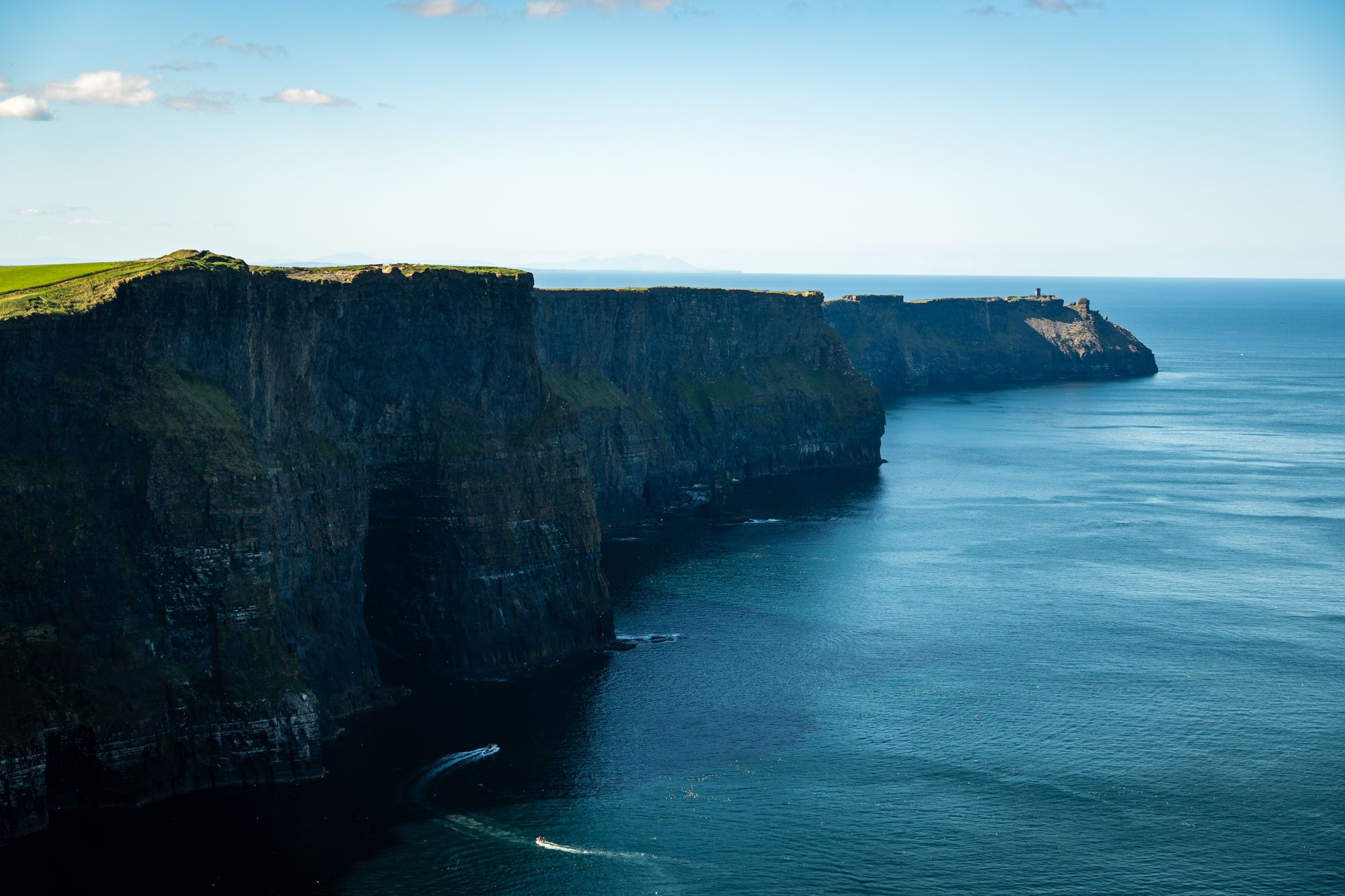
You walk the top of a sheer Atlantic wall: the Aran Islands from the northern path on a clear day, Goat Island's puffins from the southern one.
The face in front of you is layered rock, thin bands of shale and sandstone stacked one on another and cut vertical along the whole length of the cliffs. There is no slope between the grass and the drop: the edge is abrupt. At the foot, the waves keep working at the soft shale.
On the water the layers are laid bare. From a boat at sea level they separate into distinct stripes of siltstone and mudstone, and the visitors at O'Brien's Tower look as small as ants.
The tower is the viewing point north of the centre, and with the front of the centre it is where the crowds gather. Southward the cliffs run on toward Hag's Head. One rock formation along the face is shaped like a giant chess piece and is home to thousands of nesting seabirds.
The white patches on the cliff face mark where the birds are. Razorbills nest here in internationally important numbers.
The puffins dig burrows in the grassy top of Goat Island, and a pair usually returns to the same burrow, with the same mate, each year. If your trip falls after they have gone, the puffins on Skellig Michael, off the Kerry coast, stay until early August.
Two paths leave the visitor centre along the cliff top, one each way. Staff at the gate tell you how far you can see that day, and if fog hides the face and you are staying nearby, the same ticket lets you back in within 24 hours.
Go north first, walking on past O'Brien's Tower rather than stopping at it, and return the same way. Then take the southern path to the platform opposite Goat Island, with binoculars if you have them.
Keep the centre, dug into the hillside under a grass roof, for the end, or for when it rains: it holds an exhibition and a short virtual-reality film of the cliff face.
Dress for a colder day than the forecast promises, because the wind takes the temperature well below it. Pack a scarf and a rain jacket even on a bright morning, since sun can turn to a downpour within minutes.
Walk on past the first crowded viewpoint in each direction. The tour groups gather in front of the centre and at the tower, and further along the path you get the same wall of cliff with few other visitors.
On a road trip south, the Kerry Cliffs outside Portmagee stand higher, at over 1,000 feet, and look out to the Skellig Islands rather than the Aran Islands.
Doolin, and further afield
A scattered village on the Clare coast with no real centre, three pubs that have carried traditional music since the 1970s, and the ferry…
The largest of the three Aran Islands, fourteen kilometres of limestone laid across the mouth of Galway Bay, walled into thousands of tiny…
The county town of Clare, a medieval street plan curling around a friary on the Fergus, and the place the county's traditional music is…
A small harbour city at the mouth of the Corrib where the river runs fast enough through the middle of town to be heard from the street,…
An estate village of thatched cottages on the Maigue, laid out by the Earls of Dunraven in the 1820s and generally called the prettiest…
A Shannon city built on a Viking and Norman island, with a Georgian grid south of it that is the largest outside Dublin, and a rugby…
A village on the isthmus between Lough Corrib and Lough Mask where the river runs underground through limestone, holding a ruined…
The capital of Connemara, a planned town of 1812 on a sea inlet under the Twelve Bens, and the base for the quartzite mountains, the…
The official pages this guide was checked against.
Last updated