 Submit a photo
Ninety seconds on Odle
Close up, the Odle are a wall of rock spires above the forest at the head of Val di Funes, and you can walk the foot of their north faces on a signed loop from Zans.
The Odle, the Geislergruppe in German, form the border between Val di Funes (Villnöss) and Val Gardena (Gröden). Their two highest summits, Sass Rigais and Furchetta, both reach 3,025 m.
From Zans the path stays in the forest at first, and the towers come into view once you climb above the treeline. In 2009 the Dolomites were added to the UNESCO World Heritage List, and Puez-Odle is one of the mountain groups in the listing.
Without the walk, the classic view is from the valley floor. Park at the Naturparkhaus car park in Santa Maddalena and walk a short way to the viewpoint, or stop at the Ranui chapel on the way up the valley.
To see the south side, take the cable car from Ortisei in Val Gardena to the top of Seceda, which sits below the spires on the sunny side of that valley.
Trail 6 is the way in. From the Zans car park or the Zanserhütte bus stop, it climbs over roots through the forest before leaving the trees.
Above the trees, turn onto the Adolf Munkel trail, which runs along the foot of the north faces. The official loop is 9.1 km, just under three hours of walking.
Have lunch at the Geisleralm or at the Gschnagenhardt Alm on the same circuit. Then come back down to Zans by trail 36.
A longer option is the 12 km walk there and back from Santa Maddalena to the Geisleralm.
The loop and the other walks around Zans are done on your own, following the trail numbers on the signs.
Climbing Sass Rigais is a different day out. The circuit to the summit is about 20 km, rated difficult, and calls for normal mountain gear plus a via ferrata set, helmet, gloves and ankle-high boots.
Pack a warm layer and a rain jacket even on a clear morning, because the weather in the mountains can change quickly.
The Geisleralm is open for summer walkers from 14 May to 8 November. If you cannot manage the walk up, reserve a taxi to the hut through the Geisleralm.
Camper vans and motorhomes cannot reserve a day ticket for the Zans car park in advance, so leave the van in the valley and take the bus up. The last bus down from Zans leaves in the early evening, so check the timetable before you set out.
Explore the rest of Val di Funes
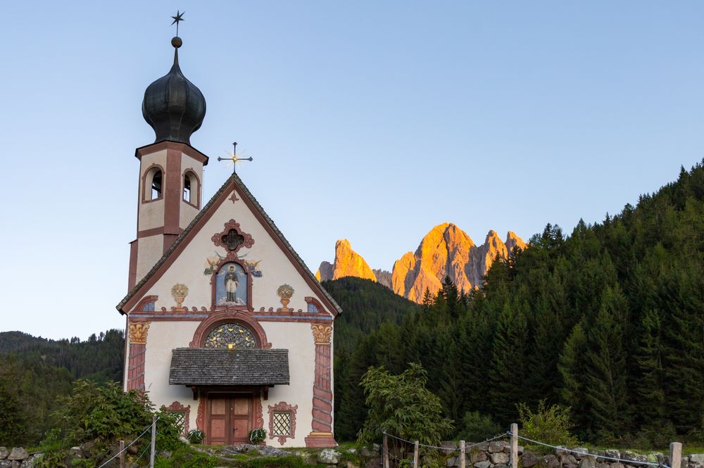
An onion-domed chapel of 1744 stands alone in the Ranui meadows beside the Ranuihof farm, with the Odle rising behind it. It is privately…
The main town of Val Gardena, a woodcarving centre for four centuries and still Ladin-speaking. Two cable cars lift straight from the town…
The main village of Alta Badia, a Ladin-speaking valley under the Sella massif. It sits on the Sella Ronda circuit, which is skied in…
The official pages this guide was checked against.
Last updated