 9 min from Victory Square
Ġgantija
Ġgantija's two Neolithic temples still have walls standing to about 6 metres in places, and you walk among ruins that are well preserved for buildings of their age.
Read the guide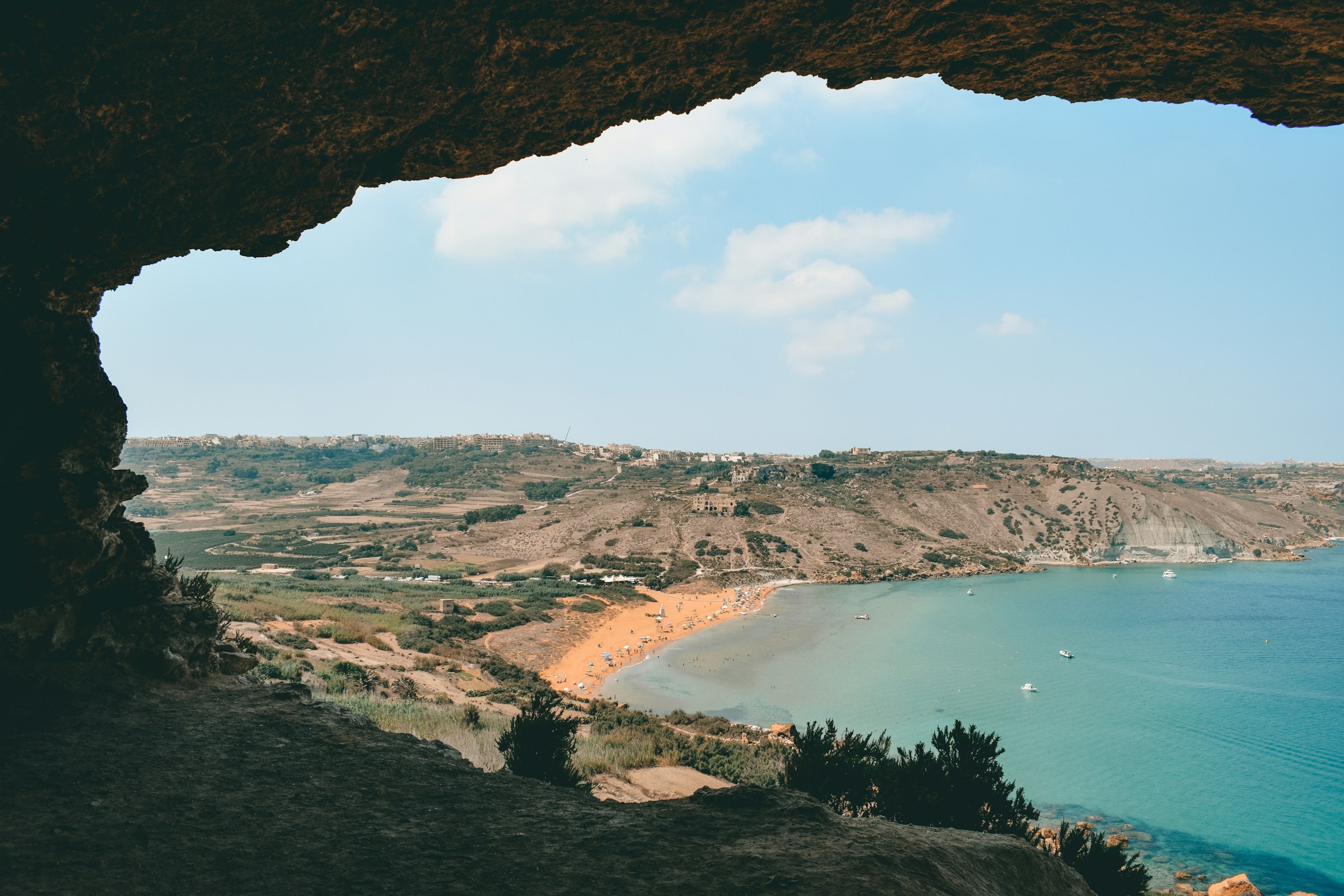
The Ġgantija temples, dated to as early as 3600 BC, stand in the village where you sleep, and Ramla Bay is a bus ride or a walk away.
Town guide, Malta. Meridian Dispatch.
Ninety seconds on Xagħra
Malta Public Transport route 322 starts at the Vapur stop in Mġarr harbour, passes Nadur and Ramla, and ends up in Xagħra before carrying on to Marsalforn. Route 301 leaves the same harbour for Victoria instead.
Route 307 runs direct between Victoria and Xagħra, from the Victoria Bay 3 stop. Route 322 links Xagħra with Ramla, and route 302 links Ramla with Victoria. Timetables are on the Malta Public Transport route pages.
Ġgantija opens daily on Heritage Malta's seasonal hours, with last entry 30 minutes before closing; heritagemalta.mt gives the closing time for a late visit. It is shut on 1 January, Good Friday and 24, 25 and 31 December. From the village square the entrance is a five-minute walk, and a bus stop sits 2 minutes away.
Summer brings stands selling food, plus showers and toilets, to the beach entrance. Some facilities may close in winter.
Every 8 September, so it can fall on any day of the week.
Take airport route TD1 to Ċirkewwa, cross by Gozo Channel ferry to Mġarr, then board route 322. The airport, MLA, is on Malta's main island; the ferry sails daily.
Stay in Xagħra and Ġgantija is five minutes from your door, with Ramla Bay half an hour's walk below.
See all towns in MaltaCompare Malta town by town
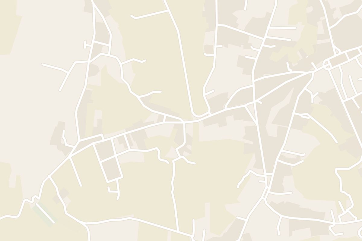
Xagħra sits on a plateau in the north-east of Gozo, with Ġgantija at its edge and Ramla Bay in the valley below. Mġarr, where the ferries from Malta land, and the coves round Qala are a short ride south-east.
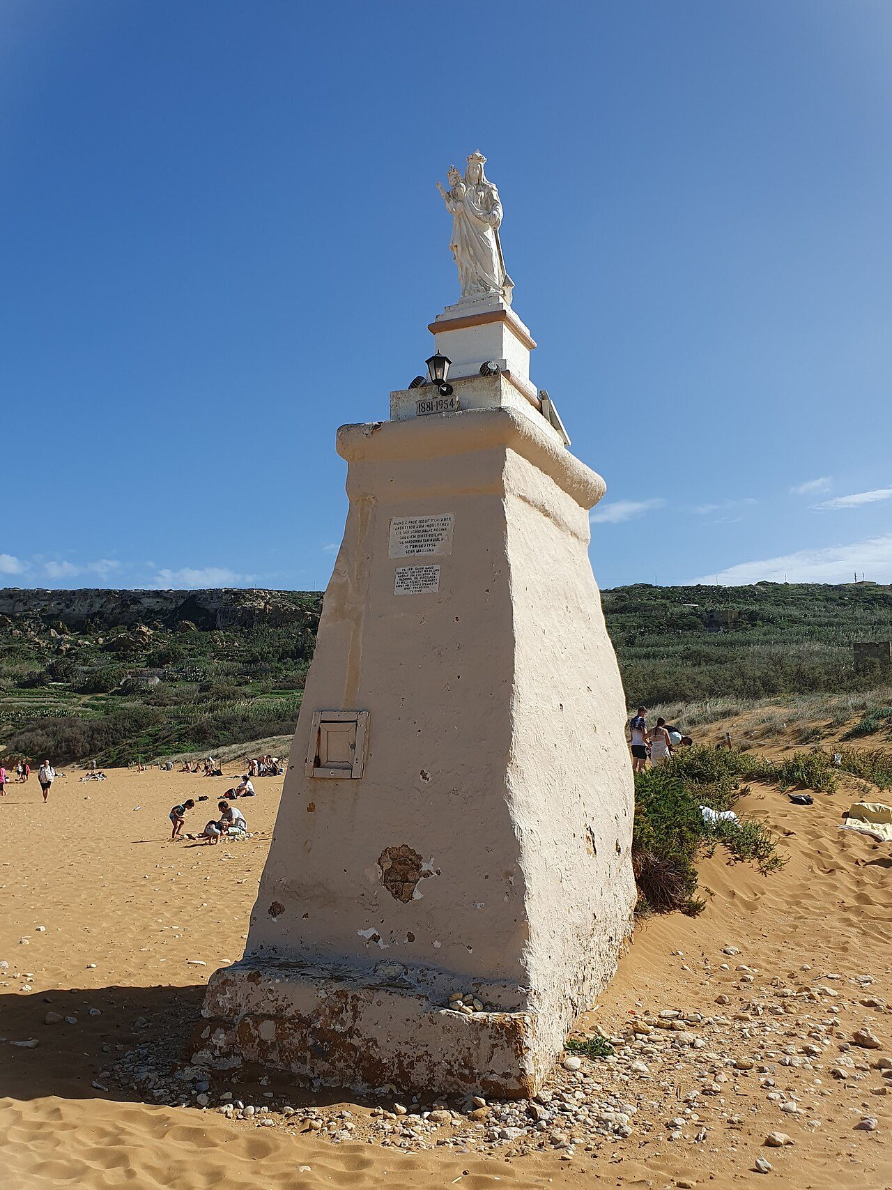

3600 BC
Il-Logga, on Church Street, has a rooftop pool and stands a few minutes' walk from the square.
Grouped by what each place is best for, from the temples on the plateau to the red sand and the coves below it.
Ġgantija, the windmill and the caves under houses are a few minutes apart in the village. Ramla is down the hill, and Mġarr and Qala are a bus or taxi ride south-east.
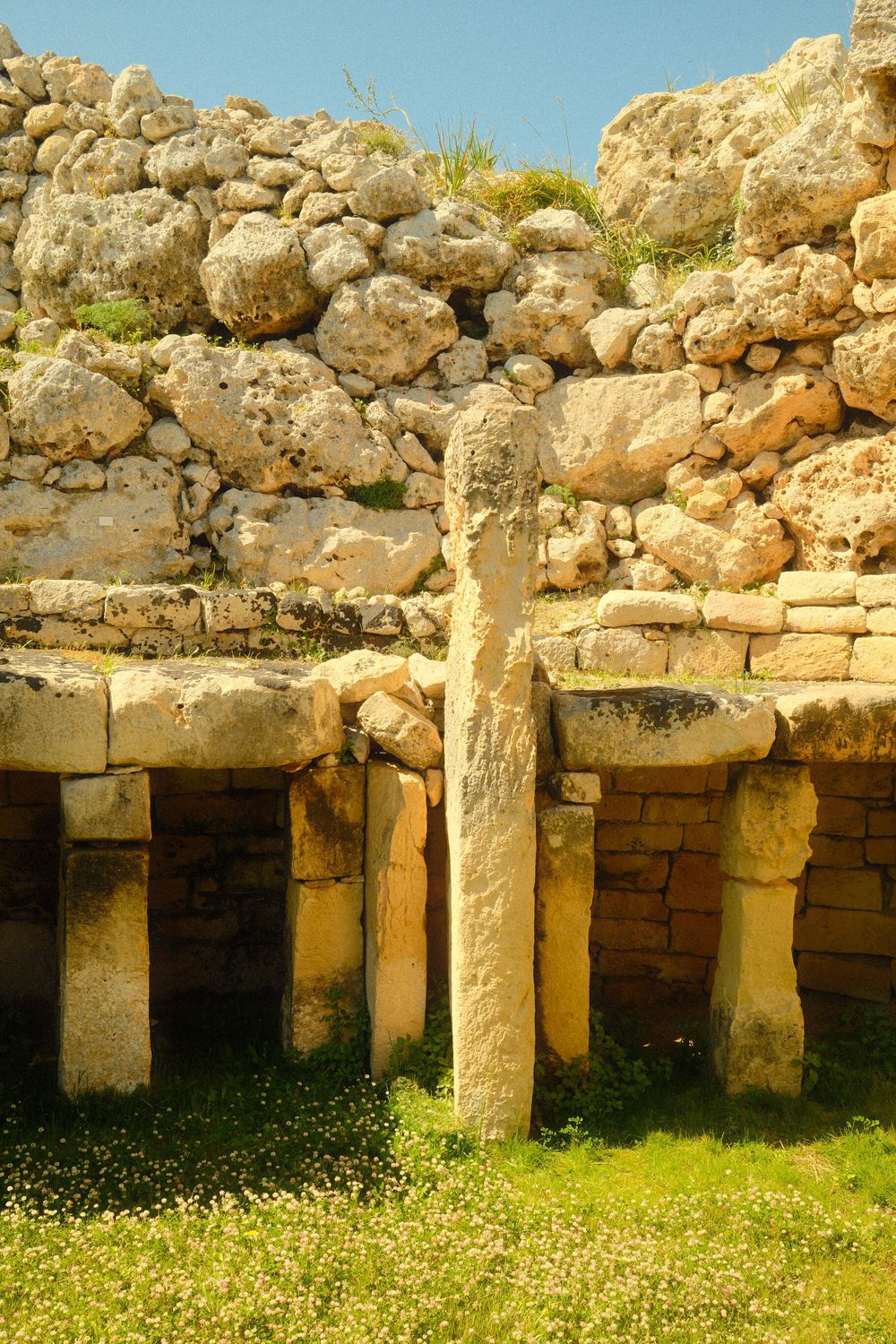
Ġgantija's two Neolithic temples still have walls standing to about 6 metres in places, and you walk among ruins that are well preserved for buildings of their age.
Read the guide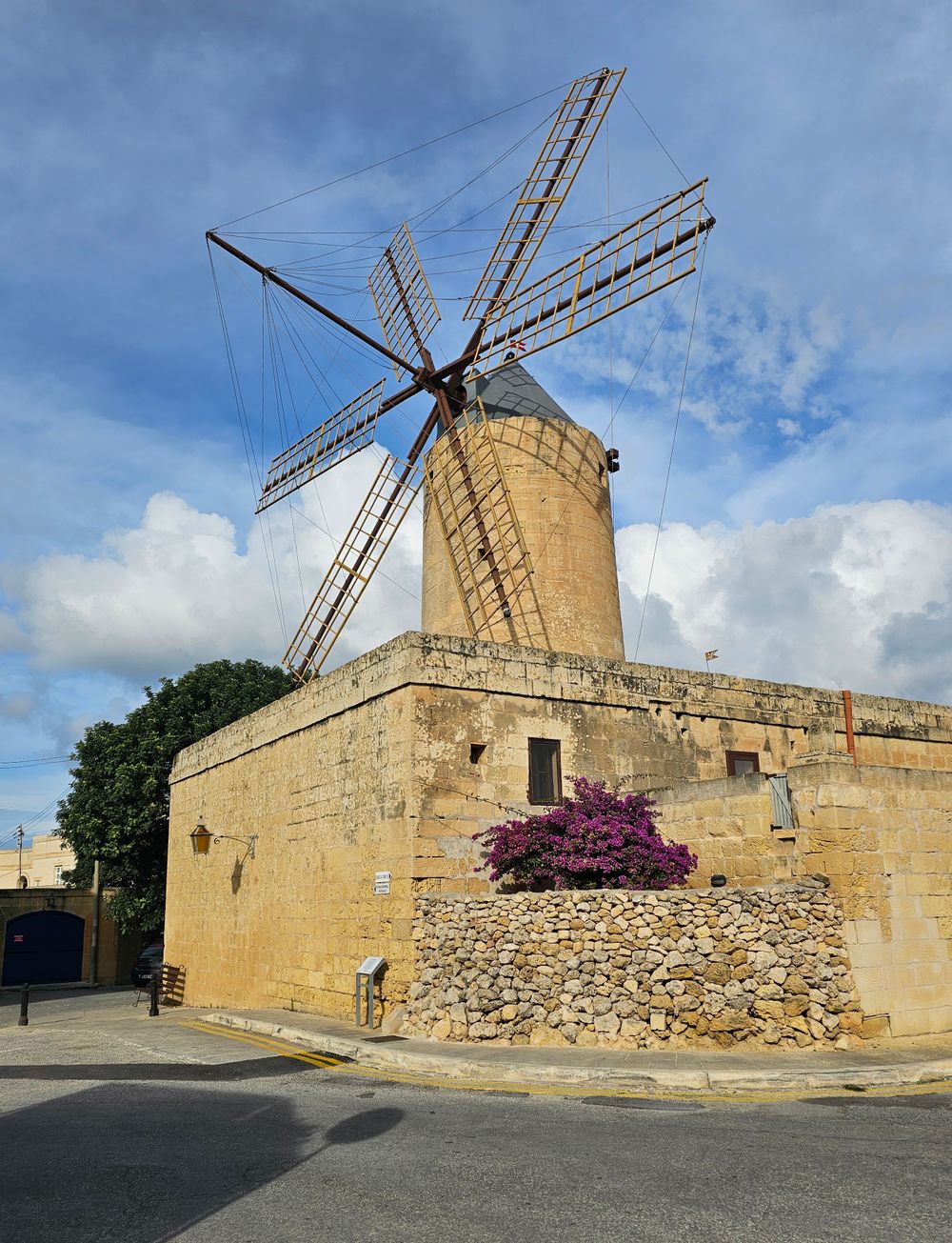
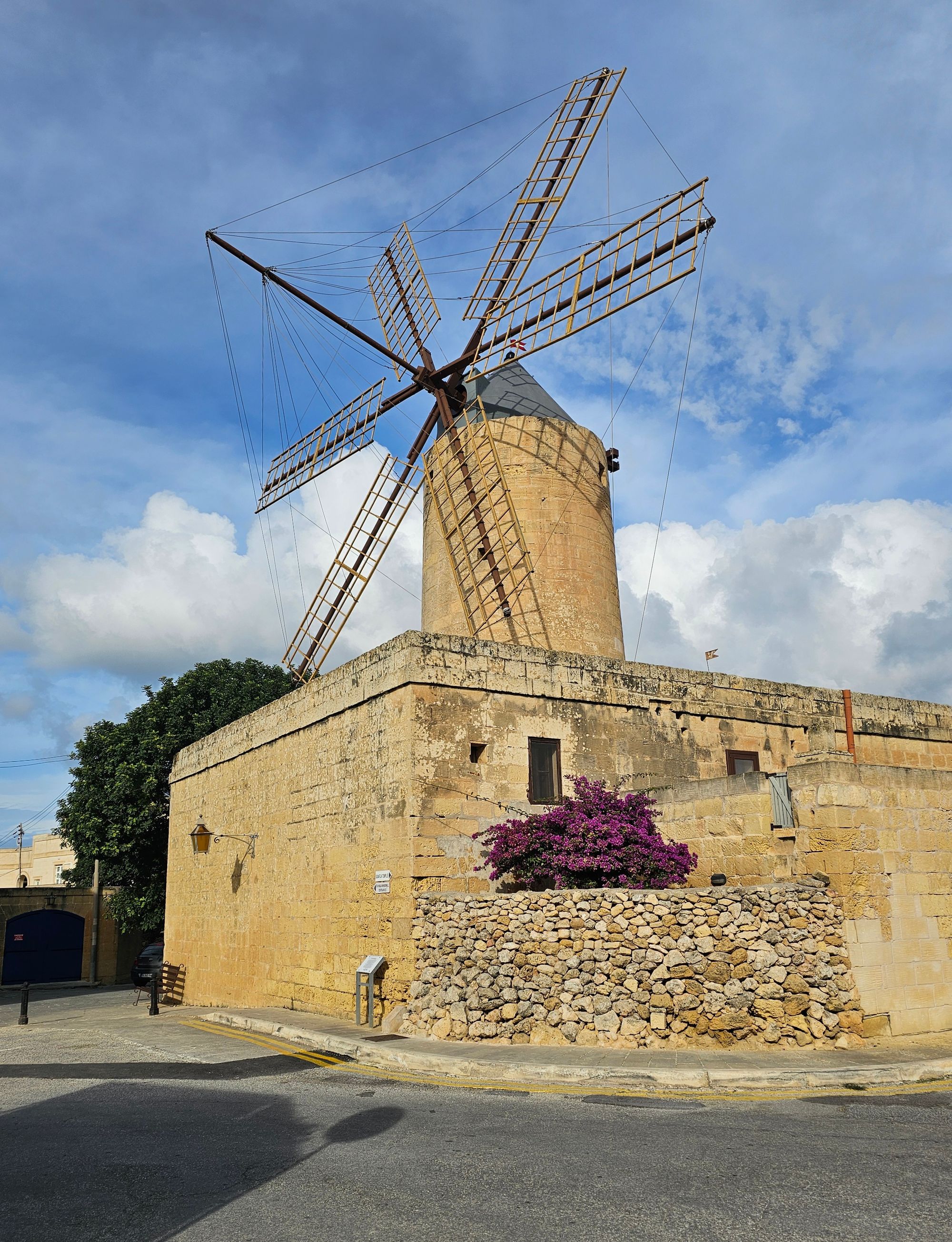
Climbing this windmill takes you past the restored rooms where its last miller lived and worked, in one of the few left on the Maltese Islands from the Knights' period.
Read the guide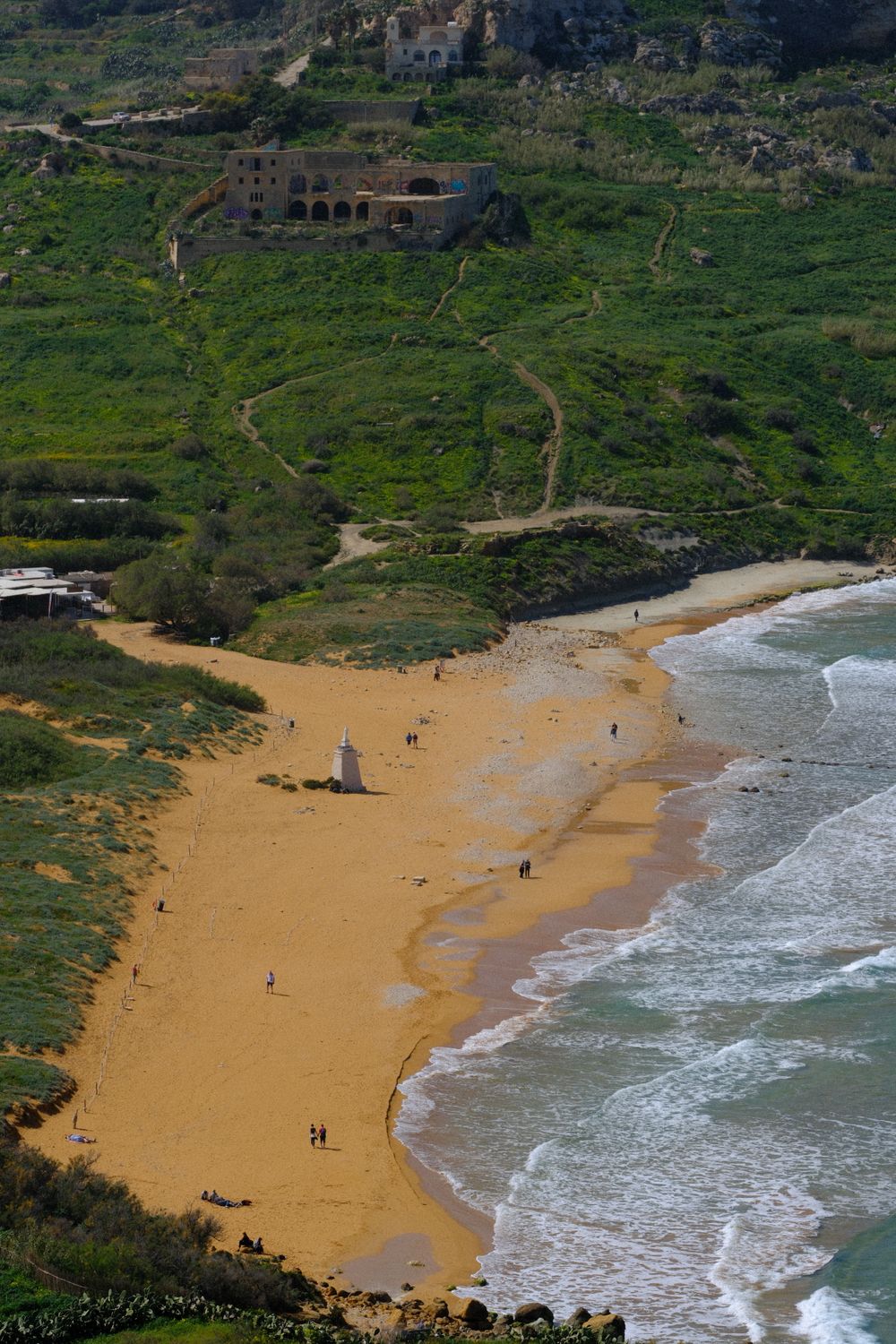
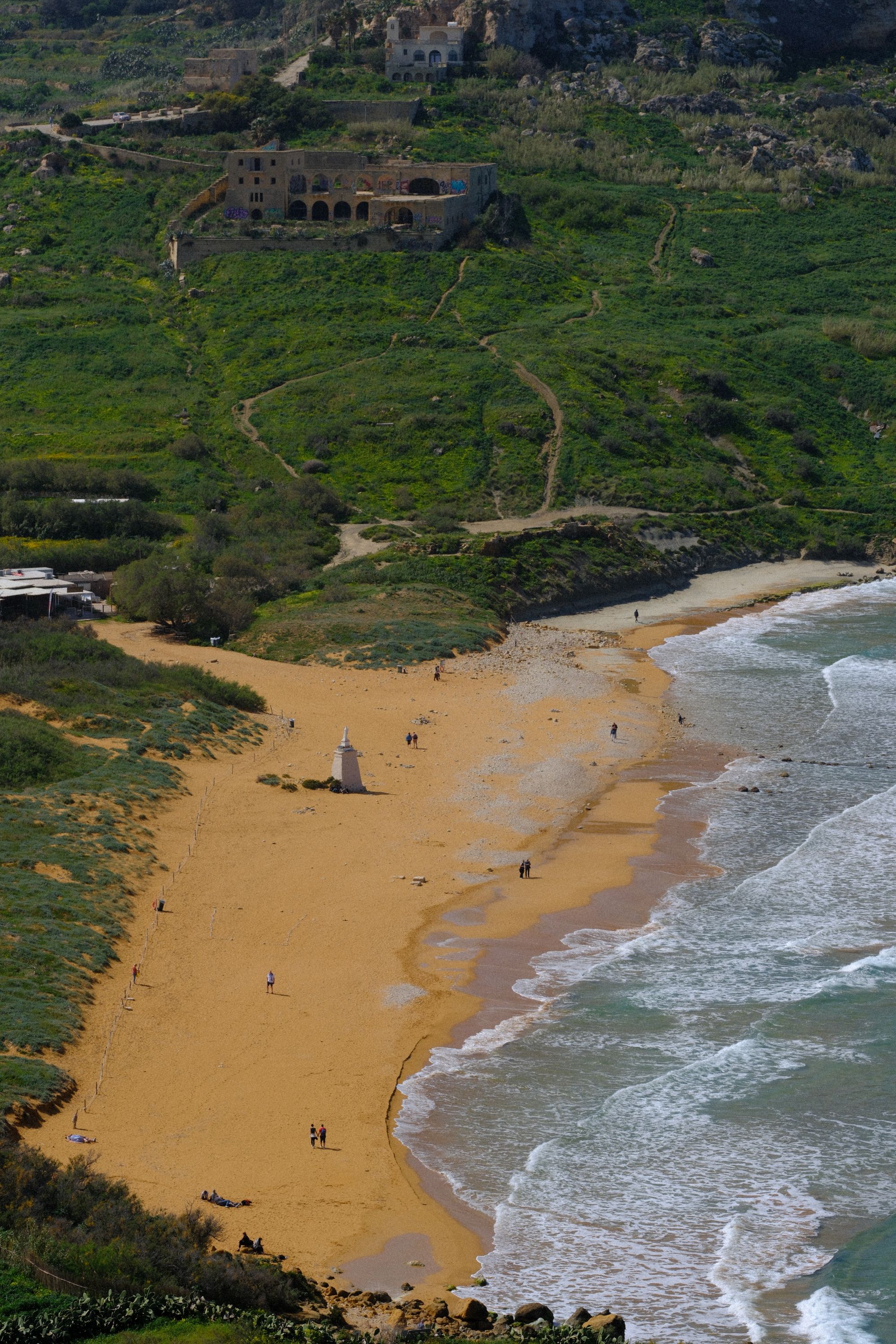
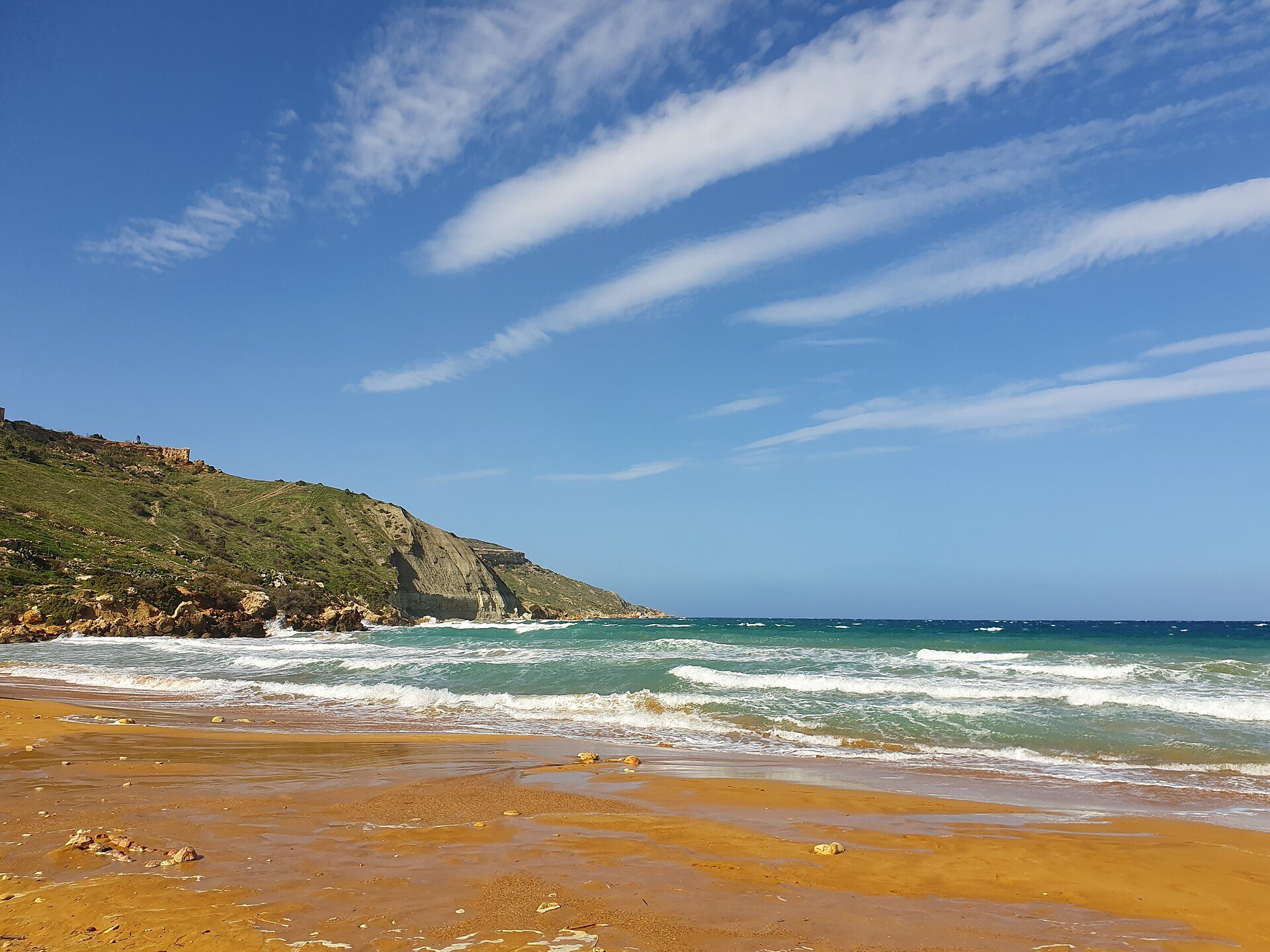
Red-gold sand sets Gozo's largest sandy beach apart. You can swim off it in summer, then climb the track above it for a view over the whole bay.
Read the guide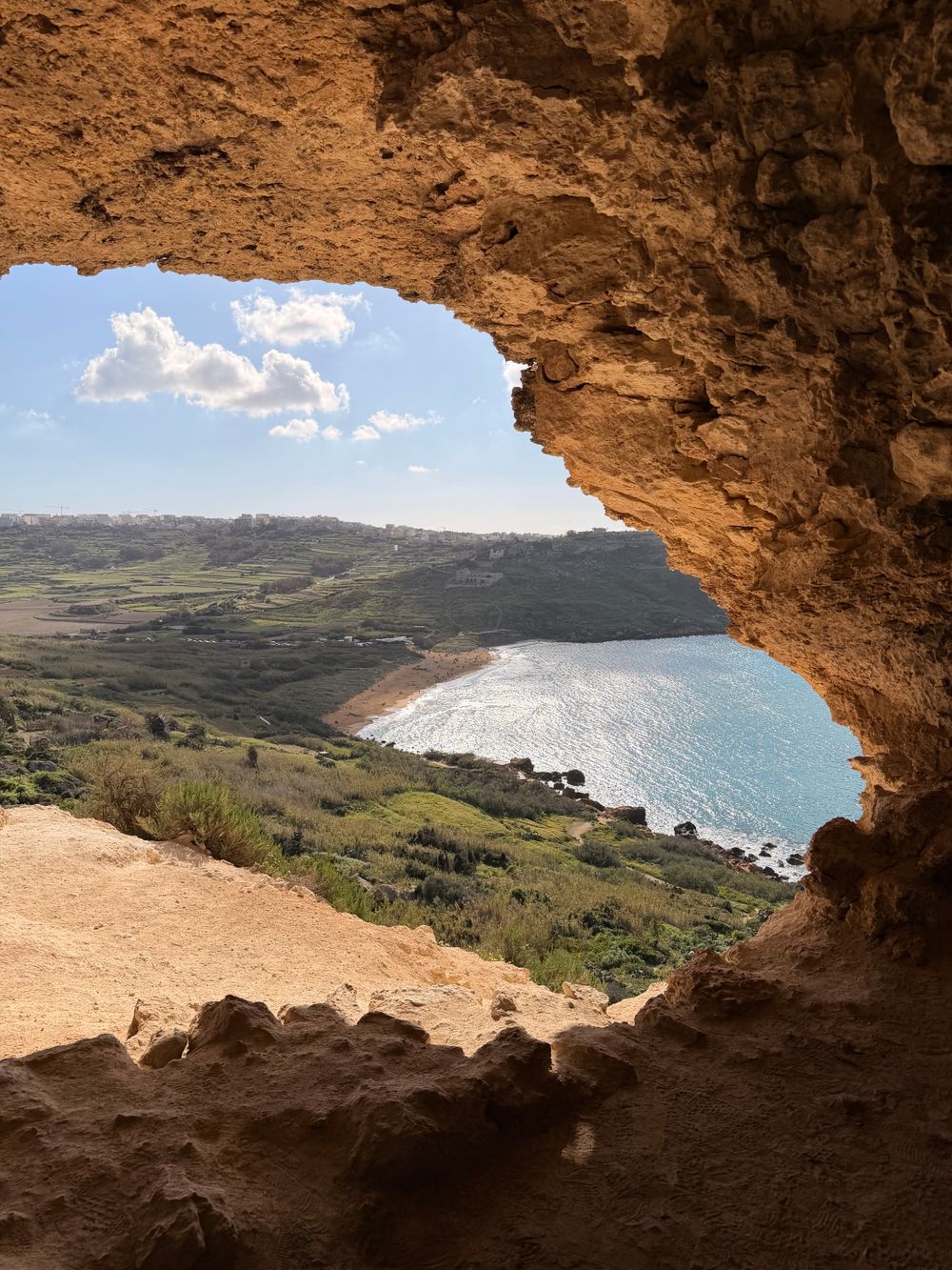
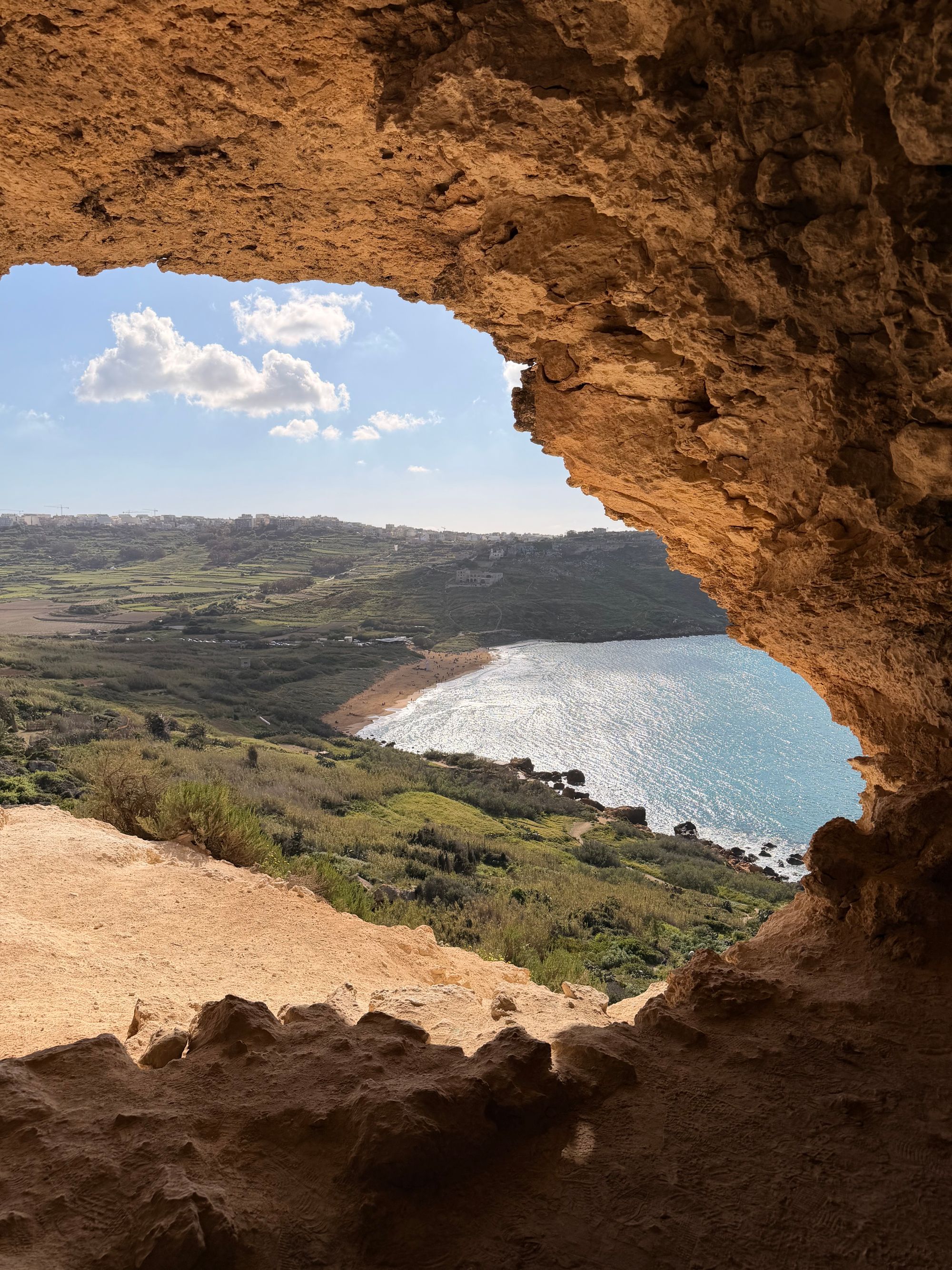
Mixta Cave opens 68 metres above the sea, and its wide west-facing mouth frames the orange-red sand of Ramla Bay and the green or golden fields behind it.
Read the guide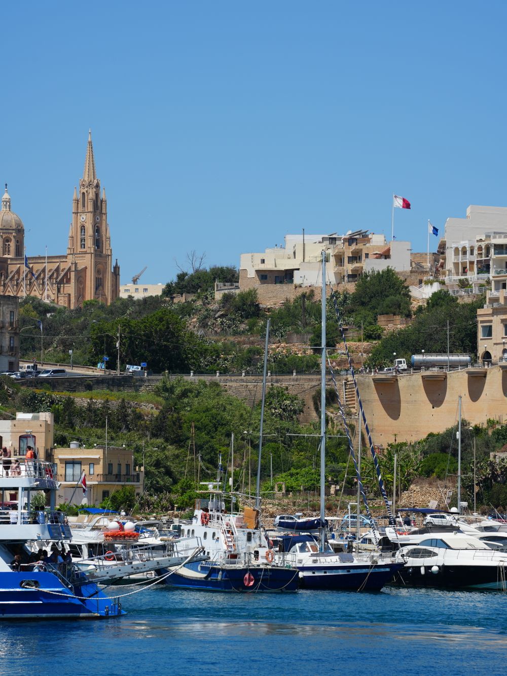
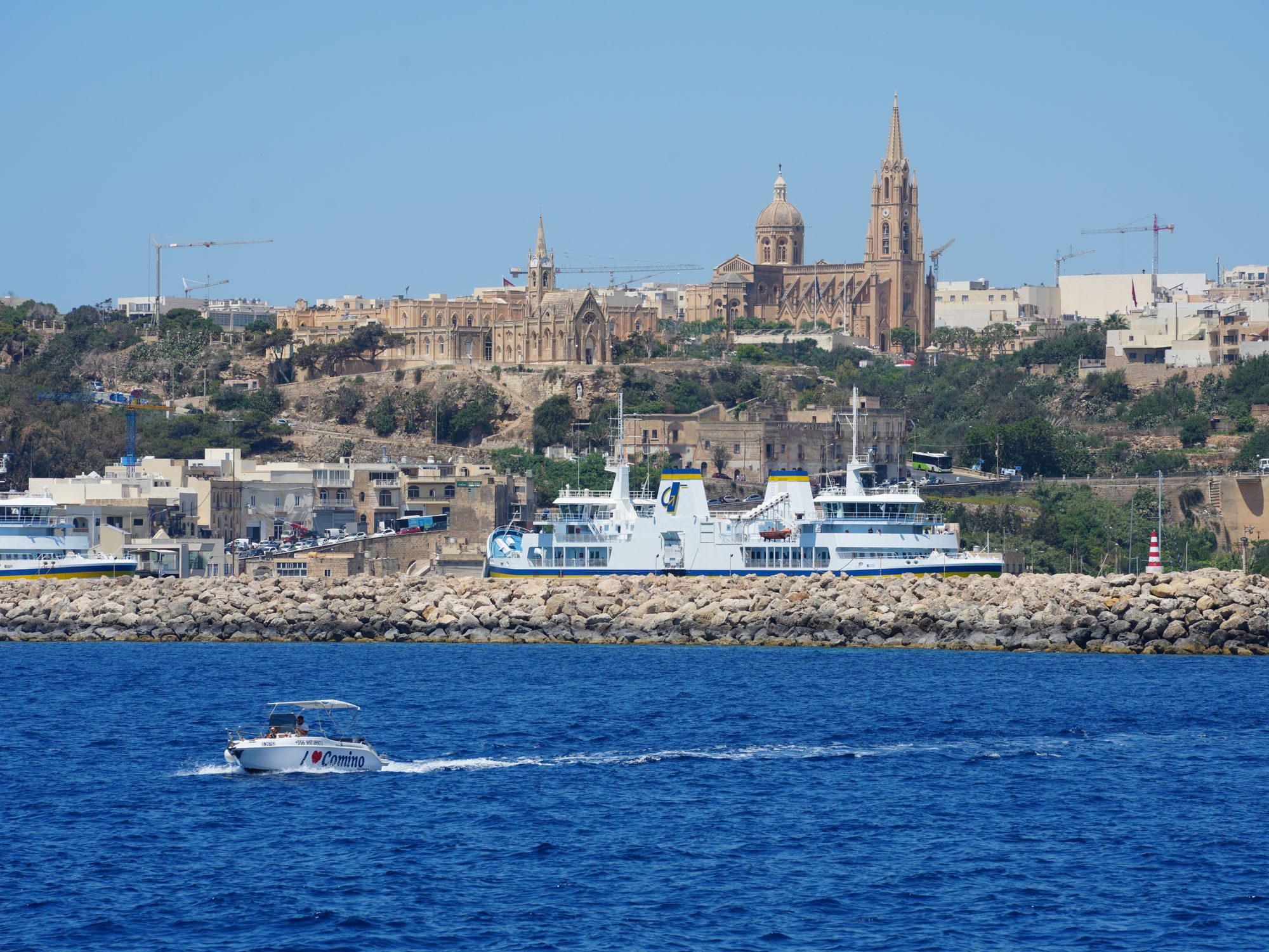
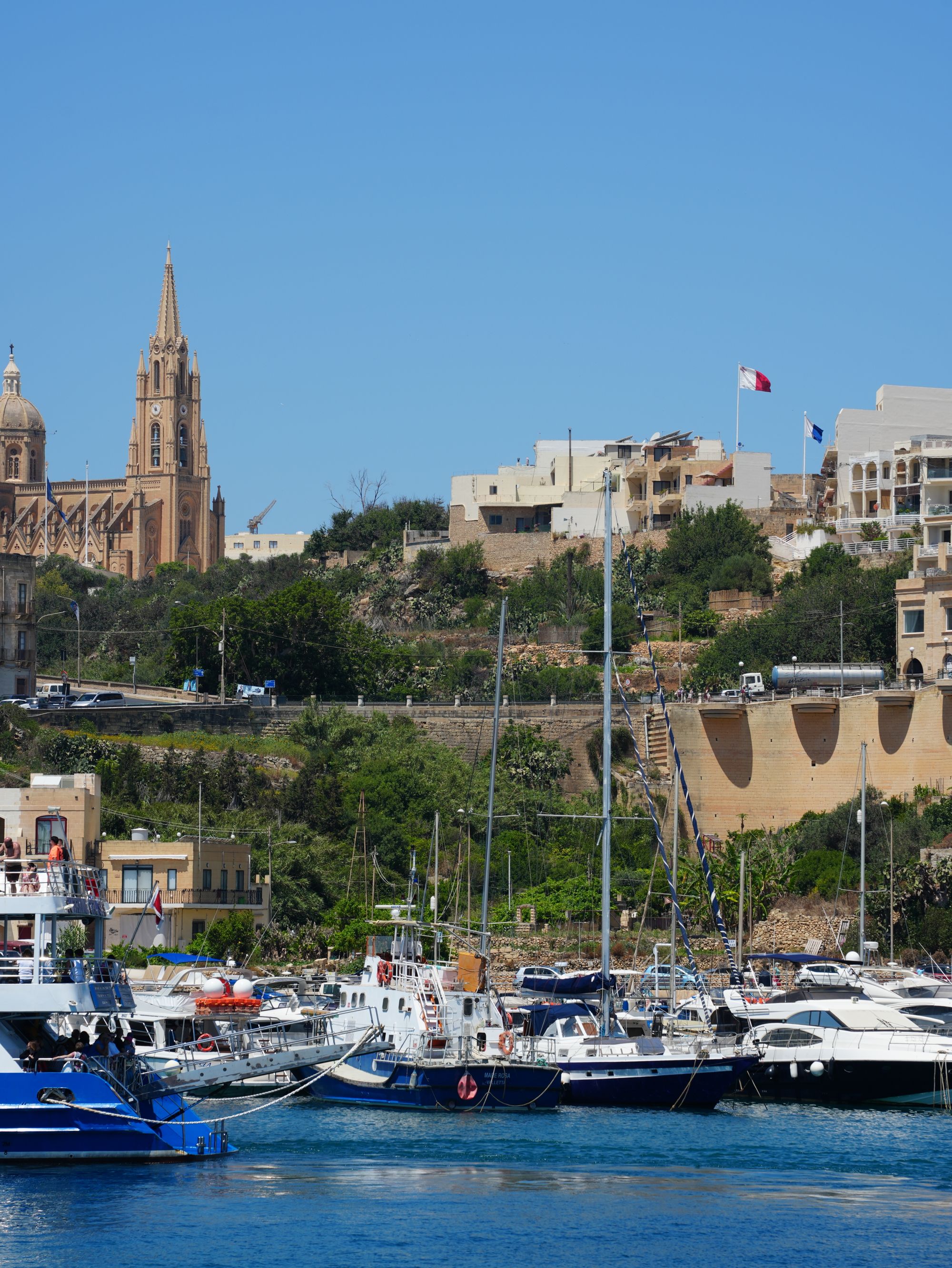
From the ferry deck, Mġarr Harbour is your first view of Gozo: a working marina of yachts and fishing boats, and the Lourdes Chapel looking down from its hill.
Read the guide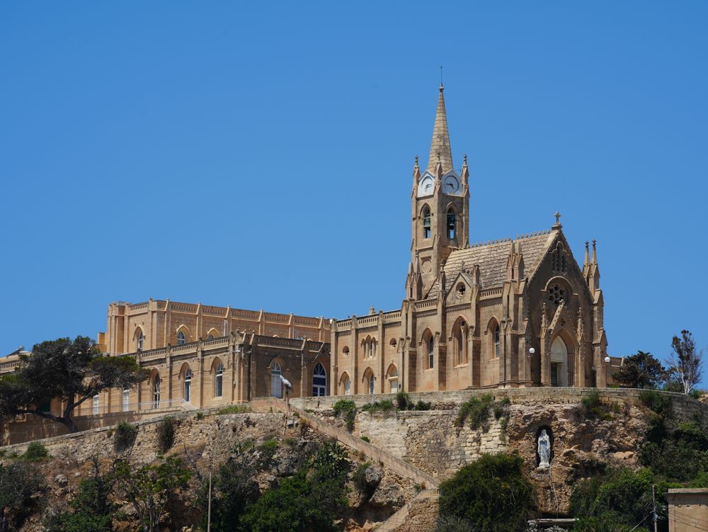
Climb to this spired Gothic chapel above Mġarr Harbour, and its terrace shows you the whole bay at once, with Fort Chambray on the opposite headland and the Comino channel beyond.
Read the guideInside Xagħra's basilica, you walk over coloured marble floors, past pilasters and under paintings and gilded cornices that run the full length of the vault.
Read the guideOne small limestone chamber, hung with stalactites, lies under a family house in Xagħra, and the family walks you through their home to reach it.
Read the guideBeneath the streets of Xagħra, a spiral staircase inside a family home leads you down to a lit chamber of stalactites and stalagmites.
Read the guideA steep lane from Nadur leads down to this small cove of reddish-orange sand and boulders below terraced fields on Gozo's north-east coast, and you walk the final part.
Read the guideA narrow channel is all that separates this bay on Gozo's east coast from Comino and the Blue Lagoon. Swim straight off the rocks into turquoise water.
Read the guideStand on the clifftop at Calypso's Cave and you get a bird's eye view straight down on Ramla Bay, the red sand beach of Gozo, with the valley behind it.
Read the guideA hollow in the rock on the Xagħra plateau held the burial ground of Gozo's Neolithic communities. You see it on a small supervised visit booked with Heritage Malta, a short walk from Ġgantija.
Read the guideLooking at antique toys while the owner tells you the stories behind them is the draw of this private collection in Xagħra, a stop to pair with the village's temples.
Boathouses cut into the rock line this small inlet below Nadur, where local fishermen still keep their boats. A strip of sand and shingle and flat rocks give easy swimming in calm water.
Boulders, some the size of small houses, lie piled along this stretch of coast from San Blas Bay to the Riħan Valley.
Above the cliffs at the edge of Nadur, this nineteenth-century signal tower now stands in a small public garden of native plants.
Qala sits at the eastern tip of Gozo, and from this lookout the sea opens towards Comino and on to Malta. Below lies a rough, rocky shore broken by sheltered inlets such as Ħondoq ir-Rummien.
The bastions of a Knights' fort hold the high ground above the ferry port. Most of the site is now a gated private development, so see the walls from the harbour road.
Three scuttled ships lie off this shallow bay near Għajnsielem: the ferries Karwela and Xlendi and the excursion boat Cominoland, at about 40 m.
Scuttled in 2022, this former oil tanker is about 60 m long and sits upright at around 40 m. An earlier storm had driven it aground off Qawra before it was brought to Gozo as a dive site.
On the edge of Qala, looking straight at Comino, this rustic little church has a small courtyard with views across the channel.
Between Qala and the coast at Ħondoq ir-Rummien stands one of the earliest Marian shrines on Gozo, recorded in 1575. A gilded interior frames the main draw, an altarpiece attributed to Federico Barocci.
Out on Ras il-Qala, the easternmost point of Gozo, this battery of the Knights guarded the channel to Comino from the 1730s.
Sixty-five years of collecting by Kelinu Galea fill this small private museum in Nadur.
Ġgantija stands at the edge of the plateau, about five minutes on foot from Victory Square. One ticket covers it and Ta' Kola Windmill, and two caves lie under houses a few streets away.
Ġgantija's two Neolithic temples still have walls standing to about 6 metres in places, and you walk among ruins that are well preserved for buildings of their age.
Read the guideClimbing this windmill takes you past the restored rooms where its last miller lived and worked, in one of the few left on the Maltese Islands from the Knights' period.
Read the guideInside Xagħra's basilica, you walk over coloured marble floors, past pilasters and under paintings and gilded cornices that run the full length of the vault.
Read the guideOne small limestone chamber, hung with stalactites, lies under a family house in Xagħra, and the family walks you through their home to reach it.
Read the guideBeneath the streets of Xagħra, a spiral staircase inside a family home leads you down to a lit chamber of stalactites and stalagmites.
Read the guideA hollow in the rock on the Xagħra plateau held the burial ground of Gozo's Neolithic communities. You see it on a small supervised visit booked with Heritage Malta, a short walk from Ġgantija.
Read the guideLooking at antique toys while the owner tells you the stories behind them is the draw of this private collection in Xagħra, a stop to pair with the village's temples.
Ramla's red sand fills the valley below the village. San Blas and Daħlet Qorrot are smaller coves below Nadur, each at the bottom of a steep road.
Red-gold sand sets Gozo's largest sandy beach apart. You can swim off it in summer, then climb the track above it for a view over the whole bay.
Read the guideA steep lane from Nadur leads down to this small cove of reddish-orange sand and boulders below terraced fields on Gozo's north-east coast, and you walk the final part.
Read the guideA narrow channel is all that separates this bay on Gozo's east coast from Comino and the Blue Lagoon. Swim straight off the rocks into turquoise water.
Read the guideBoathouses cut into the rock line this small inlet below Nadur, where local fishermen still keep their boats. A strip of sand and shingle and flat rocks give easy swimming in calm water.
Boulders, some the size of small houses, lie piled along this stretch of coast from San Blas Bay to the Riħan Valley.
Two caves look down on Ramla from either side of the bay, and two more lie under houses in the village. Further east, a signal tower and a belvedere face Comino.
Mixta Cave opens 68 metres above the sea, and its wide west-facing mouth frames the orange-red sand of Ramla Bay and the green or golden fields behind it.
Read the guideOne small limestone chamber, hung with stalactites, lies under a family house in Xagħra, and the family walks you through their home to reach it.
Read the guideBeneath the streets of Xagħra, a spiral staircase inside a family home leads you down to a lit chamber of stalactites and stalagmites.
Read the guideStand on the clifftop at Calypso's Cave and you get a bird's eye view straight down on Ramla Bay, the red sand beach of Gozo, with the valley behind it.
Read the guideAbove the cliffs at the edge of Nadur, this nineteenth-century signal tower now stands in a small public garden of native plants.
Qala sits at the eastern tip of Gozo, and from this lookout the sea opens towards Comino and on to Malta. Below lies a rough, rocky shore broken by sheltered inlets such as Ħondoq ir-Rummien.
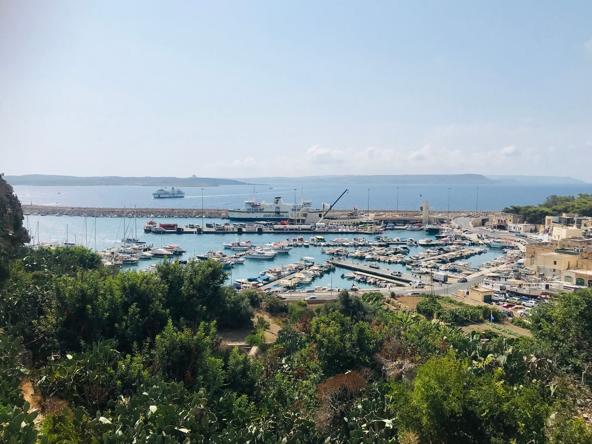
The ferries from Malta land at Mġarr. A Gothic chapel stands on the hill above the quay, and the walls of Fort Chambray hold the high ground beside it. Off Xatt l-Aħmar, a short way along the coast, wrecks lie at dive depth.
From the ferry deck, Mġarr Harbour is your first view of Gozo: a working marina of yachts and fishing boats, and the Lourdes Chapel looking down from its hill.
Read the guideClimb to this spired Gothic chapel above Mġarr Harbour, and its terrace shows you the whole bay at once, with Fort Chambray on the opposite headland and the Comino channel beyond.
Read the guideThe bastions of a Knights' fort hold the high ground above the ferry port. Most of the site is now a gated private development, so see the walls from the harbour road.
Three scuttled ships lie off this shallow bay near Għajnsielem: the ferries Karwela and Xlendi and the excursion boat Cominoland, at about 40 m.
Scuttled in 2022, this former oil tanker is about 60 m long and sits upright at around 40 m. An earlier storm had driven it aground off Qawra before it was brought to Gozo as a dive site.
Qala is the village at the eastern tip of Gozo, facing Comino across the channel. Ħondoq ir-Rummien is the swim below it, with two chapels and a Knights' battery on the way out, and Nadur next door has a signal tower and a maritime museum.
A narrow channel is all that separates this bay on Gozo's east coast from Comino and the Blue Lagoon. Swim straight off the rocks into turquoise water.
Read the guideAbove the cliffs at the edge of Nadur, this nineteenth-century signal tower now stands in a small public garden of native plants.
Qala sits at the eastern tip of Gozo, and from this lookout the sea opens towards Comino and on to Malta. Below lies a rough, rocky shore broken by sheltered inlets such as Ħondoq ir-Rummien.
On the edge of Qala, looking straight at Comino, this rustic little church has a small courtyard with views across the channel.
Between Qala and the coast at Ħondoq ir-Rummien stands one of the earliest Marian shrines on Gozo, recorded in 1575. A gilded interior frames the main draw, an altarpiece attributed to Federico Barocci.
Out on Ras il-Qala, the easternmost point of Gozo, this battery of the Knights guarded the channel to Comino from the 1730s.
Sixty-five years of collecting by Kelinu Galea fill this small private museum in Nadur.
Begin at Ġgantija, about five minutes on foot from Victory Square. The Interpretation Centre comes first, with plaster fragments that still carry red ochre from the temple walls. A path then leads out to the two temples, and in summer it has little shade at midday.
The same ticket covers Ta' Kola Windmill, up the road on Bambina Street. The ground floor holds the miller's rooms and tools, and a narrow spiral stair climbs to the millstones at the top.
Back on Victory Square, the Basilica of the Nativity faces a row of cafés; cover your shoulders and knees to go in. Ninu's Cave and Xerri's Grotto lie under private houses nearby. A family member leads each short visit down a tight stair, and both take cash.
In the afternoon, follow the signs for Ramla and Calypso down to Ramla Bay, roughly half an hour on foot. In summer, food stands, showers and toilets open at the beach entrance. From the far end of the sand, a track climbs to Tal-Mixta Cave for the view back over the bay, and route 322 brings you up to the village.
Give a second day to the south-east. Route 322 runs down to Mġarr Harbour, where a ten-minute walk climbs to Our Lady of Lourdes Chapel and its terrace over the boats. Taxis wait at the harbour for the short ride to Ħondoq ir-Rummien, below Qala, where you swim facing Comino.
Malta's one airport is at Luqa, on the main island, and Gozo is a ferry crossing beyond it. Take TD1 to the car ferry at Ċirkewwa, or TD4 to the fast ferry in Valletta, then route 322 from Mġarr.
Route TD1 runs hourly from the airport to Ċirkewwa; allow about an hour by bus or taxi. The crossing to Mġarr takes about 25 minutes, with boats as often as every 30 minutes in the daytime.
Route TD4 runs from the airport to the Gozo fast ferry in Valletta's Grand Harbour. The boat takes about 45 minutes to Mġarr and carries no vehicles.
From the Vapur stop at the harbour, route 322 climbs through Nadur and Ramla to Xagħra, then runs on to Marsalforn. The day's timetable is on the Malta Public Transport route page.
Both ferries land at Mġarr, so route 322 works whichever boat you take.
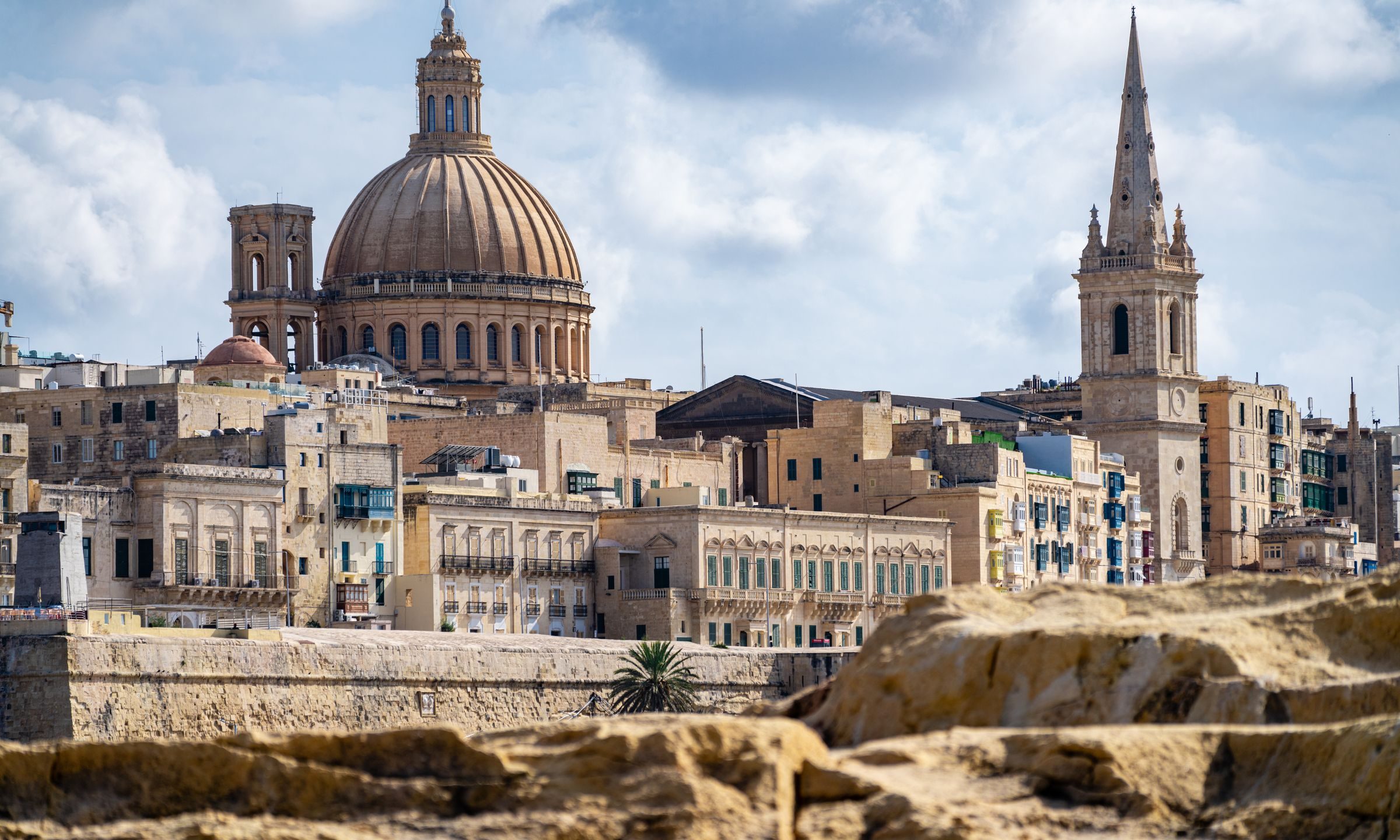
Every Malta town, place and dispatch, on one map.
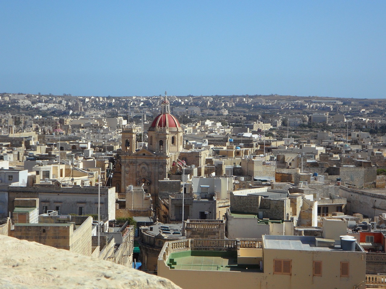
Gozo's capital stands mid-island, with its main bus terminal and the walled Cittadella.

From the top of this hill above Marsalforn, you stand beneath the Risen Christ that much of Gozo sees on its skyline.
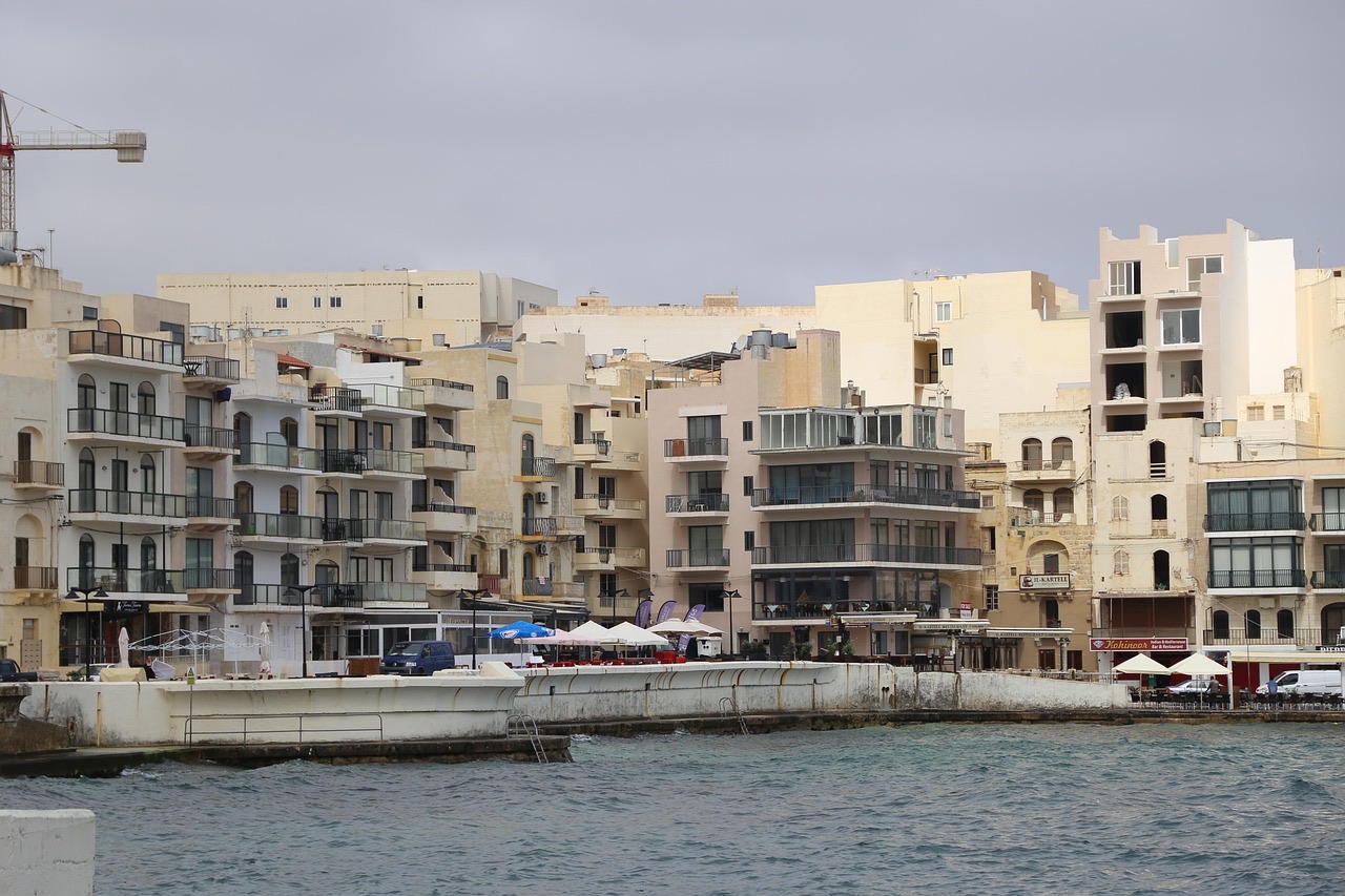
Restaurants, a small beach and a working harbour line this bay on Gozo's north coast, with swimming coves and salt pans along the shore.
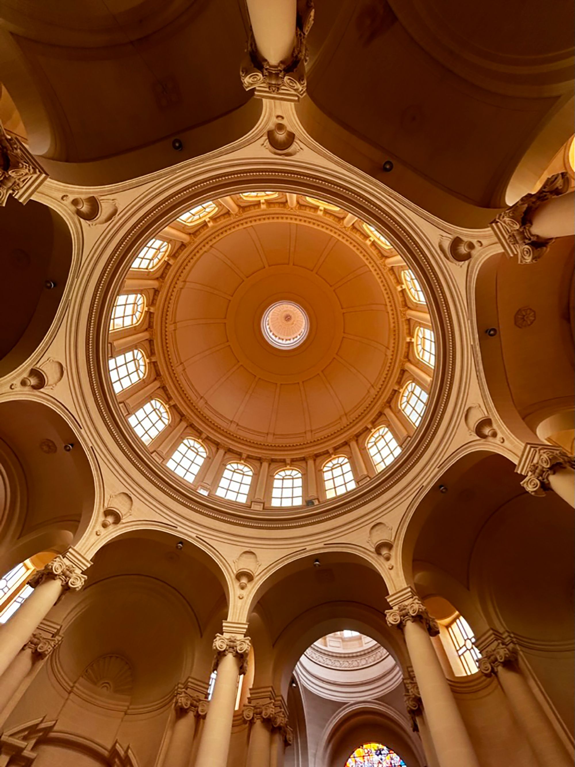
From almost anywhere on Gozo you can see this dome, which the villagers of Xewkija raised themselves over several decades.
The official pages this guide was checked against.
Last updated