Comino
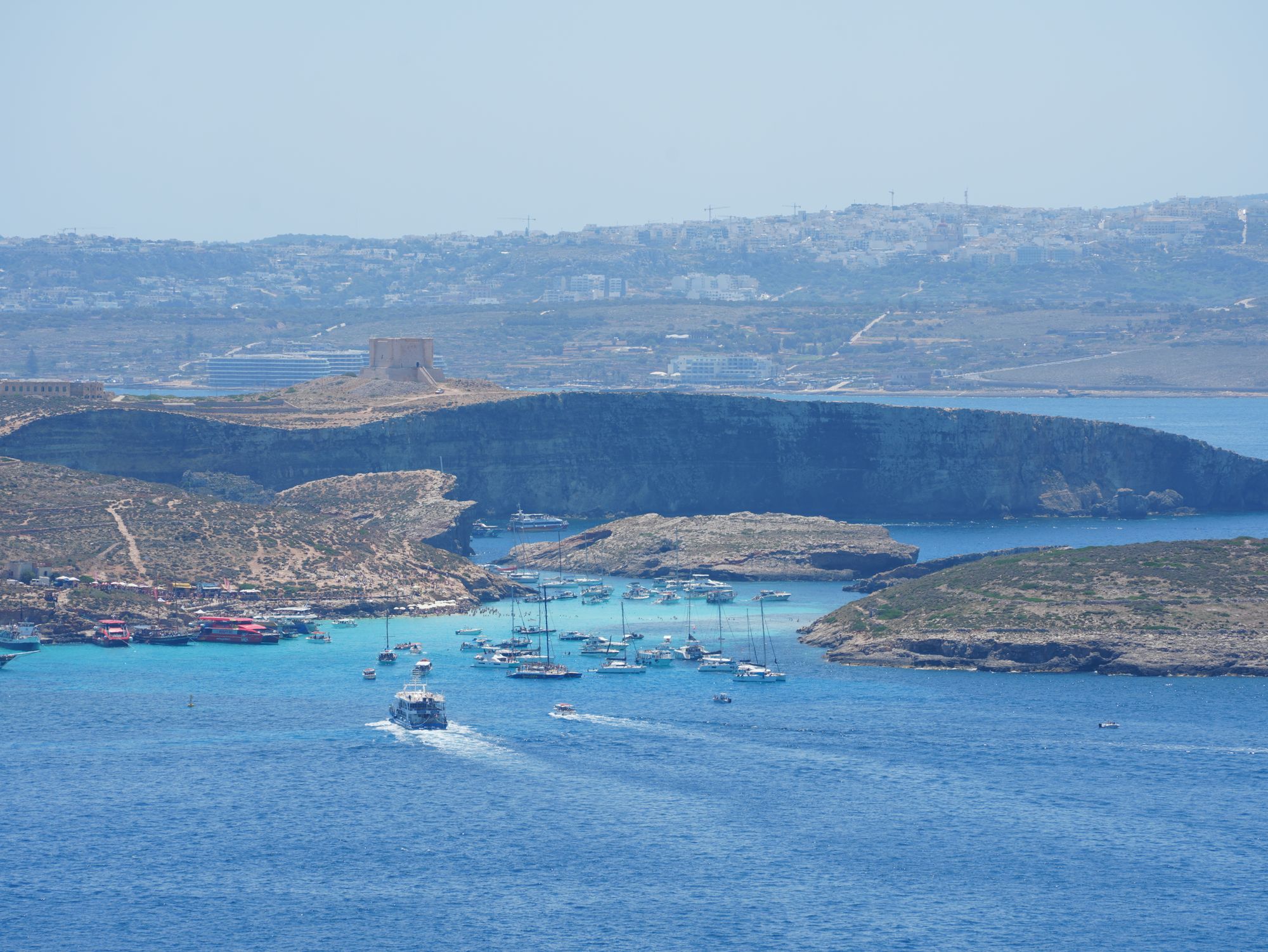
Give Comino a morning and you can walk round the whole island, along the south cliffs and back to the Blue Lagoon for a swim.
Read the guide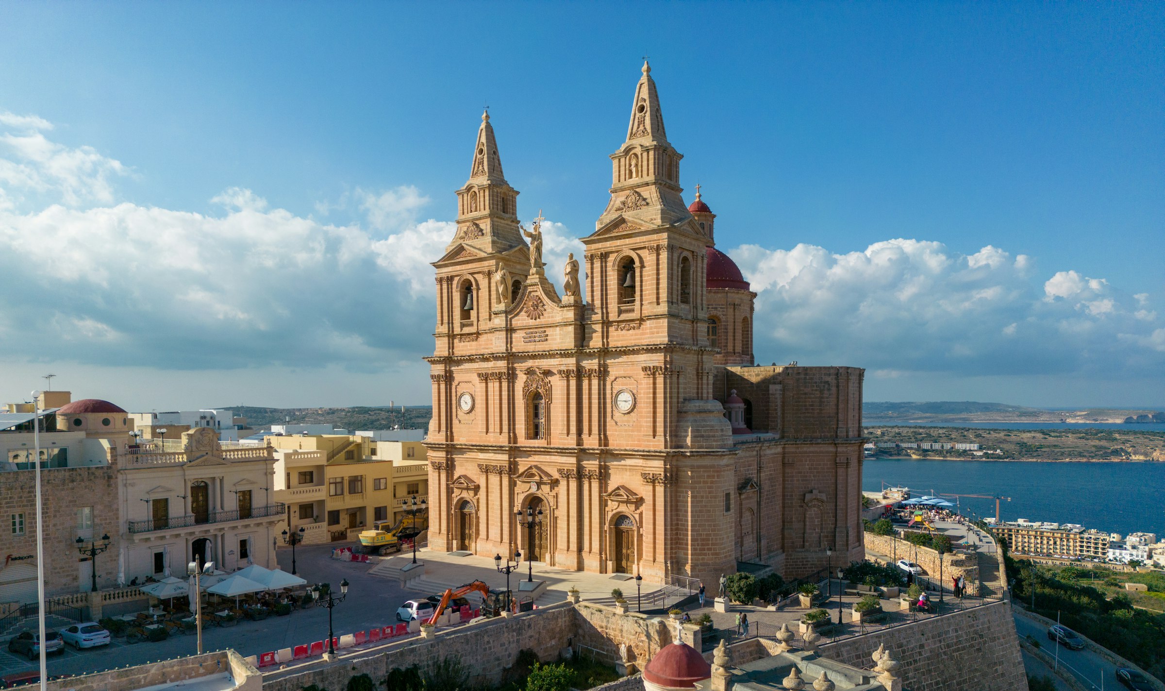
Mellieħa's ridge gives you a quiet night above the bay: the sand is about 3 km downhill, and the Parish Church terrace looks back over it in the evening.
Town guide, Malta. Meridian Dispatch.
Ninety seconds on Mellieħa
Routes 41 and 42 run from Valletta through Mellieħa to Ċirkewwa.
The village stop, Mellieħa 972, is served by route 221 to Buġibba, 222 to Sliema, 49 to Valletta (weekdays), 250 to Għadira, 101 to the Tuffieħa and Riviera stops and TD1 to the airport.
Yes. The village sits on a steep hill above the bay, with many steps. The bay is roughly 3 km downhill, and the climb back is taxing; routes 222 and 101 go up from the Għadira stop to the Mellieħa stop.
Anyone landing on Comino from a private or commercial boat needs a free landing slot, reserved at bluelagooncomino.mt ahead of sailing. Boats leave for the island from Ċirkewwa and Marfa.
Between September and May. Its winter hours are Monday, Wednesday and Friday from 13:30 to 17:00, and Saturday and Sunday from 10:00 to 16:00. It closes on Christmas Day, New Year's Day, Good Friday and Easter Sunday. Entry is free, and donations are welcome.
By route TD1, which runs between Malta International Airport, MLA, and Ċirkewwa and stops in the village. The route page has the current timetable.
Yes, for a quiet base above the sand and the Comino boats; not if you want Valletta every day.
See all towns in MaltaCompare Malta town by town
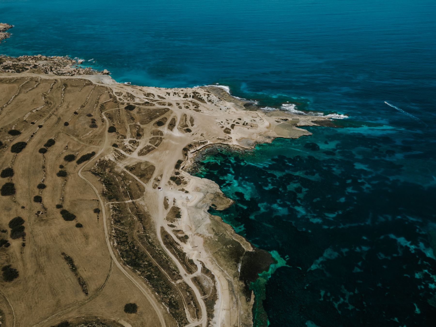
Mellieħa sits on a ridge above Malta's largest sandy beach, at the north end of the island. Golden Bay, the Popeye set and the boats to Comino are each a short ride away.
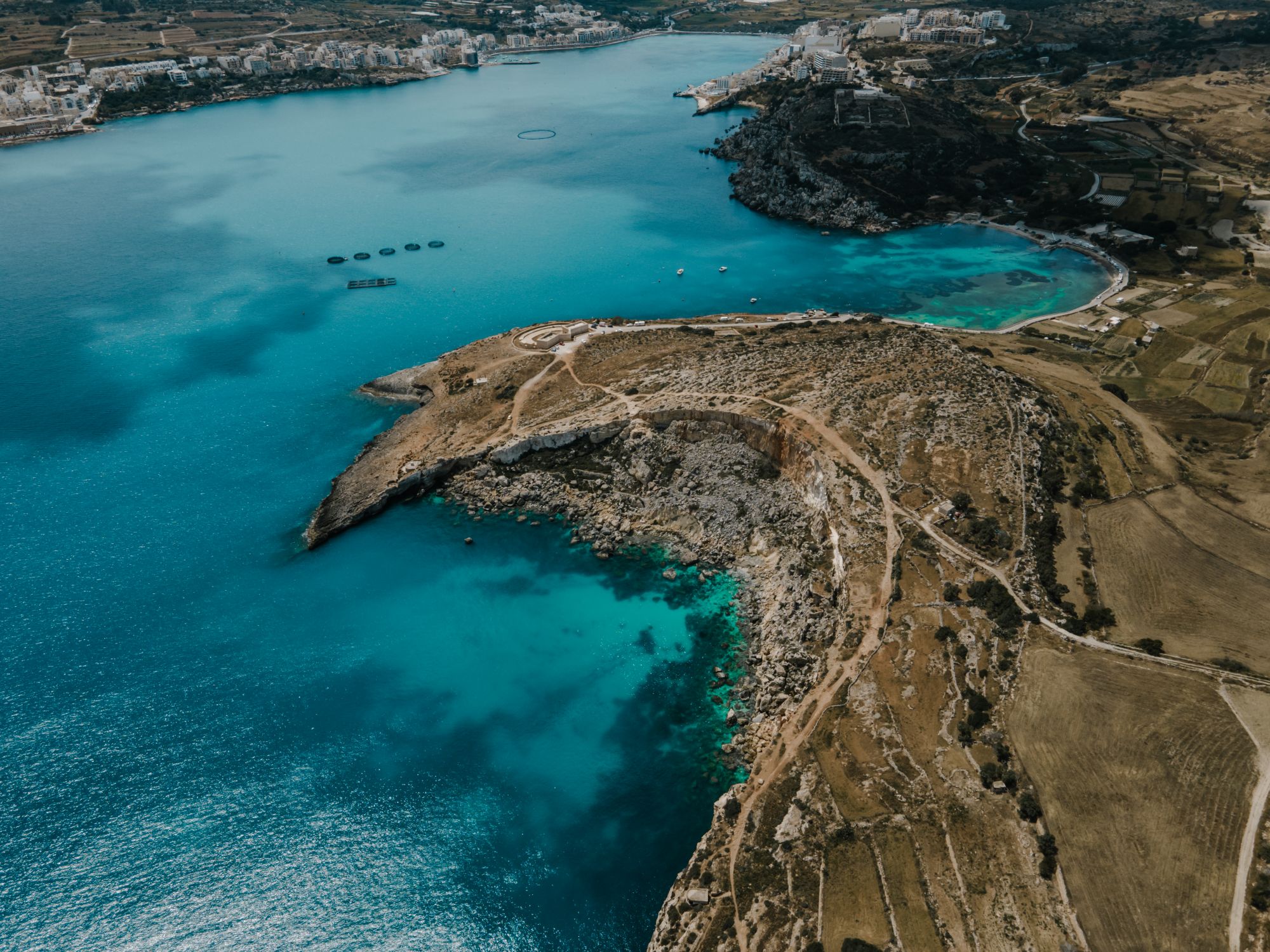
One hotel stands on the village square, with a spa. The other is a resort on the headland above Golden Bay, with a lift down to the sand.
 2 min from the village square
 51 min from the village square
Grouped by what each place is best for, from the sand below the village to Comino across the channel.
The shrine and the shelters are on Mellieħa's main street. The beaches, the towers and the Comino boats are a short bus ride or drive away.
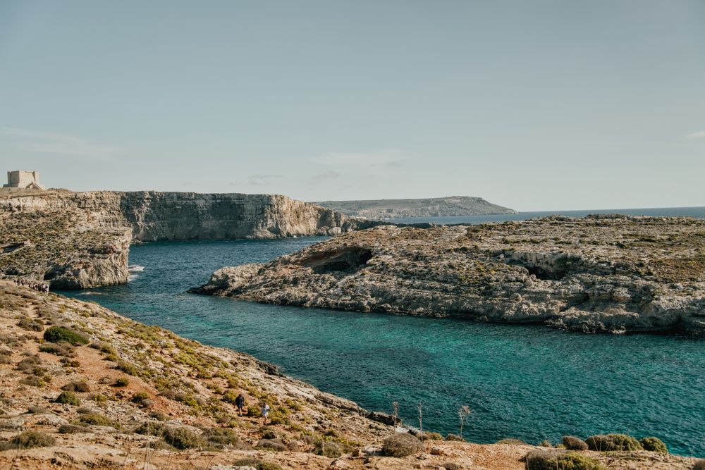

Give Comino a morning and you can walk round the whole island, along the south cliffs and back to the Blue Lagoon for a swim.
Read the guide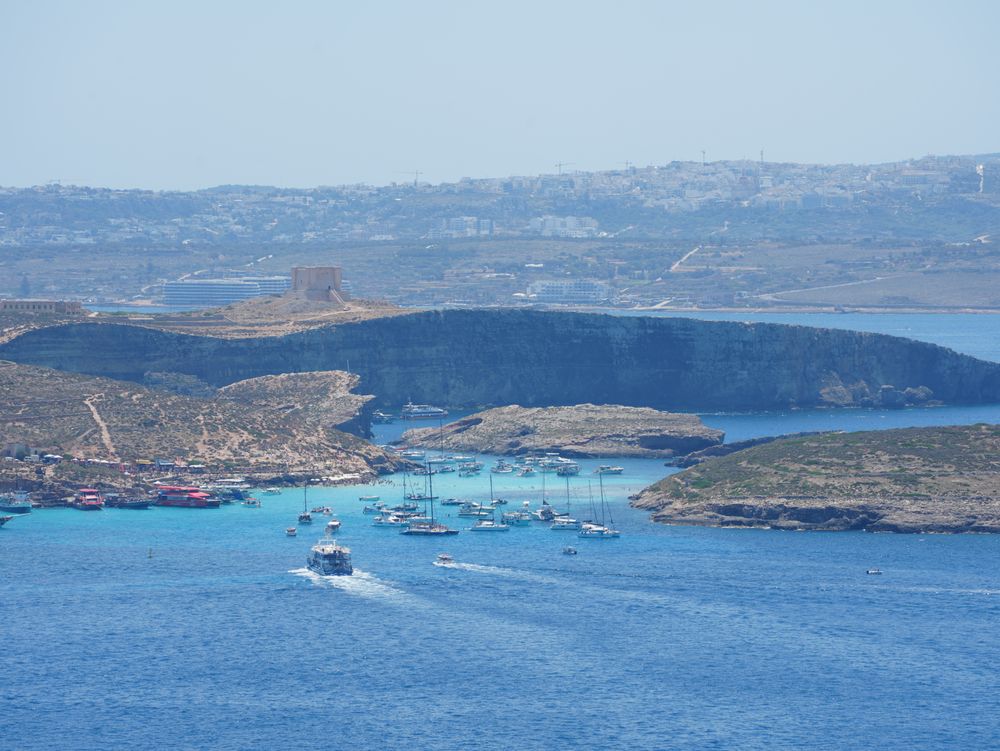
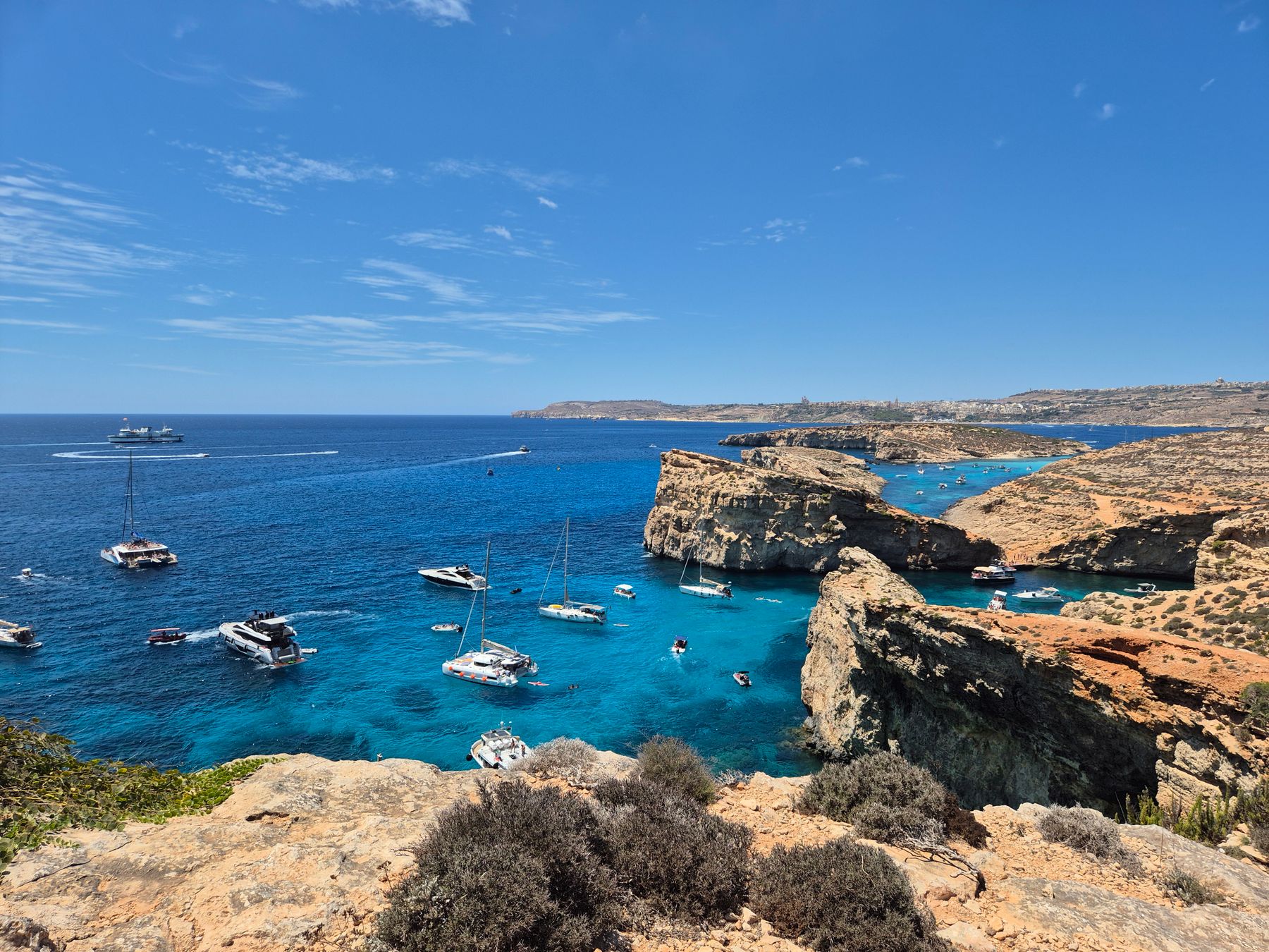
Comino's channel of turquoise water over white sand can only be reached by boat. You cross for the swim and that colour, then walk the island's paths to bays with far less company.
Read the guide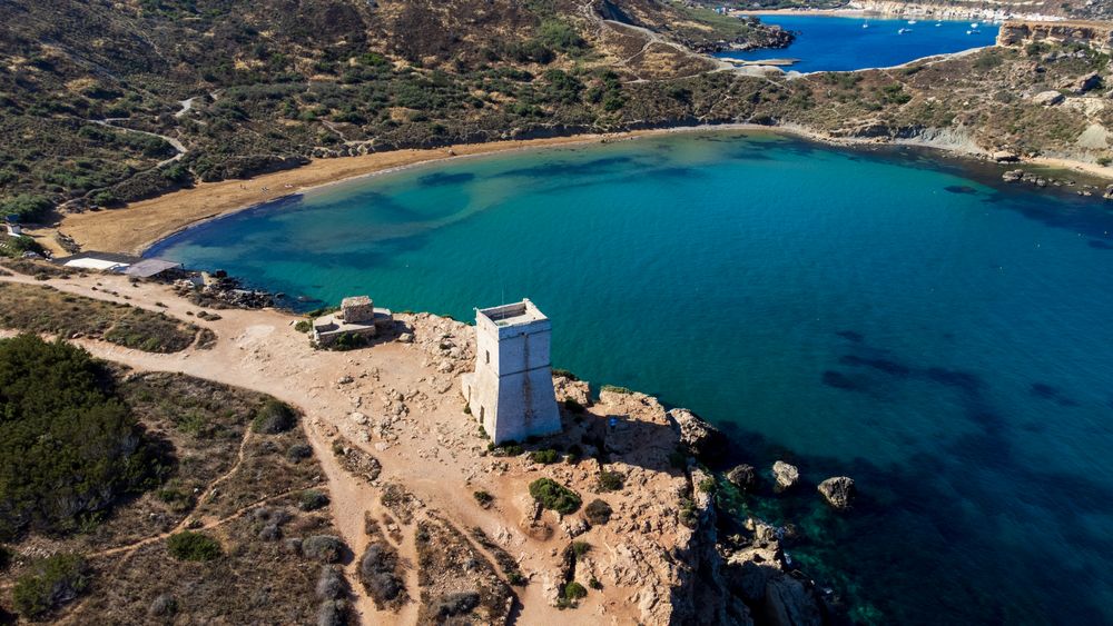
Choose this beach over Golden Bay next door when you want red sand, clay cliffs and a more natural setting. The catch is a long staircase, down to the water and back up at the end of your day.
Read the guide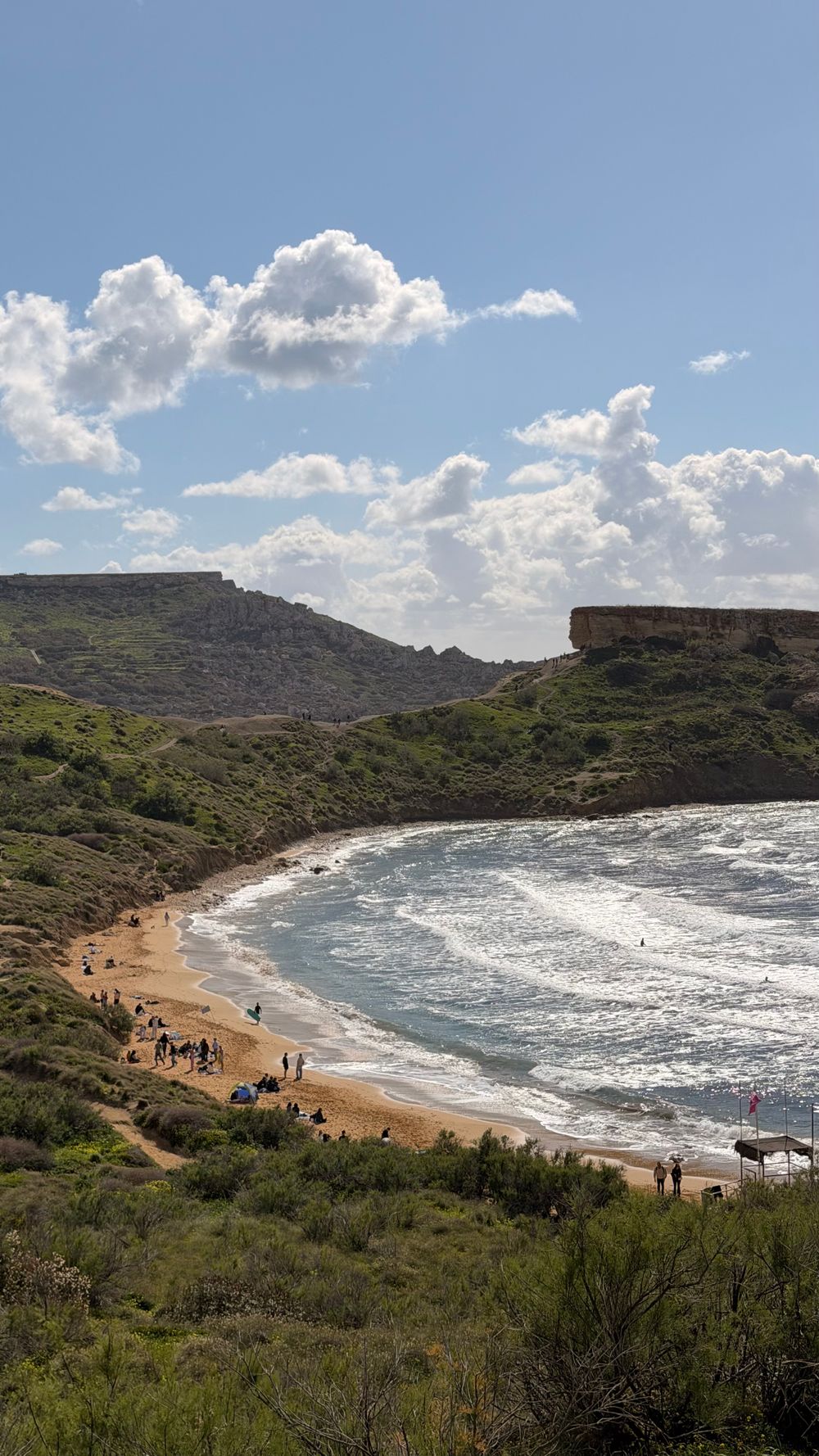
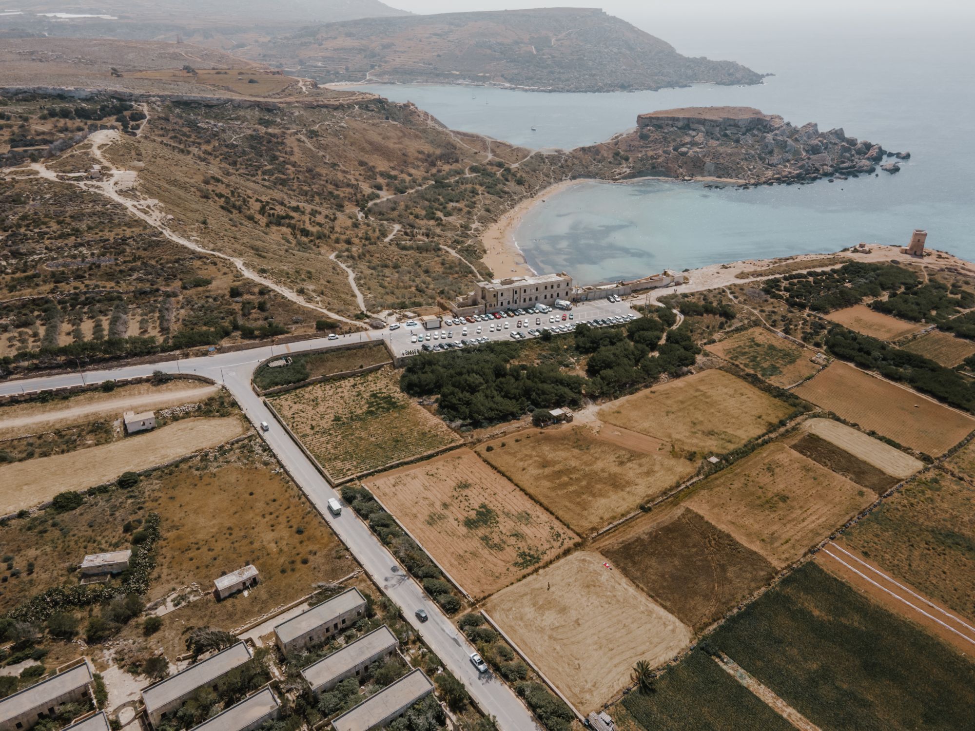
Evenings suit this beach best. The golden sand faces west, so you swim as the heat eases and then watch one of Malta's most photographed sunsets.
Read the guide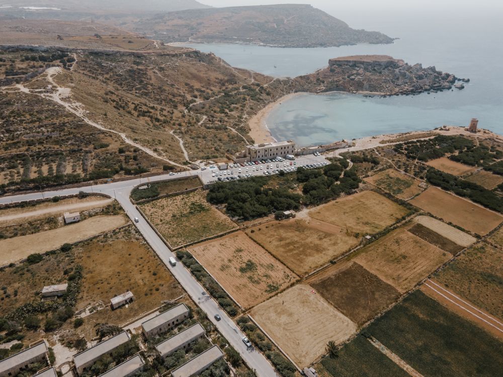
From the Riviera viewpoint above Golden Bay you can walk Malta's protected north-west cliffs to Anchor Bay and the Popeye Village film set, past two old towers and a swimming cove, and ride the bus home from the far end.
Read the guide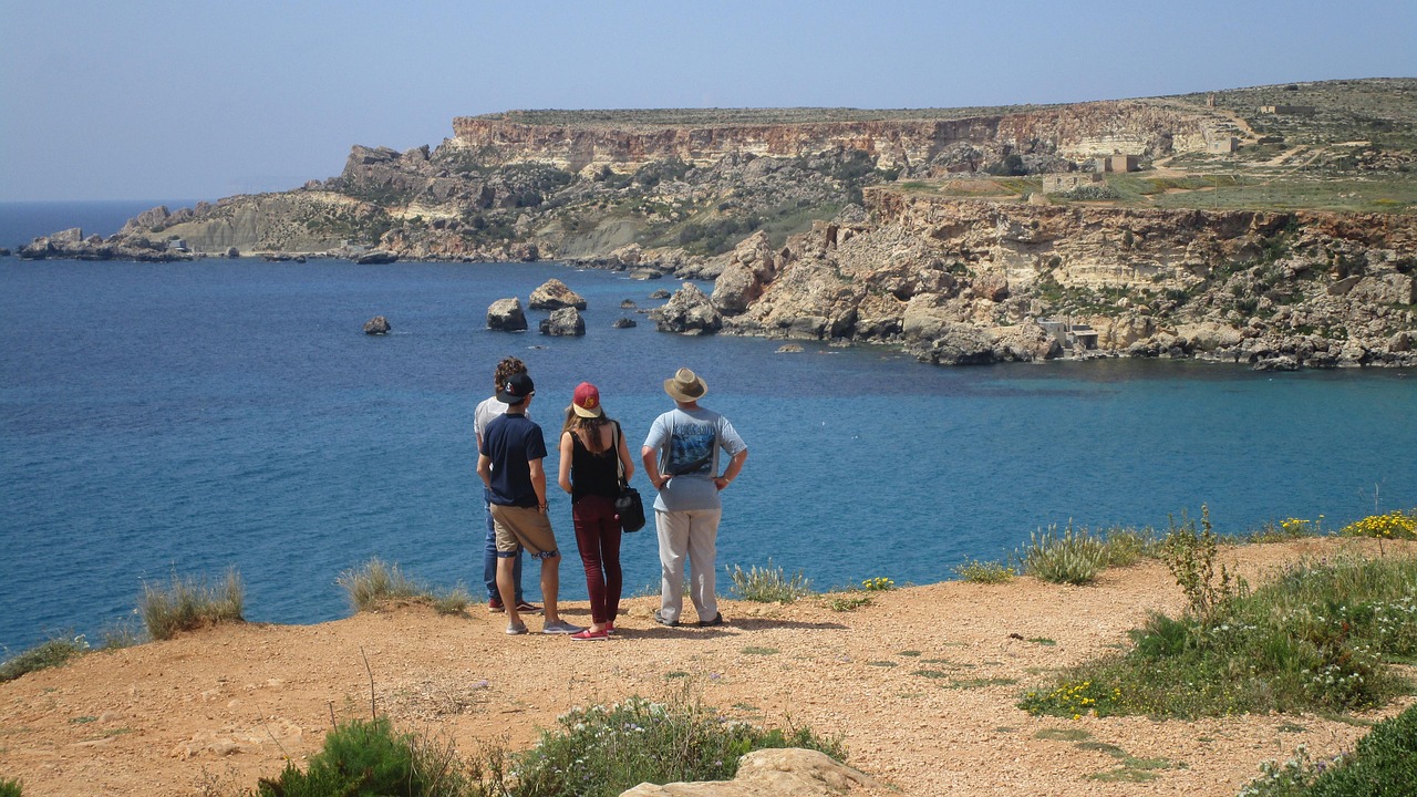
Drive right down to the water's edge: this is the easiest of the three neighbouring bays to reach, and its rock is cut with fishermen's boat garages under an old watchtower.
Read the guide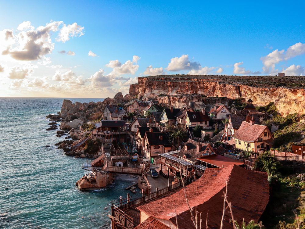
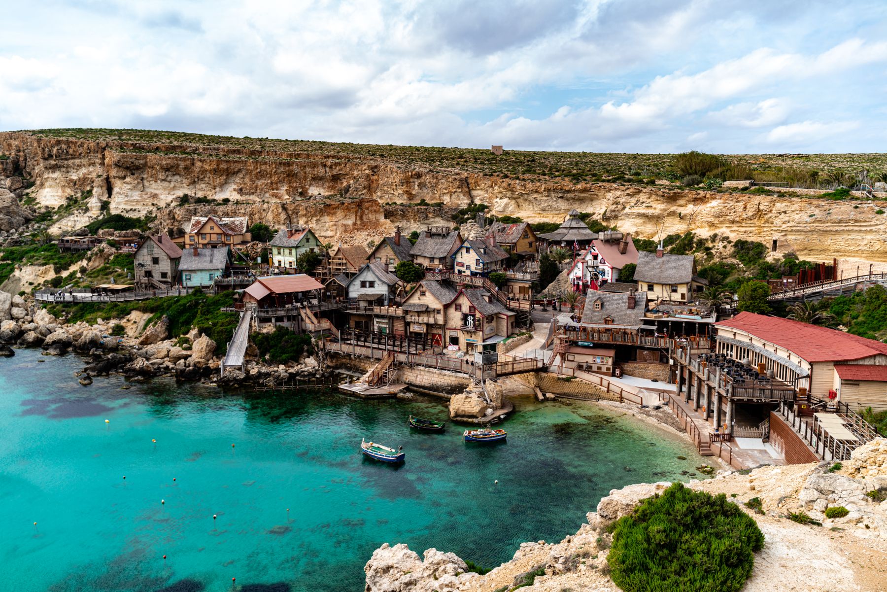
Walk the wooden film set built for the 1980 Popeye musical, still standing above Anchor Bay, then give children the live shows and climbing playhouses the village runs alongside it.
Read the guide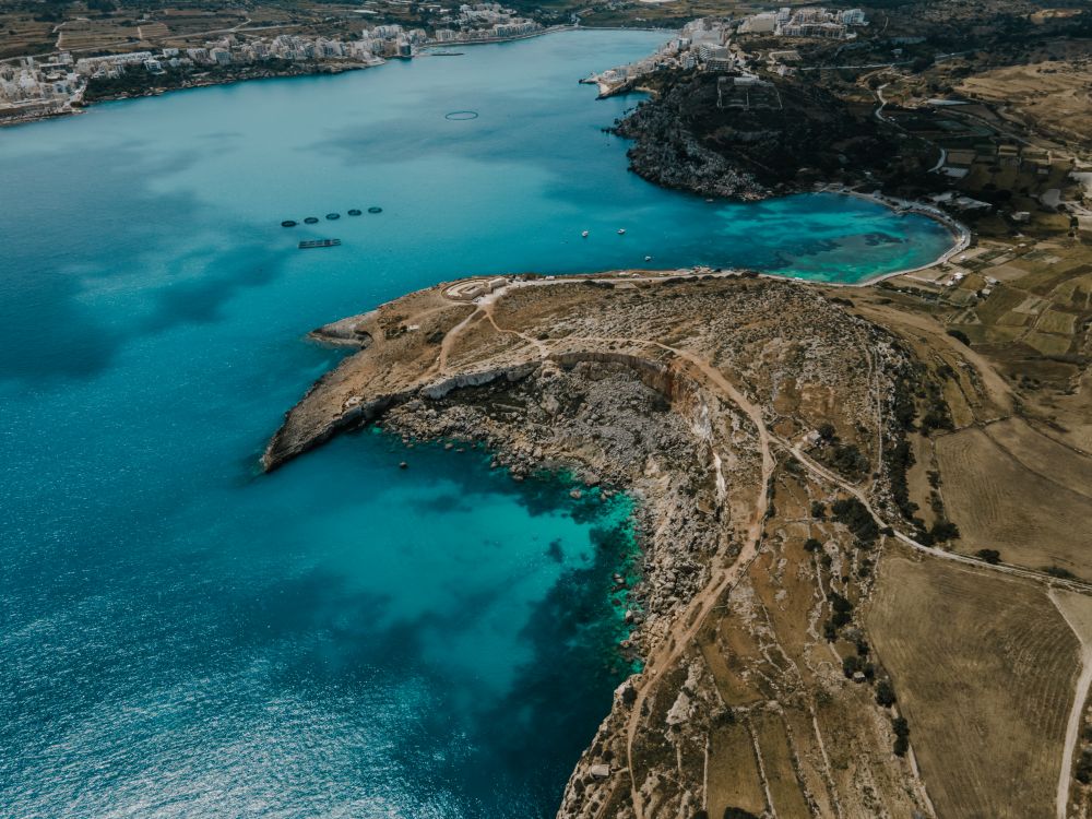
On Malta's largest sandy beach, you can wade a long way out with the sea still shallow, in a wide north coast bay below the hilltop town of Mellieħa.
Read the guide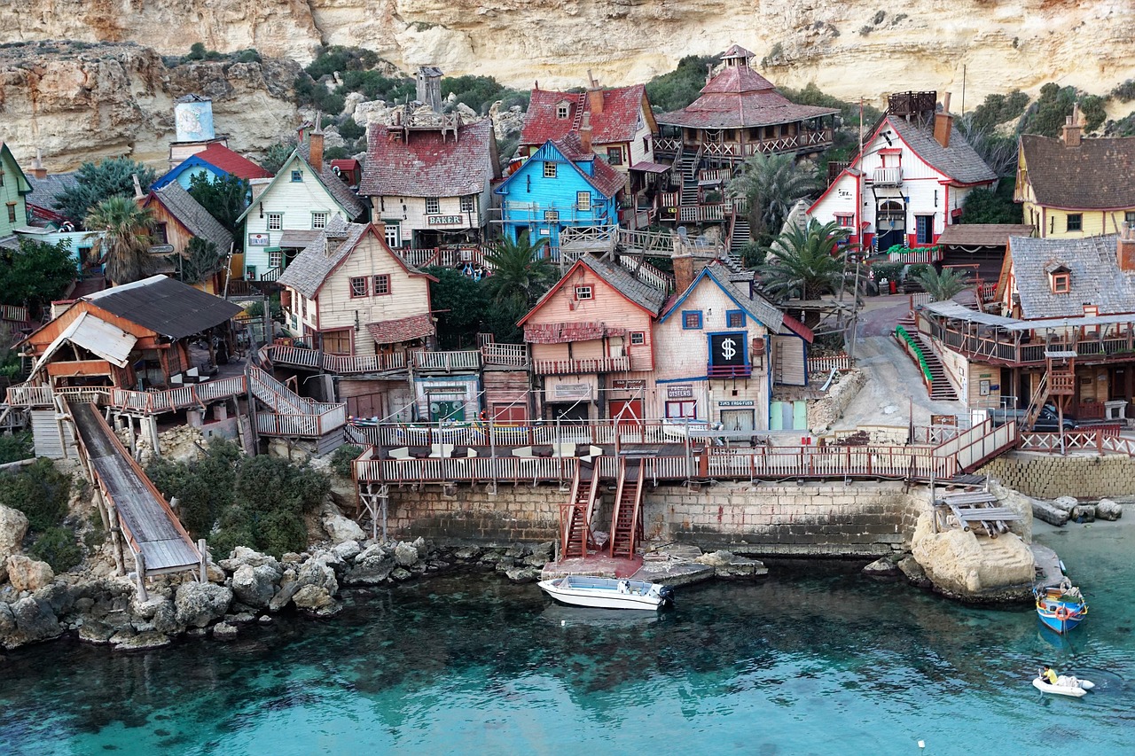
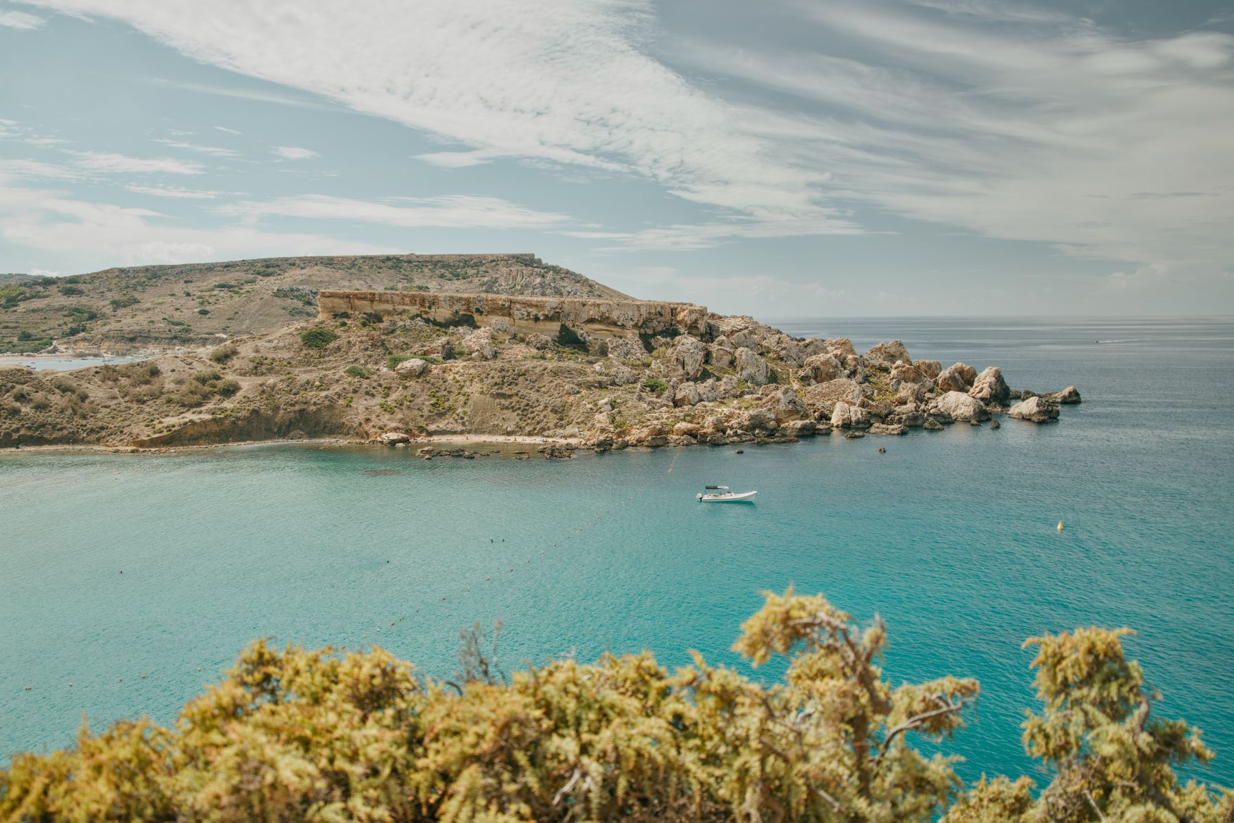
Two things bring you to this small cove: a clear look at the wooden Popeye film set on its shore, and a swim off the rocks on the far side.
Read the guide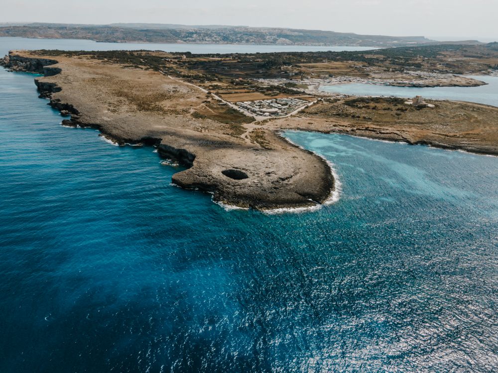
This seawater pool sits in a crater where a sea cave's roof fell in: you can swim it, or come in from open water by kayak or boat.
Read the guide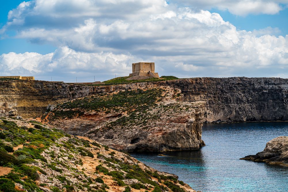
This Knights' watchtower on Comino gives you two islands at once from the ridge around it: Gozo to the north toward Mġarr, Malta to the south across the channel at Ċirkewwa, and the lagoons below.
Read the guide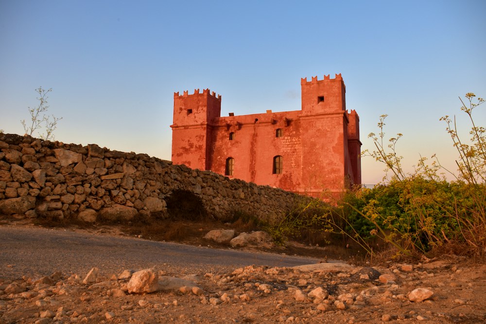
Climbing this blood-red Knights' watchtower above Mellieħa puts you on a gun platform with old cannon and a clear view over the channel to Comino and Gozo.
Read the guide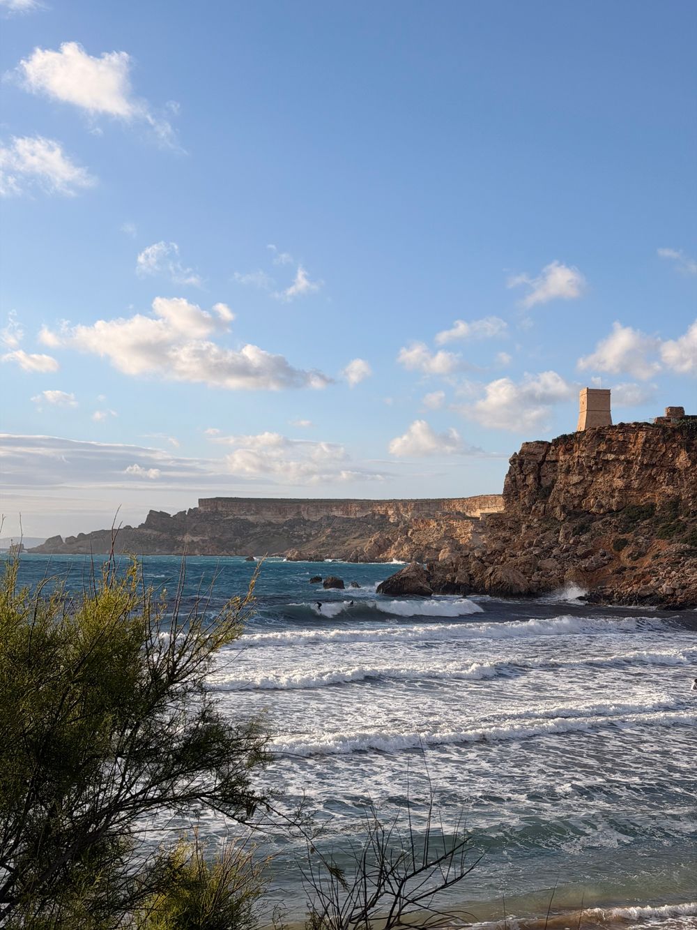
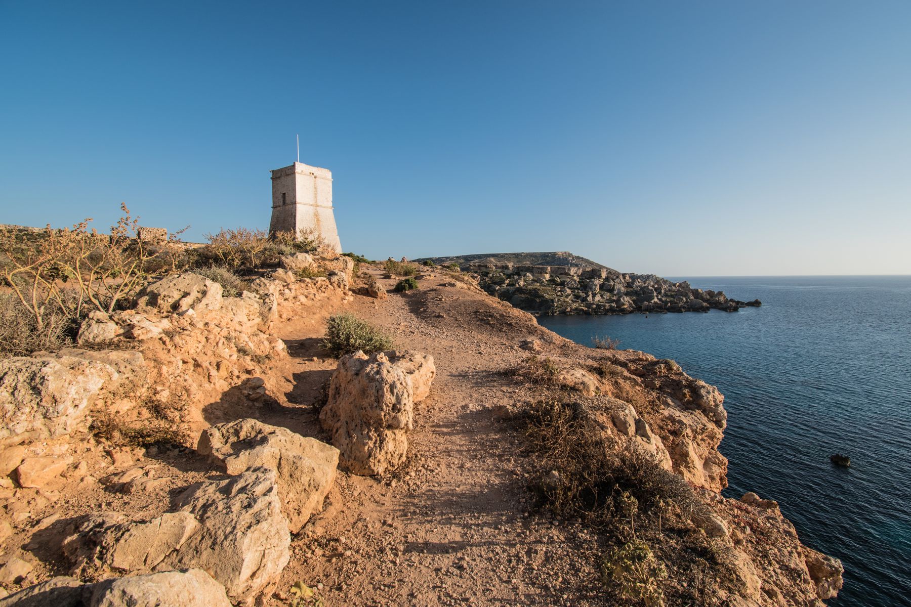
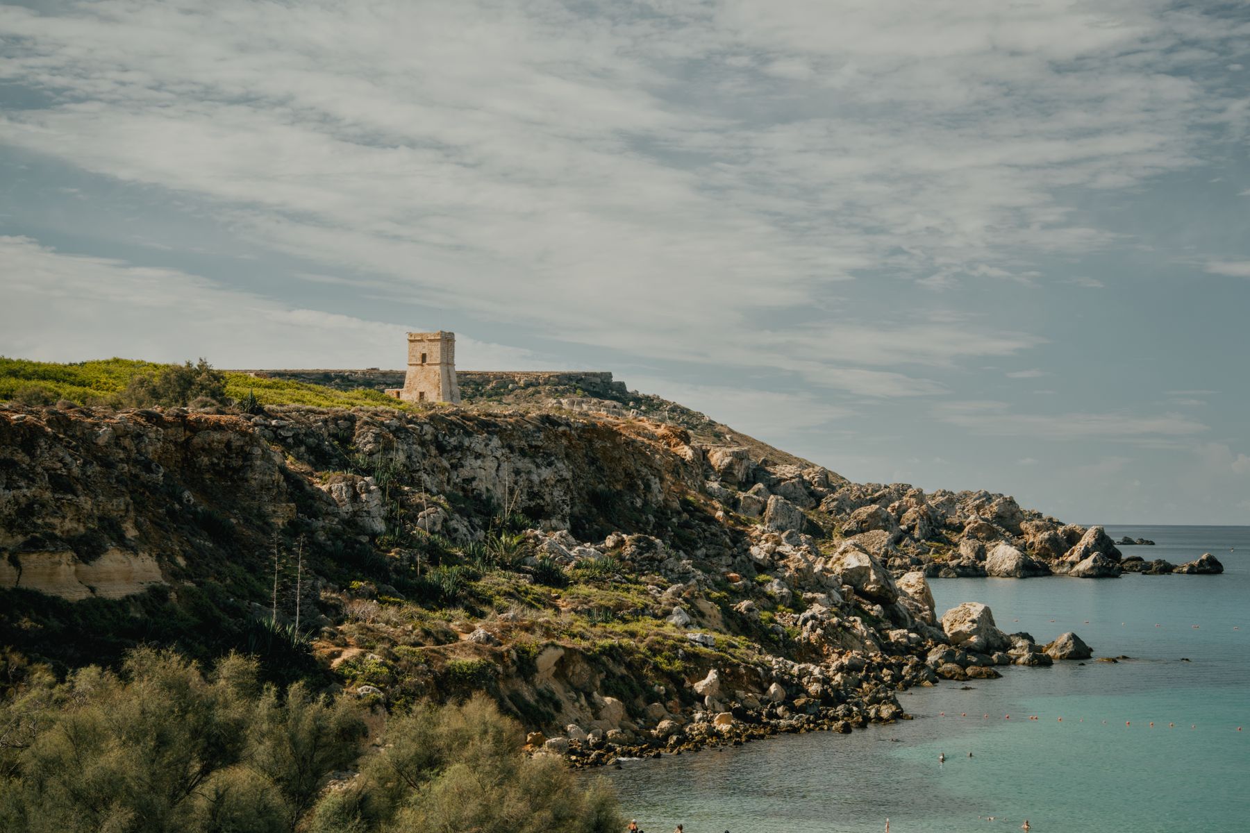
This 1637 lookout stands on the headland above Għajn Tuffieħa Bay, a smaller, wilder beach than Golden Bay next door, and a short path climbs to it from the car park.
Read the guideAt Malta's northern tip, you swim from fine sand into sheltered, clear turquoise water with Comino straight ahead across the channel.
Read the guideTwo sandy coves sit at the end of a narrow country road in the far north of Malta, giving you roughly 450 to 500 metres of golden sand between them.
Read the guideTwo sights stand side by side here, so one stop on Mellieħa's main street gives you a church built around a Madonna and Child icon and a chapel cut into the rock.
Read the guideGo underground in Mellieħa to walk one of the largest rock-cut shelters excavated in Malta during the Second World War, a network of passages dug entirely by hand.
Read the guideStep inside a coastal battery on Mellieħa Bay and see original tools from the tunnara, Malta's old way of trapping bluefin tuna.
Read the guideThe White Tower stands on the hill at L-Aħrax, at the northern tip of Malta, with Coral Beach on the slope below you and the channel to Comino and Gozo straight ahead.
Read the guideMġarr's village centre holds two megalithic temples, the larger one from the Ġgantija phase, 3600 to 3200 BC. Pair them with Skorba, on the edge of the same village.
Read the guideThe temples at Skorba, on the edge of Mġarr, stand beside traces of the earliest known houses in Malta, among the oldest structures on the Maltese Islands.
Read the guideBeside Mellieħa Bay, Għadira is one of Malta's few wetlands, and from a hide you watch waders feed on a brackish lake.
Read the guideThere is sea on three sides of this loop round the whole Marfa peninsula, with Comino and Gozo in view, and you can swim at Paradise Bay on the way round. The loop starts and ends at a bus stop, so you need no car.
Read the guideThe Blue Lagoon takes most boat trips and charters, so this quieter rock inlet is where you swim into the Tunnel Cave in peace.
Read the guide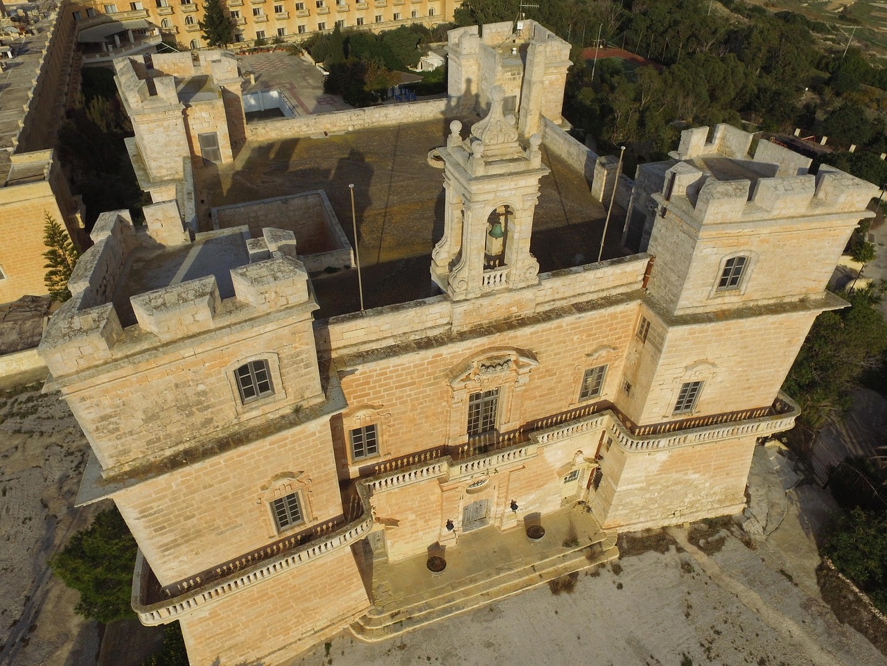
Mock bastions and fake embrasures make this 18th-century villa look like a fort from the sea. A charity built it, and rents from knights who came to hunt rabbits went towards freeing Christian slaves.
Beneath the White Tower, at the far end of the Marfa peninsula, fine sand slopes gently into turquoise water facing Comino and Gozo. A lido rents loungers and umbrellas in season.
Between the Selmun cliffs and Xemxija Hill, this small pebbled inlet stays sheltered when north-westerlies churn up the west-facing beaches.
Darker, tawnier sand shelves gently between limestone boulders in this undeveloped cove below Selmun. A single-track lane ends at a small clifftop car park, then a steep, rough path takes about ten minutes down.
On Comino's southern shore, this Knights-era gun battery points its restored cannon across the South Comino Channel toward Malta. A semicircular gun platform and blockhouse remain, open-air and free to walk around.
Dunes and tamarisk trees back this sandy bay on Comino's north coast, and the shallow water suits young children. Reach it on a walk of roughly half an hour from the Blue Lagoon or by boat.
Sea caves cut into the cliffs along Comino's north coast, and day-trip boats nose in and out of them through the season. The way to see them properly is from the water, by boat, kayak or snorkel.
The Gozo Channel ferry terminal sits on this rocky northern point, and the water around it is one of the island's main shore dives.
Formed when a cave roof fell in, this natural arch tops out 12 metres below the surface and stands 8 metres above the seabed. Divers enter from the shore by stairs and railings.
Scuttled off Ċirkewwa in 1992 as an artificial reef, this former harbour tug sits upright on sand at about 34 metres, with its engines and propeller gone. Sea bream, scorpionfish and wrasse crowd the hull.
A 52-metre former patrol boat of Malta's armed forces lies upright in about 34 metres of water, scuttled in 2007 a short swim from the Ċirkewwa shore and close to the Rozi.
A door in a wall on Triq il-Marfa opens onto a long stair dropping into the valley, with about 70 steps down to a small cave church.
Curved walls echo the megalithic temples and the corbelled stone huts of the Maltese countryside in this village church, designed by Richard England in 1962 as his first commission.
Perched on the edge of the ridge above Ġnejna Bay, this square watchtower of 1637 was the first of the Lascaris towers, with one room on each of its two floors.
Built by the British in the late 1930s on the Selmun headland, this fort was disguised to look like farm buildings from the air. It is now an abandoned ruin with open access, no ticket and no facilities.
Facing Mistra Bay, this battery of 1761 keeps its gun platform, twin blockhouses and an entrance carved with the arms of the Order and Grand Master Pinto.
Westward from the Red Tower, the ridge ends at this headland above the Gozo Channel, with long views over the islands and the ferries crossing between them.
Cliffs rising to about 25 metres on the L-Aħrax coast hold some 500 pairs of Yelkouan shearwaters, the islands' largest colony.
Red rock and clay slopes form this headland between Għajn Tuffieħa and Qarraba Bay, reached on a winding trail from the southern end of the beach. From the top, both bays open out below.
Malta's largest sandy beach sits below the village, and the west-facing bays at Golden Bay and Għajn Tuffieħa are one bus ride away.
Choose this beach over Golden Bay next door when you want red sand, clay cliffs and a more natural setting. The catch is a long staircase, down to the water and back up at the end of your day.
Read the guideEvenings suit this beach best. The golden sand faces west, so you swim as the heat eases and then watch one of Malta's most photographed sunsets.
Read the guideDrive right down to the water's edge: this is the easiest of the three neighbouring bays to reach, and its rock is cut with fishermen's boat garages under an old watchtower.
Read the guideOn Malta's largest sandy beach, you can wade a long way out with the sea still shallow, in a wide north coast bay below the hilltop town of Mellieħa.
Read the guideTwo things bring you to this small cove: a clear look at the wooden Popeye film set on its shore, and a swim off the rocks on the far side.
Read the guideThis seawater pool sits in a crater where a sea cave's roof fell in: you can swim it, or come in from open water by kayak or boat.
Read the guideAt Malta's northern tip, you swim from fine sand into sheltered, clear turquoise water with Comino straight ahead across the channel.
Read the guideTwo sandy coves sit at the end of a narrow country road in the far north of Malta, giving you roughly 450 to 500 metres of golden sand between them.
Read the guideBeneath the White Tower, at the far end of the Marfa peninsula, fine sand slopes gently into turquoise water facing Comino and Gozo. A lido rents loungers and umbrellas in season.
Between the Selmun cliffs and Xemxija Hill, this small pebbled inlet stays sheltered when north-westerlies churn up the west-facing beaches.
Darker, tawnier sand shelves gently between limestone boulders in this undeveloped cove below Selmun. A single-track lane ends at a small clifftop car park, then a steep, rough path takes about ten minutes down.
The boats to Comino leave from Ċirkewwa and Marfa, a short ride north, and the dive sites sit off the same point.
Give Comino a morning and you can walk round the whole island, along the south cliffs and back to the Blue Lagoon for a swim.
Read the guideComino's channel of turquoise water over white sand can only be reached by boat. You cross for the swim and that colour, then walk the island's paths to bays with far less company.
Read the guideThis Knights' watchtower on Comino gives you two islands at once from the ridge around it: Gozo to the north toward Mġarr, Malta to the south across the channel at Ċirkewwa, and the lagoons below.
Read the guideThe Blue Lagoon takes most boat trips and charters, so this quieter rock inlet is where you swim into the Tunnel Cave in peace.
Read the guideOn Comino's southern shore, this Knights-era gun battery points its restored cannon across the South Comino Channel toward Malta. A semicircular gun platform and blockhouse remain, open-air and free to walk around.
Dunes and tamarisk trees back this sandy bay on Comino's north coast, and the shallow water suits young children. Reach it on a walk of roughly half an hour from the Blue Lagoon or by boat.
Sea caves cut into the cliffs along Comino's north coast, and day-trip boats nose in and out of them through the season. The way to see them properly is from the water, by boat, kayak or snorkel.
The Gozo Channel ferry terminal sits on this rocky northern point, and the water around it is one of the island's main shore dives.
Formed when a cave roof fell in, this natural arch tops out 12 metres below the surface and stands 8 metres above the seabed. Divers enter from the shore by stairs and railings.
Scuttled off Ċirkewwa in 1992 as an artificial reef, this former harbour tug sits upright on sand at about 34 metres, with its engines and propeller gone. Sea bream, scorpionfish and wrasse crowd the hull.
A 52-metre former patrol boat of Malta's armed forces lies upright in about 34 metres of water, scuttled in 2007 a short swim from the Ċirkewwa shore and close to the Rozi.
The shrine, the grotto and the wartime shelters are a few steps apart on the main street, and the Popeye set sits above Anchor Bay to the west.
Walk the wooden film set built for the 1980 Popeye musical, still standing above Anchor Bay, then give children the live shows and climbing playhouses the village runs alongside it.
Read the guideTwo sights stand side by side here, so one stop on Mellieħa's main street gives you a church built around a Madonna and Child icon and a chapel cut into the rock.
Read the guideGo underground in Mellieħa to walk one of the largest rock-cut shelters excavated in Malta during the Second World War, a network of passages dug entirely by hand.
Read the guideStep inside a coastal battery on Mellieħa Bay and see original tools from the tunnara, Malta's old way of trapping bluefin tuna.
Read the guideA door in a wall on Triq il-Marfa opens onto a long stair dropping into the valley, with about 70 steps down to a small cave church.
Curved walls echo the megalithic temples and the corbelled stone huts of the Maltese countryside in this village church, designed by Richard England in 1962 as his first commission.
The Knights put a lookout on almost every headland here, and two of Malta's temple sites stand in the farmland to the south.
Climbing this blood-red Knights' watchtower above Mellieħa puts you on a gun platform with old cannon and a clear view over the channel to Comino and Gozo.
Read the guideThis 1637 lookout stands on the headland above Għajn Tuffieħa Bay, a smaller, wilder beach than Golden Bay next door, and a short path climbs to it from the car park.
Read the guideThe White Tower stands on the hill at L-Aħrax, at the northern tip of Malta, with Coral Beach on the slope below you and the channel to Comino and Gozo straight ahead.
Read the guideMġarr's village centre holds two megalithic temples, the larger one from the Ġgantija phase, 3600 to 3200 BC. Pair them with Skorba, on the edge of the same village.
Read the guideThe temples at Skorba, on the edge of Mġarr, stand beside traces of the earliest known houses in Malta, among the oldest structures on the Maltese Islands.
Read the guideMock bastions and fake embrasures make this 18th-century villa look like a fort from the sea. A charity built it, and rents from knights who came to hunt rabbits went towards freeing Christian slaves.
Perched on the edge of the ridge above Ġnejna Bay, this square watchtower of 1637 was the first of the Lascaris towers, with one room on each of its two floors.
Built by the British in the late 1930s on the Selmun headland, this fort was disguised to look like farm buildings from the air. It is now an abandoned ruin with open access, no ticket and no facilities.
Facing Mistra Bay, this battery of 1761 keeps its gun platform, twin blockhouses and an entrance carved with the arms of the Order and Grand Master Pinto.
The north-west cliffs are a protected park, and the ridges either side of the bay carry paths with the sea on both sides.
From the Riviera viewpoint above Golden Bay you can walk Malta's protected north-west cliffs to Anchor Bay and the Popeye Village film set, past two old towers and a swimming cove, and ride the bus home from the far end.
Read the guideClimbing this blood-red Knights' watchtower above Mellieħa puts you on a gun platform with old cannon and a clear view over the channel to Comino and Gozo.
Read the guideThis 1637 lookout stands on the headland above Għajn Tuffieħa Bay, a smaller, wilder beach than Golden Bay next door, and a short path climbs to it from the car park.
Read the guideBeside Mellieħa Bay, Għadira is one of Malta's few wetlands, and from a hide you watch waders feed on a brackish lake.
Read the guideThere is sea on three sides of this loop round the whole Marfa peninsula, with Comino and Gozo in view, and you can swim at Paradise Bay on the way round. The loop starts and ends at a bus stop, so you need no car.
Read the guideWestward from the Red Tower, the ridge ends at this headland above the Gozo Channel, with long views over the islands and the ferries crossing between them.
Cliffs rising to about 25 metres on the L-Aħrax coast hold some 500 pairs of Yelkouan shearwaters, the islands' largest colony.
Red rock and clay slopes form this headland between Għajn Tuffieħa and Qarraba Bay, reached on a winding trail from the southern end of the beach. From the top, both bays open out below.
Start on the main street at the Sanctuary of Our Lady of Mellieħa. Across the road, a door in the wall on Triq il-Marfa opens on the steps down to the Grotto of Our Lady, a small cave church.
Go down to Mellieħa Bay, about 3 km downhill. The water stays shallow for 10 to 15 metres from the shore. Across the road, Għadira Nature Reserve opens its hides from September to May, on Monday, Wednesday and Friday afternoons and at weekends; herons and waders stop there on migration.
In the afternoon, take route 41 or 42 towards Ċirkewwa, along the Marfa road, to the Red Tower. A short, steep path climbs to the door, and a spiral stair leads to the roof, where old cannon on gun carriages look over the whole bay to Comino.
End on the west coast. Route 101 runs from the village to Golden Bay, where the sand faces west for the sunset. For the whole bay, climb the clifftop path at its southern end toward Għajn Tuffieħa Tower.
Keep a second morning for Comino. The boats leave from Ċirkewwa and Marfa. Walk the loop anticlockwise from the Blue Lagoon, along the south cliffs to the battery and back by Santa Marija Bay, and check the last boat back before you set off.
Malta has one airport, at Luqa, south of Mellieħa. Route TD1 runs from the airport through the village to Ċirkewwa, and a taxi is the direct way.
Buy a fixed-fare ticket at the booth in the Welcomers' Hall.
Route TD1 runs from the airport to Ċirkewwa and stops in Mellieħa village. It needs no booking: pay on board by cash or contactless card.
Request the car once you land, then walk to the pickup point the app shows outside arrivals. Bolt sometimes moves that point, so check the app again as you leave the terminal.
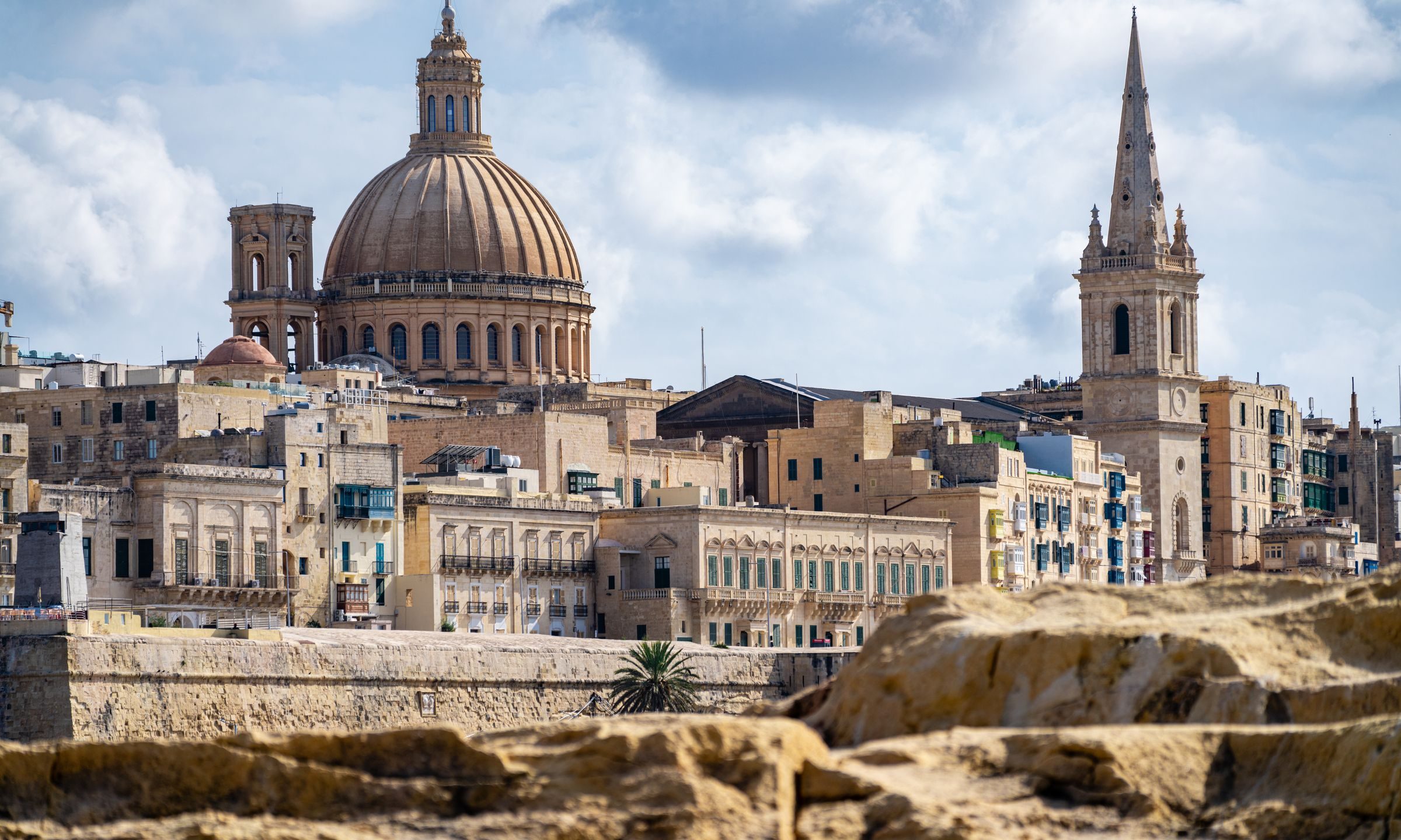
Every Malta town, place and dispatch, on one map.

Hotels, bars and a long seafront promenade fill Buġibba and Qawra, the resort strip on the north side of St Paul's Bay.


Inside a ring of bastions on a hill at the centre of Malta, the old capital is a quiet walled city of palazzi, churches and narrow lanes.
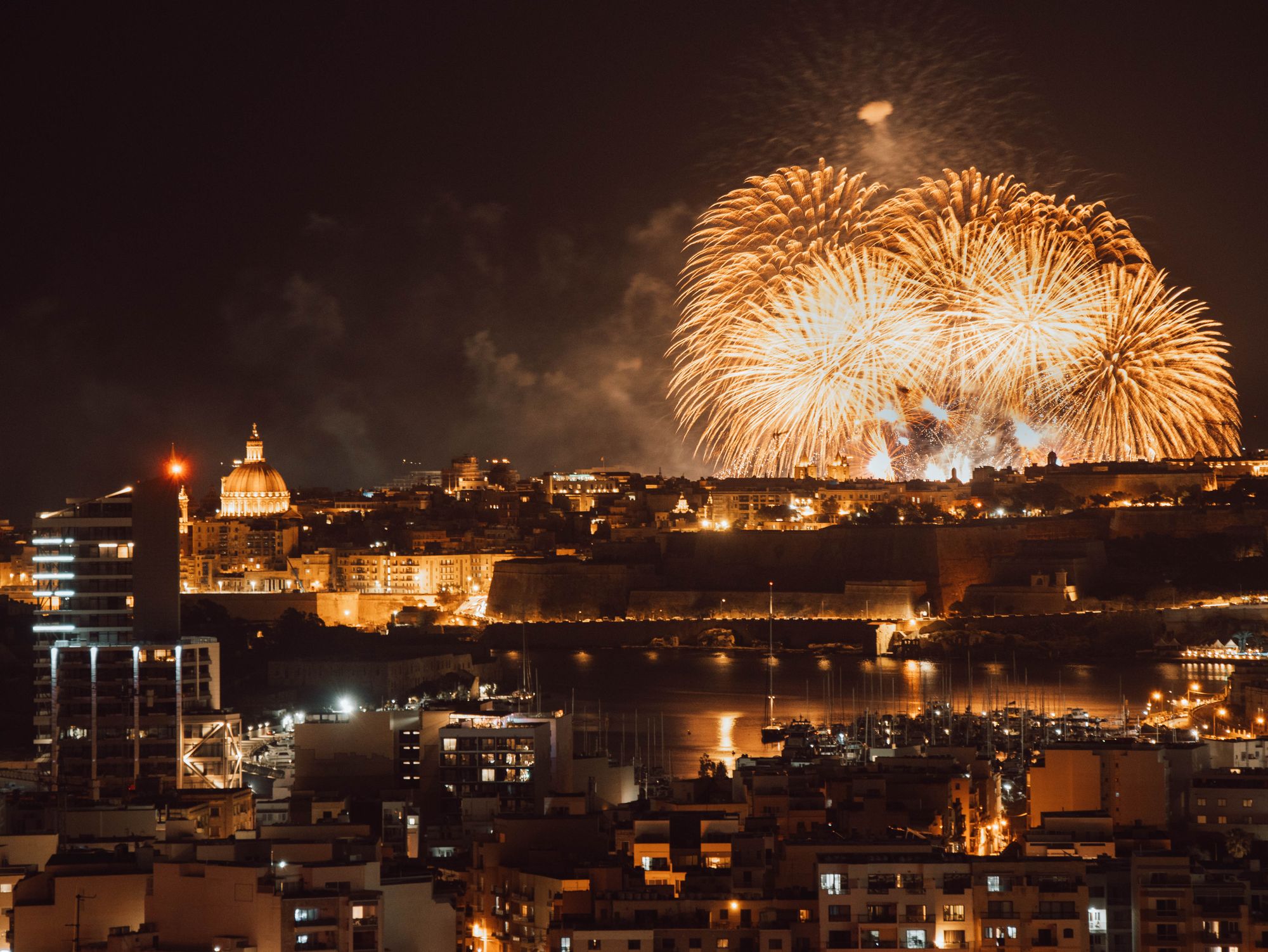
A saint's statue, a marching band and fireworks fill a Maltese parish's streets on most summer Sundays.
The official pages this guide was checked against.
Last updated