Globe Countries Cities Itineraries World's Best Events Get the App
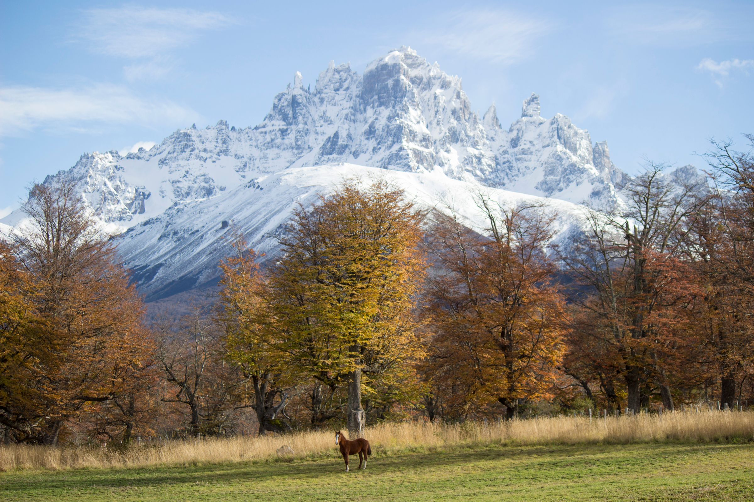
A brown horse stands in a green pasture in front of autumn trees in gold and rust, with a jagged, snow-covered mountain under a blue sky behind
Autumn pasture · snow on the peaks above the turning trees
Town brief · 45.5710°S 72.0690°W

Coyhaique

Take a full day between the long drives: the biggest town on the Carretera Austral has forest trails and a river canyon within half an hour of its plaza, and a large supermarket to stock up at before the gravel road south.

View on globe

Why you should go

Ninety seconds on Coyhaique

How long
Two nightsone day on the reserves near town, one south to Cerro Castillo
Getting around
A car for the day tripsthe centre is walkable; taxis reach the nearest reserve
When
December to Februarythe warmest, sunniest months; June is the wettest
Language
Spanishthe national language of Chile
Money
The Chilean pesocarry cash for the road south
Airports
Balmaceda BBAabout 55 km southeast, around an hour by road
How long

How many days do you need in Coyhaique?

Two nights suit most trips: one day for Coyhaique National Reserve and the Río Simpson valley, and one for the drive south to Cerro Castillo National Park and back. Trekking in Cerro Castillo adds several days, and the main circuit there needs a certified guide.

Getting around

Do you need a car in Coyhaique?

Not for the town itself: the centre is walkable, and taxis reach the national reserve on the hill to the north. For Río Simpson and Cerro Castillo a car is the practical choice. Without one, buses heading south stop at the Las Horquetas trailhead in Cerro Castillo on request. A four-wheel drive is needed only on the smallest side roads.

When

When is the best time to visit Coyhaique?

December to February, the warmest and sunniest part of the year. February is the warmest month, averaging about 15°C, and also the driest. July is the coldest at about 3°C, and June the wettest. In Cerro Castillo National Park the Las Horquetas and Estero Parada trails close for the season from May to September.

Language

What language is spoken in Coyhaique?

Spanish, as across Chile. Road signs, bus timetables and national park notices are in Spanish.

Money

What currency is used in Coyhaique?

The Chilean peso. Cash is still the main way to pay along the Carretera Austral, and cash machines are far apart. Coyhaique is the main place to draw money before Cochrane, several hours to the south.

Airports

Which airport serves Coyhaique?

Balmaceda, BBA, about 55 km southeast of Coyhaique and around an hour by road. Minibuses and car hire operate from the airport, which also has public parking.

The capital of the Aysén region sits on the Carretera Austral, the scenic road of more than 800 km through Chilean Patagonia. The town is where you sleep, eat and shop for the road. The walking and the views are a short drive out.

Start at the Plaza de Armas, then head up to Coyhaique National Reserve on the hill just north of town, which has walks of a few hours. In the afternoon, drive half an hour northwest on the road to Puerto Aysén into the Río Simpson valley, where the river runs between steep walls and canyons.

Keep one day for Cerro Castillo, 100 km south on Route 7, about an hour and a half by car. The Las Horquetas circuit and the climb to Laguna Cerro Castillo need a certified guide, and Horquetas closes from May to September, so check with the park office first. Without a car, take the bus south and ask for Las Horquetas, which is only a roadside sign.

Sleep in town, close to the restaurants and shops; a cabin on the outskirts only works if you have a car. Beyond Coyhaique most of the Carretera Austral is gravel, and many hire contracts do not cover unsealed roads, so read the insurance before you sign. A strong, cold wind usually gets up in the afternoon, so do your driving and walking in the morning.

Things to do

8
  1. Cerro Castillo National Park

    Cerro Castillo National Park

    Park · 7 hr

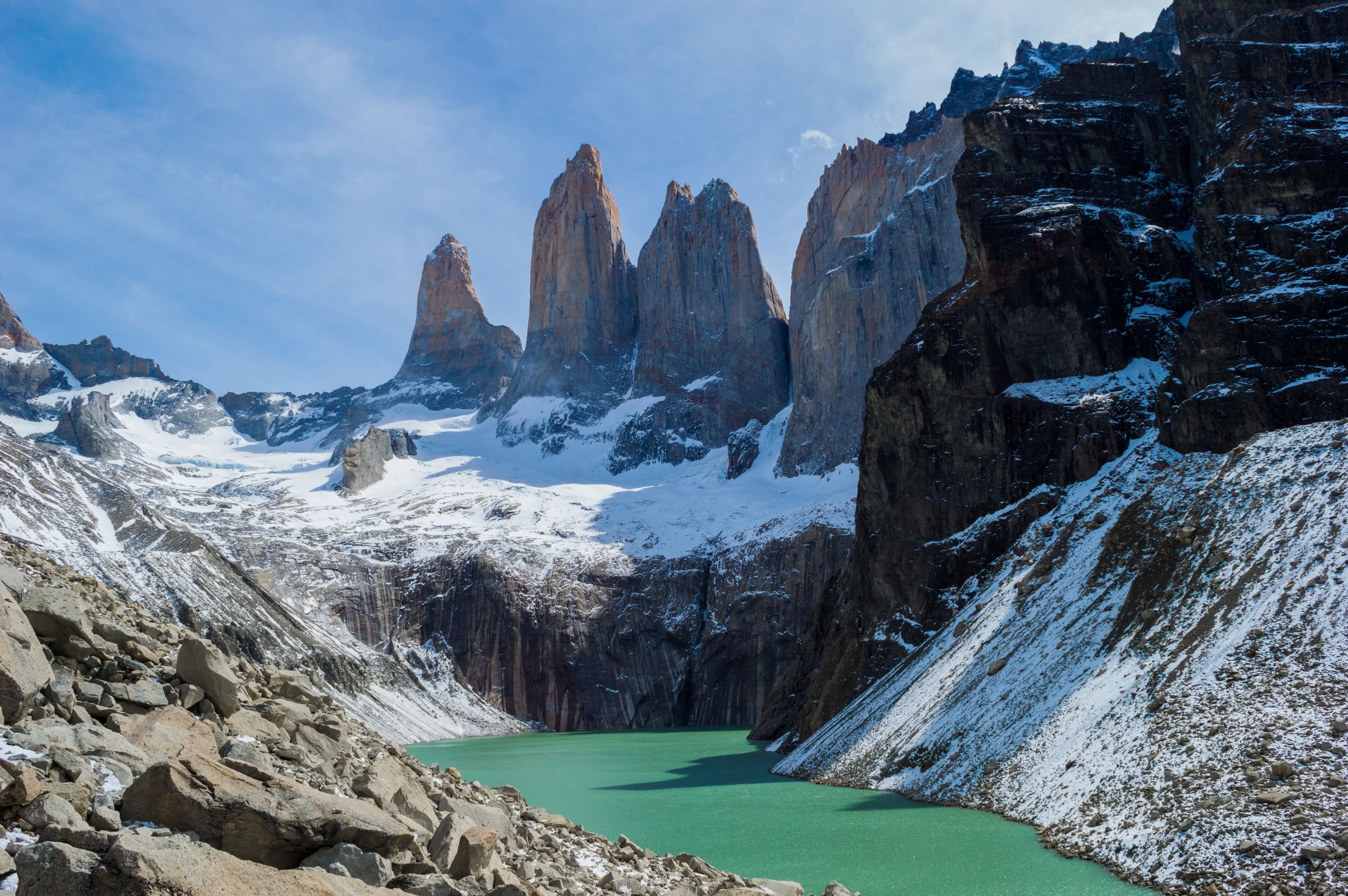
    Standing at the lagoon under Cerro Castillo's black basalt spires gives you a view that walkers compare with Torres del Paine, and the whole climb fits in one day from Villa Cerro Castillo.

    View more →
  2. Coyhaique National Reserve

    Park · 5 hr

    The CONAF reserve begins about five kilometres uphill from the plaza and covers some 2,150 hectares of lenga, coigüe and planted pine on the slopes of Cerro Cinchao. Marked loops reach Laguna Verde and Laguna Venus in two to four hours. The steep gravel access road turns to mud after rain.

  3. Laguna Cerro Castillo

    Lake · 8 hr

    A milky turquoise tarn sits in the cirque directly beneath the Castillo towers, fed by what is left of the glacier on the north face. The trail up from Villa Cerro Castillo gains about a thousand metres and runs six to eight hours return. It is open only with a certified guide, and it shuts when the weather closes on the ridge.

  4. Monumento Natural Dos Lagunas

    Park · 2.5 hr

    A small protected area about 18 km east of town on the road toward the Argentine border, built around two lakes left behind by the retreating ice. A flat interpretive loop round the water takes about an hour. The wind blows constantly across the open water, so bring a warm layer and binoculars.

  5. Museo Regional de Aysén

    Museum · 1.5 hr

    The regional museum occupies the restored sheds of the old Sociedad Industrial del Aysén on the edge of town, arranged around the wool shearing floor and the stone corrals. Its displays cover the colonisation of the region, the fires that cleared these valleys in the 1930s and 1940s, and the estancia system that followed.

  6. Nomades Hotel Boutique

    Hotel

    A small hotel a few blocks from the plaza, built in dark timber and glass with rooms facing the hills behind the city. It stays open year round, which matters in a town where much of the trade shuts out of season, and the desk arranges transfers for the road south.

  7. Plaza de Armas

    Landmark · 30 min

    This five-sided garden square sits at the centre of Coyhaique, and the main streets fan out from its sides, which makes it the easiest point to take bearings from. Trees shade its paths, with monuments and statues set among them. Start a first walk here.

  8. Río Simpson National Reserve

    Park · 4 hr

    The reserve follows the Simpson river gorge along the paved road to Puerto Aysén, about half an hour northwest of town by car. Waterfalls drop straight off the canyon rim, the Cascada la Virgen among them. A CONAF centre near the entrance keeps a small natural history display.
Basemap Meridian · data © OpenStreetMap
Explore

More of Chile

Chile
Country

Chile

Every Chile town, place and dispatch, on one map.

Puerto Río Tranquilo
Town

Puerto Río Tranquilo

Pumalín Douglas Tompkins National Park
Park · Chaitén

Pumalín Douglas Tompkins National Park

Puyuhuapi
Town

Puyuhuapi

Catedral de Ancud
Cathedral · Ancud

Catedral de Ancud

This working cathedral, finished in 2014, gives you a first look at the island's church style with nothing to book.

Sources 3

The official pages this guide was checked against.

Last updated