Things to do
15-
Kirkjufell
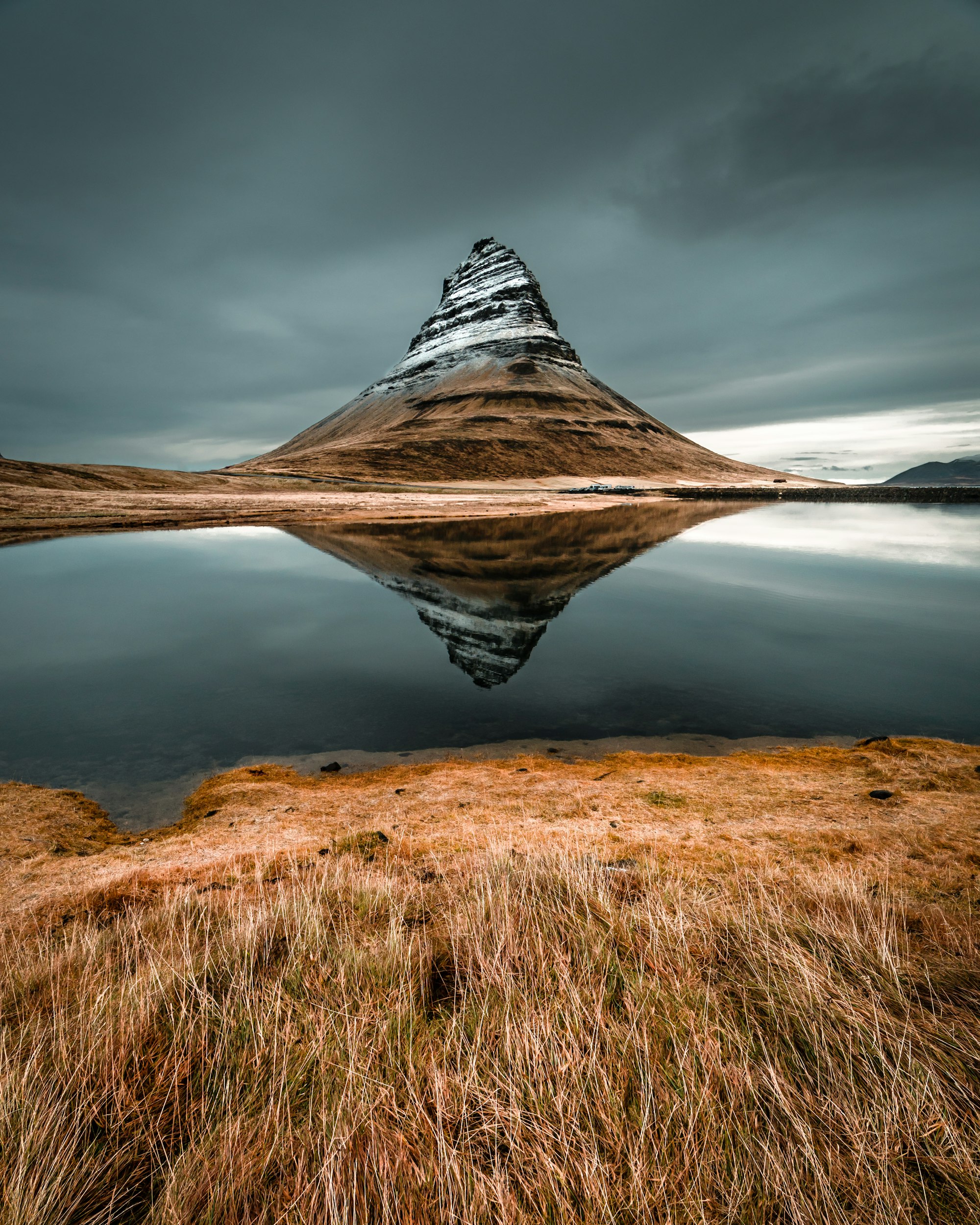
A 463 metre peak at the mouth of the fjord, its layered flanks cut into a sharp ridge by ice. It narrows to an arrowhead seen from the road west of town, near Kirkjufellsfoss, and played the arrowhead mountain in Game of Thrones. The summit route is steep and loose, with fixed ropes at several points, and has killed climbers: go only in summer, in dry weather and with a guide.
-
Berserkjahraun
A moss covered lava field east of the town, poured from craters north of Kerlingarskarð and reaching the sea at Bjarnarhöfn. The sagas give it its name: Víga-Styr set two berserks to clear a track through it and had them killed once the work was done. The track, Berserkjagata, is still walkable, and a gravel loop off Route 54 crosses the whole field.
-
Búlandshöfði
West of town, the coast road to Ólafsvík crosses the face of this steep sea cliff headland, and a pull-off on it gives the long view back along the shore to Kirkjufell. Away from the town lights, it is a dark place to stop for the aurora on a clear winter night. Wind across the headland can be strong enough to push a high vehicle about.
-
Eyrbyggja Heritage Centre
Known locally as Sögumiðstöðin, the small museum on Grundargata shares one building with the tourist information desk and the town library. It is the place to pick up walking maps and ask about road and boat conditions before heading out. The displays cover the fishing village the town grew from and the saga of the Eyrbyggja, which is set on this coast.
-
Grund í Grundarfirði
A guesthouse on a farm just east of town, with Kirkjufell across the fjord from the windows. Outside the town lights, the yard is dark enough to watch the aurora from the door on a clear winter night. A car is needed to reach it, and its few rooms go early in summer and again through the winter aurora months.
-
Grundarfjörður Swimming Pool
An outdoor pool beside the campsite, a few minutes on foot from the main street, with two hot tubs that stay open all year. The pool itself opens only in summer; in winter it is the hot tubs alone, and they close on Sundays. As at every pool in Iceland, showering without a swimsuit before getting in is expected, and the staff will say so.
-
Grundarfoss
A single tall drop off the cliffs southeast of the town, falling clear of the rock face and visible from Route 54 long before the turn. The walk in from the parking area crosses grazing land on a marked path and takes about twenty minutes each way. It is wet underfoot for most of the year and the spray reaches further than it looks.
-
Helgrindur
The long ridge behind the town rises to 988 metres and is the serious full day hike from Grundarfjörður, with more than 900 metres of climbing. From the top the view runs down over the harbour and out across the fjord. Cloud can settle on the ridge quickly, so it suits experienced walkers carrying a map and turning back early in poor weather.
-
Hótel Framnes
Set on the harbour front beside the working port, this hotel is a short drive from Kirkjufellsfoss, which makes sunset and sunrise at the falls easy from one night. The swimming pool and the shops on Grundargata are a short walk away. Rooms are simple, and in July and August it pays to reserve well before the trip.
-
Kirkjufell Hotel
A hotel on the harbour road in the middle of town, with an outdoor hot tub and a sauna looking across the fjord. Kirkjufellsfoss is a five minute drive away, close enough for sunset and sunrise at the falls from a single night. The location is the reason to book: the rooms are plain and some are dated.
-
Kirkjufellsfoss
A low three step waterfall on the Kirkjufellsá, a few minutes on foot from a paid car park west of the town, and the foreground of the most photographed view of Kirkjufell. The path crosses a footbridge that lines the falls up with the peak. Summer afternoons are the busiest time and the car park can fill, so come early in the morning or after dinner.
-
Kolgrafafjörður
The next fjord east of Grundarfjörður, crossed since 2004 by a causeway and bridge that shortened the coast road. Tens of thousands of tonnes of herring died in the fjord in the winters of 2012 and 2013, and a lack of oxygen in the water behind the causeway is the suspected cause. Seals, eider and white tailed eagles use the tidal narrows under the bridge.
-
Kvernárfoss
A waterfall in a small gorge on the Kverná river, at the eastern edge of town. Walk east to where the road crosses the river, then follow the bank upstream for fifteen to twenty minutes. It sees a fraction of the visitors who stop at Kirkjufellsfoss, and the path down to the pool is muddy and slippery after rain.
-
Melrakkaey
A small island out in the fjord, protected since 1972 for its seabirds, with puffin, kittiwake, shag and eider all nesting on it. Landing needs a permit from the national nature agency and shooting is banned within two kilometres. It is watched from the harbour road or from a boat rather than visited.
-
Mýrarhyrna
Climbed on a steep half day hike from the west side of town, this 578 metre spur puts Kirkjufell and the whole fjord below the summit. The route needs no ropes, which makes it the walker's alternative to the Kirkjufell summit, but it has no waymarks, so carry a map or a GPS track. Go on a dry, clear day: in cloud the top gives no view and the way down is hard to find.