Things to do
14-
Bobby Fischer Center
A small museum on Austurvegur, the main street, holding memorabilia of the 1972 world chess championship in Reykjavík between Bobby Fischer and Boris Spassky. Fischer is buried in the churchyard at Laugardælir, about 2km east of town. Pair the two if chess history is the reason for the stop.
-
Eyrarbakki and Stokkseyri
Two small shore villages on the open Atlantic, south of the town across the Flói farmland. Eyrarbakki keeps a long street of painted timber houses from the decades around 1900, and a path along the shore leads on to Stokkseyri. In summer, kayaks go out on the sheltered lagoons behind the Stokkseyri shore, and the walk between the villages takes about an hour.
-
Hotel Grímsborgir
A country hotel in the Grímsnes farmland north of Selfoss, now trading under Kea Hotels, with rooms and suites spread low across the site and hot tubs on the terraces. Kerið is ten minutes away and Þingvellir under an hour. It suits a Golden Circle trip that would rather not sleep in Reykjavík and drive out each morning.
-
Hótel Selfoss
The large hotel in the centre of town, on the bank of the Ölfusá by the bridge, with river views from many rooms and from the restaurant. It has a spa with hot pools. It suits a night between the Golden Circle and the south coast: the food hall, the pool and the river path are all within a short walk.
-
Húsið á Eyrarbakka
A merchant's house built in 1765 on the shore at Eyrarbakki, among the oldest timber buildings in Iceland, and home of the Árnessýsla heritage museum. The rooms show how a trading family on this coast lived, and the village streets outside are part of the visit. It opens daily from May to September; in winter, visits are by appointment.
-
Ingólfsfjall
Flat topped and steep sided, this tuff mountain rises straight out of the plain on the west bank of the Ölfusá, above the edge of town. A short, steep path climbs the face, and a longer circuit crosses the summit plateau in four to five hours. From the top the Flói farmland runs flat to the sea. Turn back in low cloud: the plateau is broad and featureless.
-
Kerið
A volcanic crater lake on Route 35, the first stop on the Golden Circle from Selfoss, with red scoria walls around green-blue water. A path runs round the rim and a stair drops to the water at one end. The crater is privately owned and ticketed, which is unusual in Iceland and is why some tours skip it.
-
Miðbær Selfoss
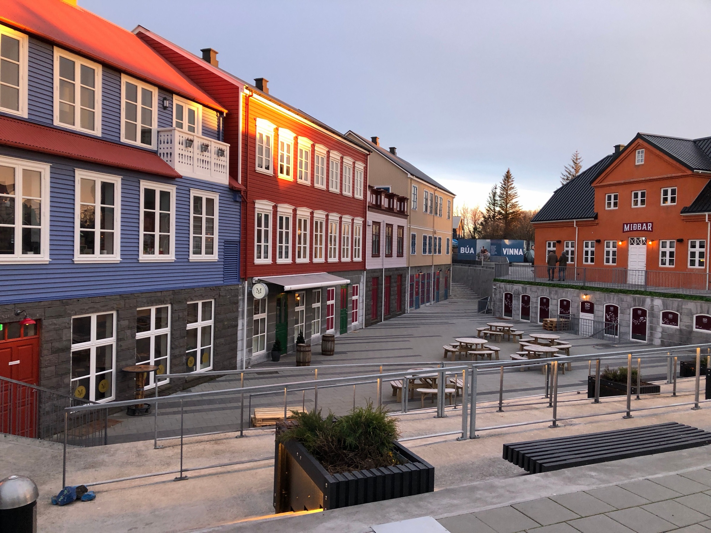
Opened in 2021 a short walk from the bridge, the new town centre is built from copies of timber and stone houses that once stood elsewhere in Iceland. Its heart is the old dairy, now a food hall with several kitchens, a bar and a beer garden. Skyrland, an exhibition on the cultured dairy food skyr, fills the basement, opens daily and is ticketed.
-
Ölfusárbrú
The bridge that carries Route 1 over the Ölfusá in the middle of town; the town grew up around the first bridge on this crossing. From the river path below, the full width of the water runs fast under it. Tryggvaskáli, the old timber house at its end, is the oldest building in Selfoss and now a restaurant.
-
Selfosskirkja
The parish church stands on the bank of the Ölfusá a short walk downstream of the bridge, and the river path runs past it. It looks best from the bridge, with the fast water in front of it. Step inside for a few minutes if the door is open.
-
Skálholt
For more than seven centuries this was the seat of the bishops of southern Iceland, and a school as well as a see. The present church, consecrated in 1963, stands alone on a rise above the Hvítá, on ground where far larger cathedrals once stood. It is about 40 minutes north-east of Selfoss by car, close to the Golden Circle road.
-
Sundhöll Selfoss
The town swimming pool on Tryggvagata, a few minutes on foot from the centre, used by residents far more than by tour groups. Outside there is a 25m lane pool, hot tubs at several temperatures, a steam room and water slides. Entry is ticketed, and the house rule of every Icelandic pool applies: shower without a swimsuit before going in.
-
Urriðafoss
A broad, low fall on the Þjórsá carrying the highest average water flow of any waterfall in Iceland, around 360 cubic metres a second. It is a few minutes off the ring road on road 302 and rarely crowded. A hydropower scheme long proposed for this stretch would remove it, and local residents have fought the plan for years.
-
Þrastaskógur
A wood of 45 hectares along the Sog, beside Route 35 at Þrastalundur on the way to the Golden Circle. It is named for the redwings that nest in it. Marked paths and a picnic ground make it an easy place to stretch the legs on a driving day.