Globe Countries Cities Itineraries World's Best Hotels Events Login
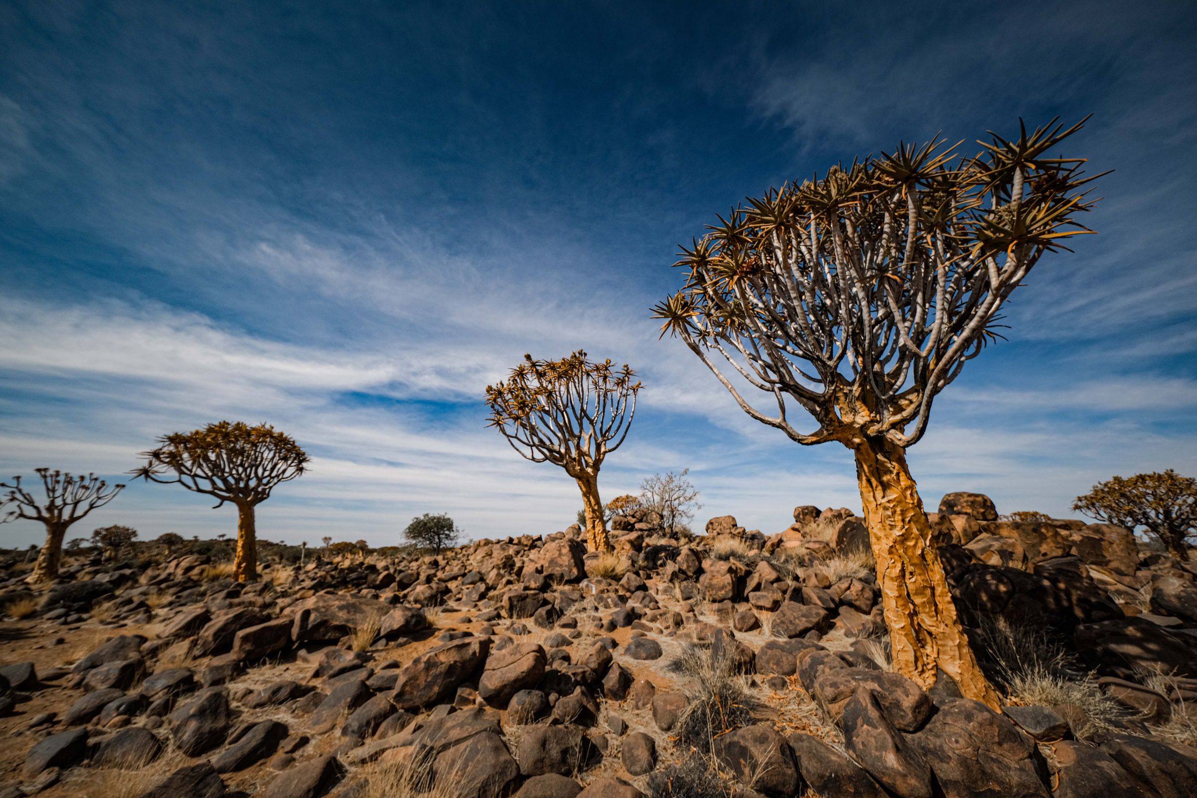
Quiver trees standing among dark dolerite boulders under a wide blue sky near Keetmanshoop
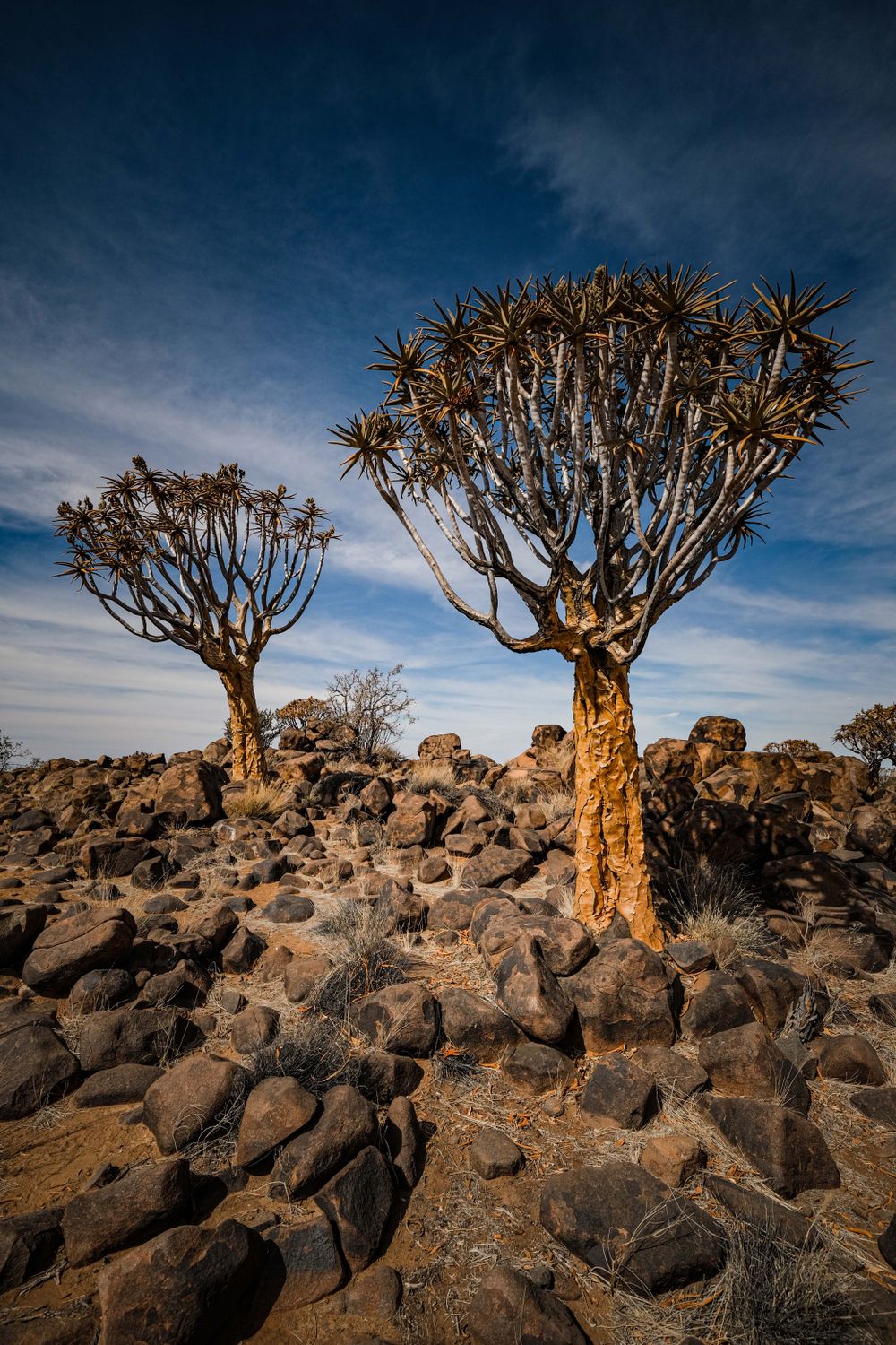
Quiver trees on dark dolerite boulders, the landscape of the forest northeast of town
Town brief · 26.5833°S 18.1333°E

Keetmanshoop

Reach town by mid afternoon: the quiver trees just out of town are the reason to stop, and you want to be walking among them in the last hour before sunset.

View on globe

Why you should go

Ninety seconds on Keetmanshoop

How long
One nightsunset among the quiver trees, the boulders next morning
Getting around
By carthe gravel out to the trees suits any car
When
May to Augustmild days, cold nights; the aloes flower in June and July
Language
English and AfrikaansNama and German are spoken here too
Money
Namibian dollarpegged to the South African rand; shops take rand too
Airports
Windhoek WDHabout 540km north; the town airport has no scheduled flights
How long

How long should I spend in Keetmanshoop?

One night. Arriving by mid afternoon leaves time for the quiver tree forest at sunset, and the next morning covers Giants Playground and the town museum before the drive on to the Fish River Canyon or Lüderitz. A second night adds the guided walk at the Mesosaurus fossil farm or the climb into the Brukkaros crater.

Getting around

Is a car needed in Keetmanshoop?

Yes. The quiver tree forest, Giants Playground and the fossil farm all lie on farms off the C17 gravel road east of town, which an ordinary car manages in dry weather. There are no tours on a fixed timetable, and regular passenger trains have been suspended since 2021. Only the short track to the upper camp at Brukkaros needs a high-clearance 4x4.

When

When is the best time to visit Keetmanshoop?

May to August. Daytime highs run from the low to mid 20s and the quiver trees flower yellow in June and July, though nights drop to around 6°C. December to February brings afternoons in the mid 30s, which makes the shadeless boulder fields hard work after mid morning. Rain is scarce all year and falls mostly in late summer.

Language

What language is spoken in Keetmanshoop?

English is the official language and works at guesthouses, rest camps and fuel stations. Afrikaans is the everyday language of the south. Khoekhoe, the language of the Nama, is widely spoken, and German is still heard on the farms.

Money

What currency is used in Keetmanshoop?

The Namibian dollar, which is pegged one to one to the South African rand; rand notes are accepted alongside it. The town has banks and cash machines, and they are the last reliable ones on the road south to the Fish River Canyon. The farms around town often work in cash.

Airports

What is the nearest airport to Keetmanshoop?

Windhoek's Hosea Kutako International, about 540km north by the B1, a full day's drive. Keetmanshoop has its own small airport northwest of town, but it handles charters only and has no scheduled passenger flights. Self-drive trips crossing from South Africa often start at Upington instead.

Keetmanshoop is a road and rail town of about 28,000 in the far south, where the B1 meets the road west to Lüderitz. It is the last town of any size on the B1 before the Fish River Canyon. What makes it worth a night is a farm 14km to the northeast, where some 250 quiver trees grow among black dolerite boulders.

Take the C17 gravel out of town and buy the permit at the rest camp reception. Walk the forest as the light drops, then come back next morning for Giants Playground, a few minutes further on and covered by the same permit. Its stacked boulders form a maze, so stay on the marked circuit.

To have the trees at sunrise as well, sleep at the rest camp inside the forest. Sleep in town instead and the museum is on your way out next morning. It fills the stone mission church, covers the Nama and the first settlers, and takes under an hour.

With a second morning, phone the Mesosaurus fossil farm, about 40km east on the same gravel road. The farmer walks you to the fossil beds and strikes the dolerite so it rings like metal. Brukkaros, a collapsed volcano west of Tses, makes a full day out: any car reaches the lower camp, and the crater rim is a steep walk of about an hour and a half from there.

From December to February the afternoons reach the mid 30s and the boulders have no shade, so walk early or late and carry water. Fill the tank and draw cash before heading south: towns are few between here and the canyon.

Things to do

6
  1. Quiver Tree Forest

    Quiver Tree Forest

    Landmark · 1.5 hr

    Before sunset, give yourself an hour among about 250 quiver trees, giant forked aloes rather than true trees, growing close together on a farm about 13 km from Keetmanshoop.

    View more →
  2. Brukkaros

    Volcano · 5 hr

    Brukkaros is a collapsed volcanic crater about 4km across, west of Tses. Leave the B1 at Tses and take the D3901 gravel towards Berseba to the camp at the foot of the mountain. Any car reaches the lower camp; from there the rim is about an hour and a half on foot, or drive the rough 2.3km to the upper camp in a high-clearance 4x4 and walk from there in under an hour.

  3. Giants Playground

    Landmark · 1 hr

    Dolerite blocks lie stacked into towers and walls across a wide stretch of open veld, a few minutes' drive past the quiver trees on the same farm. A marked circuit threads the corridors between them, and stepping off it is the quickest way to get lost. The quiver tree permit covers it; walk it in the morning, not on a summer afternoon.

  4. Keetmanshoop Museum

    Museum · 30 min

    The town museum fills the stone Rhenish mission church of 1895, the oldest building in Keetmanshoop. The displays cover the Nama community, the missionaries and the first settlers in the south, with a section on local plants and how the Nama use them. The old imperial post office of 1910 stands a block away and holds the tourist office.

  5. Mesosaurus Fossil Site

    Landmark · 2 hr

    Mesosaurus was a small reptile of an inland sea about 280 million years ago, and its fossils turn up here and in Brazil, part of the evidence that the two continents were once joined. The farmer leads the walk to the fossil beds himself, so phone ahead. On the same ground the dolerite boulders ring like metal when struck, and a dense quiver tree stand grows among them.

  6. Quivertree Forest Rest Camp

    Hotel

    The rest camp sits inside the quiver tree forest on the farm 14km northeast of town, with stone dome huts, rooms and a campsite. A night here puts the trees outside the door at sunset and again at sunrise, before the day visitors arrive. Giants Playground is a few minutes' drive away on the same permit.
Basemap Meridian · data © OpenStreetMap
Explore

More of Namibia

Namibia
Country

Namibia

Every Namibia town, place and dispatch, on one map.

Lüderitz
Town

Lüderitz

Jugendstil houses stand on bare rock above a cold bay, put up in a hurry when diamonds were found in the sand nearby.

Fish River Canyon
Canyon · Hobas

Fish River Canyon

Sesriem
Town

Sesriem

A permit office, a fuel station, a shop and a scatter of lodges and camps make up this hamlet at the gate of the Namib-Naukluft park.

Kolmanskop
Ruins · Lüderitz

Kolmanskop

At sunrise, a photographer's day pass lets you walk an abandoned diamond town almost alone, before the guided walks begin.

Sources 1

The official pages this guide was checked against.

Last updated