Globe Countries Cities Itineraries World's Best Hotels Events Login
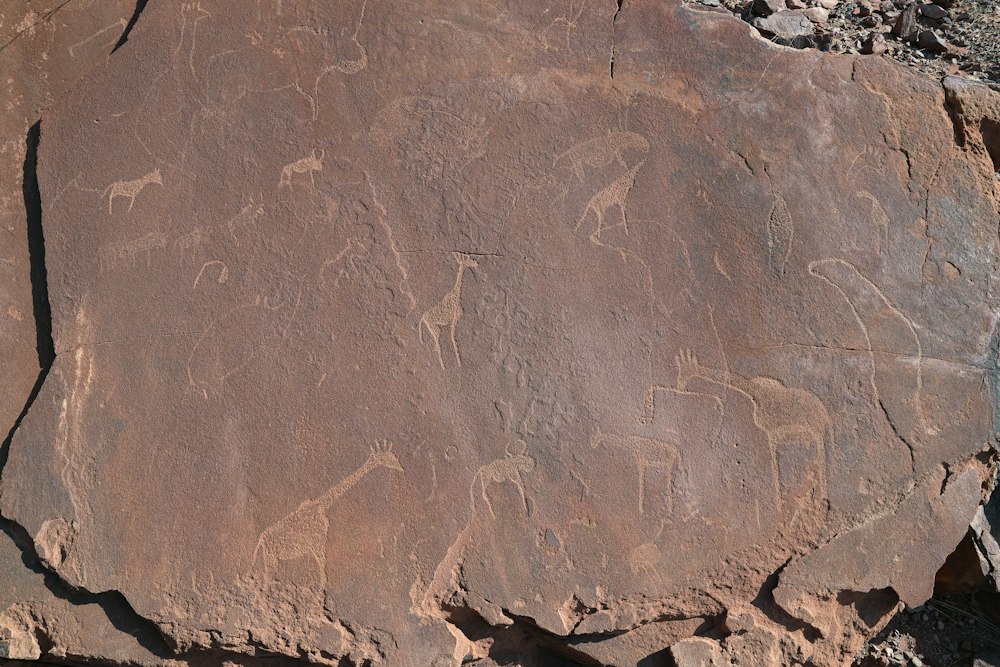
Engraved giraffes on a slab of red sandstone at Twyfelfontein, with scrub and a flat-topped ridge behind under a clear sky
Engraved giraffes on the valley's sandstone, below the ridge above the spring
Town brief · 20.5956°S 14.3726°E

Twyfelfontein

See rock engravings thousands of years old in the morning and desert elephants in a dry riverbed by afternoon, from a lodge along the dry Aba-Huab riverbed.

View on globe

Why you should go

Ninety seconds on Twyfelfontein

How long
Two nightsa morning for the engravings, an afternoon for elephants
Getting around
Your own car, on gravelthe last stretch is the corrugated D2612 and D3254
When
May to Septemberdry and clear; October to March is hot, with rain from January
Language
Englishguides also speak Khoekhoegowab, and Afrikaans is widely understood
Money
The Namibian dollar, in cashcarry cash for the engraving site; the card machine is not reliable
Airports
Windhoek WDHabout 430 km by road; charters land at a lodge airstrip
How long

How many nights do you need at Twyfelfontein?

Two nights. The engravings take a morning, best started at the eight o'clock opening before the rock heats up, and the desert elephant drives along the dry riverbeds run in the afternoon. A second night gives a back-up afternoon for the elephants and an evening at the Organ Pipes and Burnt Mountain. One night is enough only without the elephants.

Getting around

Do you need a 4x4 for Twyfelfontein?

A two-wheel-drive car manages the main gravel roads in the dry season: the C39 from Khorixas, then the D2612 and D3254, both rough, with washboard and soft sand in patches. A high-clearance 4x4 is needed for Doros Crater and helps after rain. There is no public transport; the alternative to driving is a lodge transfer or a fly-in safari.

When

When is the best time to visit Twyfelfontein?

May to September, the dry season, with clear days in the mid to high twenties and nights that drop close to freezing in June and July. From October to March the days are hot, and the rains, when they come, fall between January and March and can make the riverbed tracks impassable.

Language

What language is spoken at Twyfelfontein?

English, Namibia's official language, is used by the site guides and at the lodges. The guides come from the local conservancy and speak Khoekhoegowab, the Damara and Nama language, at home. Afrikaans is widely understood across the region.

Money

Can cards be used at Twyfelfontein?

Sometimes, but cash is the safer plan: the visitor centre may take cards when its terminal works, and there is no cash machine in the valley. Namibian dollars and South African rand are both accepted at one to one, so draw cash in Windhoek, Swakopmund or a larger town on the way in.

Airports

Which airport is closest to Twyfelfontein?

Hosea Kutako International (WDH), outside Windhoek, is the main gateway, about 430 km by road, or roughly five hours of driving before stops. Walvis Bay (WVB) suits a route that starts on the coast. Fly-in safaris use the gravel airstrip at Twyfelfontein Country Lodge, which takes charter flights only.

There is no town at Twyfelfontein. The engravings sit in a valley inside a community conservancy, and the beds are in a handful of lodges and camps along the dry Aba-Huab riverbed, between three and twenty kilometres away. Book the bed before you set off, because the nearest town is a ninety-minute drive.

The visitor centre opens at eight. The guided loop takes about an hour, but it climbs over boulders on bare sandstone that is hot by mid morning, so wear closed shoes and carry water and a hat. Ask for the Lion Man route for the best-known panel; the Dancing Kudu route covers the other half of the site.

Spend the afternoon on the riverbeds. Most lodges run drives along the Aba-Huab and the Huab in open vehicles to look for desert-adapted elephants, which dig for water under the sand. Sightings depend on where the herds are that week, so book the drive for your first afternoon and keep the second as a back-up.

Visit the Damara Living Museum later the same morning: it sits about ten kilometres north on the road to the lodges, and Damara guides from the nearby settlements demonstrate fire-making, tool-making and plant medicine. Leave the Organ Pipes and Burnt Mountain, which stand side by side a short drive south-east, for the last light of the day.

Most of what goes wrong here is the road. Signs to the engravings are few, the gravel is corrugated and sandy in places, and between January and March rain can bog a vehicle in a riverbed. Fill the tank in Khorixas, Uis or Palmwag before the last stretch of gravel, drive slowly, and arrive before dark.

Things to do

14
  1. Twyfelfontein Rock Engravings

    Twyfelfontein Rock Engravings

    Archaeological Site · 2 hr

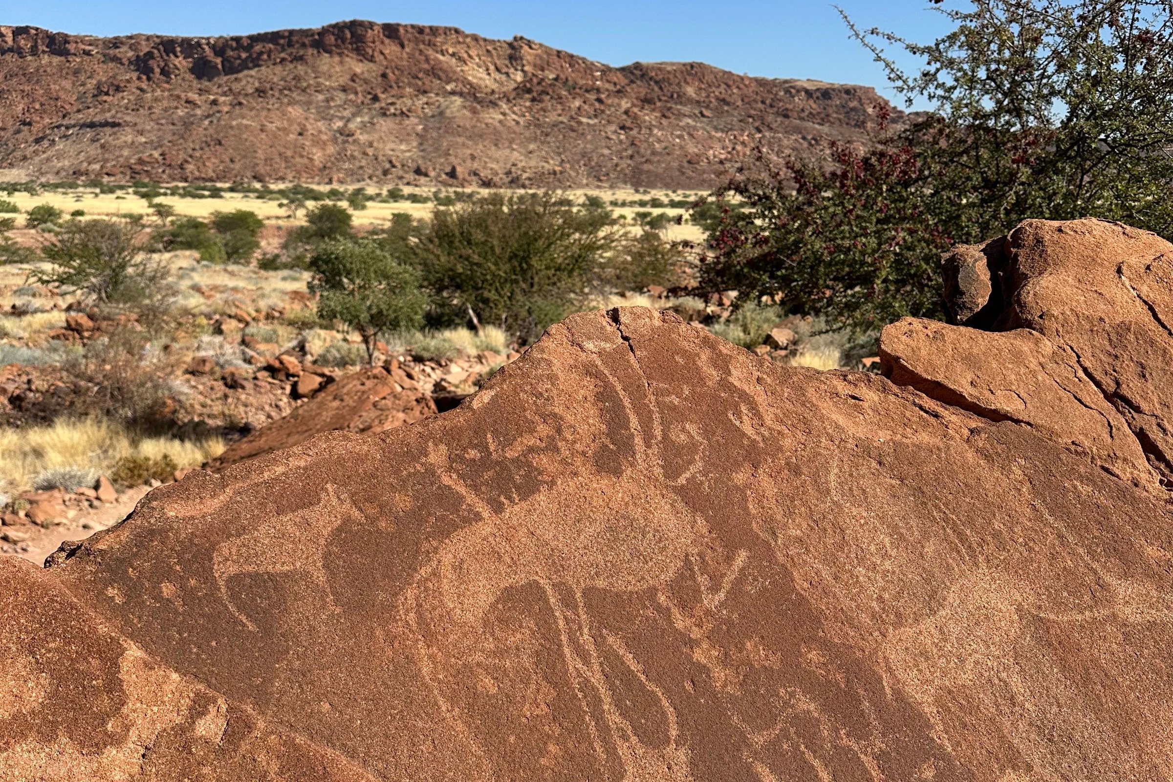
    Twyfelfontein puts more than 2,000 engravings of animals and their tracks on sandstone slabs above a desert spring, and a guide walks you to the Lion Man or the Dancing Kudu.

    View more →
  2. Aba-Huab River

    Other · 3 hr

    The dry bed of the Aba-Huab runs past the lodges north of the engravings, and water below the sand keeps its trees green enough to draw desert-adapted elephants. The lodges run afternoon drives along it in open vehicles. Elephant movements change week to week, so a drive is never a promise, and the sand is soft after rain.

  3. Burnt Mountain

    Landmark · 30 min

    Heat from an intrusion baked the shale of this ridge into blackened hornfels, leaving a slope that carries almost no plants. Come at sunrise or in the last hour of light, when the slope shows reds and purples. A viewing point sits beside the road and the walking is limited.

  4. Camp Kipwe

    Hotel

    Rooms are tucked among granite boulders east of the valley, a short drive from the engravings, the Organ Pipes and Burnt Mountain. The camp runs drives along the dry riverbeds in search of desert elephants, and the boulders behind it make a natural sundowner spot.

  5. Damara Living Museum

    Museum · 1.5 hr

    Watch Damara men and women light a fire with sand and sticks, forge tools and name the bush plants that feed and heal.

    View more →
  6. Doro Nawas

    Hotel

    On a low ridge about fifteen kilometres north-west of the engravings, this camp lets guests pull their beds out onto the deck and sleep under the stars; between May and August that means a night near freezing. Guided drives run to the engravings and along the Aba-Huab and Huab riverbeds after the elephants.

  7. Doros Crater

    Landmark · 5 hr

    A ring of dark volcanic hills about 18 kilometres south of the engravings, reached on a rough track that needs a high-clearance vehicle and a GPS route. There is nothing out there, so carry in all the water and fuel for the trip.

  8. Mowani Mountain Camp

    Hotel

    Thatched domes are set among granite boulders on a ridge above the Aba-Huab, so the rock screens most rooms from each other. A sundowner point looks west over the valley. Drives run to the engravings and out along the riverbed after the elephants.

  9. Organ Pipes

    Landmark · 30 min

    Dark volcanic rock cooled into tight, many-sided columns that now line the walls of a small gorge. A short path leads down from the parking area. The columns are only a few metres tall, so pair the gorge with Burnt Mountain next door.

  10. Petrified Forest

    Landmark · 1.5 hr

    Trunks turned to stone lie half buried across a slope west of the town, carried down by floodwater from far away and fossilised where they stranded. The growth rings and bark are still legible in the rock. Guides from the community walk each group round, and welwitschias grow among the trunks.

  11. Twyfelfontein Country Lodge

    Hotel

    Set against a red sandstone outcrop under three kilometres from the engraving site, this is the closest bed to the rock art. It runs its own elephant drives, and a gravel airstrip beside it takes the charter flights that fly-in safaris use.

  12. Ugab Terrace Lodge

    Hotel

    Rooms sit on the edge of the terrace looking across at the pillar, with a restaurant built on the clifftop above them. A path runs along the rim from the lodge. It is the closest bed to the Vingerklip, which is how guests come to see the valley at either end of the day.

  13. Vingerklip

    Landmark · 1.5 hr

    A limestone finger left standing when the rest of the Ugab terrace eroded away rises about thirty five metres out of the valley floor. A short steep path climbs to its base. The surrounding flat topped hills are the remains of the same surface, which makes the whole valley read as a scaled down Monument Valley.

  14. Wondergat

    Landmark · 30 min

    A collapsed sinkhole drops into darkness a short walk from a parking spot off the D3254, about four kilometres north of the engravings. The rim is loose rock, so stay well back from the edge and keep children close. It makes a quick stop on the way to or from the lodges.
Basemap Meridian · data © OpenStreetMap
Explore

More of Namibia

Namibia
Country

Namibia

Every Namibia town, place and dispatch, on one map.

Spitzkoppe
Town

Spitzkoppe

Brandberg
Landmark · Uis

Brandberg

45 minutes on foot up a dry granite gorge takes you to the White Lady, the best known painting on Namibia's highest mountain.

Okaukuejo
Town

Okaukuejo

Cape Cross
Landmark · Swakopmund

Cape Cross

Sources 1

The official pages this guide was checked against.

Last updated