Globe Countries Cities Dispatches World's Best Events Get the App
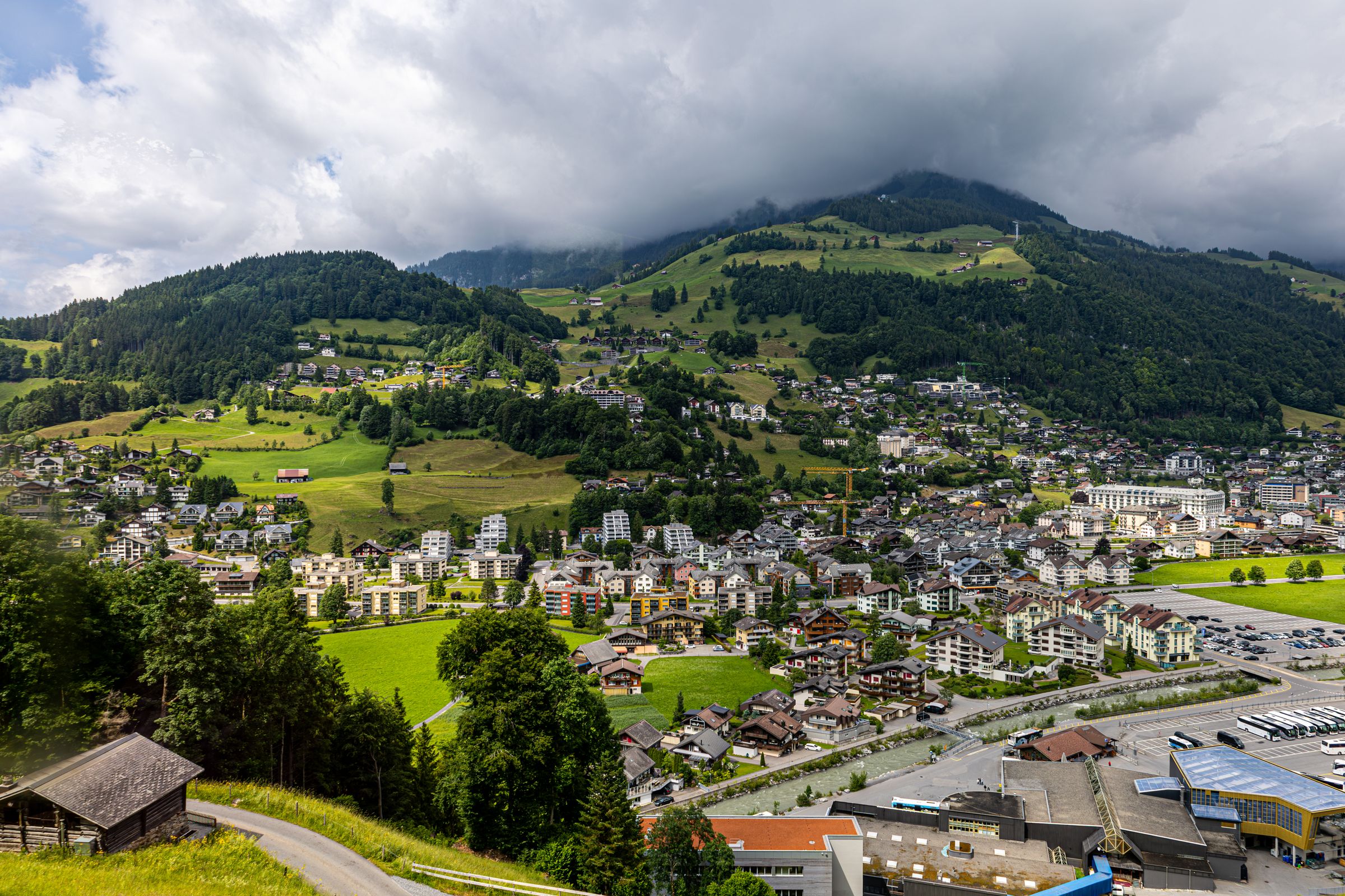
Engelberg seen from the hillside above, chalets and apartment blocks across the green valley floor under forested slopes and low cloud
The village from the slopes above · about four thousand people live at the end of the line from Lucerne
Town brief · 46.8207°N 8.4018°E

Engelberg

Day-trippers from Lucerne ride up the Titlis and leave; stay two nights and your second day is for the quieter side of the valley, the Fürenalp cable car and the walk down past the waterfalls.

View on globe

Why you should go

Ninety seconds on Engelberg

How long
Two nightsone for the Titlis, one for Brunni or the Fürenalp
Getting around
On foot and the free busthe village bus to the station and every lift station is free
When
July to Septemberevery lift and summer hut open; skiing into late spring
Language
GermanSwiss German spoken; English common at the lifts
Money
The Swiss franceuros are of little use; cards taken almost everywhere
Airports
Zurich ZRHabout two hours by train, changing at Lucerne
How long

How many days do you need in Engelberg?

Two nights covers the essentials: one day for the Titlis, with Trübsee on the way down, and one for the Brunni side or the Fürenalp cable car and the walk back to the village. A third night adds a long hike, such as the Surenen Pass or the walk over the Jochpass to Engstlensee, or a day trip to Lucerne.

Getting around

Do you need a car in Engelberg?

No. The village is walkable, and a free local bus runs at short intervals to the train station and the valley station of every lift through the summer and winter seasons, with a reduced service in the quiet weeks between them. The road and the railway both end at Engelberg, and most visitors arrive by train from Lucerne.

When

When is the best time to visit Engelberg?

July to September for walking, when the summer huts, the Trübsee loop and every lift are open. Snow tubing at the Titlis Glacier Park runs from late May to mid July, snow permitting. The ski season lasts from autumn into late spring.

Language

What language is spoken in Engelberg?

German, spoken day to day as Swiss German. Signs and timetables are in standard German, and English is widely spoken at the lifts, in hotels and at the tourist office.

Money

What currency does Engelberg use?

The Swiss franc. Euros are of little use in the village, but cards are accepted almost everywhere, including the lift ticket offices. Some francs in cash are useful at the small summer huts on the alps.

Airports

Which airport do you fly into for Engelberg?

Zurich, ZRH, about two hours away by train with a change at Lucerne, where the trains for Engelberg leave every hour.

Engelberg sits where the railway from Lucerne ends, on a flat valley floor ringed by cliffs and glaciers. Lifts leave from the edge of the village on both sides, the Titlis to the south and the Brunni slopes to the north, so a different mountain is a short walk or bus ride away each morning.

Save the Titlis for your clearest morning, and check the summit webcam before you buy a ticket. In cloud the top station shows you nothing, and the lake at Trübsee or the Brunni side is the better use of the day. Wear closed shoes with grip and bring a jacket, because the glacier cave stays below freezing even in July.

The Brunni side is gentler and suits children: a cable car and a chairlift reach a small lake with a barefoot path. For a longer day, ride the Fürenalp cable car up and walk back down past the Stäuber waterfall and the summer cheese huts to the valley station.

Out of season some lifts close for a few weeks of maintenance, usually in spring and November, and the last cabins down leave in the late afternoon. Plan a long walk so that it ends at a lift with time to spare.

Sleep near the station and the Titlis valley station and you can walk to both; the chalets up the slopes are quieter but need the bus. Trains to Lucerne leave every hour and take 43 minutes, so the lake makes a good plan for a cloudy day.

Things to do

11
  1. Titlis

    Titlis

    Viewpoint · 4 hr

    The top station sits at about 3,020 metres, just below the 3,238-metre summit, with a glacier cave cut into the ice and a suspension bridge along the cliff. The revolving Rotair is the usual way up; when it is closed for maintenance, the TITLIS Connect cableway runs instead. Go up on the first lift, before the tour groups fill the cabins from mid morning.

  2. Canyon

    Aa Gorge

    Canyon · 2 hr

    A shaded path follows the river down from the village through a wooded gorge, with bridges, small falls and mossy rock, as far as Grafenort. Take the train back up from Grafenort station. Wet roots and stones make the narrow sections slippery, so wear shoes with grip.

  3. Engelberg Abbey

    Monastery · 1.5 hr

    A Benedictine community founded in 1120 still occupies the head of the valley, in Baroque buildings raised after a fire in 1729. The abbey church holds the largest organ in Switzerland, with 137 stops on four manuals. Guided tours of the monastery can be booked ahead, and a show dairy inside the walls makes cheese in front of visitors.

  4. Ski Resort

    Engelberg-Titlis

    Ski Resort · 6 hr

    In winter the lifts above Trübsee, the Jochpass and the Titlis make one ski area, with the glacier at the top skied from autumn into late spring. The Laub, a long open face dropping toward Gerschnialp, is the run freeriders come for. The sunnier Brunni slopes across the valley are smaller and lose their snow first.

  5. Lake

    Engstlensee

    Lake · 4 hr

    From Trübsee a chairlift climbs to the Jochpass, and a path drops from the pass to this lake on the Bernese side. The water is clear and very cold, with an old mountain hotel on the shore at Engstlenalp. To get back, ride the Engstlenalp chairlift up to the pass and walk down to Trübsee.

  6. Fürenalp

    Viewpoint · 2.5 hr

    A steep cable car climbs the other side of the valley to an alp at 1,850 metres with a full view of the Titlis across the valley. A hard via ferrata climbs the cliff below the top station, for those with a head for heights or a guide.

  7. Lake

    Härzlisee

    Lake · 2.5 hr

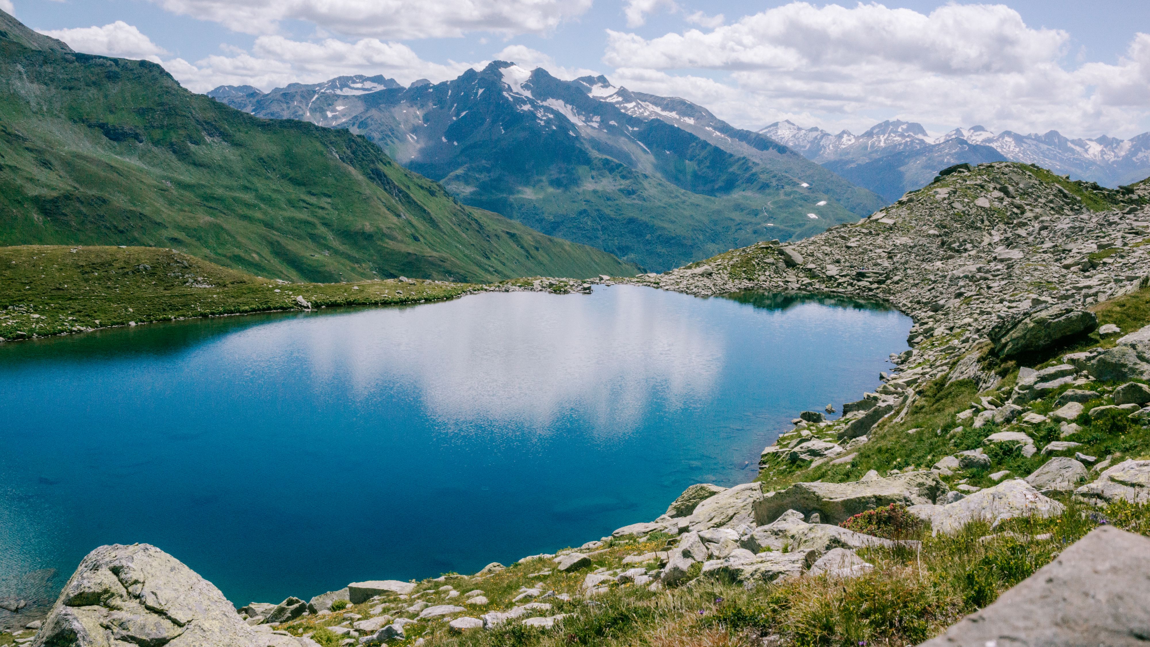
    A small heart-shaped lake on the Brunni side of the valley, reached by the cable car to Ristis and a chairlift, with a barefoot path around the shore and a mountain hut beside it. The easy Brunnistöckli via ferrata starts a short walk away, and via ferrata kits can be hired at the lift. In summer this is the quieter mountain, and the better one for children.

  8. Waterfall

    Stäuber Waterfall

    Waterfall · 4 hr

    Near the head of the valley a big fall pours off the rock below the Fürenalp, on the walk from the top of that cable car down past the summer huts at Aebnet and Stäfeli to the valley station. The path is long but mostly downhill, and the huts sell cheese from their own alps. They open only in the alpine summer, so outside it carry food.

  9. Other

    Surenen Pass

    Other · 8 hr

    The old route out of the valley crosses this pass on foot into canton Uri and ends at Attinghausen, near Altdorf, with the train back by way of Lucerne. Start at Stäfeli to shorten the climb and allow a full day. It is a serious mountain walk, so go only in settled weather in high summer or early autumn.

  10. Waterfall

    Tätschbachfall

    Waterfall · 1.5 hr

    Off the cliffs on the south side of the valley, this waterfall is about an hour's level walk from the village along the river toward the Fürenalp lift. It runs fullest in early summer with the snowmelt, which makes it a good short outing on an evening or a cloudy day.

  11. Trübsee

    Lake · 2 hr

    A lake at 1,764 metres on the way up the Titlis, with a flat path around it of about an hour and a half and the Titlis wall standing over the far end. It is where the ascent is usually broken and it is worth stopping for on its own.
Basemap Meridian · data © OpenStreetMap
Explore

More of Switzerland

Switzerland
Country

Switzerland

Every Switzerland town, place and dispatch, on one map.

Weggis
Town

Weggis

Mount Pilatus
Viewpoint · Lucerne

Mount Pilatus

Come in summer or early autumn and you can ride a loop: boat from Lucerne, cogwheel railway up, cableway and gondolas down to Kriens.

Andermatt
Town

Andermatt

A village at the crossing of the country, where the roads over the Gotthard, Furka and Oberalp passes meet in one valley at 1,437 metres.

Chapel Bridge
Bridge · Lucerne

Chapel Bridge

Last updated

Meridian Dispatch for iPhone

Plan the trip.
Keep the journal.

Every other travel app asks you to start logging. Meridian Dispatch opens with years of your travel already written, from the photographs you already took.