Things to do
17-
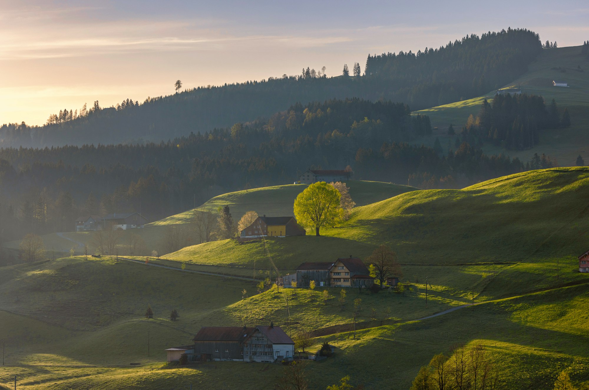
Appenzell Village
Along the Hauptgasse, gabled wooden house fronts carry painted flowers, animals and lettering above shops selling cheese, embroidery and Biber gingerbread. The street opens onto the Landsgemeindeplatz, a car park for most of the year, where on the last Sunday of April the canton's voters decide its business by a show of hands. The station is a five minute walk away.
-
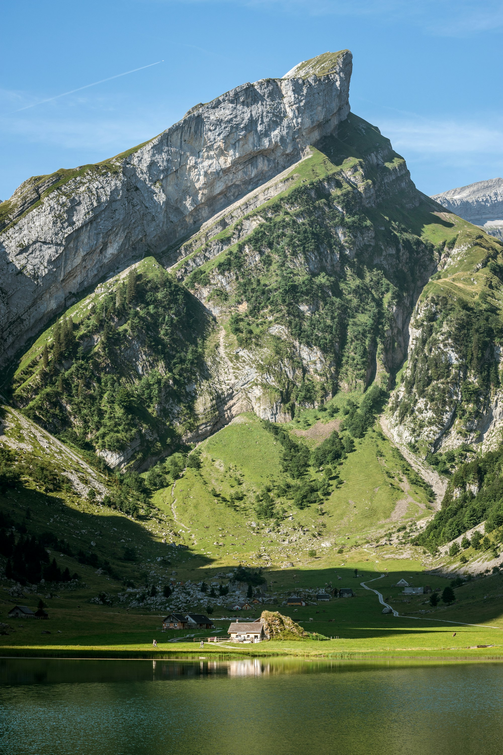
Seealpsee
Under the Saentis at 1,142 metres, this lake fills a bowl reached on foot from Wasserauen station in about an hour, on a steep but mostly paved track. Two mountain inns stand on the shore, and on hot summer days swimmers use the water. Its reflection of the Alpstein wall is the picture the canton is sold on.
-
Museum
Appenzell museum of popular traditions
In Urnäsch, a short train ride west, two old houses hold the costumes, bells and painted milk pails of the Appenzell farming year. The highlight is the masks and headdresses worn by the Silvesterchläuse, who walk the village on 31 December and again on 13 January. Come on one of those days to see the real thing in the street.
-
Other
Appenzeller Schaukäserei
In the village of Stein, about fifteen minutes north by road, a working dairy shows Appenzeller cheese being made behind glass, with a walk through the cellar where thousands of wheels ripen. Come in the morning, since the cheese making finishes by mid-afternoon. A tasting of the different ages ends the visit.
-
Ebenalp
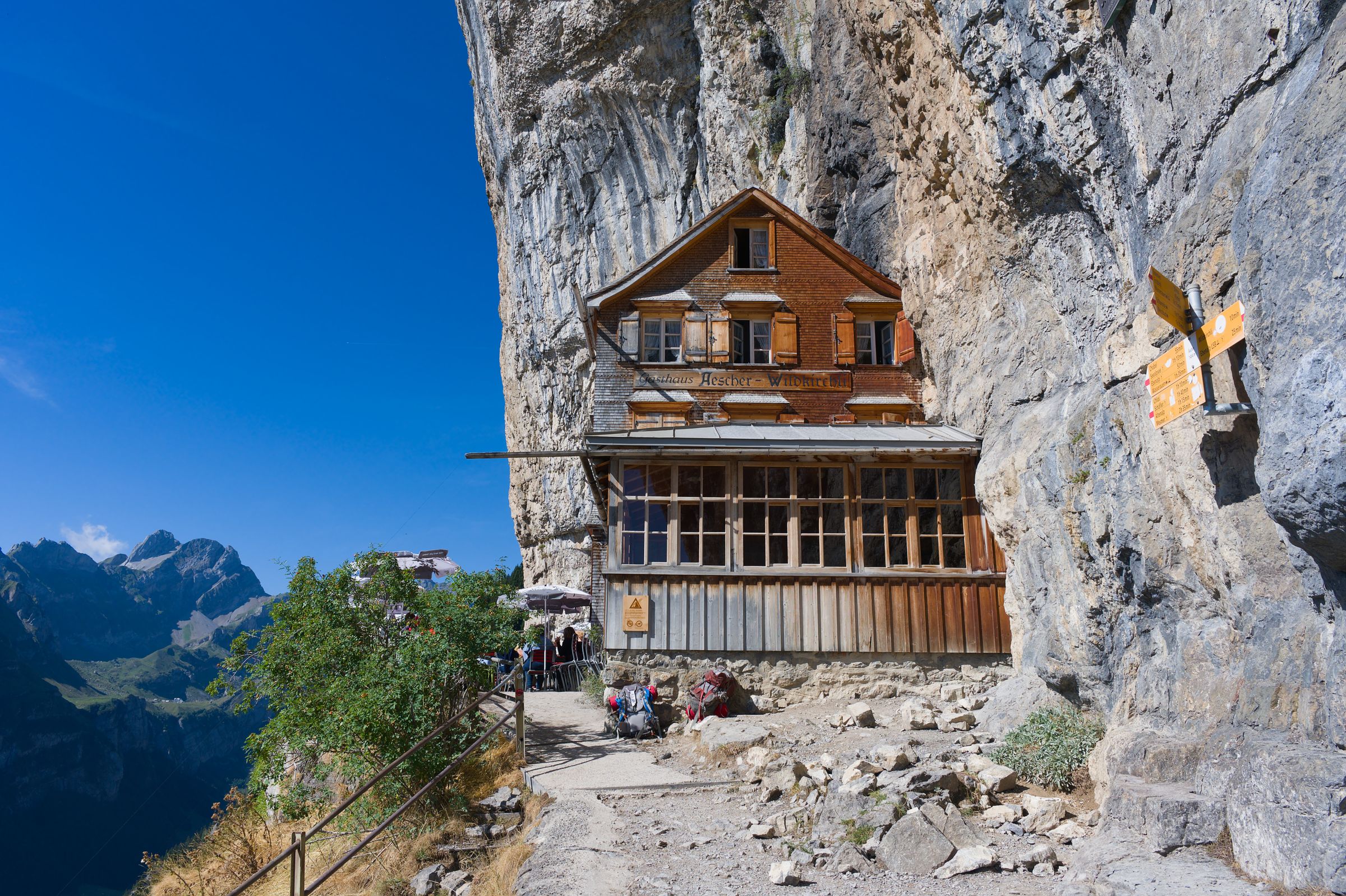
A cable car from Wasserauen station climbs to this ridge at 1,644 metres, with open views over the green Appenzell hills. From the top, a path drops about fifteen minutes through the Wildkirchli caves to the Aescher guest house, built under the cliff. The path on down to the Seealpsee is narrow and exposed above a drop, so walkers who are not sure-footed should return to the top and ride the cable car down.
-
Lake
Fälensee
A long green lake lies in a trench between two rock ridges, with a mountain inn on its shore at Bollenwees. It is reached on foot only, either up from Brülisau past the Sämtisersee or down from Hoher Kasten along the ridge. Budget a full day and start early, since the walk out is as long as the walk in.
-
Viewpoint
Hoher Kasten
A cable car from Brülisau climbs to a summit at 1,794 metres with the Rhine valley falling away on one side and the Alpstein on the other. A rotating restaurant turns a full circle in about an hour, and a short loop on the top shows four countries on a clear day. Walk down to Brülisau in about ninety minutes, or follow the ridge toward the Saxer Lücke.
-
Viewpoint
Kronberg
From Jakobsbad, a few stops west on the Gossau line, a cable car climbs to a grassy summit at 1,663 metres facing the full wall of the Säntis. It is the gentler of the three local lifts, with a summer toboggan run, a rope park and easy paths down. Come for the morning view, before cloud builds on the Alpstein.
-
Gallery
Kunsthalle Ziegelhütte
Brick kilns and a tall chimney from a former tile works now hold a contemporary art space on the edge of town, five minutes' walk from the station. The old drying lofts make long, timbered galleries for changing shows. It shares opening days with the Kunstmuseum and closes on Monday and Tuesday.
-
Gallery
Kunstmuseum Appenzell
Beside the station, this gallery sits in a long building clad in silver steel shingles with saw-tooth roofs, designed by Gigon/Guyer. Inside, the rooms are lit from above and show changing exhibitions alongside the work of the Liner family of painters. The Kunsthalle Ziegelhütte, five minutes' walk away, runs a separate programme, and both close on Monday and Tuesday.
-
Museum
Museum Appenzell
Next to the town hall on the Hauptgasse, an old town house covers the canton's embroidery, costume, farm painting and the open-air vote held in the square outside. Labels are mostly in German, so ask at the desk for the English guide. It shares a door with the tourist office, which makes it the natural first stop.
-
Church
Parish Church of St. Mauritius
Steps from the Landsgemeinde square, the parish church has a tall tower that marks the centre from every approach road. Inside, the nave is bright, with painted ceilings and gilded altars. Look in on a weekday, since Sunday mornings are for mass.
-
Saentis
Standing alone at the north edge of the Alpstein, this summit at 2,502 metres looks across six countries on a clear day: Switzerland, Germany, Austria, Liechtenstein, France and Italy. A cable car climbs from Schwaegalp to the top, where a tall transmitter tower stands. Pack a warm layer even in summer.
-
Lake
Sämtisersee
Above Brülisau, a farm track climbs for about an hour to a shallow lake in a closed valley under the Alpstein ridges. The water drains away underground, so in a dry summer the lake shrinks and the meadow shore widens. Carry on over the low saddle and the path reaches the Fälensee.
-
Viewpoint
Saxer Lücke
A notch in the Alpstein ridge looks straight along a row of tilted limestone fins called the Kreuzberge, with the Rhine valley far below. Most walkers come along the ridge from Hoher Kasten or up from the Fälensee, a long day either way. Leave it for a dry day, because the rock and grass turn slippery after rain.
-
Viewpoint
Schäfler
Above Ebenalp, a mountain inn stands on a narrow summit at 1,924 metres with the Seealpsee straight below and the Säntis across the gap. The path from the cable car takes about ninety minutes and is steep and rocky near the top. Book a bed there to see sunset and sunrise without walking down in the dark.
-
Landmark
Wildkirchli
Fifteen minutes down the path from the Ebenalp cable car, a hermit's chapel sits in the mouth of a cave in the cliff. The walk goes through the cave itself, which is dark and wet underfoot, so carry a torch. On the far side the path drops to the Aescher guest house, built under the overhang.