Things to do
17-
Basílica de Santa María de la Asunción
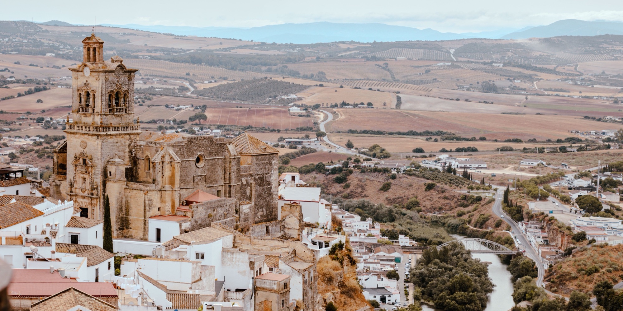
The main church of Arcos fills one side of the Plaza del Cabildo, a Gothic nave behind a carved stone front, with a Renaissance main altarpiece inside. One ticket covers the church and the bell tower, which is climbed in small groups every half hour for a view down onto the white rooftops and the river. Opening hours are short and stop for a long break at lunch, so mornings suit a visit best.
-
Convento de las Mercedarias Descalzas
The last enclosed convent in Arcos stands on the lane from the Plaza del Cabildo towards San Pedro. The nuns bake biscuits and almond sweets and sell them through a revolving wooden hatch, so the buyer never sees the seller. Buyers ring the bell, ask through the grille and leave the money on the turn; nobody answers during the long lunch break.
-
El Bosque
A village at the western gate of the Sierra de Grazalema park, home to the park's main visitor centre, which answers questions on the restricted walks and their permits. The easy riverside path along the Majaceite starts here and follows the water upstream under shade to Benamahoma. Trout from the local farm is the dish on the menus around the square.
-
Lake
Embalse de Zahara-El Gastor
The reservoir under Zahara de la Sierra fills a valley of olive groves with water that turns bright turquoise on clear days. The Arroyomolinos recreation area on its shore has a small beach, a swimming area and kayak hire in summer. The shore is stony, so water shoes help, and the car park fills early on hot weekends.
-
Garganta Verde
A narrow gorge with walls up to 400 metres high, reached by a steep path from the Zahara to Grazalema road. Griffon vultures nest on the ledges. The path ends at a large cave, the Cueva de la Ermita, on the gorge floor, and the climb back out is the hard part. A free permit, booked online through the Junta de Andalucía, is required. The path is closed from 1 June to 15 October for fire risk.
-
Grazalema
Most walkers in the Sierra de Grazalema Natural Park sleep in this mountain village of whitewashed houses under grey limestone peaks. It is one of the wettest places in Spain, with most rain between November and April. The blanket mill on the Ronda road is open to visitors on weekdays, except in August, and viewpoints on the edge of the village look down the valley. Cars stay at the village entrance.
-
Iglesia de San Pedro
The second parish church sits at the eastern end of the old town, right on the cliff edge, reached through a maze of narrow lanes from the Plaza del Cabildo. Its Baroque bell tower can be climbed, but the top has few railings and is no place for anyone uneasy with heights. Entry is ticketed, and the Mirador de Abades is a few steps away.
-
Lago de Arcos
A reservoir on the Guadalete directly below the eastern end of the cliff, ringed by reedbeds that shelter herons and other water birds. Kayaks and paddleboards are hired on the shore in the warm months, and the water gives the classic view up to the white town on its rock. A path follows part of the bank for an evening walk.
-
Mirador de Abades
A small terrace at the end of Calle Abades, entered through a whitewashed arch near San Pedro, looks down over the lower town, the river bend and the olive country to the south. It is quieter than the Plaza del Cabildo balcony and better at sunset, when the houses below turn pink and the swifts circle the cliff. Free, and open at any hour.
-
Village
Olvera
Olive groves surround this hilltop town on every side, and its Moorish castle and large church can be seen from kilometres away. The castle is ticketed and its tower looks over the groves to the mountains. The old station at the foot of the town is one end of the Vía Verde de la Sierra cycle path, so a visit pairs well with a ride.
-
Palacio del Mayorazgo
A noble house beside San Pedro with a carved Renaissance doorway, now used by the town as a cultural building. When it is open, entry is free, and the patio and upper floor give a view over the rooftops towards the countryside. It makes an easy stop on the walk between San Pedro and the Mirador de Abades.
-
Parador de Arcos de la Frontera
The state parador occupies the old magistrate's house on the Plaza del Cabildo, at the very edge of the cliff. The rooms worth booking are the ones on the cliff side, whose balconies hang over the drop and face the sunset across the Guadalete plain. Guests can drive up to the square, which spares the walk up the lanes with luggage. Rooms for Easter sell out well ahead.
-
Pinsapar de Grazalema
A forest of Spanish fir, a tree that survives in only a few mountain ranges, grows on the north slope of the Sierra del Pinar. The marked path from the Grazalema road to Benamahoma crosses it with a steep climb and descent, and ibex are often seen. A free permit, booked online through the Junta de Andalucía, is required, and the path is closed from June to mid October for fire risk.
-
Plaza del Cabildo
The square at the top of the old town holds the town hall, the Parador, the basilica and the walls of the dukes' castle, which is private. Its open side is the Mirador de la Peña Nueva, a railed balcony over a sheer drop to the Guadalete and the farmland beyond. Kestrels and swifts nest in the cliff face below, and late afternoon light falls straight across the plain.
-
Puerto de las Palomas
The mountain pass on the road between Zahara and Grazalema climbs through tight hairpins to a viewpoint at the top, with the Zahara reservoir far below on one side and the peaks of the park on the other. Griffon vultures ride the air currents close to the parking area. The bends are sharp and unlit, so the pass is a daylight drive.
-
Other
Vía Verde de la Sierra
An old railway bed between Puerto Serrano and Olvera turned into a car-free path for cyclists and walkers, about 36 kilometres long, through 30 tunnels and over high viaducts. Halfway along, the Peñón de Zaframagón rock holds a large griffon vulture colony, watched from an observatory in the old station. Bikes are hired at the stations, and a light helps in the longest tunnels.
-
Village
Zahara de la Sierra
Houses climb a steep hill to a ruined Moorish tower here, with a turquoise reservoir spread below. The path up to the tower is short but steep and gives a view across the lake to the Sierra de Grazalema. Afterwards, the small square by the church is the place to sit. The village has a single steep road in, and cars are best left below the old streets.